Forum Discussion
sue_t
Aug 20, 2013Explorer
If you want to know the location of:
- all the backroads (for boondocking)
- good fishing spots
- rest areas
- spots beside the highway and creeks for lunch/overnighting
- historical info of the Alaska Highway
- historical stops, such as Soldier's Summit
- lodges/gas stations, including which are closed
- territorial/provincial/state campgrounds and recreation areas
- hiking trails, cycling trails, parks
- wildlife and birding areas
- distance from A to B
then the Milepost is a good resource. The amount of info can be overwhelming to some.
When we were novice travellers up here (before moving here) I would review the relevant pages the night before and mark things of interest with a yellow highlighter.
These days, I usually use the digital Milepost in pdf format, saved on the laptop and open while we drive. We usually monitor our position with the GPS via livetracking on the laptop too. So the Milepost and nRoute are open side-by-side on the laptop, which sits in my lap while DH drives.
Over the years I've collected thousands of waypoints. I also waypoint locations that I take note of but where we didn't stop. Maybe the next trip we'll check it out. Yeah, I'm anal about data, love it! :B
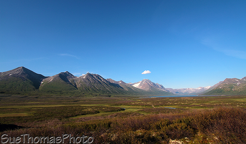
We've found some amazing boondock spots this way, including this one this year:
- all the backroads (for boondocking)
- good fishing spots
- rest areas
- spots beside the highway and creeks for lunch/overnighting
- historical info of the Alaska Highway
- historical stops, such as Soldier's Summit
- lodges/gas stations, including which are closed
- territorial/provincial/state campgrounds and recreation areas
- hiking trails, cycling trails, parks
- wildlife and birding areas
- distance from A to B
then the Milepost is a good resource. The amount of info can be overwhelming to some.
When we were novice travellers up here (before moving here) I would review the relevant pages the night before and mark things of interest with a yellow highlighter.
These days, I usually use the digital Milepost in pdf format, saved on the laptop and open while we drive. We usually monitor our position with the GPS via livetracking on the laptop too. So the Milepost and nRoute are open side-by-side on the laptop, which sits in my lap while DH drives.
Over the years I've collected thousands of waypoints. I also waypoint locations that I take note of but where we didn't stop. Maybe the next trip we'll check it out. Yeah, I'm anal about data, love it! :B
We've found some amazing boondock spots this way, including this one this year:
About Bucket List Trips
13,488 PostsLatest Activity: Jul 25, 2025