Well, Joe, one can stay safe and just look at Google Street View to see the area that is under water now.
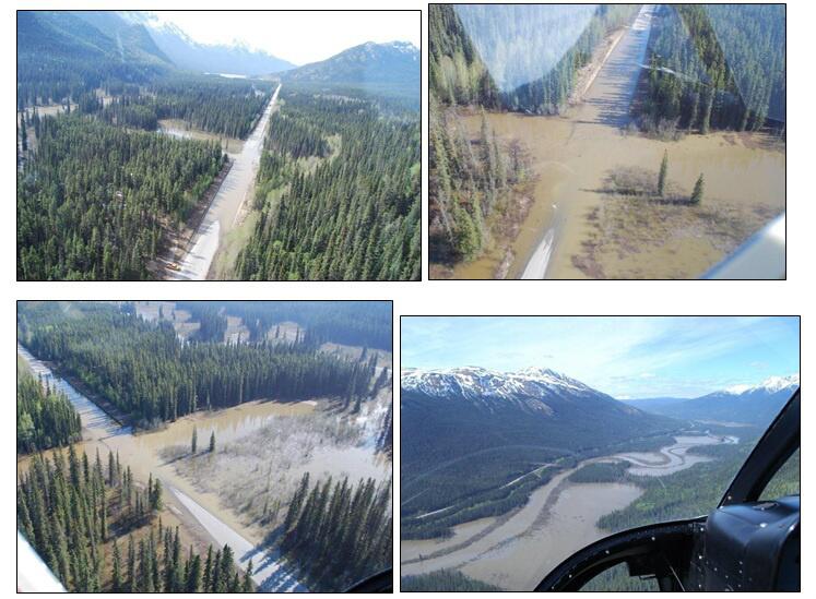
The spot looks to be a naturally low marshy area normally so not too surprising that it took on water from the river and flooded across.
I'm wondering about the integrity of the highway once the flood has receded ... I think this is one of the sections that hasn't been upgraded yet.
This from Google Earth Street View, looking northward on the Cassiar:

And this the Satellite view of the marsh when it isn't flooded