Forum Discussion
8 Replies
 RE_ToddExplorer4 lane interstate highway. Hwy 70 from Alamogordo to Las Cruces. Take the I25 south to the I10 west in Las Cruces to avoid the town streets.
 derekgarcia5404ExplorerAre there any problems for a full size motorhome from Alamogordo to Deming NM? Just wondering. The information above was great for US 82, I needed that info also, but wondering about the above? Thanks in advance
 2chiefsRusExplorerOriginal Poster here - Thanks for all the information. We ended up going to Deming, NM right from Guadalupe Mountains Natl Park via El Paso. We had thought that some parts we were waiting on would take longer to come in but they arrived early.
 PawPaw_n_GramExplorerOne mile (5,300 ft) descent in 14 driving miles.
Fun.
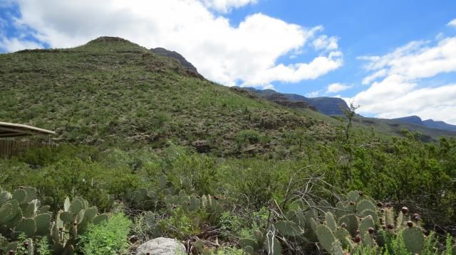
Valley of Fires is worth the trip up to Carrizozo - if just to take the nature trail across the lava flow.
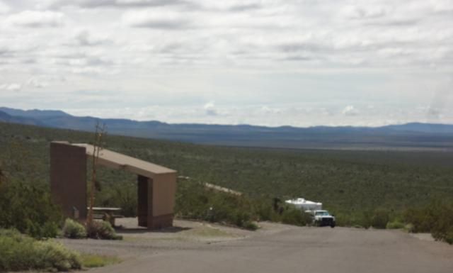
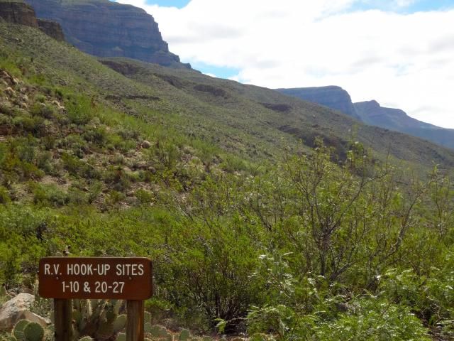
Another great stop is the BLM campground at Three Rivers Petroglyph Site. It has two 50Amp sites with water ($18 per day/ $9 senior pass). There are restrooms, but no showers and no dump station.
Three Rivers Petroglyphs DesertHawkExplorer
frizzen wrote:
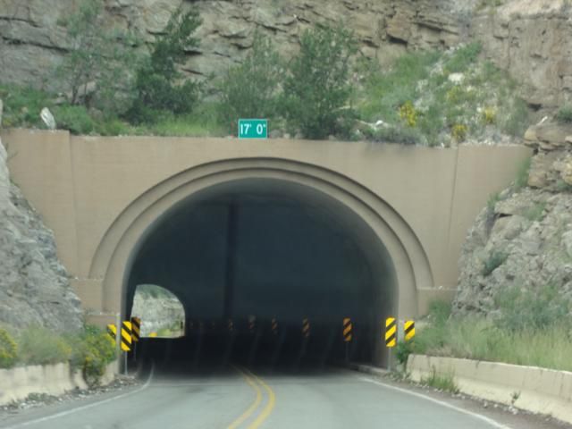
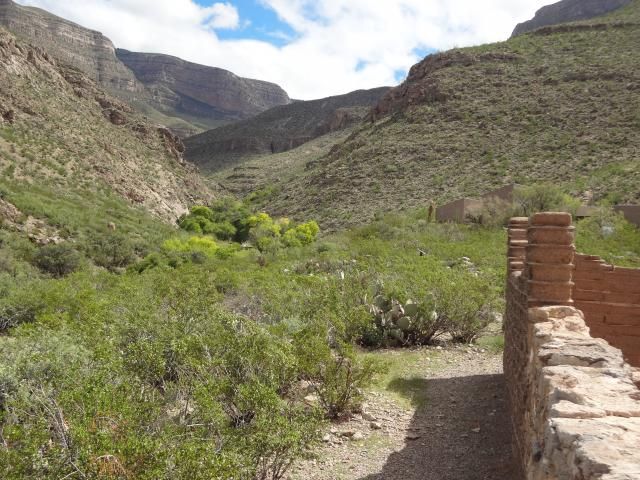
The tunnel has plenty of clearance. There is one hairpin turn and some steep grades below Cloudcroft. - No problem if you keep your speed under control.
:) 2X Run-Away-Truck Ramps are still there. Two lane at times with passing lanes.
Side trip in tow
Bluff Springs
Sunspot Peak/The National Solar Observatory
Directions: From Cloudcroft, turn south onto NM130 and then right onto NM6563 (Sunspot Scenic By-Way) about 2 miles later. Continue for about 18 miles to the end of the Scenic Byway to the intersection of NM6563 and Sacramento Rd (C2). Veer right at this point. A short ways past this intersection you will turn left at the sign for the Visitor Center.
Visitor Center for the Sunspot and Apache Point Observatories located at the end of the Sunspot Scenic By-way (NM 6563)
Apache Point Observatories
Hiking
Things to Do Cloudcroft
Photos of Cloudcroft Area
Camping
Silver Overflow
Valley of Fires BLM Campground (near Carrizozo north of Alamo) is a first rate campground with electric & water hookups, good dump station and a fine shower house. Not Alpine area, warmer. Pics & description can be found:
:C Campground . . and . . Cloudcroft, Lincoln/Capitan, Carrizozo/White Oaks.
Only HWY Tunnel in New Mexico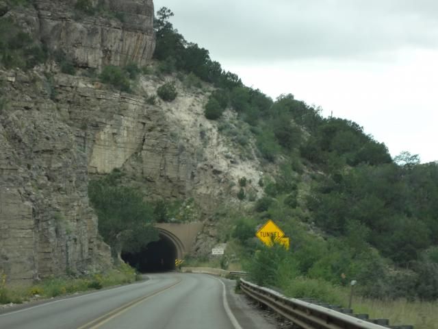
Also Hikes & Star Parties at times, Oliver Lee Memorial State Park south of Alamo
O. Lee State Pk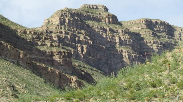

Saturday, May 16
09:00 PM - 10:30 PM
Oliver Lee
Calisto and Arcus
The Amateur Astronomers Group will be sponsoring a summer sky tour. Learn the constellations Ursa Major and Bootes, which are linked by the myths of Callisto and Arcus. Come early and enjoy the beauty of Dog Canyon at sundown. Meet at Group Shelter.
Fees: Regular Entrance Fee
Contact: Wendy Justice 575-437-8284
Last place we stopped for lunch before we sold our Scamp:

Alamogordo Area
Alamogordo Things:
NM Space Museum
White Sands
Alameda Park and Zoo
Toy Train Museum and Train Ride
Las Cruces Area & Southern NM Mexican Food plus camping and attractions in the area. At least try a Green Chile Cheese Burger. Video
Taste of NM Pecans: Stahmanns or Salopek
In Las Cruces: Hacienda RV Resort and Siesta RV Park are the easiest to get to, just of I-10 exit 140. Las Cruces KOA and Sunny Acres RV Park off I-10 exit 135. KOA on the mesa over looking the Mesilla Valley, Sunny Acres in the Valley. Park Reviews Siesta RV has gravel roads & pads, Hacienda RV has paved roads, maybe concrete pads. Sunny Acres more into town, maybe cramped??? Also there is a Passport America CG, Coachlight RV Park which is behind The Coachlight Inn at Exit 139 off of I-10.
Leasburg Dam State Park is about 17 miles N of Las Cruces on I-25. With Fort Selden State Mon't near by. A young Douglas Mac Arthur called the fort home while his father was post commander in the late 1880s.
On the east side of the Organ Mountain, Southeast of Alamo & east of Las Cruces at Aguirre Spring BLM area. Two national recreation trails start at the campground. The Baylor Pass Trail has its eastern end at the campground. This is a one-way trail of six miles, which will take you to the Baylor Canyon Road on the west side of the mountains. The Pine Tree Trail is a four-mile loop that climbs to the base of the Organ Needles, in Ponderosa Pine habitat. Both trails provide spectacular views of the Organ Mountains and the Tularosa Basin. The Baylor Pass Trail is open to hiking and equestrian use. The Pine Tree Trail is open to hiking only. Aguirre Spring BLM
Also on the west side of the Organs, Dripping Springs Natural Area has hikes.


As well as hiking at the Soledad Canyon Day Use Area.


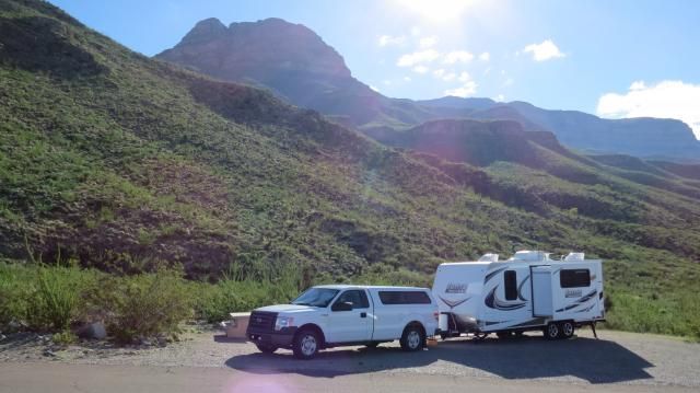
 frizzenExplorerThe tunnel has plenty of clearance. There is one hairpin turn and some steep grades below Cloudcroft. I've been up and down with a 27 foot 5er pulling a 16 foot trailer with 2 quads. No problem if you keep your speed under control.
- accsysExplorerWe did that run in 2011 and had no problem whatsoever. You just have to watch your speed on the west side of Cloudcroft. You can read about our experience on our blog entry for that trip.
- Second_ChanceExplorer IIThere's at least one tunnel and a couple of pretty steep grades west of Cloudcroft. Used to be runaway truck ramps on that side. Beautiful country, though.


About Bucket List Trips
13,488 PostsLatest Activity: Jan 17, 2025