Forum Discussion
6 Replies
 NaioExplorer IIThanks, Tiger! It's clunky, compared to an app, but it's something!
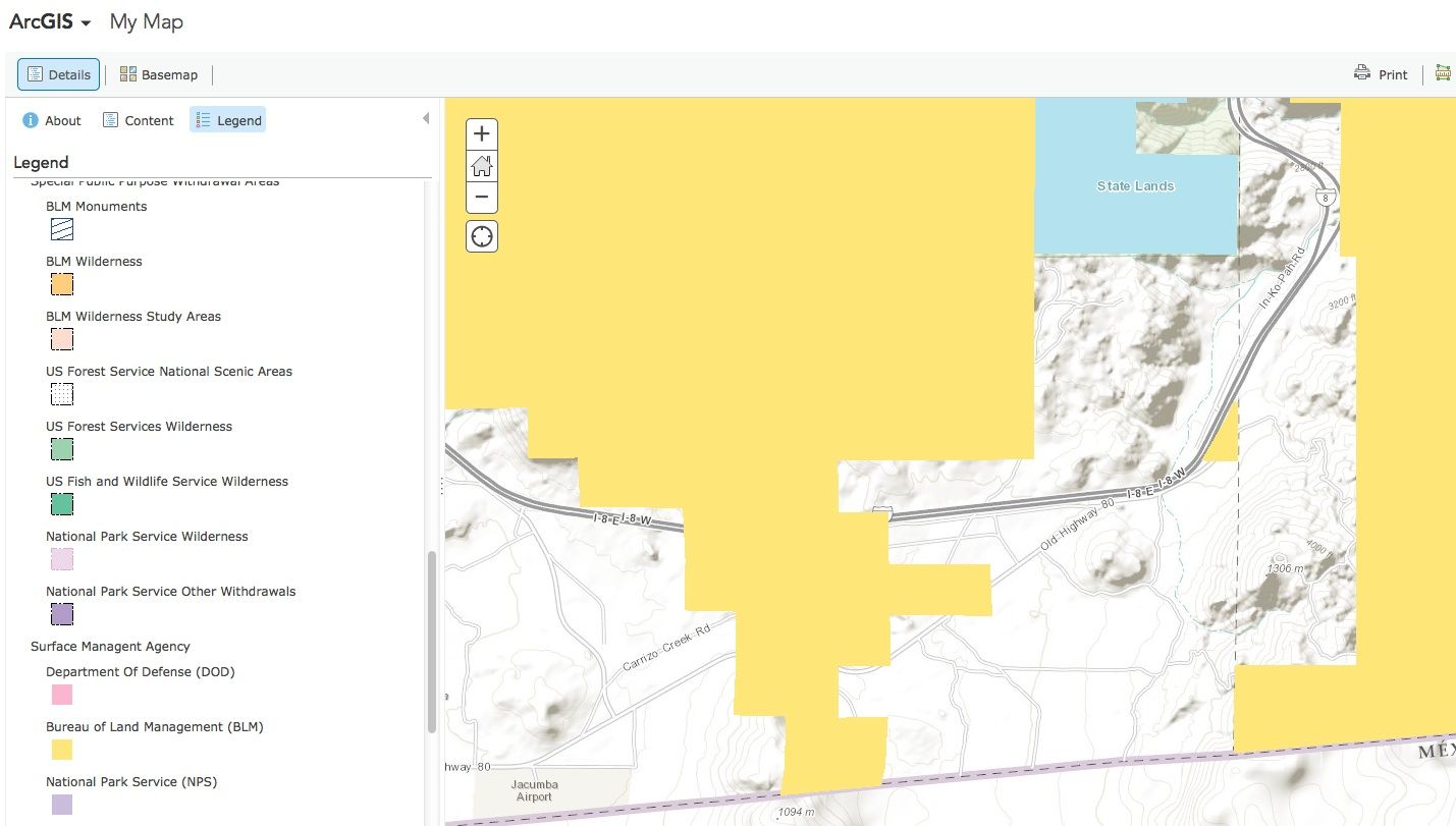
I have a paper surface management maps for a couple of states, but they are tough to find (preprinted or online to print out). Not cheap, either, although better than $35 per state ;).- Not an app, but free from the BLM Surface Management Agency via GeoCommunicator. I poked around and came up with this:
When you are online, save screenshots of areas that interest you. It's what we did before there were apps. :-) - NaioExplorer IIThanks, folks!
I see that onX and Hunt are the same thing, and I have to pay for an upgrade before I can see the land ownership layers. $35 per state! I downloaded it, and the download page said I would get a free 7 day trial period, but that does not seem to have happened.
The technomadia one has some pretty bad reviews, citing inaccuracy. Have you found it to be accurate in the places you have been?
Is there anything else out there?  pawattExplorerGo to Technomadia,s Blog, they have an app for this.
- BillinwoodlandExplorerWhen I hunt in unfamiliar areas I use the HUNT app. It gives you property line boundaries, name and contact info for the landowner, and allows you to precisely be on public property such as BLM. Some landowners like to claim adjacent BLM land as their private refuge. This app settles the discussion immediately.

About RV Must Haves
Have a product you cannot live without? Share it with the community!8,805 PostsLatest Activity: May 15, 2026