jefe_4x4
Oct 04, 2013Explorer
HIGH SIERRA HIGH XTC, trip report (warning: lots of pix)
Early on the idea was to put together an XTC trip itinerary and invite a few hard-core XTC friends to participate. Where? The Eastern side of the central to northern Sierra Nevada. Why? It is a singular landscape with a rain shadow transition from Alpine to desert, depending on elevation. When? Over four decades of visits, I thought the best time to go, over all, would be the third week of September. This would be our best shot at the end of summer. No crowds. Slim chance of snow. Still temperate enough to sit around the evening campfire at the end of the trail.
What about all those XTC friends? For various reasons, I hope I’m not one of them, they had other very valid things to do. So I called my brother John who has an XTC and is a very experienced 4WD-er mostly in rock racing his tube buggy at the Hammers. He and his GF, Krys came too and cooked up some mighty fine victuals. So, game on. A few days before the liftoff, Tiger4x4 emailed me and said the new titanium knees were of sufficient strength to trail along. Good enough. Now there were 4 people in 3 rigs to do the first part of the trip.
The objective was to camp at the highest elevation you could camp in an XTC, all approaches from the east. After doing the San Juan High several years ago, I was eagerly anticipating a similar crusty, rugged trip.
I packed up the TC, which seemed voluminous with only one body in there for the duration. I had recently attached my new Glow steps, no generator, roll up table, one director’s chair, tools, and a little more food than I needed, and an allotment of one beer per day.
Since Bro John was leaving from L.A. and I was leaving from Nevada City, we had about the same drive time to meet in Bishop for lunch. Tiger4x4 joined us there.
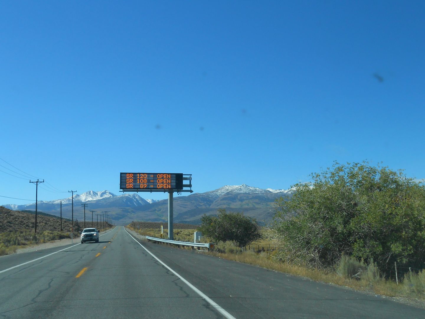
The color was just starting to change in the Eastern Sierra and all the passes were open. Motoring south on Hwy. 395, the sign says Monitor, Tioga, and Sonora passes are open. Whopee!
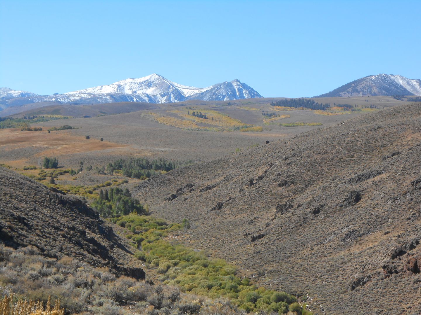
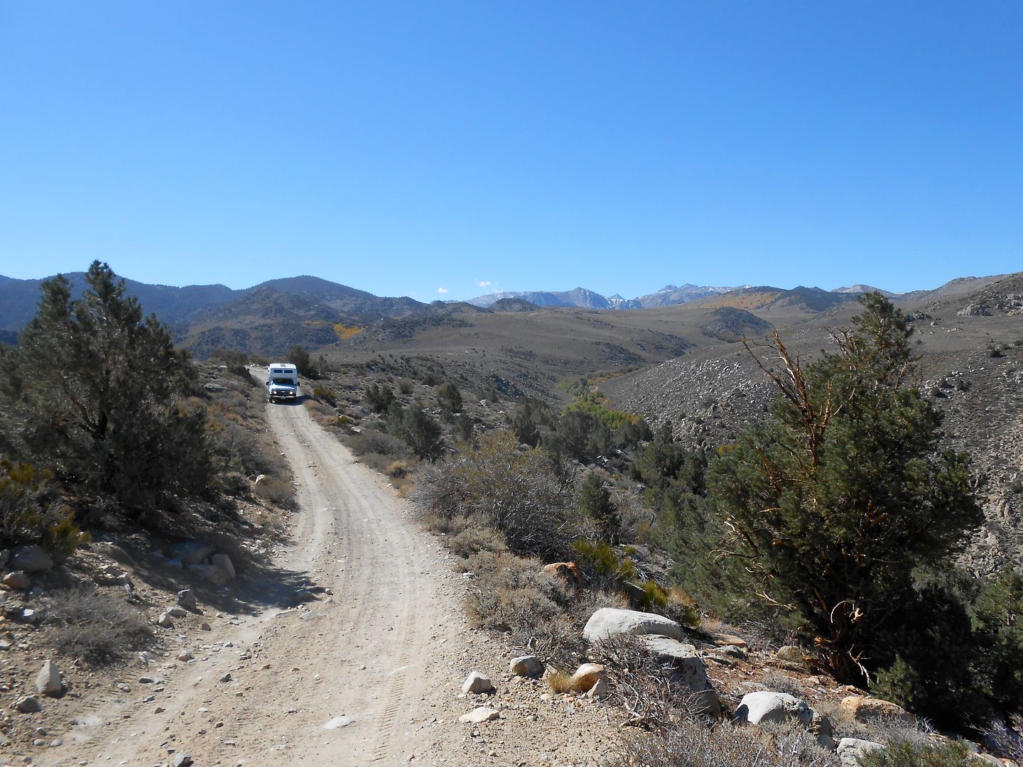
Continuing south. 5 days later we would be camping in that green patch high and to the right off Dunderberg road:
After meeting for lunch in Bishop (4000 feet), we transitioned from desert to high plateau going up Salty Peterson's switchbacks:
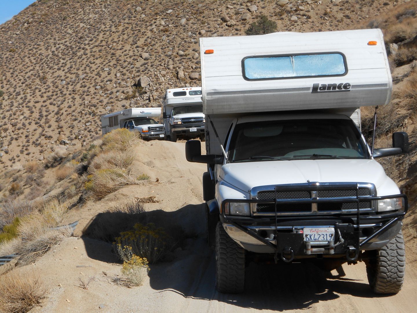
Here's the trio of white boxes on one of the switchbacks: Do you notice what I forgot to remove? Hmm? Hmm?
Tiger has a perfect wheelbase to get stuck in some huge potholes coming up this leg and had to pump it a few times to make it up. Bro and I had a lot longer wheelbases and missed all the cool action:
This little valley is above 9000 feet and very rocky;
This was not as rocky as it got. When it's real bad, you just don't want to stop to take pix. Steep, yes. We were in 1st/2nd gear, low range for about 4 hours. Ugh! This trail is a trans eater. Luckily, Tiger 4x4 had the bullet proof 6 spd. Allison auto and Bro and I had 6 speed manuals.

This was our final resting place in our attempt to get to Coyote Flats (10,000 feet). A little creek around Salty Peterson's Mill site. He originally put the road in to service his Tungsten mine and mill. It was windy and cold here. Plus, there was a campfire ban in effect because of the low rainfall season. Next AM, we returned to Bishop to confer on where to go next.
Coming downgrade:
Bishop is still 4000 feet below:
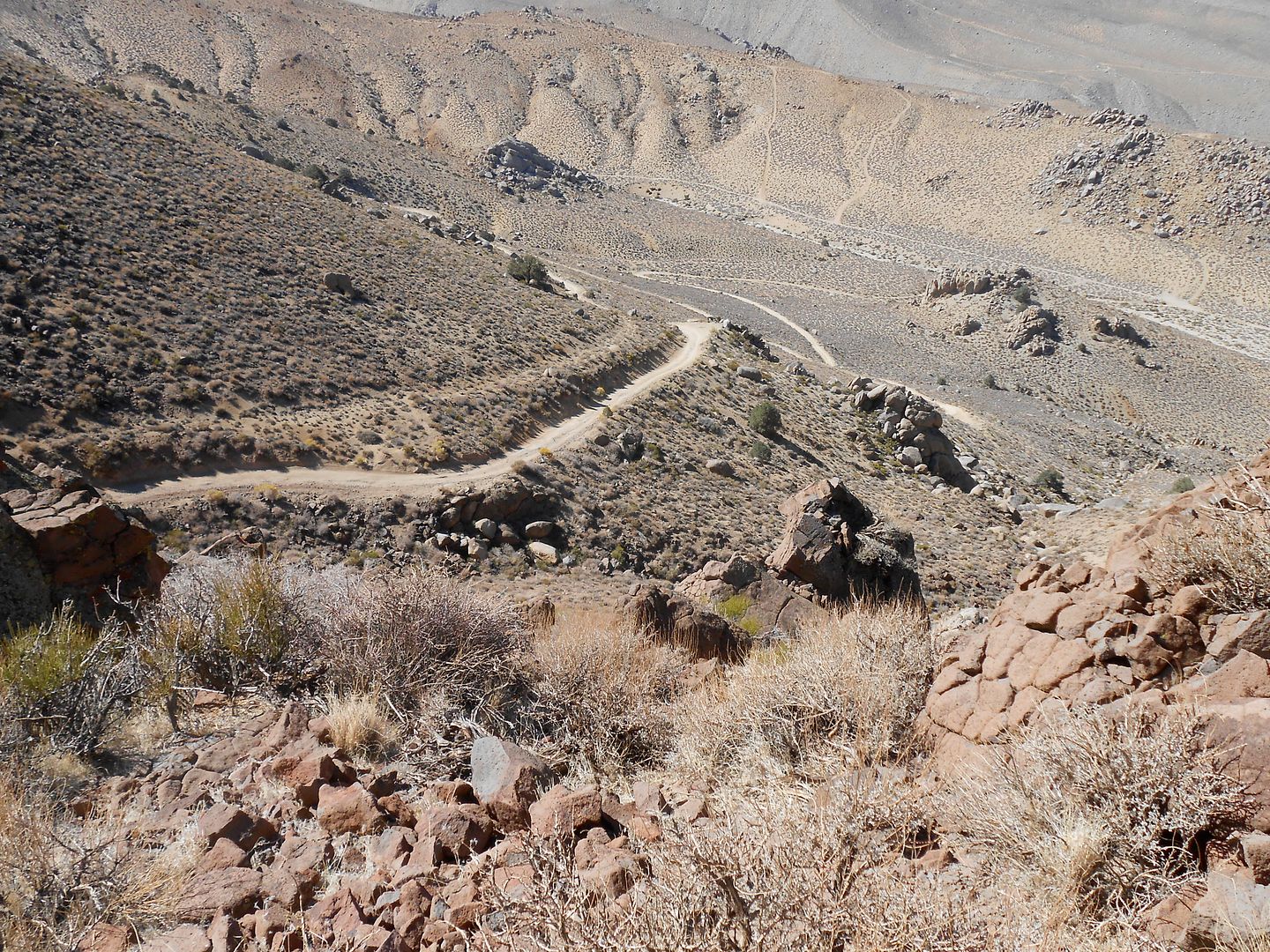
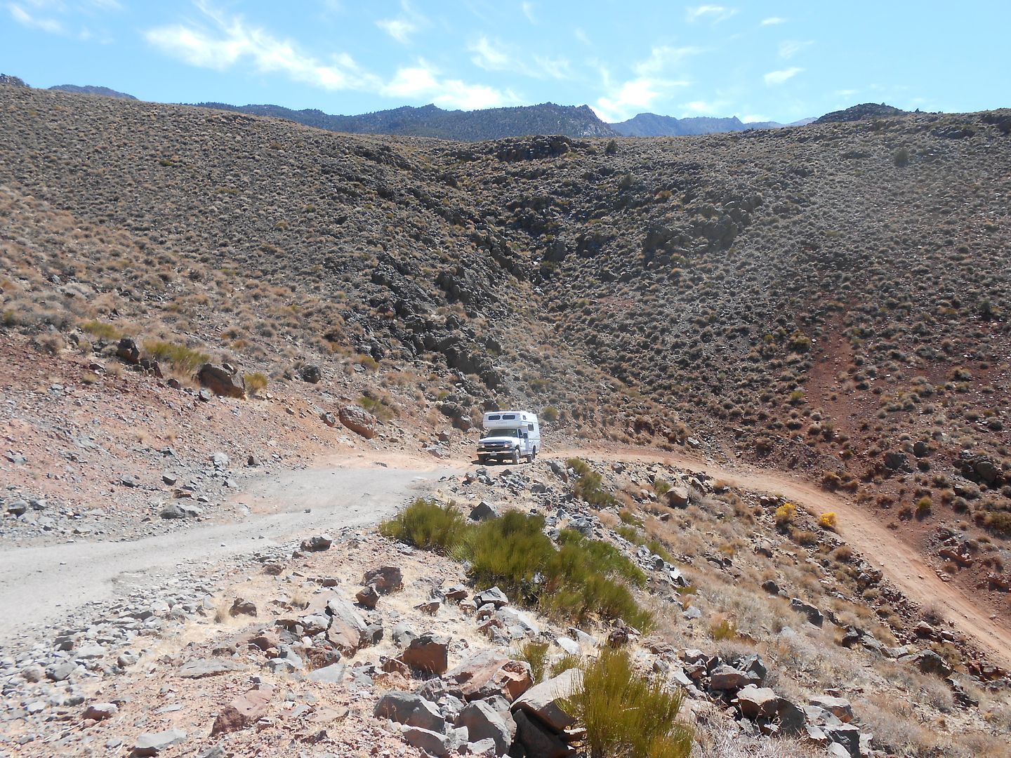
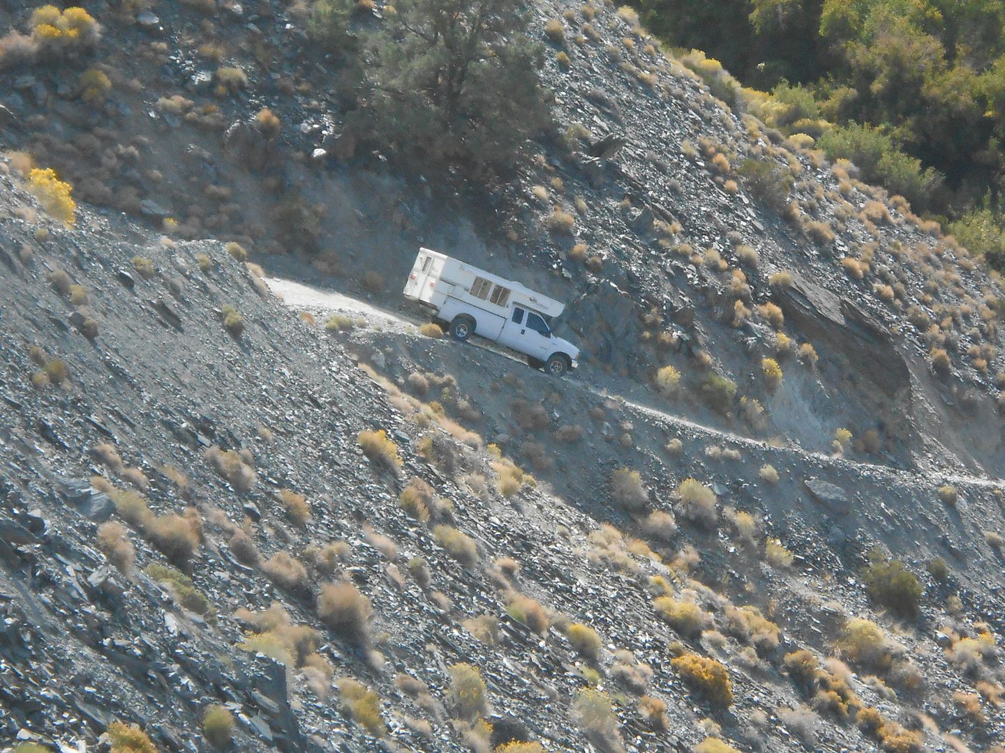
A pit stop. This road brought us to our knees, so to speak, as it was so rough. The volcanic rock sections chewed my super singles into a new tread pattern. We all agreed this is the only time we would be on this road in a TC (or small 4x4 class C). Humbling to say the least.
A last shot coming down Salty's grade and switchbacks:
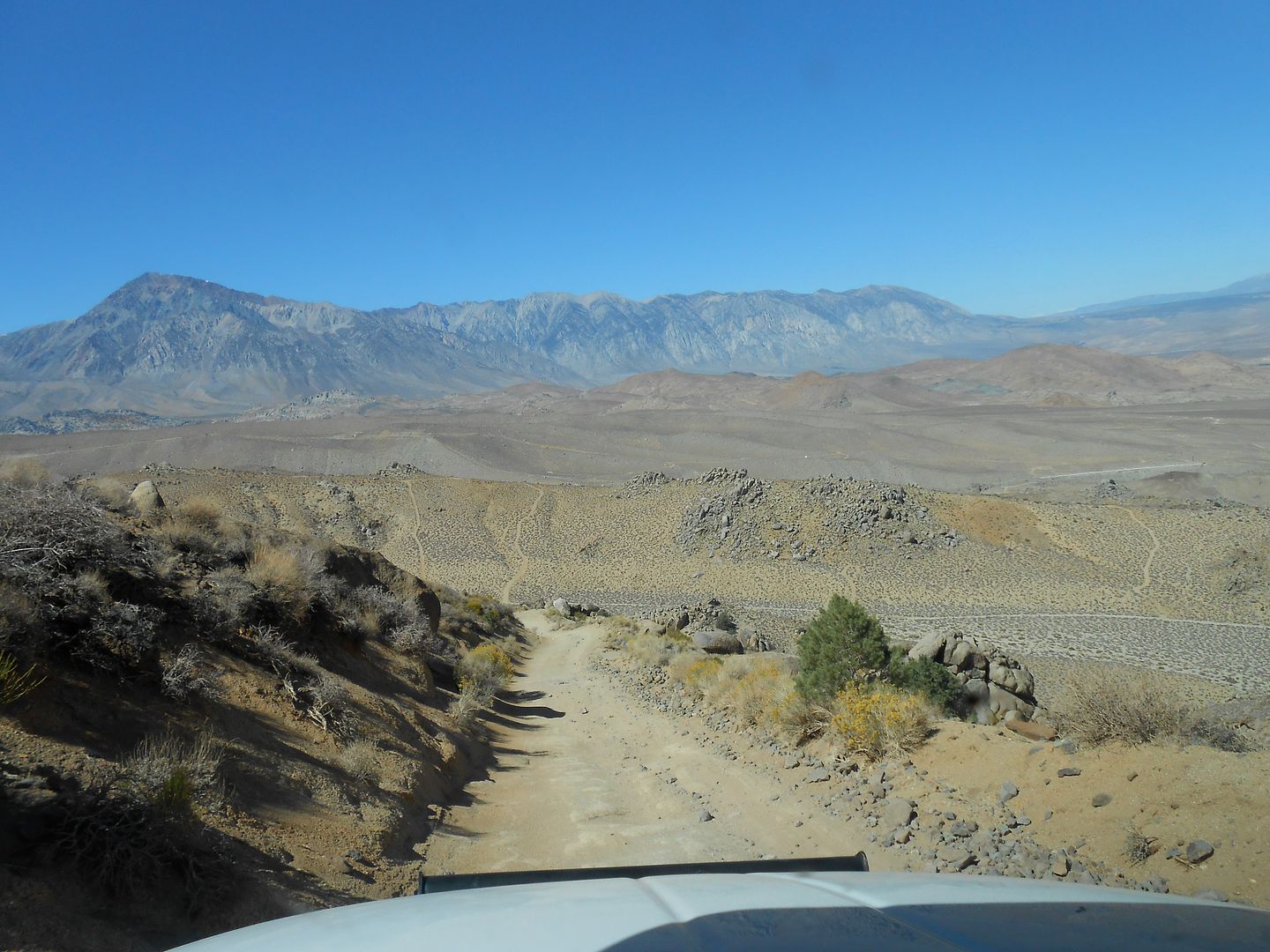
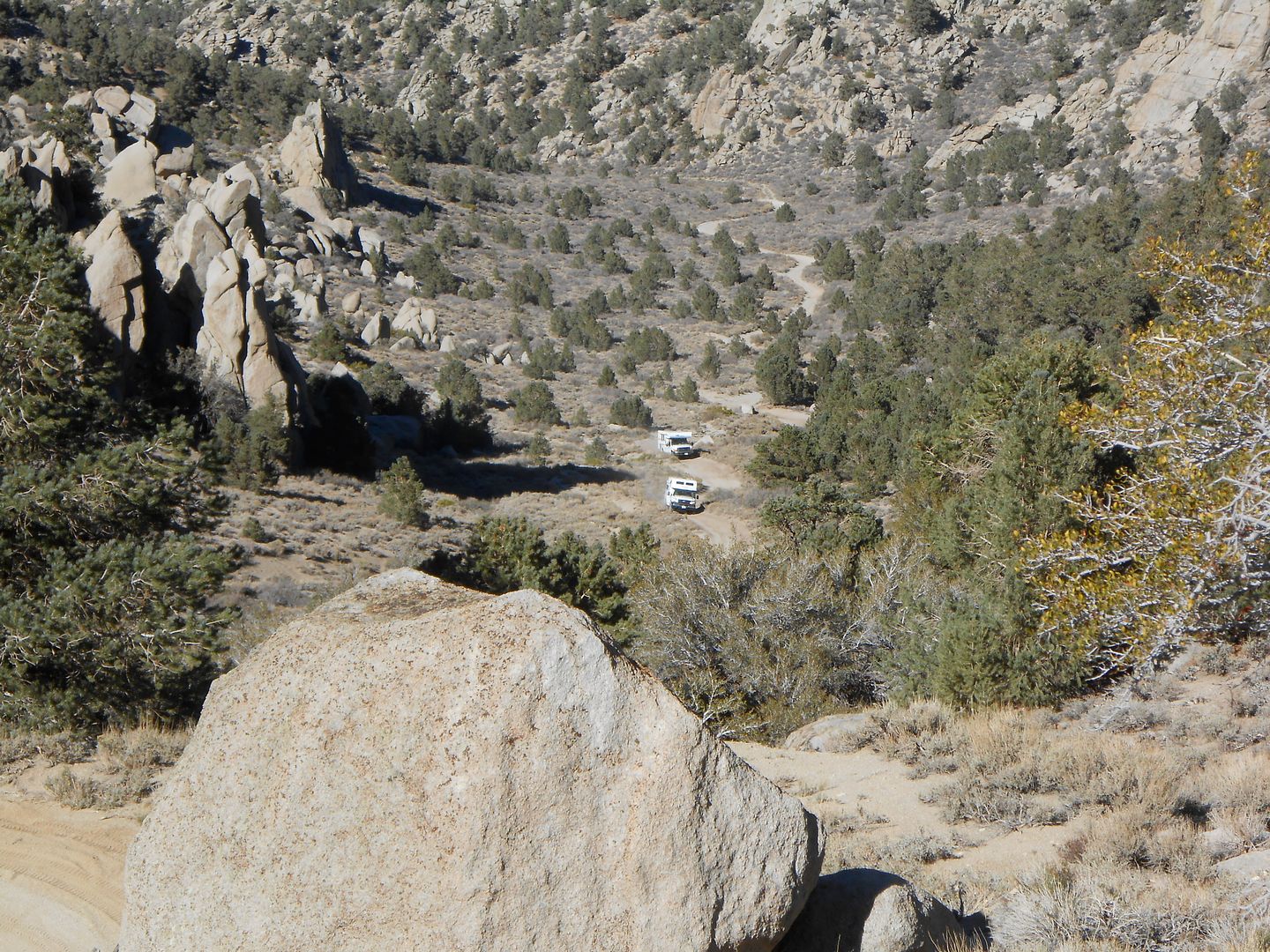
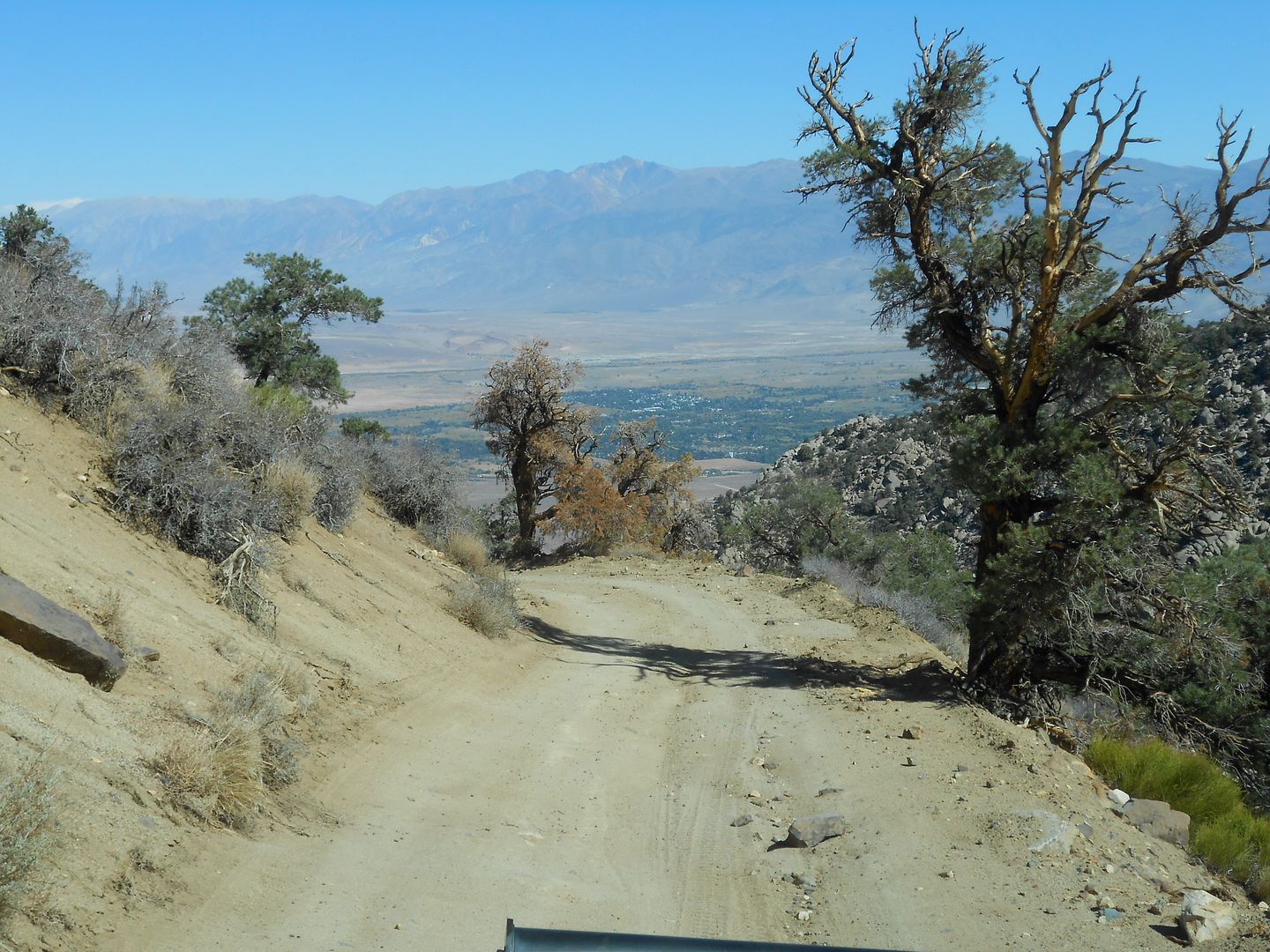
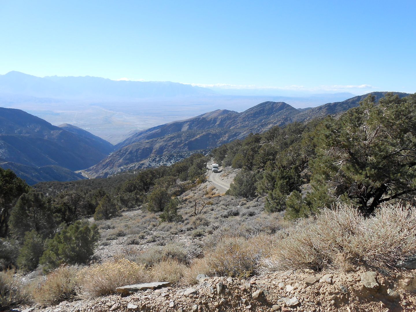
After saying good by to Tiger 4x4, Bro and I headed up Silver Canyon with the hope of seeing the Bristlecone Pines up close and personal. Silver Cyn. Rd. is basically a power line access road that winds up and up from 4000 feet to near 11,000 feet in one pop:
We are already gaining elevation and have some surprises in store:
A cottonwood oasis deep in the canyon:
fast moving, clear water supporting many flora and fauna;
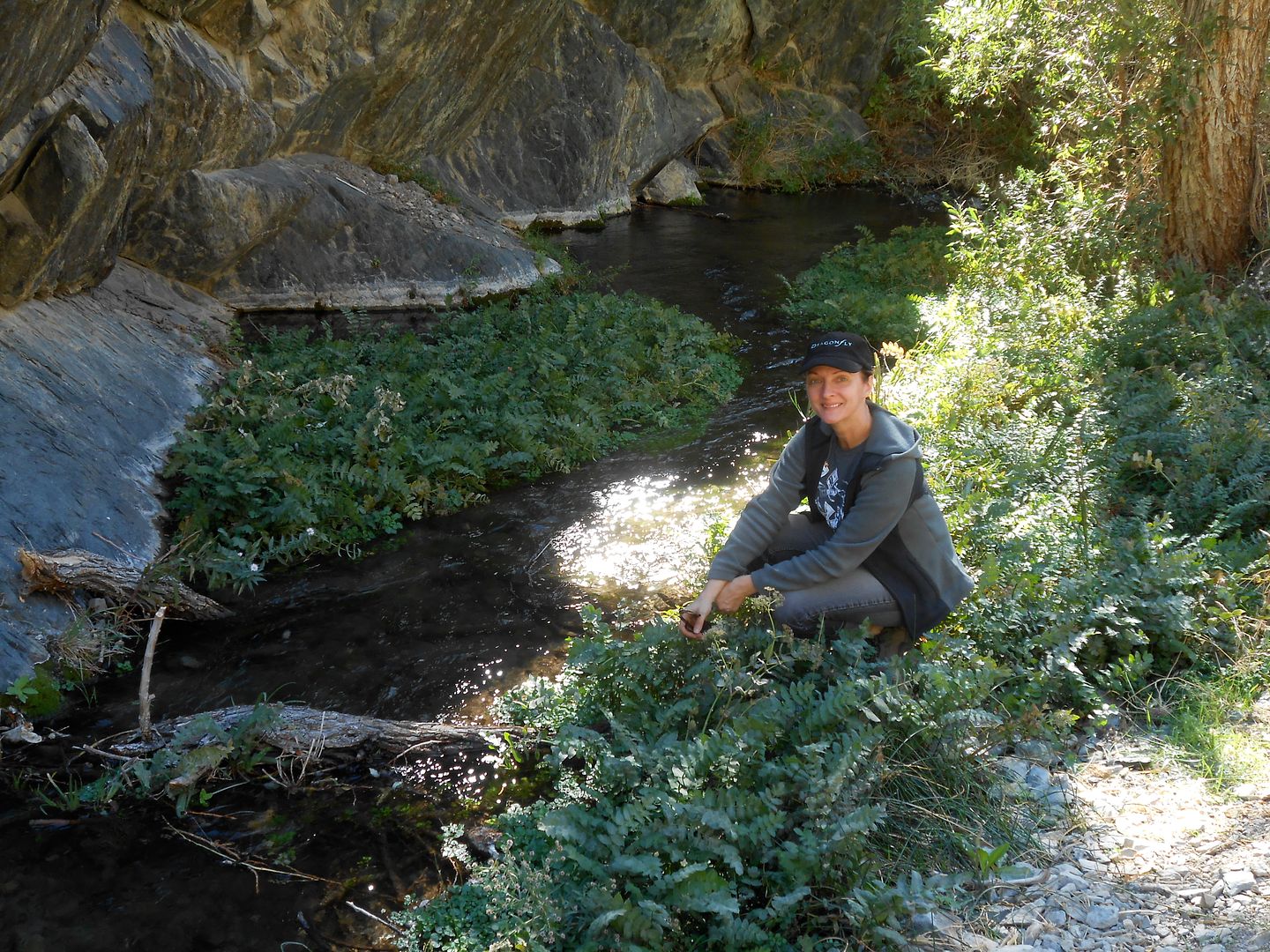
Krys gives a sense of scale in this fern grotto in the desert. A sylvan glade it is:
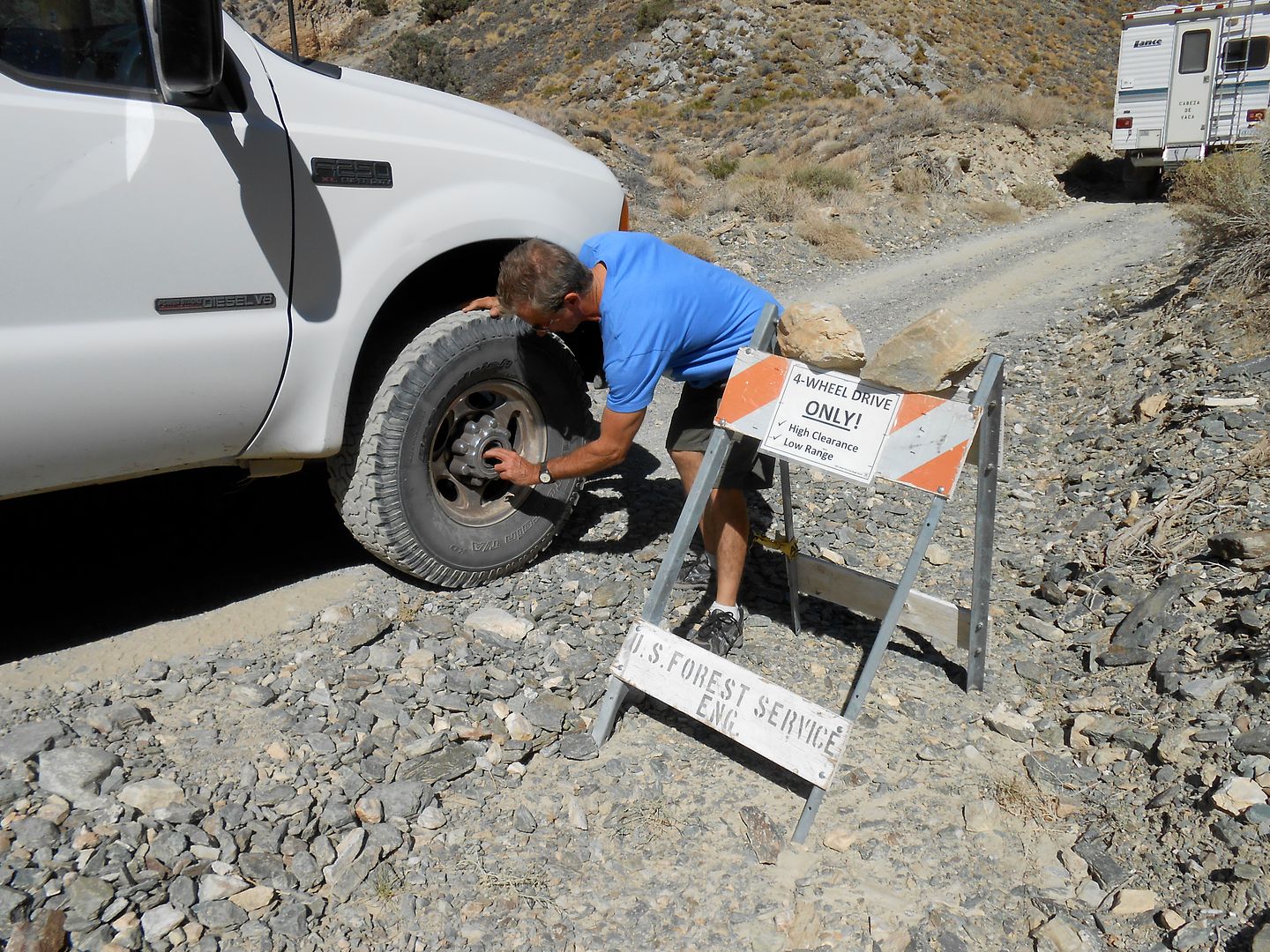
Bro puts his hubs on. He will need them in a short time.
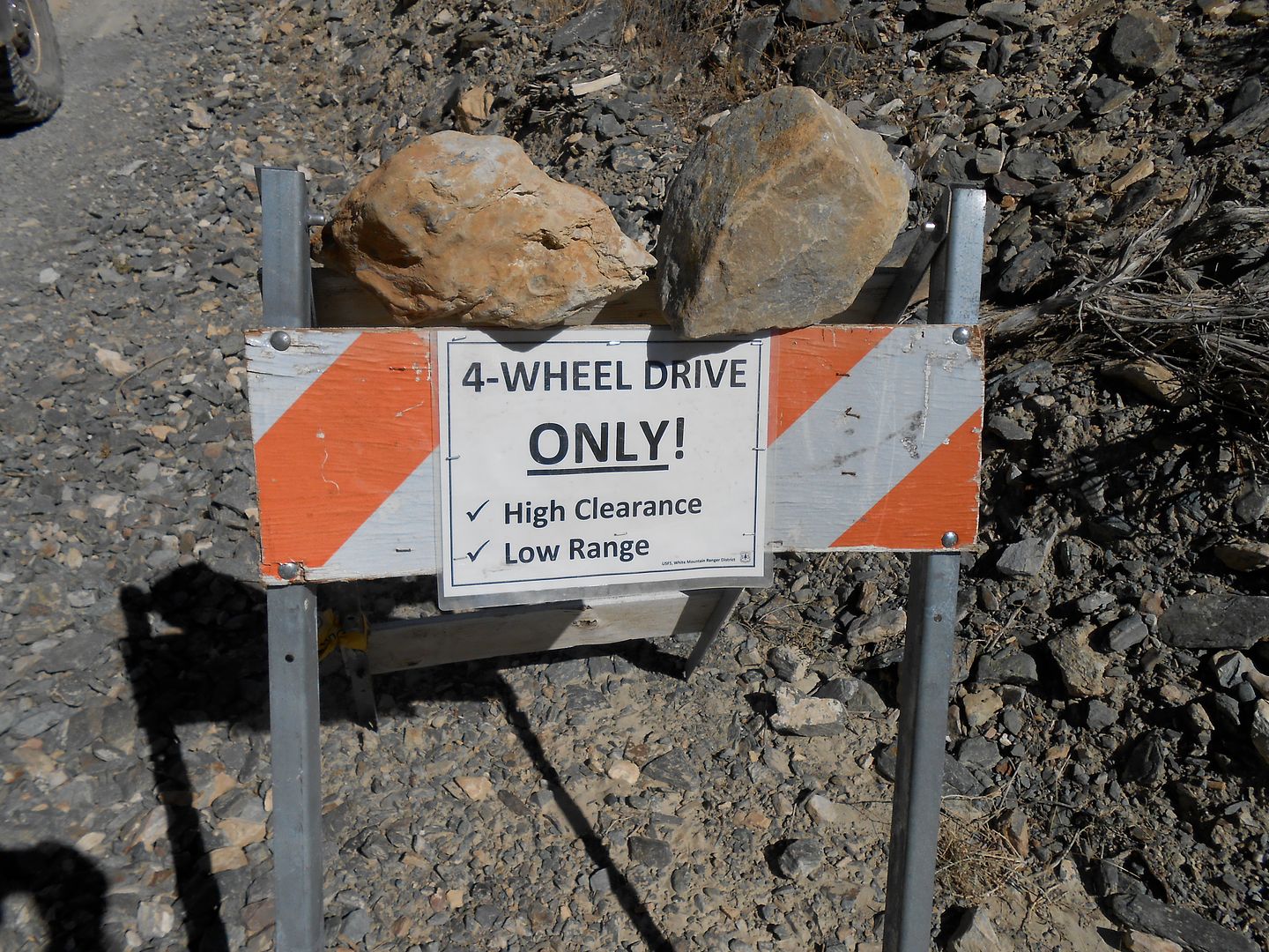
I love the sign. It has it's own check list. Me thinks with the proliferation of AWD SUV;s too many people tried this with their Subarus and got into deep doodoo very quickly: so the sign:
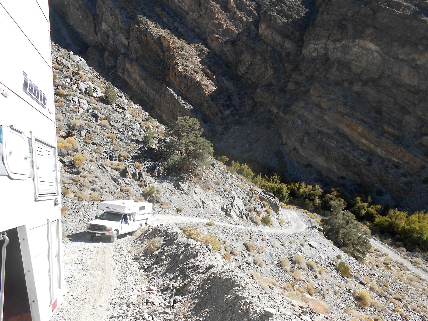
And within 30 seconds, steep it was as we crawled out of the canyon: Much of this was low range/low gear for me.
We are up above 10,000 feet by now with Bishop far down the canyon:
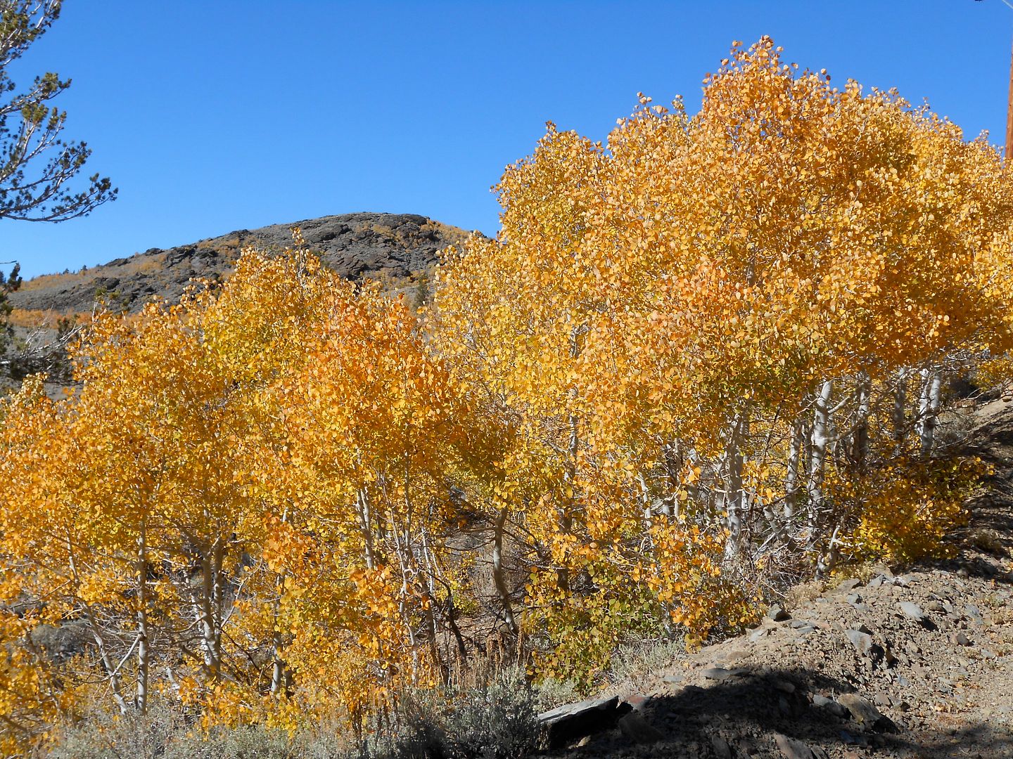
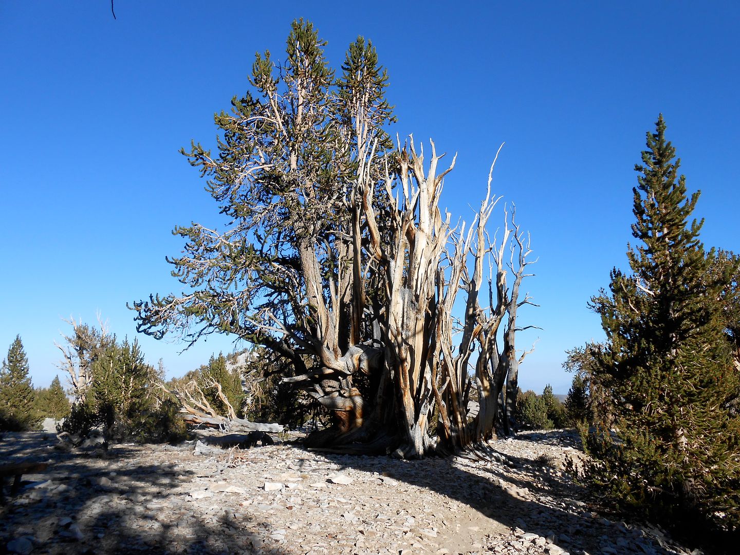
Near the top, at about 10,500 feet we hit a high stand of intruding Aspens to this area: These have only appeared in the last couple decades:
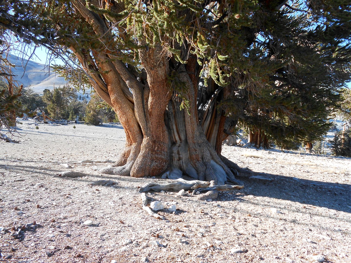
A small wooden sign said to turn left and go to the Patriarch Grove of the long-lived Bristle cone pines. After 10 long and dusty miles we came upon THE Patriarch: People, this was a religious experience. How many times do you meet something in this life which has lived from 3400 years up to 4000 years? I thought so. I got tre choked up and had to just touch the Patriarch. This grove lived at 10,800 feet up to 11,000 feet in the cold, dry air. The only thing that matters to these trees is temperature. It must be cold, and high enough to miss the grinding glaciers of sundy Ice ages. The tree is so hearty, it will under duress, forsake 90% of it's bark and bulk to keep one tiny branch alive for the next generation. So those light gray areas lead up to a dead branch higher up in the tree.
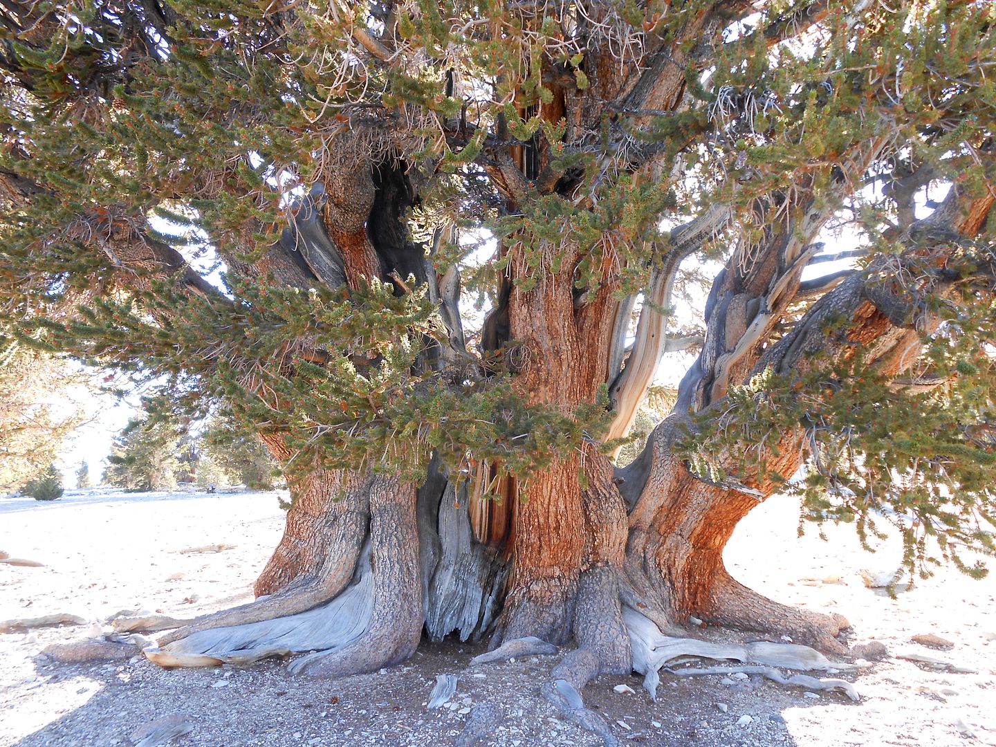
The combined trunk is about 11 feet across:
The other side of the Patriarch:
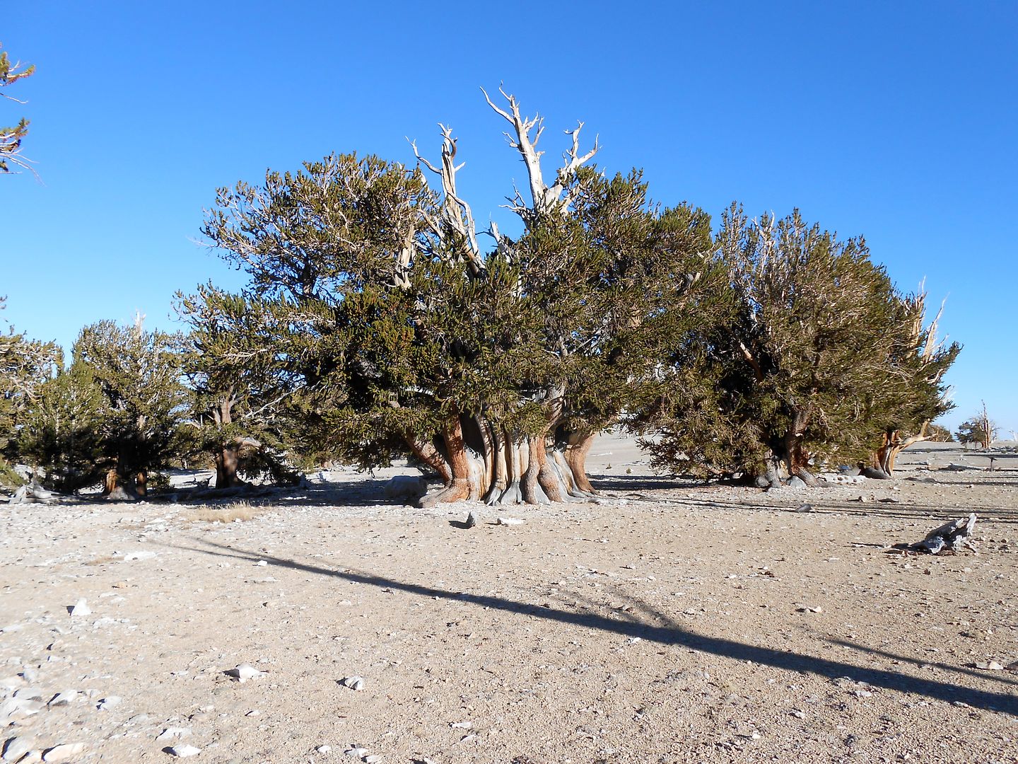
Another that has forsaken most of its bark:
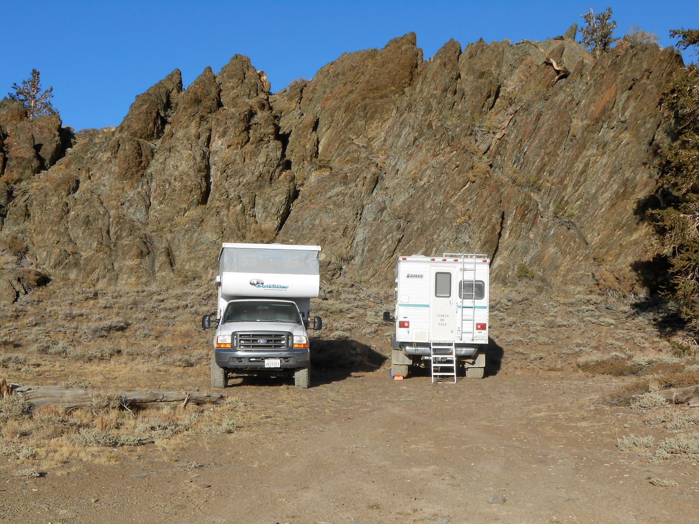
At sundown, we beat it back along the ridge line to this camp (seen the next AM). We are at the very ridge of the Inyo mountains here. Pay special attention to two things. One is Bro's camper attitude. The other is that this is the last picture of my Glow steps alive and well.
We are on our way back down Silver Cyn. with the same sign warning of steepness ahead:
Yes, it's steep:
and narrow too:
We made it down to the valley floor and toured the narrow gage train exhibit at Laws. I went back to the camper door to get some lunch out and.....there were no steps! The threshold, bottom framing, 6 lag bolts and the entire stair assy was GONE! Way back up the canyon were many creek crossings which had big dips. I surmise that a rock or something got hold of the steps and had their way with them. I had them tied up with three rubber cords, all gone. It was so rough, I decided not to spend hours looking for them. We headed to a big box store in Bishop and I bought a medium step ladder to get me by. We then noticed Bro's OUTFITTER! was caddy whompus to the truck bed. This is the first trip he has been on where he removed the electric jax (He is the new King of the Jax-off). Whip out the winch cable in the parking lot and pull the OUTFITTER! back into position. Bro uses 1K pound ratchet straps to hold everything in place and no camper guides, but I think he's under secured for steep climbs. The R-front strap snapped. We bought some more straps at the big box store. He also had a propane leak and after much digging surmised it was in the basement between the tank and the other side of the OUTFITTER! So, another day. Just make do. He turned off the gas at the tank when not in use, but his propane/gas leak detector kept going off at wierd times, like in the middle of the night. He finally cut the wire until he can fix the leak.
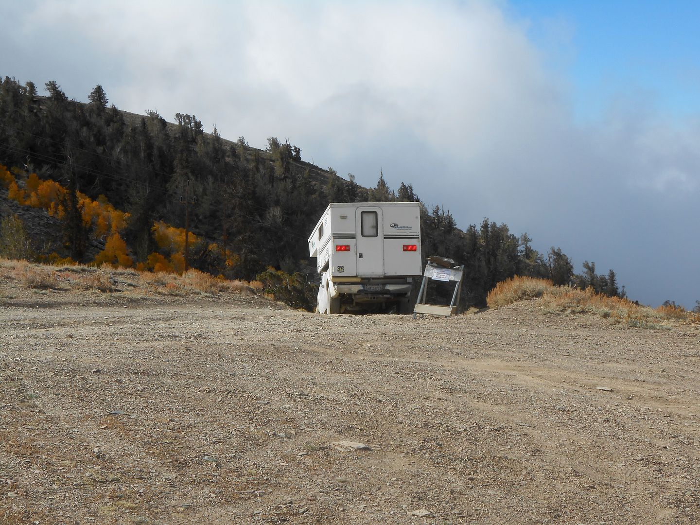
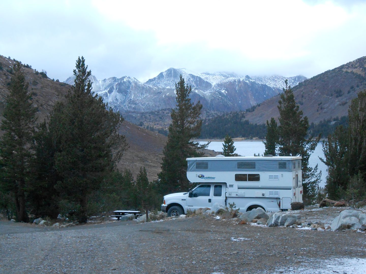
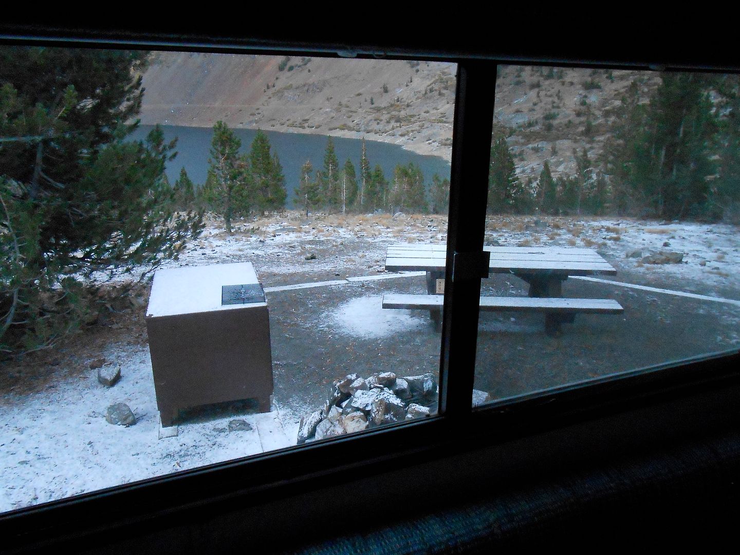
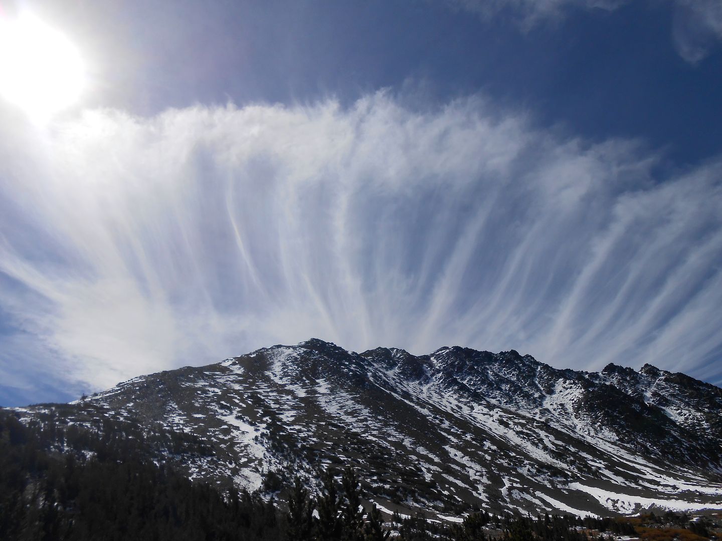
Alright, we proceed to Tioga Pass only 35 miles north. The objective is to camp at the highest NF campground in California: Saddlebag Lake. It is thursday evening so we think it is open and there will be space. It was and there was. Only 2 other people in camp besides the host. He came right up to us wanting to talk to someone, anyone, and Oh, take our money for the night. We arrived in a light snow:
The next day was cool and clear so we decided to do the 5 mile hike around Saddlebag lake.
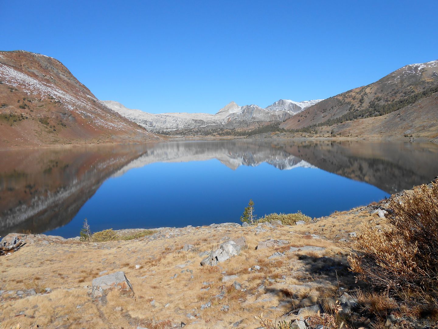
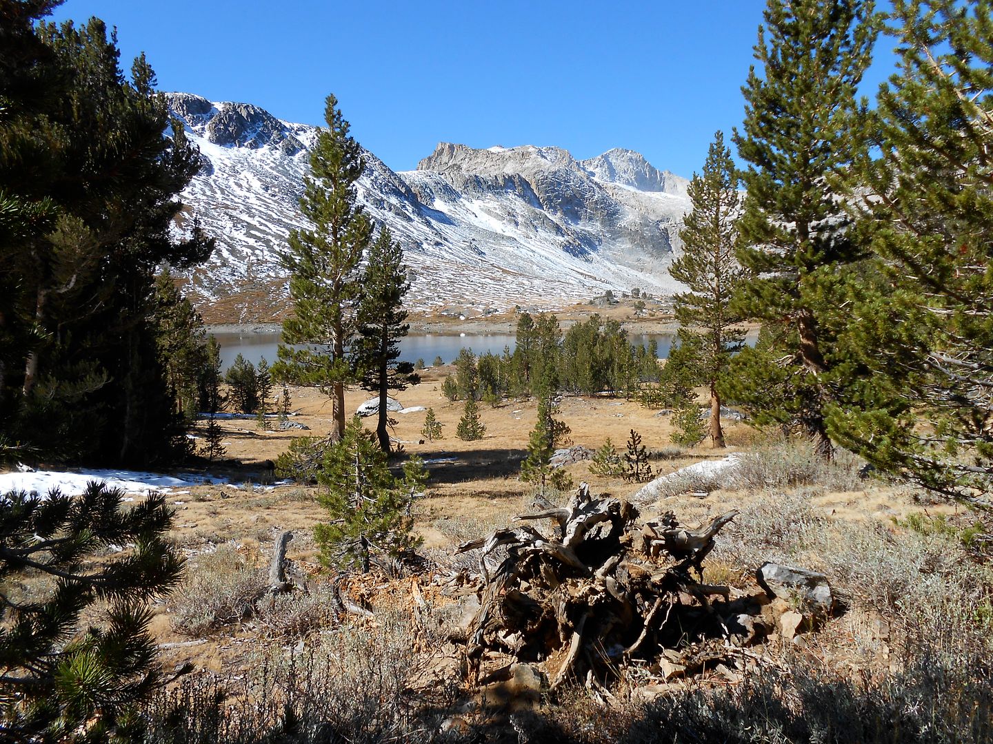
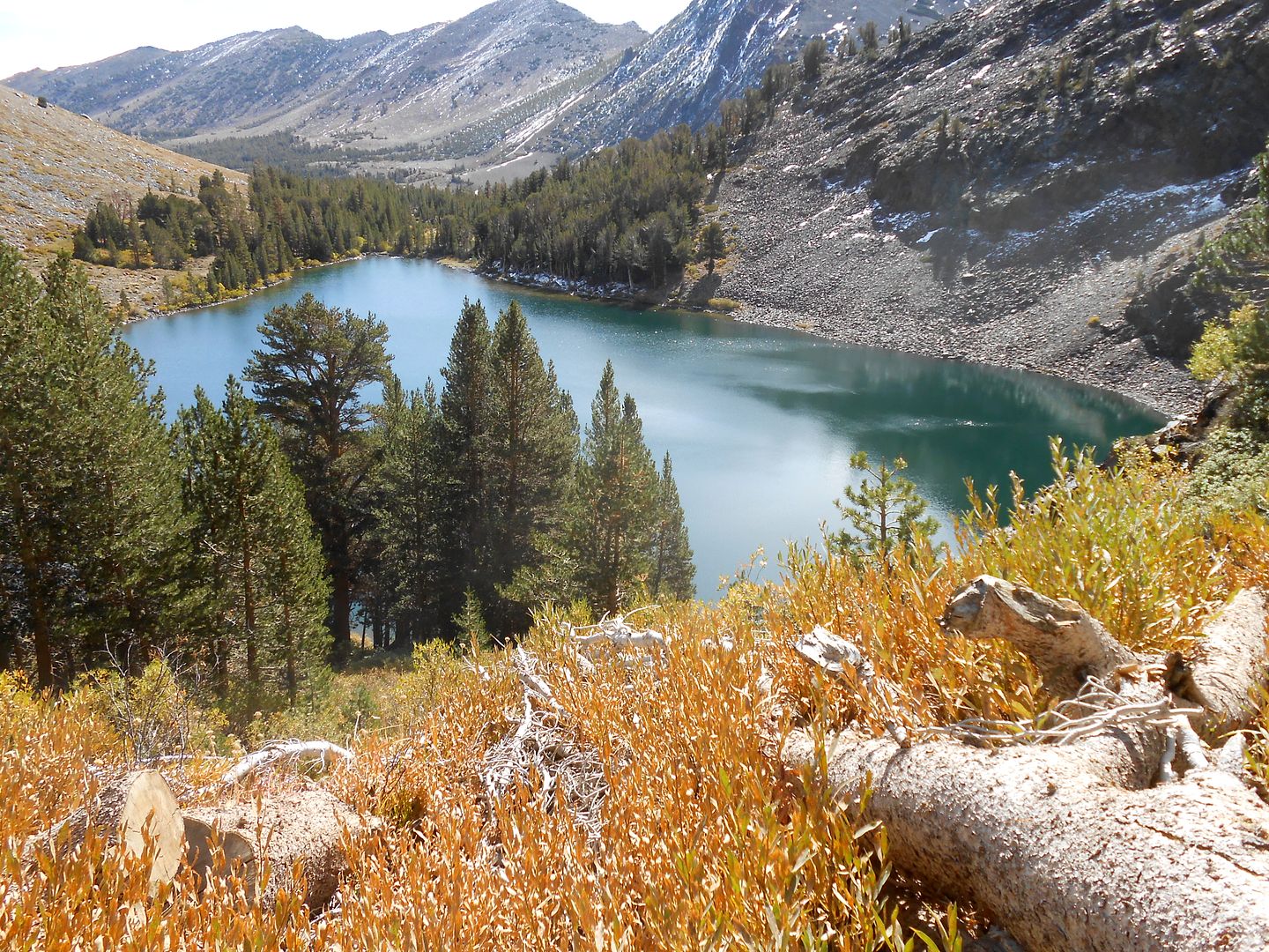
Along the way around the lake: Those peaks are 12K'ers.
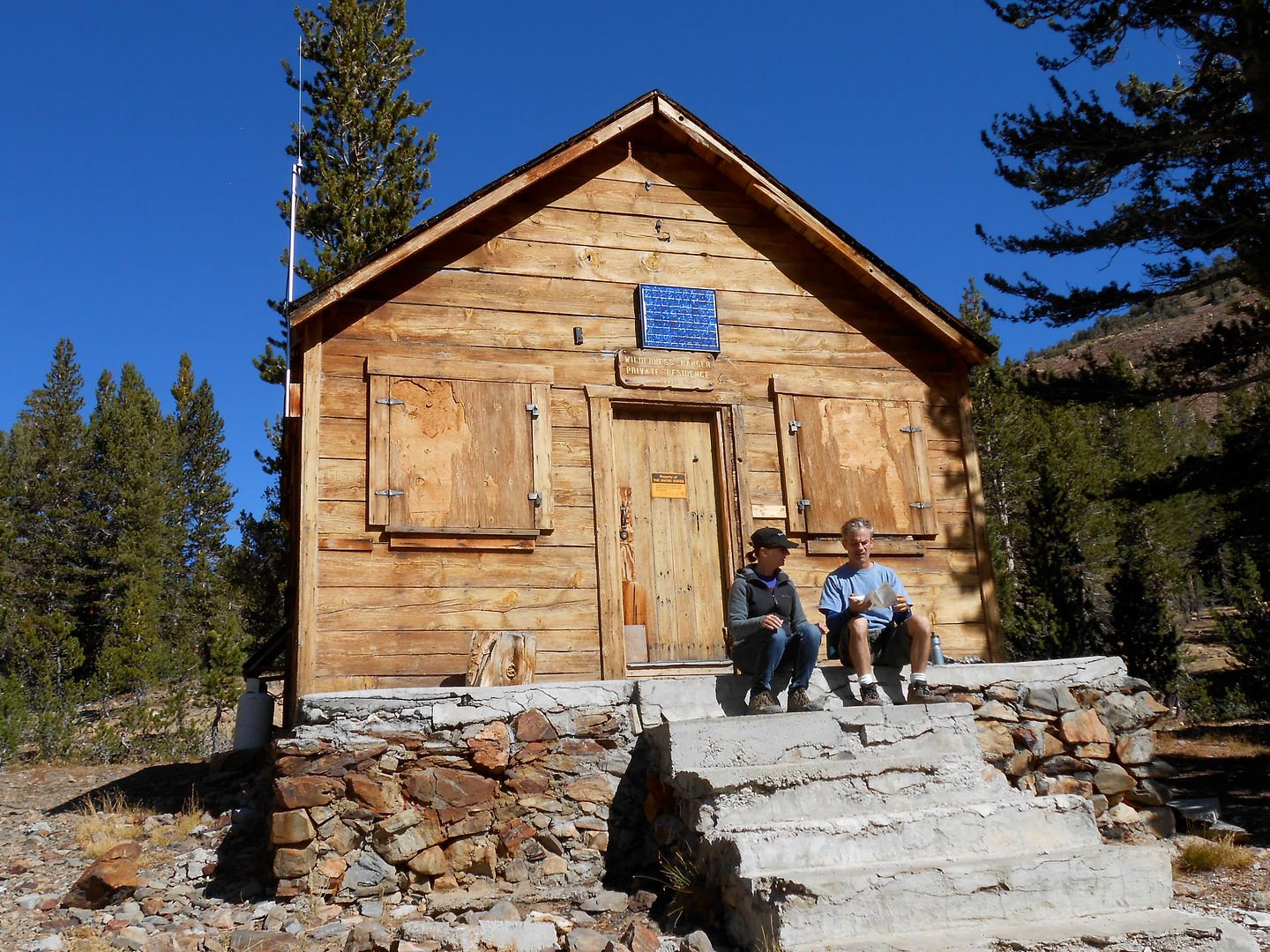
A quick lunch stop at a ranger's cabin. It's old with newish ammenities like short wave radio and solar panel to keep the batteries up.
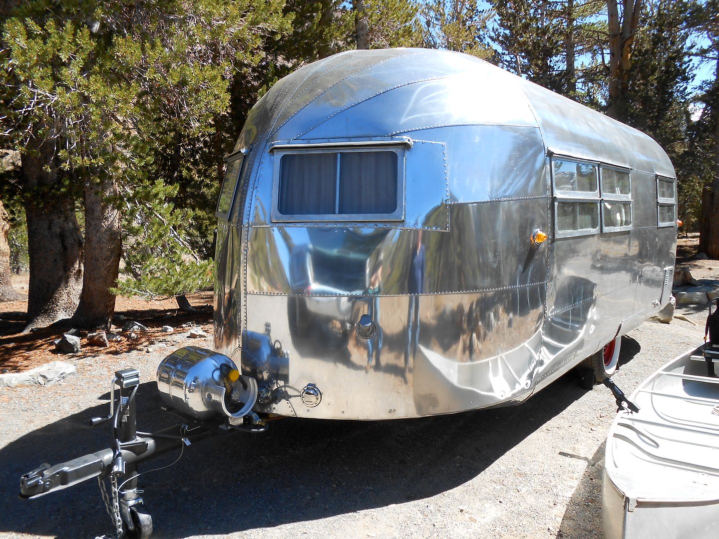
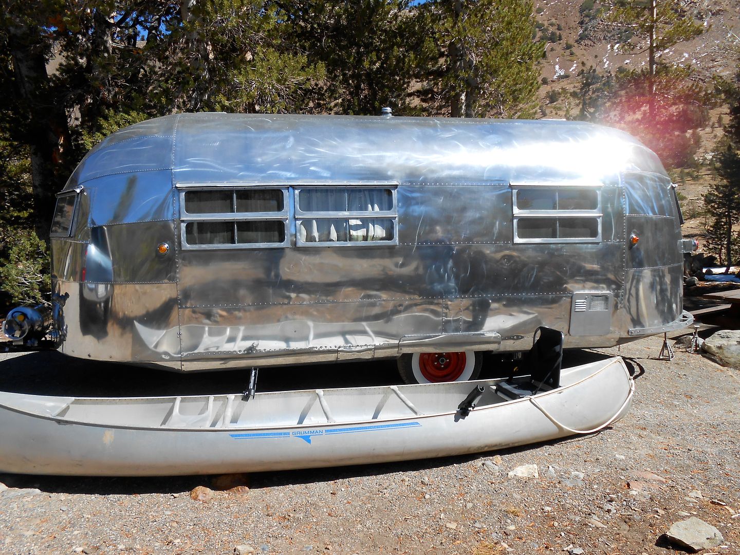
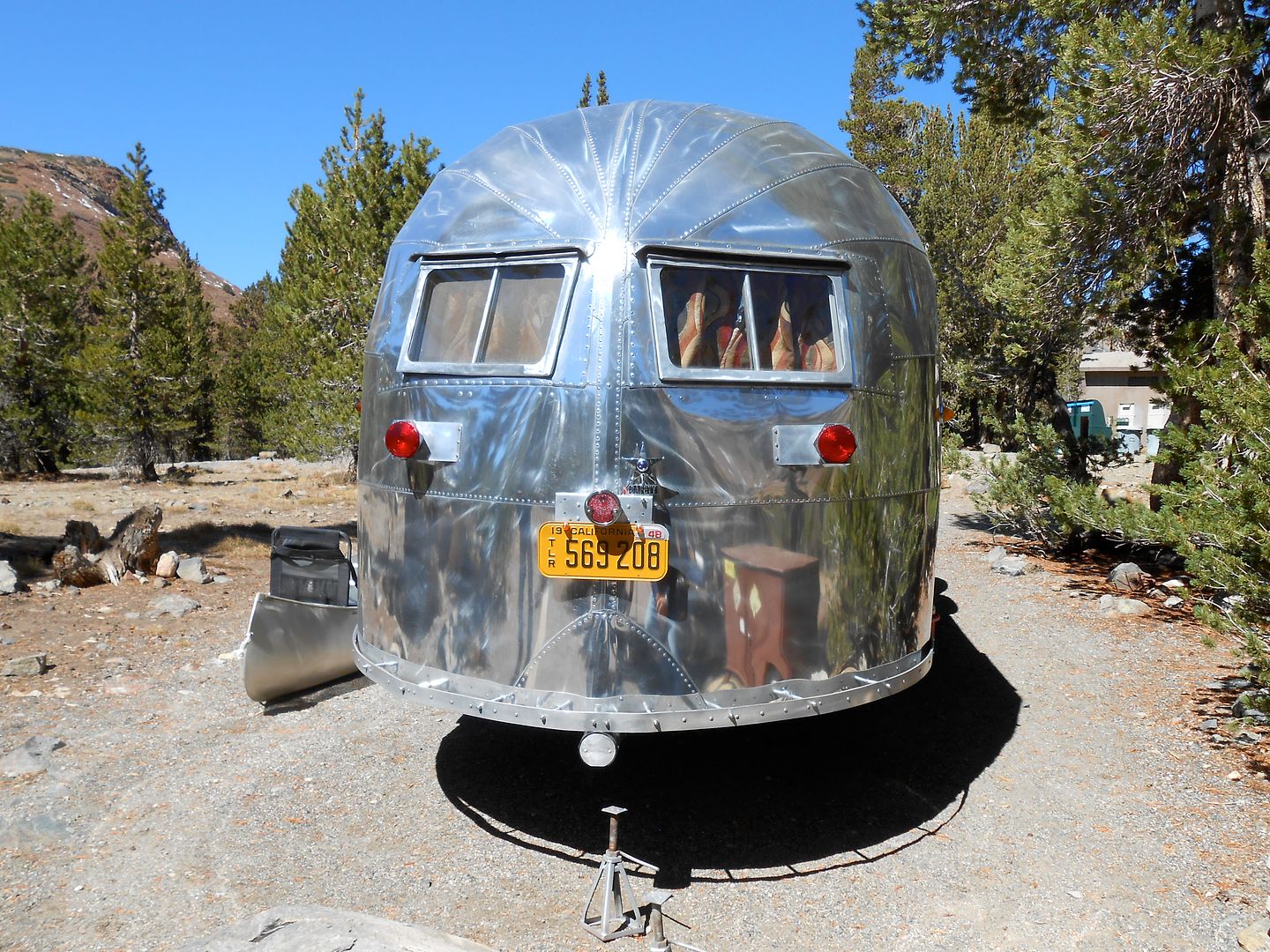
One of the only other rigs in camp was this 1946 throwback aluminum trailer painstakingly restored by the owner:
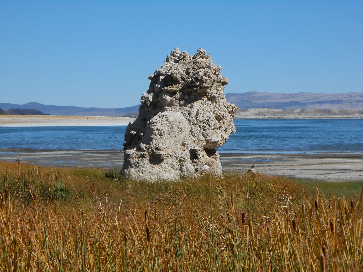
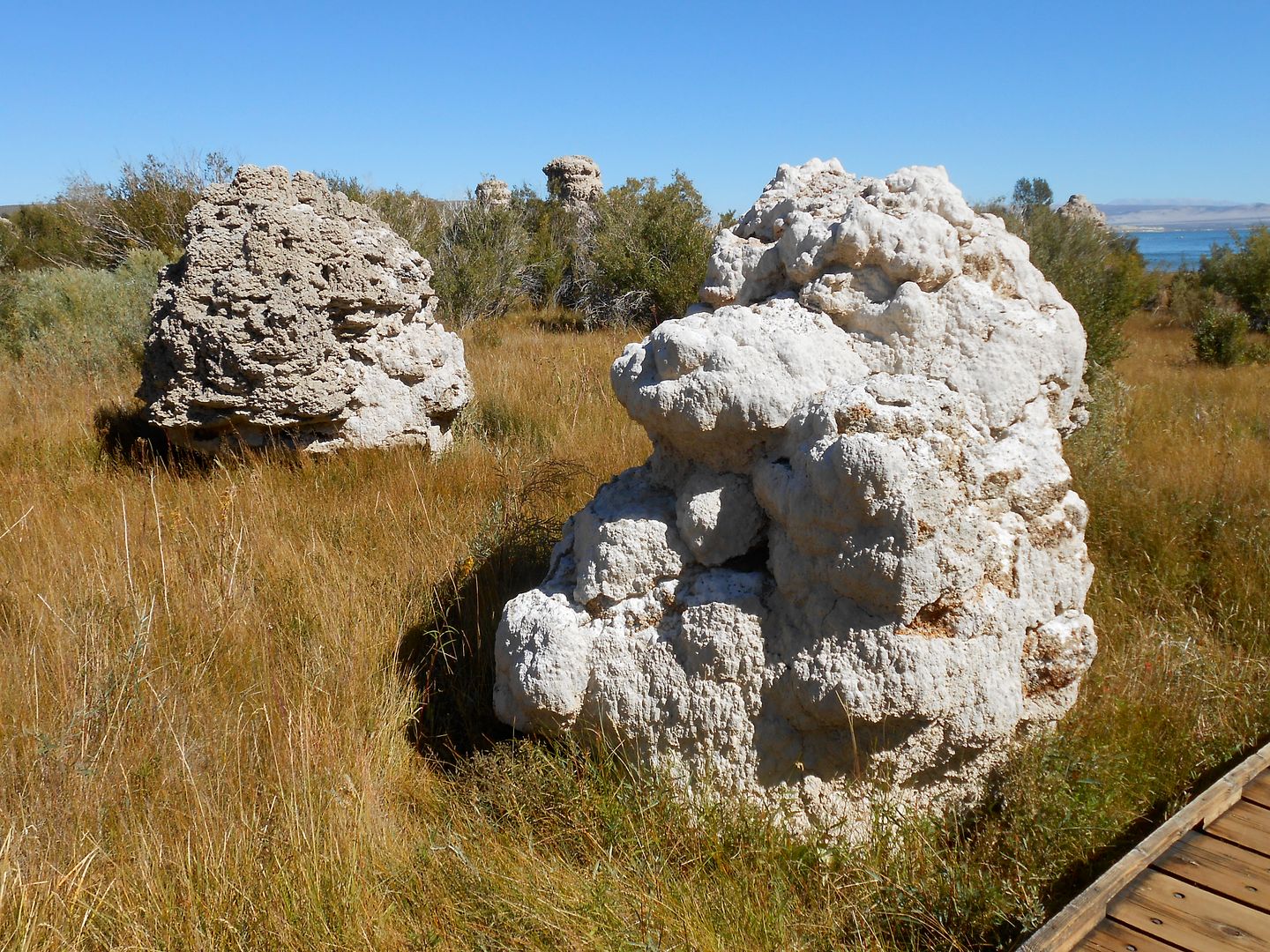
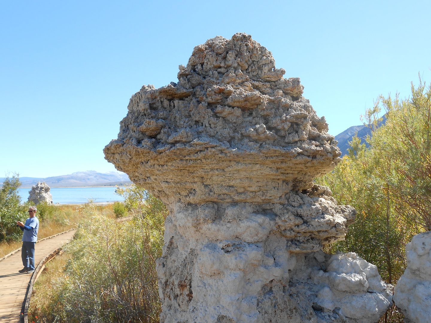
Next day we dropped down to Mono Lake. Here is tufa made from the secretions of underwater springs (when they were underwater):
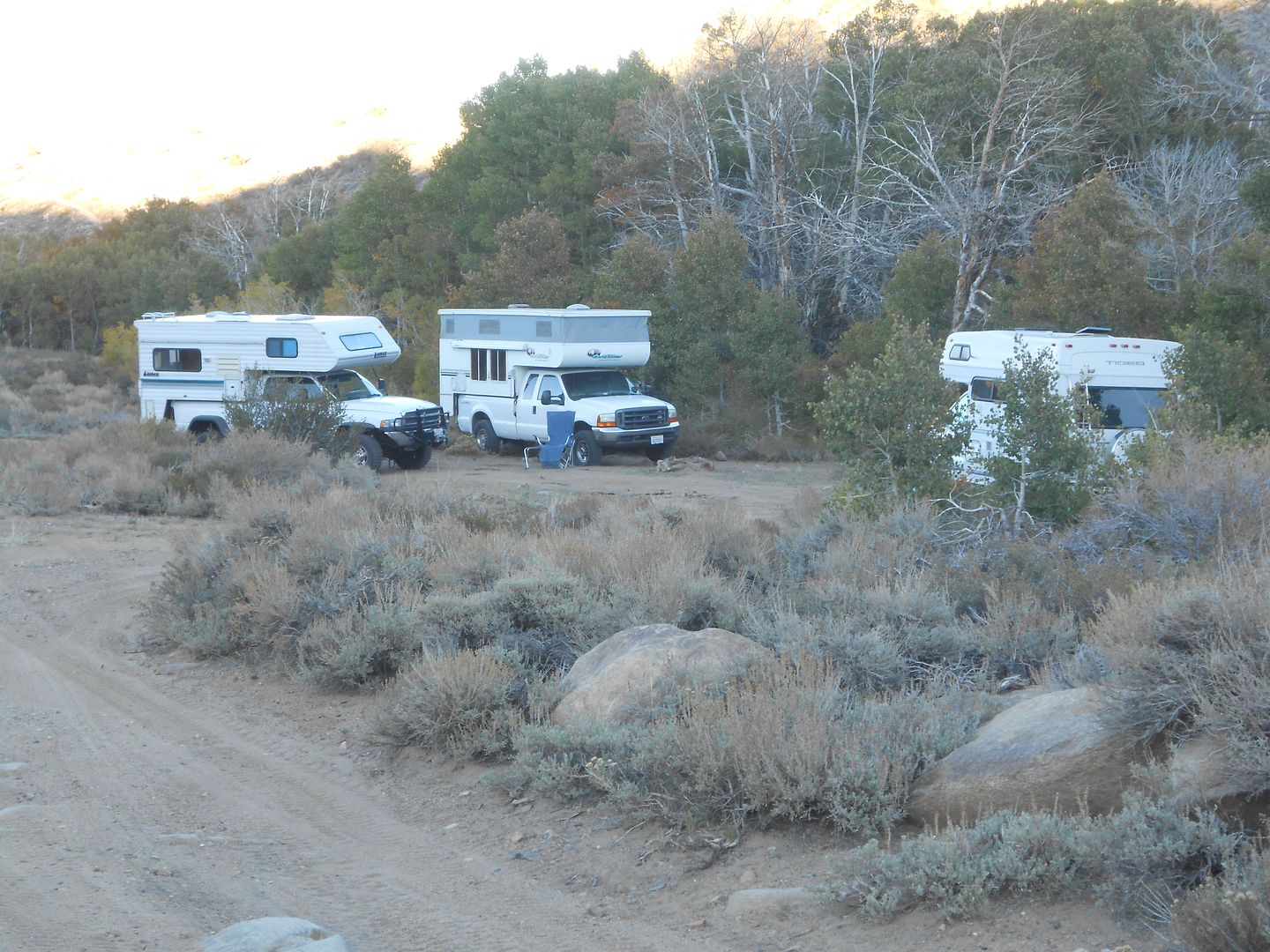
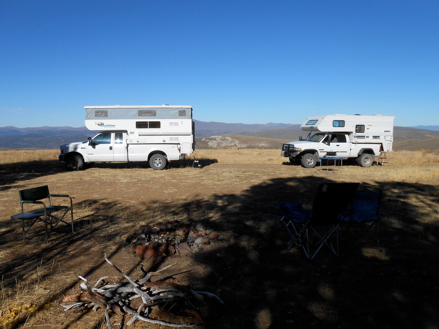
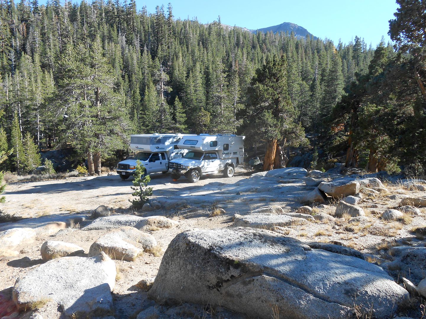
After a partial trip aroud the lake via jeep trails we headed up into the mountains again to one of my favorite camping locales of all time. Just off Dunderberg road: I think now 8800 feet.
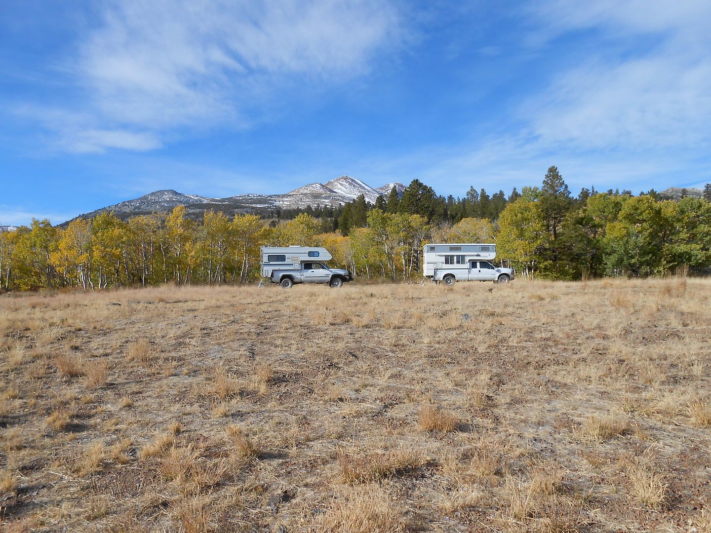
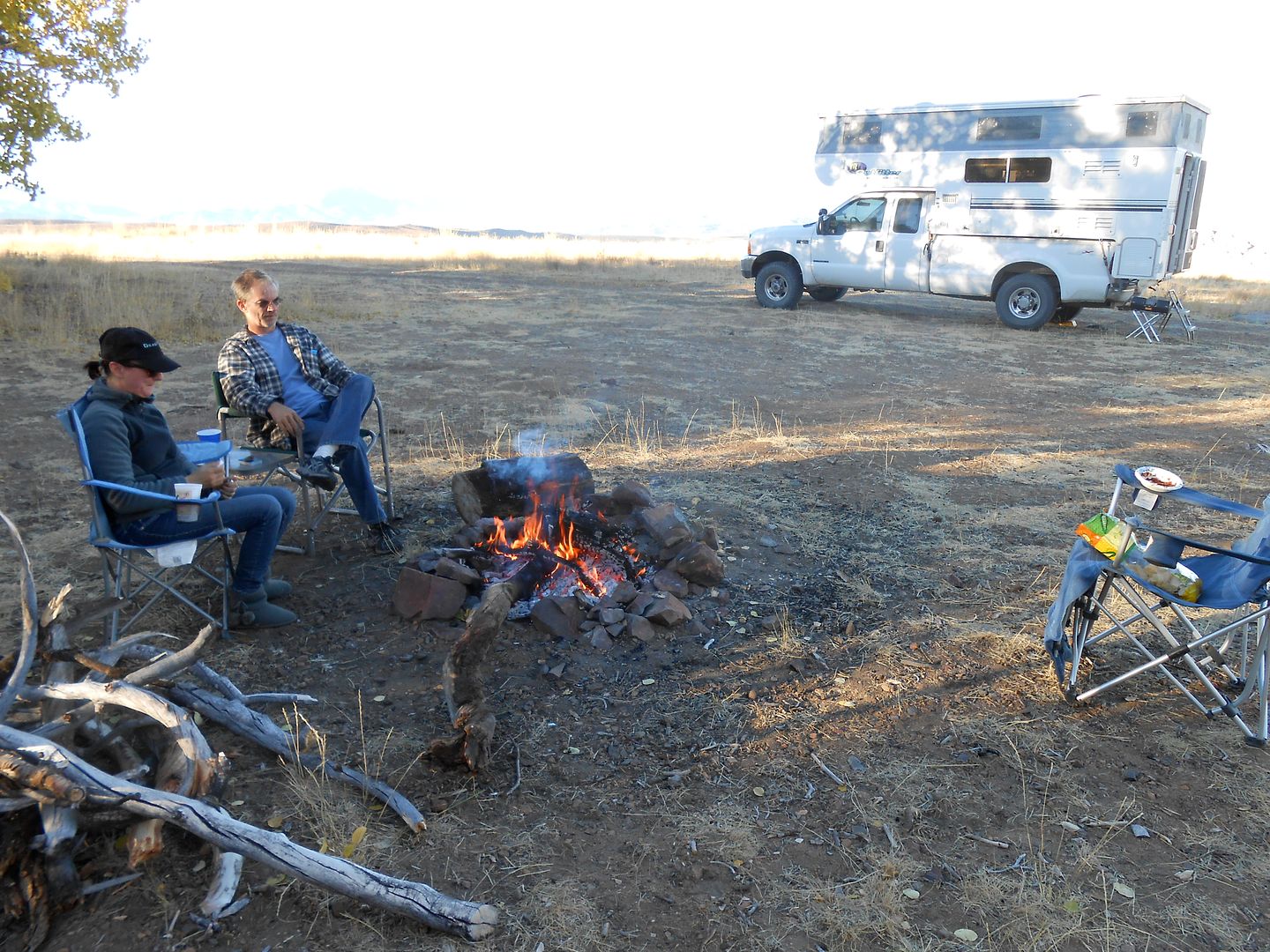
That blank place behind the rigs is Nevada which you can see for a long ways: The campfire ban now lifted, we hustled up some down and dead wood and had a great campfire:
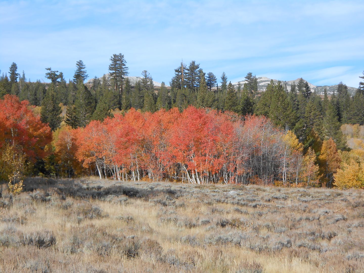
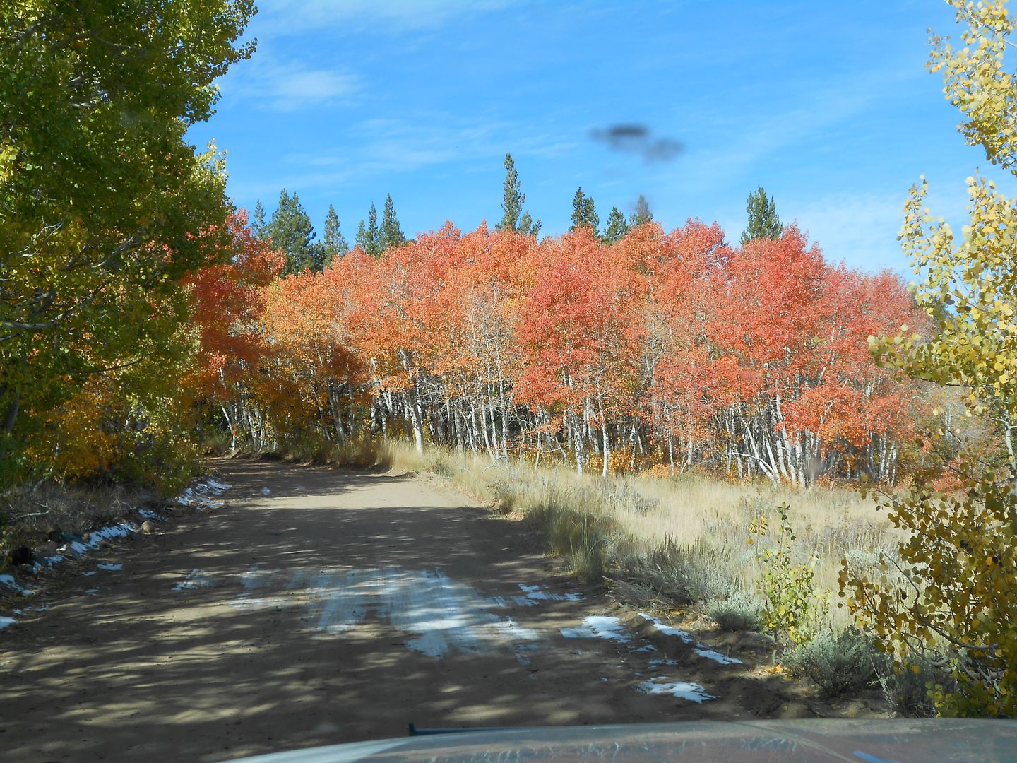
Some nice reds in Aspen:
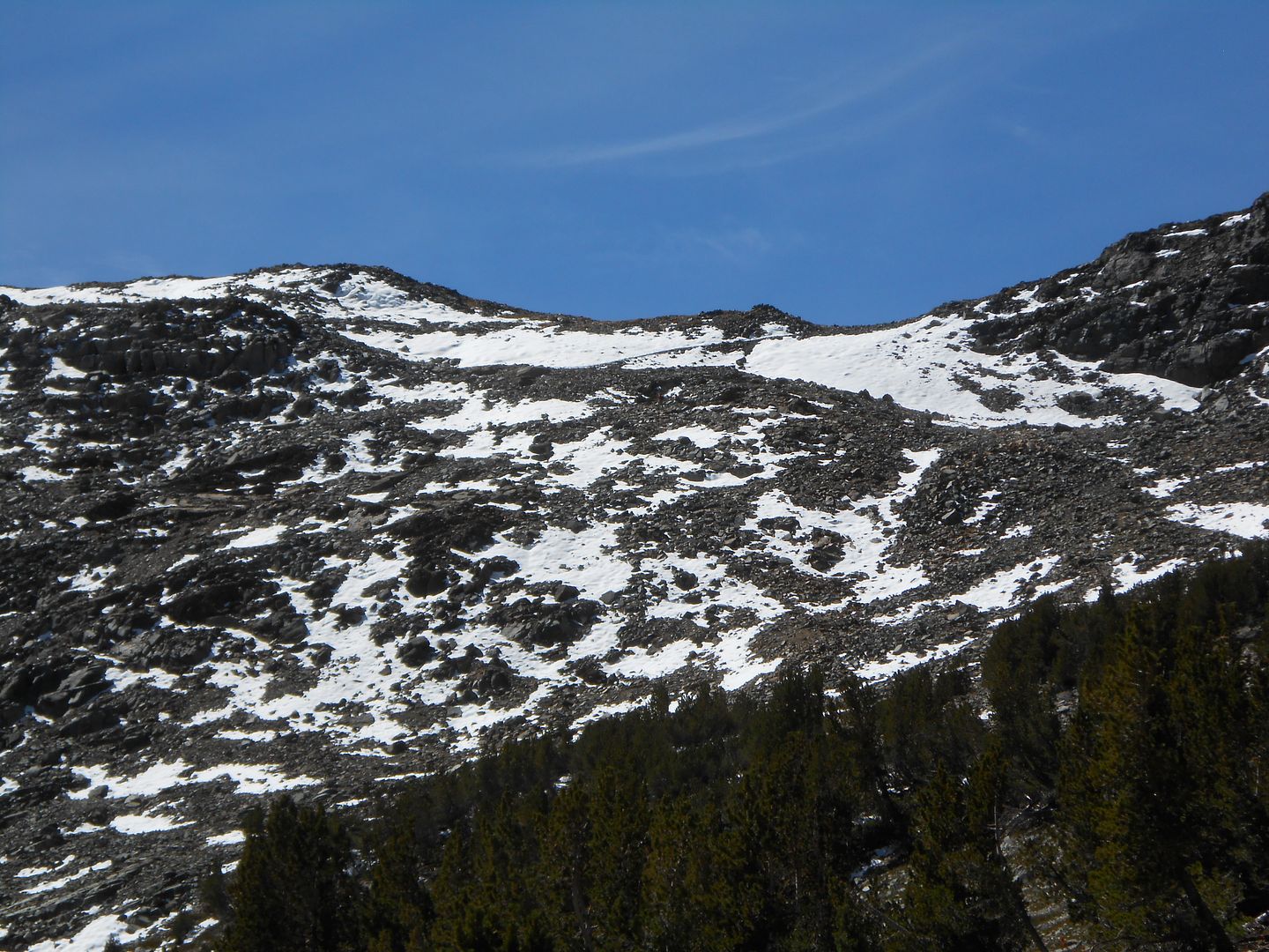
Next day we drove the few miles up higher to the Virginia Lakes roadend and took a hike up to the pass. Well, the kids made it to the pass, gramps pooped out a few hundred trail feet less:
This is as far as I got. The pass is right/center.
After the hike we skipped over to Sonora Pass (you know, the 26% grade pass) and settled in at another favorite spot near the summit at the confluence of two creeks: This is as far south as the White Bark Pines grow. Too warm farther south.
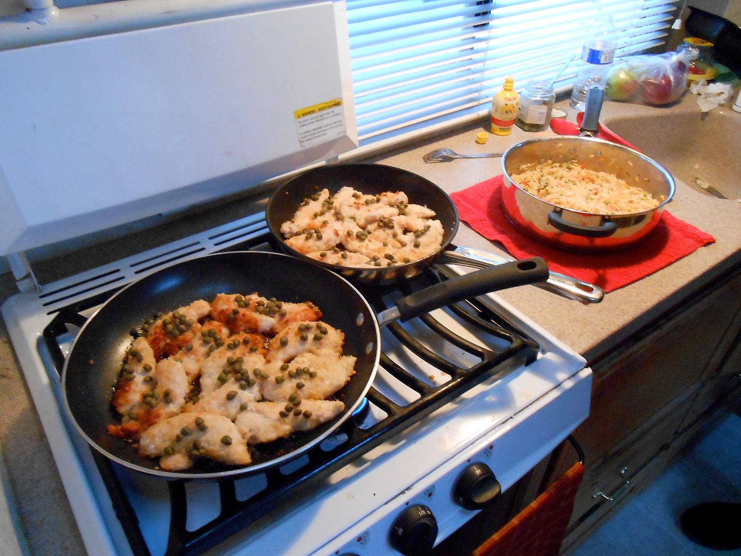
I'll leave you with the last supper at Sonora Pass: It was so sumptuous that we need my stove top also to have enough burners to make it. I cooked the rice, which is about all I'm good for.
Next morning we went our separate ways back to anonymity.
Overall, a humbling experience, in many ways.
regards, as always, jefe
What about all those XTC friends? For various reasons, I hope I’m not one of them, they had other very valid things to do. So I called my brother John who has an XTC and is a very experienced 4WD-er mostly in rock racing his tube buggy at the Hammers. He and his GF, Krys came too and cooked up some mighty fine victuals. So, game on. A few days before the liftoff, Tiger4x4 emailed me and said the new titanium knees were of sufficient strength to trail along. Good enough. Now there were 4 people in 3 rigs to do the first part of the trip.
The objective was to camp at the highest elevation you could camp in an XTC, all approaches from the east. After doing the San Juan High several years ago, I was eagerly anticipating a similar crusty, rugged trip.
I packed up the TC, which seemed voluminous with only one body in there for the duration. I had recently attached my new Glow steps, no generator, roll up table, one director’s chair, tools, and a little more food than I needed, and an allotment of one beer per day.
Since Bro John was leaving from L.A. and I was leaving from Nevada City, we had about the same drive time to meet in Bishop for lunch. Tiger4x4 joined us there.
The color was just starting to change in the Eastern Sierra and all the passes were open. Motoring south on Hwy. 395, the sign says Monitor, Tioga, and Sonora passes are open. Whopee!

Continuing south. 5 days later we would be camping in that green patch high and to the right off Dunderberg road:

After meeting for lunch in Bishop (4000 feet), we transitioned from desert to high plateau going up Salty Peterson's switchbacks:

Here's the trio of white boxes on one of the switchbacks: Do you notice what I forgot to remove? Hmm? Hmm?

Tiger has a perfect wheelbase to get stuck in some huge potholes coming up this leg and had to pump it a few times to make it up. Bro and I had a lot longer wheelbases and missed all the cool action:

This little valley is above 9000 feet and very rocky;

This was not as rocky as it got. When it's real bad, you just don't want to stop to take pix. Steep, yes. We were in 1st/2nd gear, low range for about 4 hours. Ugh! This trail is a trans eater. Luckily, Tiger 4x4 had the bullet proof 6 spd. Allison auto and Bro and I had 6 speed manuals.

This was our final resting place in our attempt to get to Coyote Flats (10,000 feet). A little creek around Salty Peterson's Mill site. He originally put the road in to service his Tungsten mine and mill. It was windy and cold here. Plus, there was a campfire ban in effect because of the low rainfall season. Next AM, we returned to Bishop to confer on where to go next.

Coming downgrade:


Bishop is still 4000 feet below:

A pit stop. This road brought us to our knees, so to speak, as it was so rough. The volcanic rock sections chewed my super singles into a new tread pattern. We all agreed this is the only time we would be on this road in a TC (or small 4x4 class C). Humbling to say the least.

A last shot coming down Salty's grade and switchbacks:

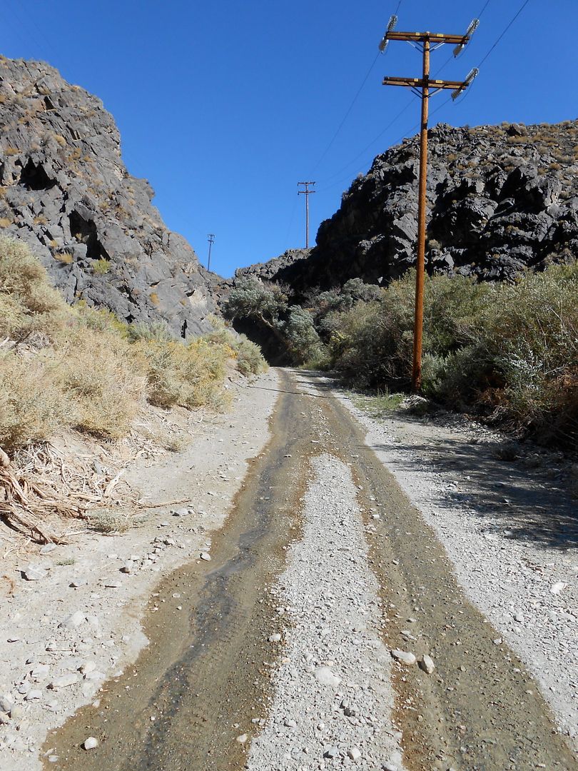
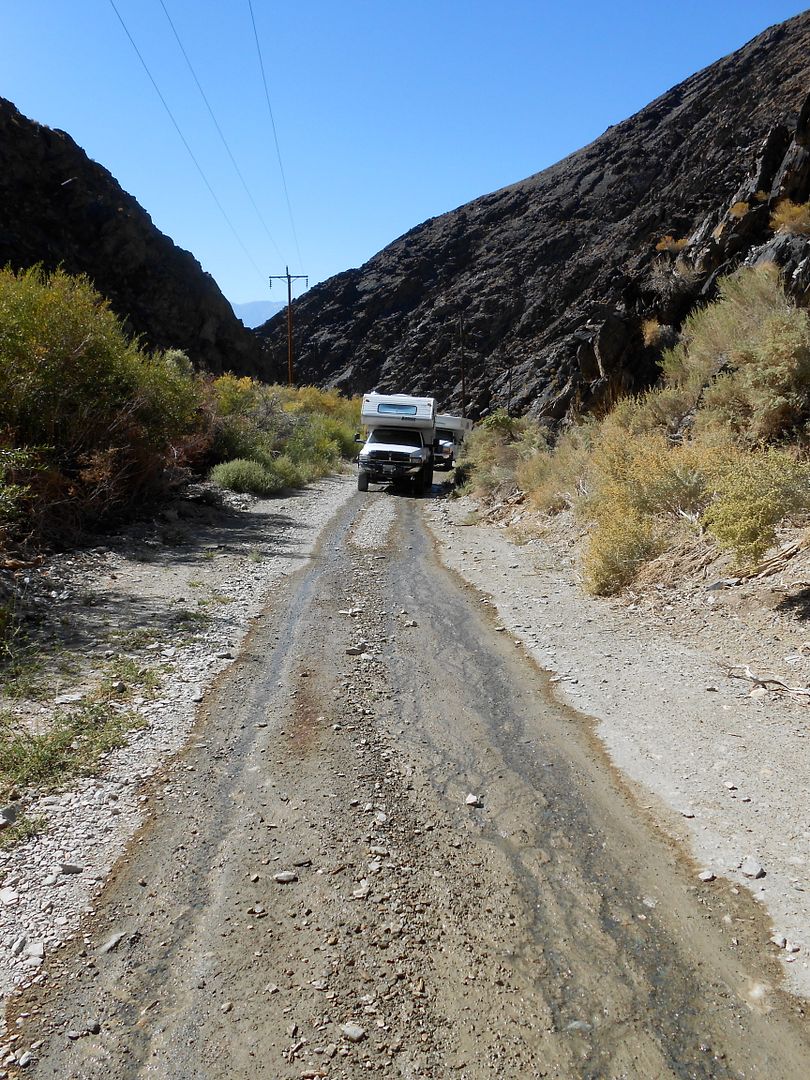
After saying good by to Tiger 4x4, Bro and I headed up Silver Canyon with the hope of seeing the Bristlecone Pines up close and personal. Silver Cyn. Rd. is basically a power line access road that winds up and up from 4000 feet to near 11,000 feet in one pop:

We are already gaining elevation and have some surprises in store:

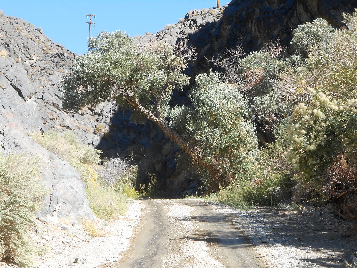
A cottonwood oasis deep in the canyon:

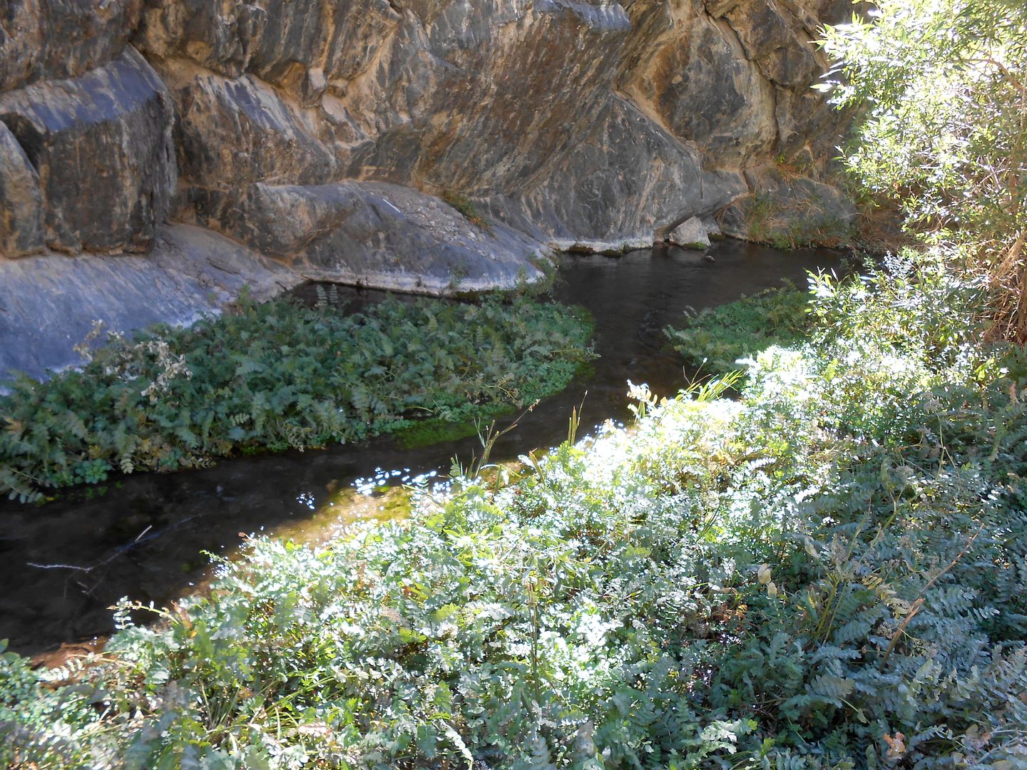
fast moving, clear water supporting many flora and fauna;

Krys gives a sense of scale in this fern grotto in the desert. A sylvan glade it is:

Bro puts his hubs on. He will need them in a short time.

I love the sign. It has it's own check list. Me thinks with the proliferation of AWD SUV;s too many people tried this with their Subarus and got into deep doodoo very quickly: so the sign:

And within 30 seconds, steep it was as we crawled out of the canyon: Much of this was low range/low gear for me.

We are up above 10,000 feet by now with Bishop far down the canyon:

Near the top, at about 10,500 feet we hit a high stand of intruding Aspens to this area: These have only appeared in the last couple decades:

A small wooden sign said to turn left and go to the Patriarch Grove of the long-lived Bristle cone pines. After 10 long and dusty miles we came upon THE Patriarch: People, this was a religious experience. How many times do you meet something in this life which has lived from 3400 years up to 4000 years? I thought so. I got tre choked up and had to just touch the Patriarch. This grove lived at 10,800 feet up to 11,000 feet in the cold, dry air. The only thing that matters to these trees is temperature. It must be cold, and high enough to miss the grinding glaciers of sundy Ice ages. The tree is so hearty, it will under duress, forsake 90% of it's bark and bulk to keep one tiny branch alive for the next generation. So those light gray areas lead up to a dead branch higher up in the tree.

The combined trunk is about 11 feet across:

The other side of the Patriarch:

Another that has forsaken most of its bark:

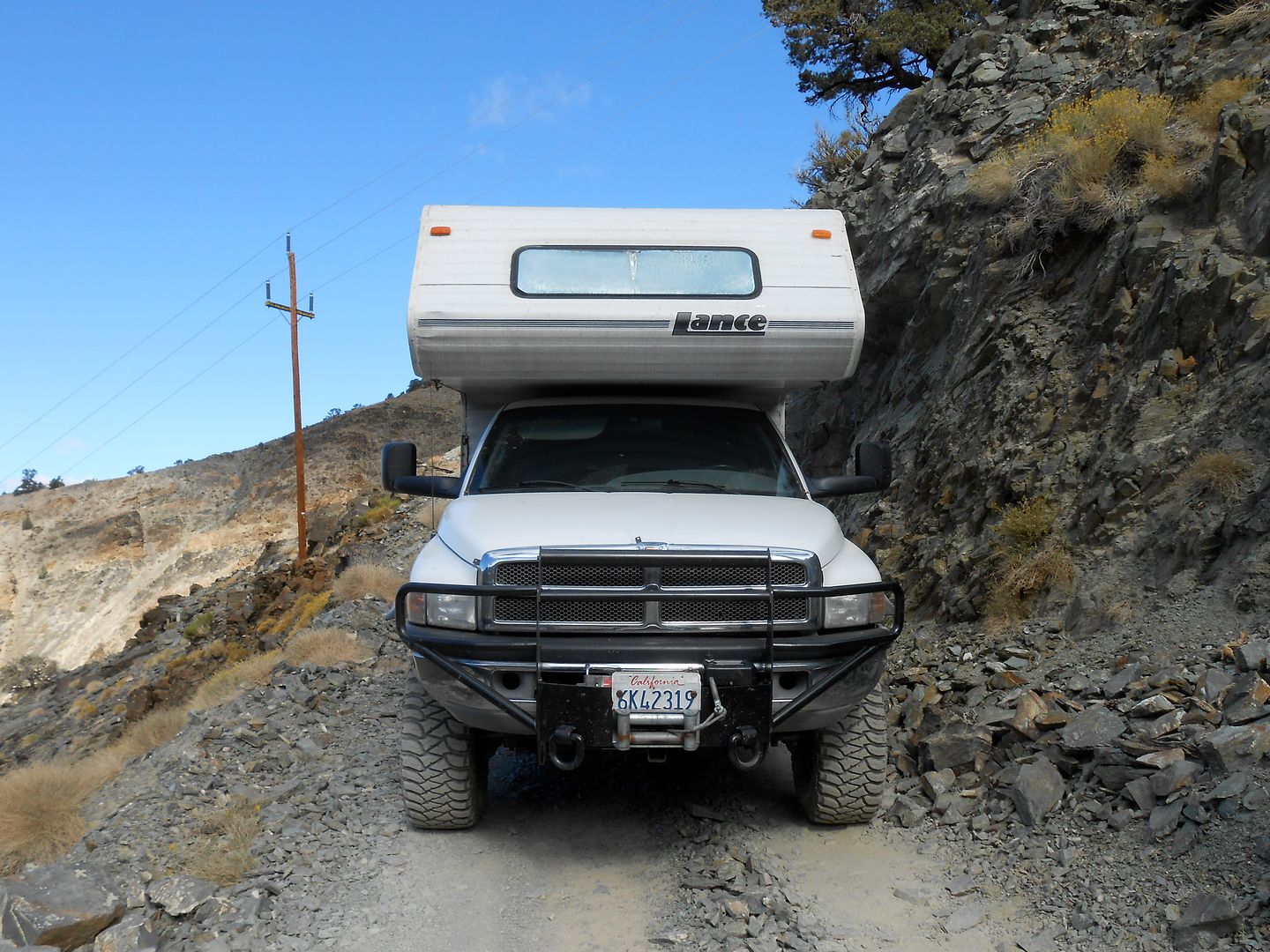
At sundown, we beat it back along the ridge line to this camp (seen the next AM). We are at the very ridge of the Inyo mountains here. Pay special attention to two things. One is Bro's camper attitude. The other is that this is the last picture of my Glow steps alive and well.

We are on our way back down Silver Cyn. with the same sign warning of steepness ahead:

Yes, it's steep:

and narrow too:

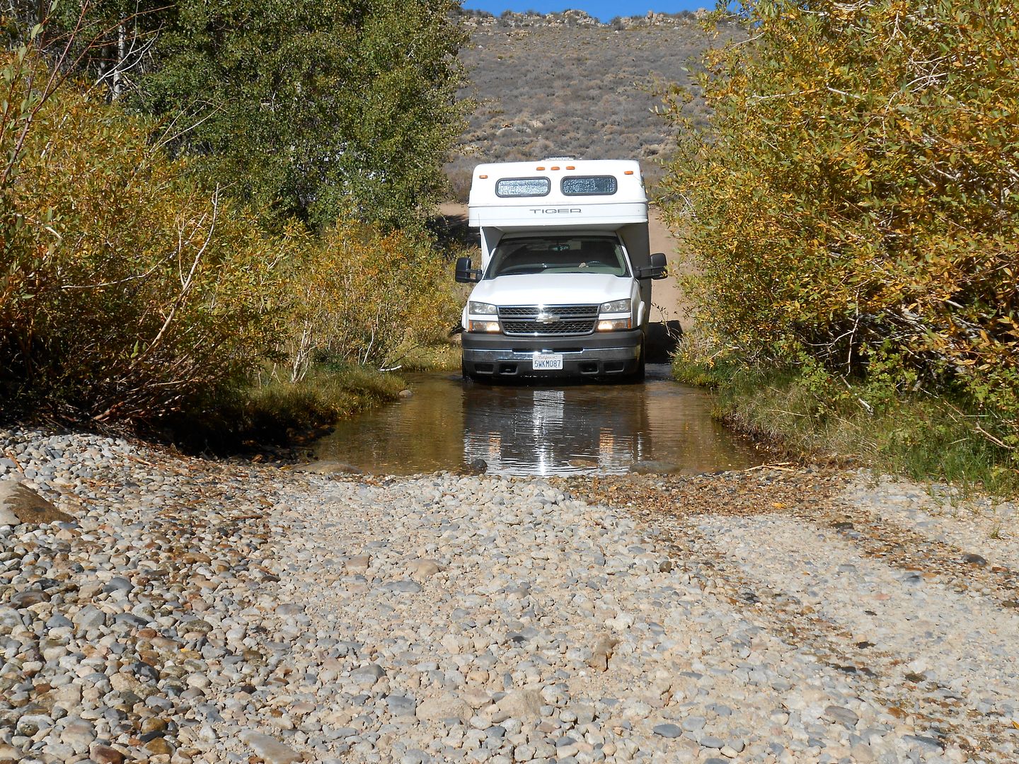
We made it down to the valley floor and toured the narrow gage train exhibit at Laws. I went back to the camper door to get some lunch out and.....there were no steps! The threshold, bottom framing, 6 lag bolts and the entire stair assy was GONE! Way back up the canyon were many creek crossings which had big dips. I surmise that a rock or something got hold of the steps and had their way with them. I had them tied up with three rubber cords, all gone. It was so rough, I decided not to spend hours looking for them. We headed to a big box store in Bishop and I bought a medium step ladder to get me by. We then noticed Bro's OUTFITTER! was caddy whompus to the truck bed. This is the first trip he has been on where he removed the electric jax (He is the new King of the Jax-off). Whip out the winch cable in the parking lot and pull the OUTFITTER! back into position. Bro uses 1K pound ratchet straps to hold everything in place and no camper guides, but I think he's under secured for steep climbs. The R-front strap snapped. We bought some more straps at the big box store. He also had a propane leak and after much digging surmised it was in the basement between the tank and the other side of the OUTFITTER! So, another day. Just make do. He turned off the gas at the tank when not in use, but his propane/gas leak detector kept going off at wierd times, like in the middle of the night. He finally cut the wire until he can fix the leak.
Alright, we proceed to Tioga Pass only 35 miles north. The objective is to camp at the highest NF campground in California: Saddlebag Lake. It is thursday evening so we think it is open and there will be space. It was and there was. Only 2 other people in camp besides the host. He came right up to us wanting to talk to someone, anyone, and Oh, take our money for the night. We arrived in a light snow:


The next day was cool and clear so we decided to do the 5 mile hike around Saddlebag lake.

Along the way around the lake: Those peaks are 12K'ers.

A quick lunch stop at a ranger's cabin. It's old with newish ammenities like short wave radio and solar panel to keep the batteries up.

One of the only other rigs in camp was this 1946 throwback aluminum trailer painstakingly restored by the owner:


Next day we dropped down to Mono Lake. Here is tufa made from the secretions of underwater springs (when they were underwater):


After a partial trip aroud the lake via jeep trails we headed up into the mountains again to one of my favorite camping locales of all time. Just off Dunderberg road: I think now 8800 feet.

That blank place behind the rigs is Nevada which you can see for a long ways: The campfire ban now lifted, we hustled up some down and dead wood and had a great campfire:


Some nice reds in Aspen:


Next day we drove the few miles up higher to the Virginia Lakes roadend and took a hike up to the pass. Well, the kids made it to the pass, gramps pooped out a few hundred trail feet less:


This is as far as I got. The pass is right/center.

After the hike we skipped over to Sonora Pass (you know, the 26% grade pass) and settled in at another favorite spot near the summit at the confluence of two creeks: This is as far south as the White Bark Pines grow. Too warm farther south.


I'll leave you with the last supper at Sonora Pass: It was so sumptuous that we need my stove top also to have enough burners to make it. I cooked the rice, which is about all I'm good for.

Next morning we went our separate ways back to anonymity.
Overall, a humbling experience, in many ways.
regards, as always, jefe
