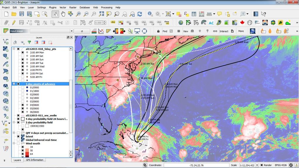
I've done an A - B compare (A is the Thursday morning white field and white tracks; B is the Friday morning black field with black tracks) in my climate app. on the model runs less than 30 hours apart.
Now, remember that Joaquin really hasn't moved AT ALL over the last 2 days (perhaps 200 kilometers: its currently scrubbing clean the surface of many Bahamian islands), and will not likely move more than 100 kilometers over the next 24 hours. Note how completely different the A and B analyses are. I've only included the following 3 primary models:
-TVCN - consensus of GFS, UKMET, NOGAPS, GFDL, HWRF, GFDN, and ECMWF models
-GFDN - United States Navy version of GFDL model using NOGAPS
and finally, the:
-GFDL - Geophysical Fluid Dynamics Laboratory (GFDL) model
You can see dramatically how utterly fickle the hurricane model runs are, given that the primary "steering mechanism" for hurricanes from more than a week ago, to about several weeks from now, is a fairly stable "Bermuda High" semi-permanent system (remember that this hurricane will rapidly drop from a Cat 4 now, to a highly steerable Cat 2 by about Saturday evening). So, this begs the question: why did the scenario A) TVCN, GFDN and TVCN vary so much from the scenario B) over such a very short period (a few dozen hours), when the macro climatological environment hadn't / didn't change and won't change significantly for at least 5+ days into the future? So really, we have very little idea where this hurricane will go over the next 2, 3, 5 days. So, better to use the precautionary principle on this one vis preparation.
Cheers,
Silver-