SheepCamp
Nov 10, 2014Explorer
TR: Some time at the Reef
It was a busy summer and we didn’t get out as much as we had hoped so we decided to spend some time over in Central Utah at Capitol Reef National Park and explore the area a bit with a little time in the San Rafael Swell. We took off about midday on the Tuesday before Halloween. Made good time and decided to call it day just north of Lake Powell.
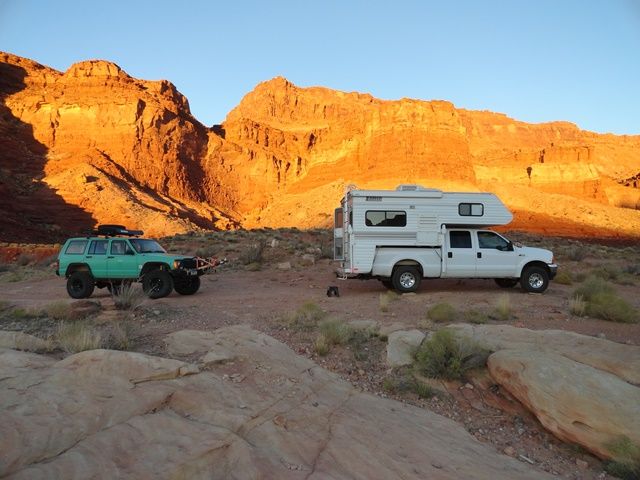
Morning found the sun up and welcoming us to a beautiful day. In order to make it easier to explore some of the areas we wanted, we decided to bring the DW’s jeep along. It flat tows nicely and saves the weight on the truck from the flatbed trailer.
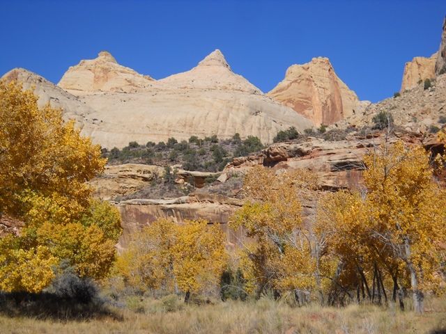
Headed on up the Fremont River in Capital Reef National Park. Fall comes a bit later in the desert and the trees were in full color. Capitol Dome is in the center and gives the Park its name.
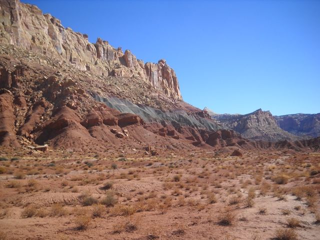
Found a nice camp spot in the campground and had time for a scenic drive before dinner. The geology of the area is shown in some of the amazing canyons and bluffs that are found in the Park.
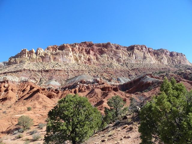
On Thursday we take off to the SE toward the towns Boulder and Escalante to explore. There is some amazing county in Central Utah and the people that settled it were far tougher than we are today.
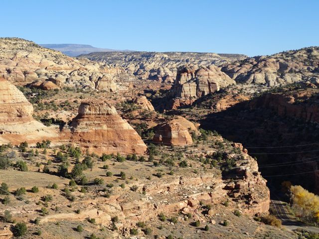
At Escalante we headed up the FS road to the Hell’s Backbone. It is a pleasant 30 mile loop up through the forest overlooking some amazing canyons.
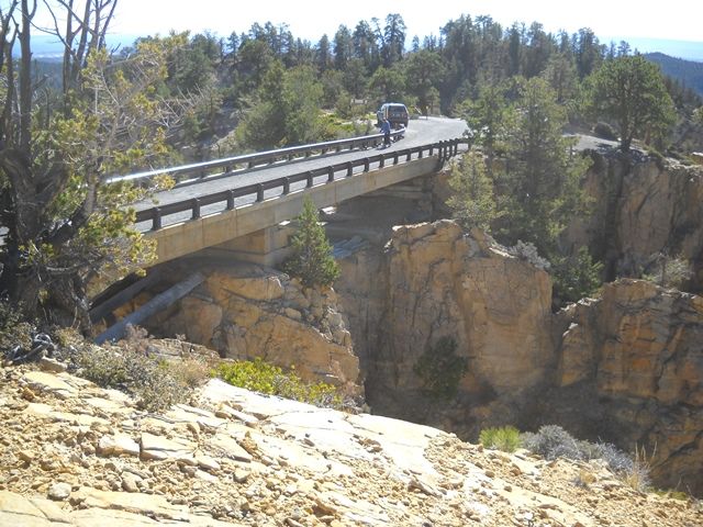
The highlight is the one lane bridge over the spines of the backbone. The original bridge was built with logs in the 1930’s by the CCC. It has been updated in recent years as the logs rotted out.
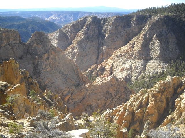
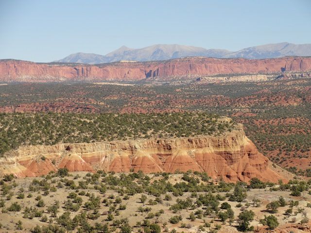
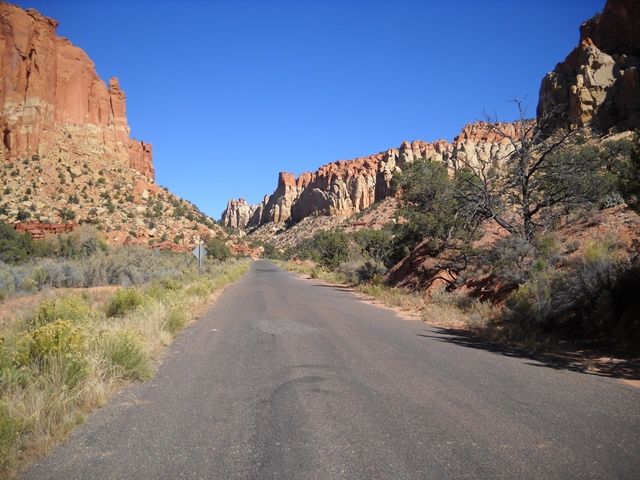
The trail loops around and comes out back at the town of Boulder. Being a little hungry we broke out the cooler and enjoyed our lunch at the Anasazi State Park and Museum. It is a nice facility that is worth your time to stop at if you pass through the area. From there we headed off down the Burr Trail. The trail is a 60 mile loop that runs from Boulder to just east of Capital Reef. The first half is paved with the last half good gravel. If you don’t want to do the gravel part, take some time and drive out and back on the paved part. There are many side roads and boondocking opportunities. The Henry Mountains are in the background. They have a free roaming herd of about 300 buffalo that lives on their western slopes.
Just about half way along is a side track up the Muley Twist Creek. A short 3 mile spur that leads to a interesting hike along the narrow canyon and a short side trail to an overlook of the Waterpocket Fold.
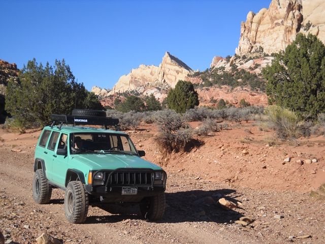
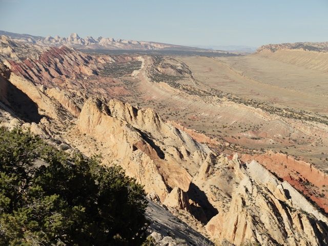
An impressive view of the Waterpocket Fold and what Mother Nature can do when she gets mad and folds up the earth’s crust. Looking south.
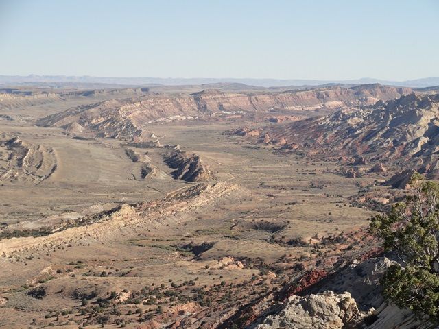
Looking north. Capitol Reef in the background
With one day left at Capitol Reef we decided that we would take a trip to Cathedral Valley. This is a 60 dirt track through some amazing geologic features.
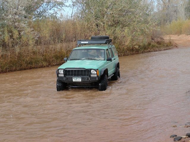
At the start start, you ford the Fremont River. Not to bad but could be interesting after a storm
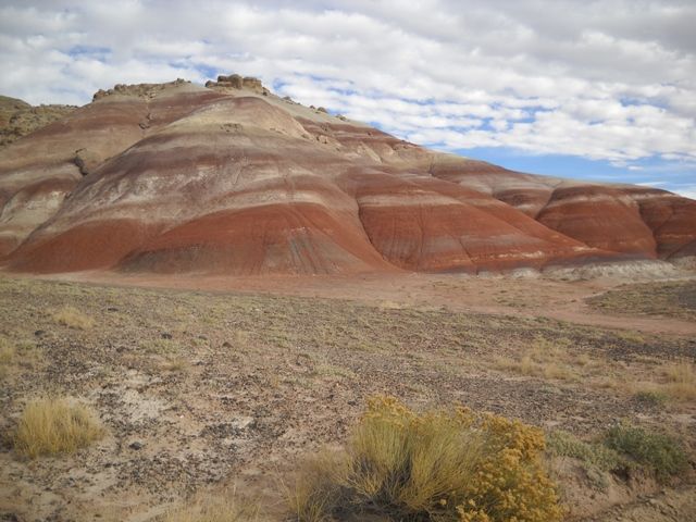
Brightly colored Bentonite Hills
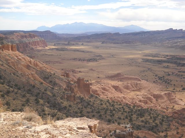
Desert Overview shows the varied geology. Volcanic plugs and dikes mixed in with multi-colored sandstones. Henry Mountains in the distance
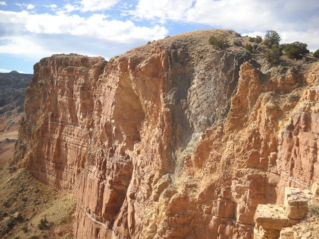
Hasn’t everyone always wondered what a volcano looks like underground. (OK, maybe someone has) here is your chance, a volcanic plug with its side exposed.
Overview of Cathedral Valley
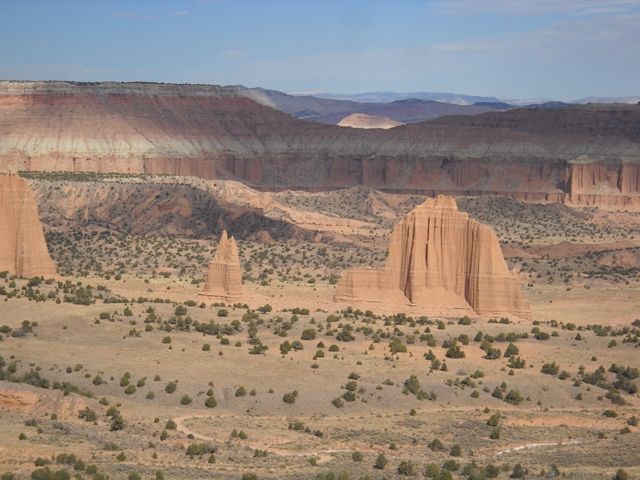
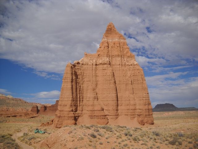
On the way out you pass the Temples of the Sun and Moon. Our lunch stop at the Temple of the Moon
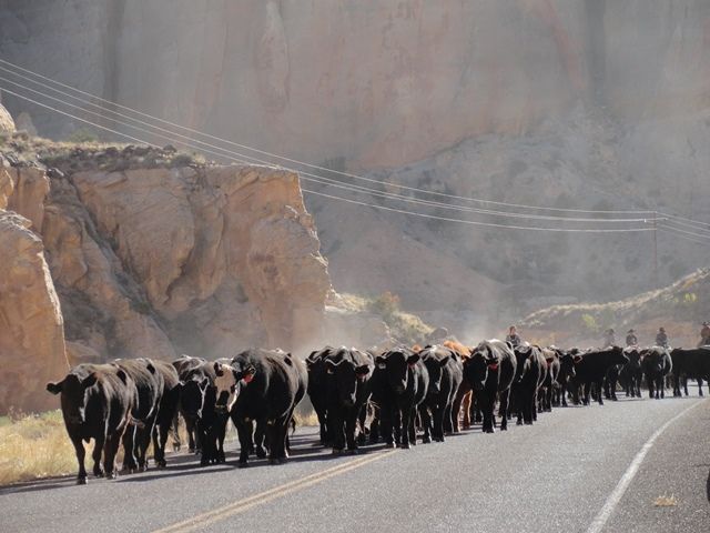
On our way back to camp, we ran into a western traffic jam. Local cowboys were moving their cows from their summer pasture in the high mountains down into the desert where they will spend the winter. Just two weeks before we had helped our son move his father-in law’s large herd of cows and calves from their mountain pastures in the La Plata Mountains down through downtown Mancos, Colorado, along Main Street past the Bank and Post Office to their home ranch south of town.
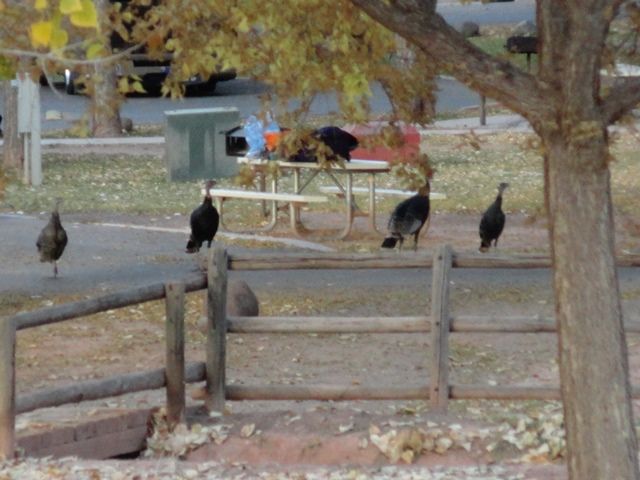
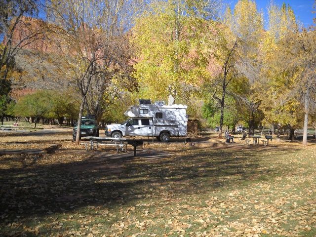
Capitol Reef has a very nice campground (no hookups) at the old Mormon community of Fruita. Large cottonwood trees in the campground and with abundant wildlife roaming through the spaces. Mule deer and wild turkeys roam freely among the campers and feed on fallen fruit from over 3200 fruit trees from the well maintained orchards that were planted in the 1880’s by the pioneer settlers. One of the nicest treat is the Gifford House, an old homestead home that now is a store run by the local Park Association. They bake fresh bread and fruit pies daily (also delicious cinnamon rolls) and many home canned goods. Fresh Pie and homemade ice cream sure made dinner a pleasure each night.
Apple orchards in the left background. I took a walk and picked some apples for snacks (they provide ladders and picking sticks). They open the orchards as the fruit becomes ripe for you to pick in quanity for a small fee. They have most fruits somewhere around the area, apples, peaches, pears, cherries and others.
While we enjoy the modern amenities of the area, it is fascinating to realize that we are not the first to enjoy this area. This area has been a homeland to people for thousands of years. Archaic hunters and gatherers migrated through the canyons and later, the Fremont Culture began farming corn, beans, and squash. Petroglyphs etched in rock walls and painted pictographs remain as sacred remnants of the ancient Indians' saga.
The pictographs here are about 3 ft tall.
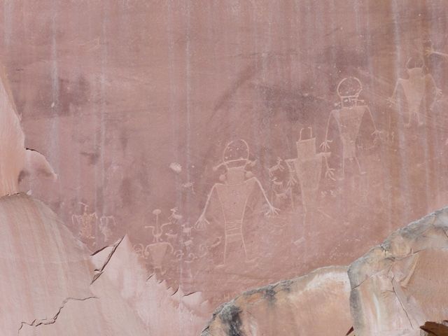
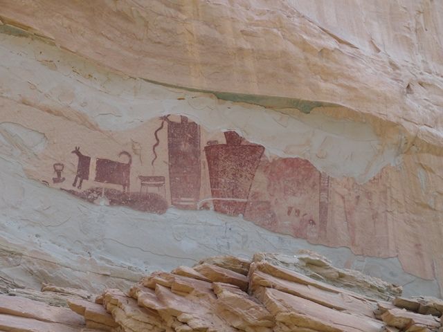
These larger than life pictographs are in a canyon in the San Rafael Reef. They have weathered pretty hard as the sandstone has flakes off. There are both older Barrier Canyon style (1500 to 4000 Yr old) and newer Fremont style (700 to 1300 Yr old). The animal on the left is a dog.
After our time at the “Reef”, we decided to go and poke our toes into the “Swell”. To the NE about 60 miles is some more exciting areas to explore. On the day after Halloween we stop by Goblin Valley State Park to check out the amazing hoodoos and spires.
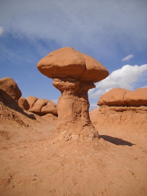
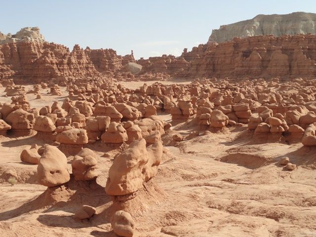
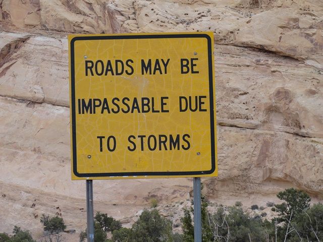
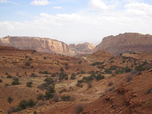
An hour or so playing hide and seek with the hundreds of goblins wore us out so we turned the Cherokee loose and headed into the San Rafael Swell. With limited time and inclement weather rolling in, we just got our feet wet exploring the Swell as we made plans for an extended time to return to the Swell in the future.
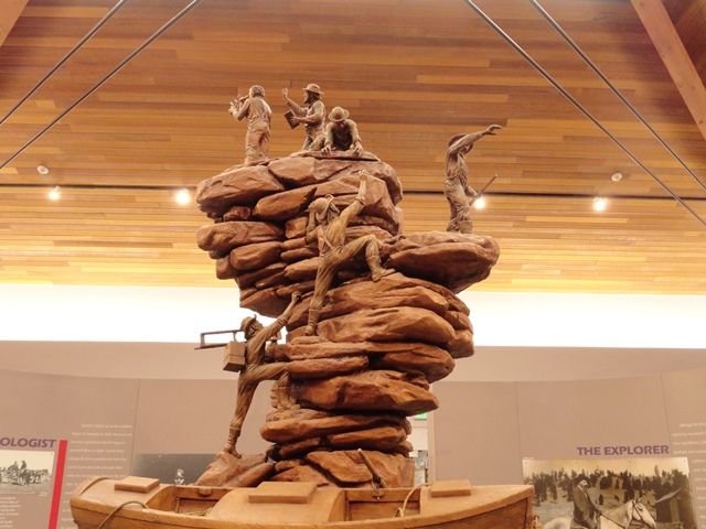
With our goal of Moab for the night we headed to the town of Green River. One of those hidden treasures in Utah is the John Wesley Powell River History Museum. On the banks of the Green River on the east end of town is a first class museum that is worth a couple hours of your time. Very nice museum which is full of interesting displays and information on the exploration of the Green and Colorado Rivers.
On to Moab for a night along the Colorado River and a nice dinner in town before our final run for home.
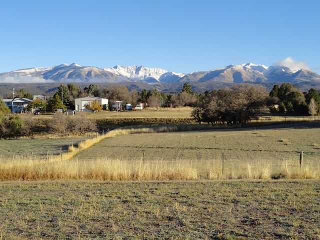
As winter shows it is not far off, we settle in at home to plan our future trips to the wilds of the Colorado Plateau.
Morning found the sun up and welcoming us to a beautiful day. In order to make it easier to explore some of the areas we wanted, we decided to bring the DW’s jeep along. It flat tows nicely and saves the weight on the truck from the flatbed trailer.

Headed on up the Fremont River in Capital Reef National Park. Fall comes a bit later in the desert and the trees were in full color. Capitol Dome is in the center and gives the Park its name.

Found a nice camp spot in the campground and had time for a scenic drive before dinner. The geology of the area is shown in some of the amazing canyons and bluffs that are found in the Park.


On Thursday we take off to the SE toward the towns Boulder and Escalante to explore. There is some amazing county in Central Utah and the people that settled it were far tougher than we are today.

At Escalante we headed up the FS road to the Hell’s Backbone. It is a pleasant 30 mile loop up through the forest overlooking some amazing canyons.
The highlight is the one lane bridge over the spines of the backbone. The original bridge was built with logs in the 1930’s by the CCC. It has been updated in recent years as the logs rotted out.


The trail loops around and comes out back at the town of Boulder. Being a little hungry we broke out the cooler and enjoyed our lunch at the Anasazi State Park and Museum. It is a nice facility that is worth your time to stop at if you pass through the area. From there we headed off down the Burr Trail. The trail is a 60 mile loop that runs from Boulder to just east of Capital Reef. The first half is paved with the last half good gravel. If you don’t want to do the gravel part, take some time and drive out and back on the paved part. There are many side roads and boondocking opportunities. The Henry Mountains are in the background. They have a free roaming herd of about 300 buffalo that lives on their western slopes.


Just about half way along is a side track up the Muley Twist Creek. A short 3 mile spur that leads to a interesting hike along the narrow canyon and a short side trail to an overlook of the Waterpocket Fold.

An impressive view of the Waterpocket Fold and what Mother Nature can do when she gets mad and folds up the earth’s crust. Looking south.

Looking north. Capitol Reef in the background

With one day left at Capitol Reef we decided that we would take a trip to Cathedral Valley. This is a 60 dirt track through some amazing geologic features.
At the start start, you ford the Fremont River. Not to bad but could be interesting after a storm

Brightly colored Bentonite Hills

Desert Overview shows the varied geology. Volcanic plugs and dikes mixed in with multi-colored sandstones. Henry Mountains in the distance

Hasn’t everyone always wondered what a volcano looks like underground. (OK, maybe someone has) here is your chance, a volcanic plug with its side exposed.

Overview of Cathedral Valley

On the way out you pass the Temples of the Sun and Moon. Our lunch stop at the Temple of the Moon

On our way back to camp, we ran into a western traffic jam. Local cowboys were moving their cows from their summer pasture in the high mountains down into the desert where they will spend the winter. Just two weeks before we had helped our son move his father-in law’s large herd of cows and calves from their mountain pastures in the La Plata Mountains down through downtown Mancos, Colorado, along Main Street past the Bank and Post Office to their home ranch south of town.

Capitol Reef has a very nice campground (no hookups) at the old Mormon community of Fruita. Large cottonwood trees in the campground and with abundant wildlife roaming through the spaces. Mule deer and wild turkeys roam freely among the campers and feed on fallen fruit from over 3200 fruit trees from the well maintained orchards that were planted in the 1880’s by the pioneer settlers. One of the nicest treat is the Gifford House, an old homestead home that now is a store run by the local Park Association. They bake fresh bread and fruit pies daily (also delicious cinnamon rolls) and many home canned goods. Fresh Pie and homemade ice cream sure made dinner a pleasure each night.

Apple orchards in the left background. I took a walk and picked some apples for snacks (they provide ladders and picking sticks). They open the orchards as the fruit becomes ripe for you to pick in quanity for a small fee. They have most fruits somewhere around the area, apples, peaches, pears, cherries and others.

While we enjoy the modern amenities of the area, it is fascinating to realize that we are not the first to enjoy this area. This area has been a homeland to people for thousands of years. Archaic hunters and gatherers migrated through the canyons and later, the Fremont Culture began farming corn, beans, and squash. Petroglyphs etched in rock walls and painted pictographs remain as sacred remnants of the ancient Indians' saga.
The pictographs here are about 3 ft tall.

These larger than life pictographs are in a canyon in the San Rafael Reef. They have weathered pretty hard as the sandstone has flakes off. There are both older Barrier Canyon style (1500 to 4000 Yr old) and newer Fremont style (700 to 1300 Yr old). The animal on the left is a dog.

After our time at the “Reef”, we decided to go and poke our toes into the “Swell”. To the NE about 60 miles is some more exciting areas to explore. On the day after Halloween we stop by Goblin Valley State Park to check out the amazing hoodoos and spires.


An hour or so playing hide and seek with the hundreds of goblins wore us out so we turned the Cherokee loose and headed into the San Rafael Swell. With limited time and inclement weather rolling in, we just got our feet wet exploring the Swell as we made plans for an extended time to return to the Swell in the future.


With our goal of Moab for the night we headed to the town of Green River. One of those hidden treasures in Utah is the John Wesley Powell River History Museum. On the banks of the Green River on the east end of town is a first class museum that is worth a couple hours of your time. Very nice museum which is full of interesting displays and information on the exploration of the Green and Colorado Rivers.

On to Moab for a night along the Colorado River and a nice dinner in town before our final run for home.
As winter shows it is not far off, we settle in at home to plan our future trips to the wilds of the Colorado Plateau.

