Forum Discussion
AKsilvereagle
May 08, 2022Explorer II
Practically all of the private storage and RV parks in Fairbanks are relatively safe from potential thieves if one is to temporarily leave their rig there, in order to venture elsewhere abroad....
As mentioned about Pioneer Park (formerly Alaskaland) which was first built in 1967 commemorating the 100th year anniversary of the 1867 Alaska purchase from Russia, is a safe parking lot to stay at also as is Walmart, Cosco, etc. - however if one were to leave their rig unattended for a few days at those type of unsecured public type places I would highly advise NOT leaving an RV there (or anywhere in Alaska for that matter) while unattended other than one full day at the most....people here know how to case things out and rip off too.
Two factors not mentioned reference to the Taylor Hwy (Alaska Hwy 5)-
1 - Before venturing on this road in a class C or motorcoach, DO CHECK ROAD CONDITIONS prior to travel if it has been raining substantially as portions of this roadway and terrain can potentially washout like it did in four places in 2010 and made it impassible for 2 months...if the road is open for travel while severely wash boarded or saturated, traveling in a large type vehicle thru this stretch is not for the faint at heart.
The general roughest parts I am mentioning are in the mile 60 thru mile 96 stretch at the Y (Jack Wade Junction)...please take it slow and don't try to make time like some idiots do in their 40 ft motorcoaches driving 50 mph+ thru these stretches....
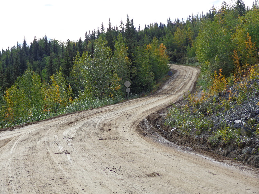
August 2014 - Mile 72 Taylor Hwy :
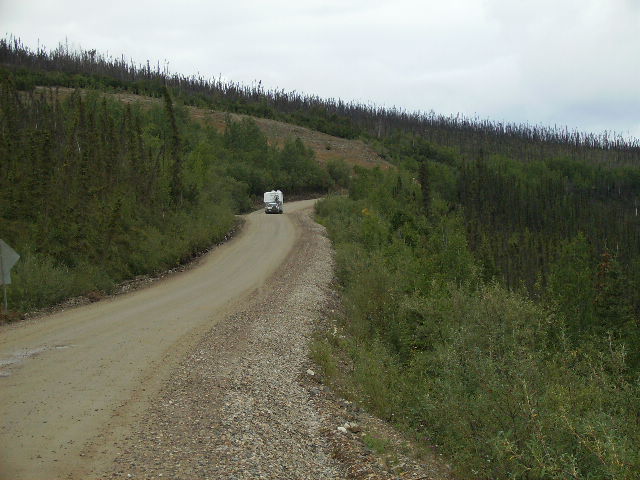
August 2008 - Mile 81 Taylor Hwy :
Soft shoulder area showing truck pulling fifth wheel -
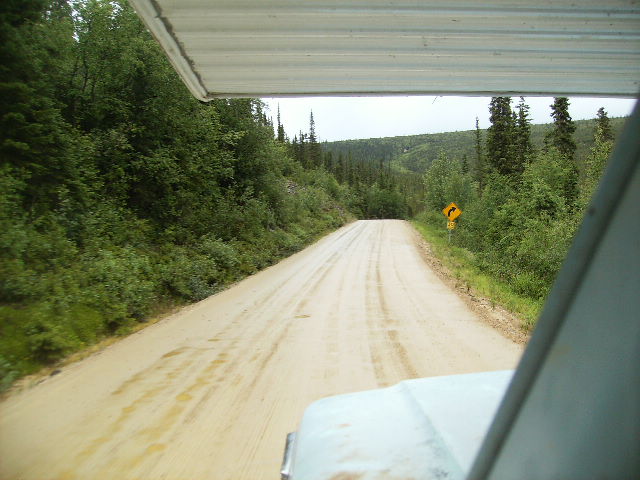
July 2010 - Mile 92 Taylor Hwy :
Saturated and slippery roadway while climbing grade - 10 days before the historic road closure happened in four locations due to flooding and torrential rains...
There are a few BLM campgrounds along the way on this route (Walker Fork at mile 81 is my favorite) as their are also a few turnouts and remote spots to park for an overnighter.
Chicken at mile 66 has sites available as well, and make sure to visit "Downtown Chicken" for the real experience !!!
2 - Since 2014, Boundary Spur Road which is the 14 mile stretch linking the Y at Jack Wade Junction (mile 96) to the International Border (joint Canada - US Customs station) has been fully paved for the first time ever and was real nice when I drove it in 2014 and 2016...
August 2014 - Mile 8 Boundary Spur Road and Airstrip :

July 2010 - Mile 8 Boundary Spur Road and Airstrip :
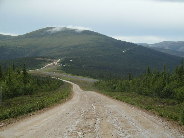
I would today expect a few unattended potholes to dodge here and there since these roads are the far north normalcy type of condition, however it is such a blessing compared to the old unpaved condition of this stretch which most of the time took me an hour to drive 14 miles in the past it was so beat up, especially during and after the rain.
As mentioned, the Canadian side (Top of the World Hwy) is spot on with intermittent chip seal surfaces, and unpaved portions as well that are not as rough compared to the rough stretch of the Taylor Hwy.
August 2016 - Mile 65 top of the World Hwy.

May 1992 - Canada Customs - Mile 66 Top of the World Hwy. :
My first trip to Dawson City 30 years ago this year in my 1970 Thunderbird when it was still separate custom stations -
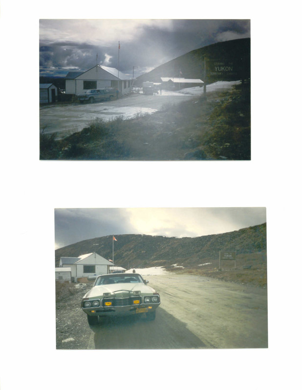
July 1998 - better picture of separate custom stations on my second trip to Dawson City (and Skagway) during the 100th anniversary Klondike Gold Rush :

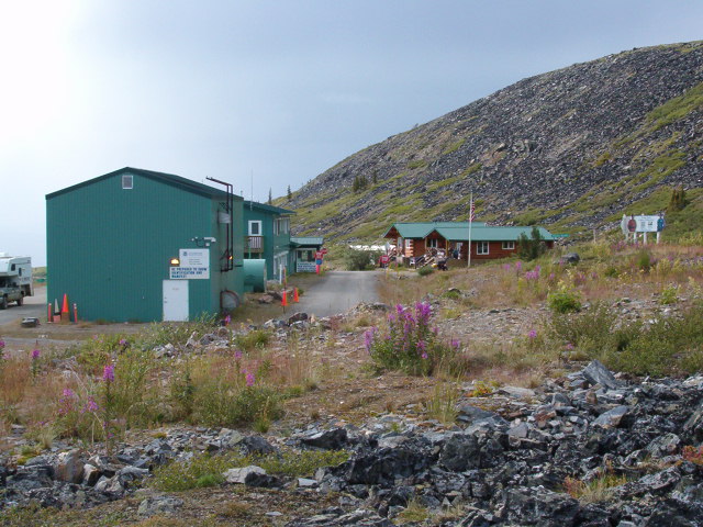
Fun Fact : the white Canada customs building was moved a second time to it's current location of 4 miles on the Alaska side just outside of Boundary at mile 10, I think I seen it one mile inside Alaska previously when the new joint building station was completed...

...To this day in 1998 was the best road surface condition I ever seen the Top of the World Hwy. in, real smooth all the way from the border to Dawson.
August 2006 - First picture taken of replacement joint Canada-USA Customs Station :
Dawson City Yukon is like Virginia City Nevada on steroids, they really preserve the history of the town and is a very unique area - and the local people are really something there as my great friend introduced me to pioneers that have lived there for a very long time as their grandparents were first generation Gold Rush settlers.
September 2012 - Fifth Ave. at York St. - Dawson City Yukon :
My friend owns this vacant lot in downtown Dawson as I get to boondock next to the Gold Rush RV Park -

August 2016 :

Tombstone Territorial Park on the Dempster Hwy. is worth a sidetrip to visit as long as it is ok or good enough weather....
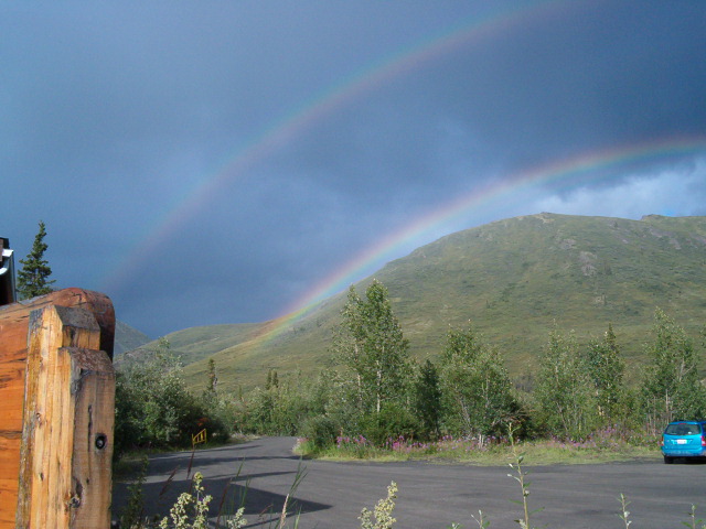
August 2006 - Tombstone Territorial Park - double rainbow :
I would also highly recommend driving at least 50 miles north of Tombstone Territorial Park to see the substantial changes to the landscape every 10 miles which blew my mind as I only driven as far as Engineer Creek before having to turn around due to my front truck cab mount caving in and made my steering real tight (steering shaft was holding up the entire truck cab) and lucky enough made it back to Dawson and then all the way home...so Inuvik is still on my bucket list.
August 2006 - Mile 52 Dempster Hwy. - Angelcomb Peak :
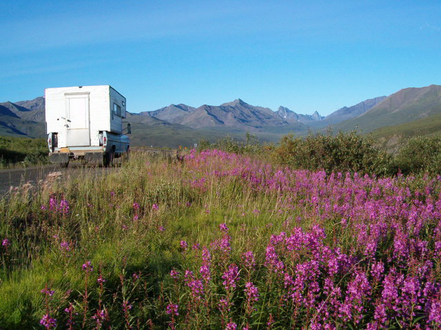
August 2006 - Mile 63 Dempster Hwy.
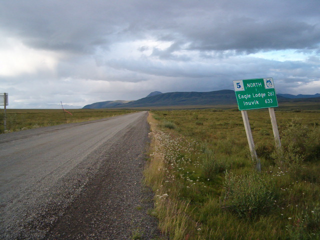
August 2006 - Mile 77 Dempster Hwy. - Highway and government airstrip
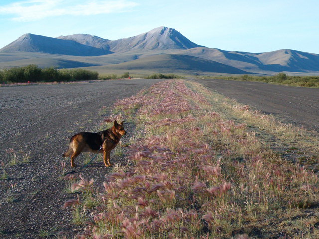
August 2006 - Mile 89 Dempster Hwy.
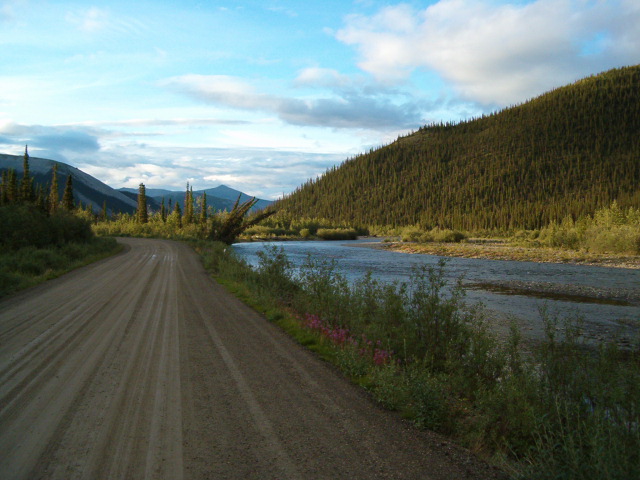
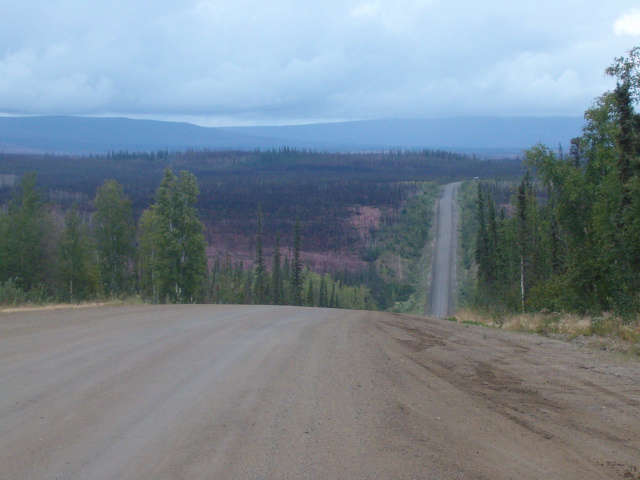
Well, Haul Road is Haul Road...the Dalton Hwy. will have some ok portions and some rough portions along the way...
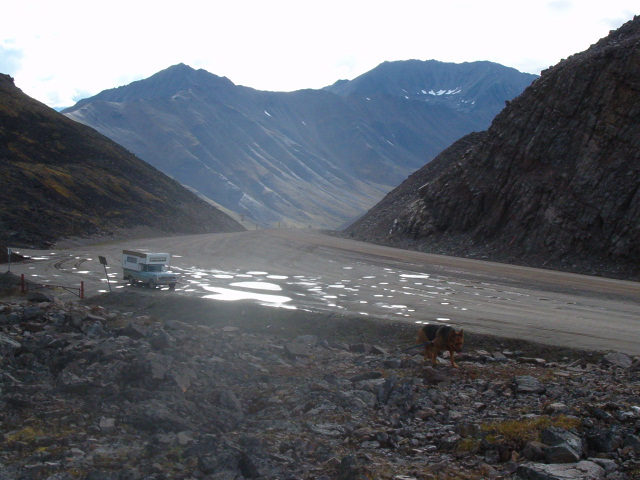
I temporarily lost vacuum while driving my camper rig (my 70 F250 Ford) downhill on the 12% south grade of Atigun Pass and lost all braking power as my engine rpm was over 3000 in low gear creeping as slow as possible without burning up the brakes as my braking power finally re-engaged before reaching the sharp hair pin turn or I wouldn't be typing here now posting about it.....that was my only bad experience on the Haul road.
August 2006 - Mile 72 thru 74 Dalton Hwy - the roller coaster :
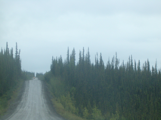
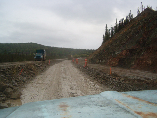
August 2006 - Mile 45 Dalton Hwy - construction zone :
August 2006 - Mile 244 Dalton Hwy - top of Atigun Pass - Arctic Circle Alaska :
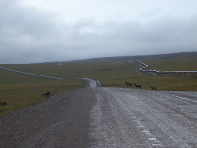
August 2006 - Mile 276 Dalton Hwy - caribou herd - North Slope Alaska :
Hope this insight helps -
To the OP -
As a native southern Californian such as myself, if this is your first far north trip, you will see why I lived in Alaska for 39 years...
During my tenure in Orange County, I resided off of Lincoln-Glassell, Rio Vista-South, Chapman-West and worked near Tustin-La Palma.
As mentioned about Pioneer Park (formerly Alaskaland) which was first built in 1967 commemorating the 100th year anniversary of the 1867 Alaska purchase from Russia, is a safe parking lot to stay at also as is Walmart, Cosco, etc. - however if one were to leave their rig unattended for a few days at those type of unsecured public type places I would highly advise NOT leaving an RV there (or anywhere in Alaska for that matter) while unattended other than one full day at the most....people here know how to case things out and rip off too.
Two factors not mentioned reference to the Taylor Hwy (Alaska Hwy 5)-
1 - Before venturing on this road in a class C or motorcoach, DO CHECK ROAD CONDITIONS prior to travel if it has been raining substantially as portions of this roadway and terrain can potentially washout like it did in four places in 2010 and made it impassible for 2 months...if the road is open for travel while severely wash boarded or saturated, traveling in a large type vehicle thru this stretch is not for the faint at heart.
The general roughest parts I am mentioning are in the mile 60 thru mile 96 stretch at the Y (Jack Wade Junction)...please take it slow and don't try to make time like some idiots do in their 40 ft motorcoaches driving 50 mph+ thru these stretches....
August 2014 - Mile 72 Taylor Hwy :

August 2008 - Mile 81 Taylor Hwy :
Soft shoulder area showing truck pulling fifth wheel -

July 2010 - Mile 92 Taylor Hwy :
Saturated and slippery roadway while climbing grade - 10 days before the historic road closure happened in four locations due to flooding and torrential rains...

There are a few BLM campgrounds along the way on this route (Walker Fork at mile 81 is my favorite) as their are also a few turnouts and remote spots to park for an overnighter.
Chicken at mile 66 has sites available as well, and make sure to visit "Downtown Chicken" for the real experience !!!
2 - Since 2014, Boundary Spur Road which is the 14 mile stretch linking the Y at Jack Wade Junction (mile 96) to the International Border (joint Canada - US Customs station) has been fully paved for the first time ever and was real nice when I drove it in 2014 and 2016...
August 2014 - Mile 8 Boundary Spur Road and Airstrip :

July 2010 - Mile 8 Boundary Spur Road and Airstrip :

I would today expect a few unattended potholes to dodge here and there since these roads are the far north normalcy type of condition, however it is such a blessing compared to the old unpaved condition of this stretch which most of the time took me an hour to drive 14 miles in the past it was so beat up, especially during and after the rain.
As mentioned, the Canadian side (Top of the World Hwy) is spot on with intermittent chip seal surfaces, and unpaved portions as well that are not as rough compared to the rough stretch of the Taylor Hwy.
August 2016 - Mile 65 top of the World Hwy.

May 1992 - Canada Customs - Mile 66 Top of the World Hwy. :
My first trip to Dawson City 30 years ago this year in my 1970 Thunderbird when it was still separate custom stations -

July 1998 - better picture of separate custom stations on my second trip to Dawson City (and Skagway) during the 100th anniversary Klondike Gold Rush :

Fun Fact : the white Canada customs building was moved a second time to it's current location of 4 miles on the Alaska side just outside of Boundary at mile 10, I think I seen it one mile inside Alaska previously when the new joint building station was completed...

...To this day in 1998 was the best road surface condition I ever seen the Top of the World Hwy. in, real smooth all the way from the border to Dawson.
August 2006 - First picture taken of replacement joint Canada-USA Customs Station :

Dawson City Yukon is like Virginia City Nevada on steroids, they really preserve the history of the town and is a very unique area - and the local people are really something there as my great friend introduced me to pioneers that have lived there for a very long time as their grandparents were first generation Gold Rush settlers.
September 2012 - Fifth Ave. at York St. - Dawson City Yukon :
My friend owns this vacant lot in downtown Dawson as I get to boondock next to the Gold Rush RV Park -

August 2016 :

Tombstone Territorial Park on the Dempster Hwy. is worth a sidetrip to visit as long as it is ok or good enough weather....
August 2006 - Tombstone Territorial Park - double rainbow :

I would also highly recommend driving at least 50 miles north of Tombstone Territorial Park to see the substantial changes to the landscape every 10 miles which blew my mind as I only driven as far as Engineer Creek before having to turn around due to my front truck cab mount caving in and made my steering real tight (steering shaft was holding up the entire truck cab) and lucky enough made it back to Dawson and then all the way home...so Inuvik is still on my bucket list.
August 2006 - Mile 52 Dempster Hwy. - Angelcomb Peak :

August 2006 - Mile 63 Dempster Hwy.

August 2006 - Mile 77 Dempster Hwy. - Highway and government airstrip

August 2006 - Mile 89 Dempster Hwy.

Well, Haul Road is Haul Road...the Dalton Hwy. will have some ok portions and some rough portions along the way...
I temporarily lost vacuum while driving my camper rig (my 70 F250 Ford) downhill on the 12% south grade of Atigun Pass and lost all braking power as my engine rpm was over 3000 in low gear creeping as slow as possible without burning up the brakes as my braking power finally re-engaged before reaching the sharp hair pin turn or I wouldn't be typing here now posting about it.....that was my only bad experience on the Haul road.
August 2006 - Mile 72 thru 74 Dalton Hwy - the roller coaster :


August 2006 - Mile 45 Dalton Hwy - construction zone :

August 2006 - Mile 244 Dalton Hwy - top of Atigun Pass - Arctic Circle Alaska :

August 2006 - Mile 276 Dalton Hwy - caribou herd - North Slope Alaska :

Hope this insight helps -
To the OP -
As a native southern Californian such as myself, if this is your first far north trip, you will see why I lived in Alaska for 39 years...
During my tenure in Orange County, I resided off of Lincoln-Glassell, Rio Vista-South, Chapman-West and worked near Tustin-La Palma.
About Bucket List Trips
13,487 PostsLatest Activity: Jan 18, 2025