NVR2L82AV8
Aug 16, 2014Explorer
TR - Great Basin National Park, Baker NV - Aug 2014
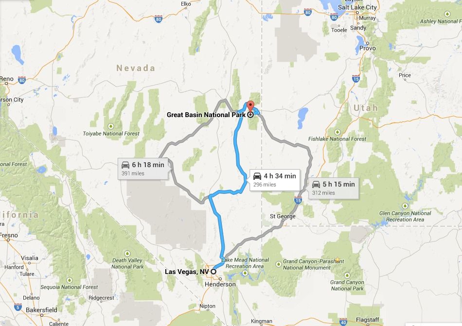
We had a plan to jump up to Great Basin National Park (GBNP) during the 4th of July weekend but work got in the way--go figure. Then last week, with our son home from college for a few weeks, and our daughter in between jobs, we made a quick decision to take a few days’ vacation and head up to Great Basin National Park (5 hour drive from Las Vegas).
I got to tell you the forecast park temperatures had zero, and I mean zero, influence whatsoever.....;)

On previous camping trips driving on Highway 93 we'd paralleled the West side of GBNP simultaneously admiring the Snake Mountain Range which stretch over 60 miles. Interestingly, NV has over 314 named mountain ranges. Looking East at GBNP and Mt Wheeler from HWY 93.
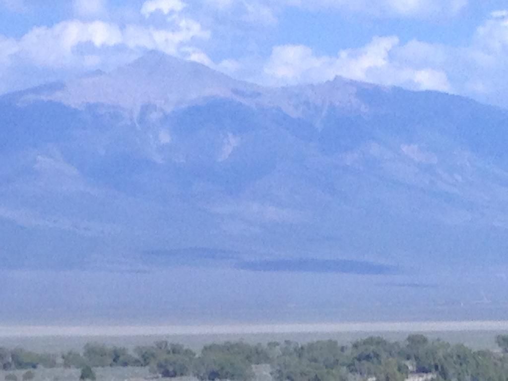
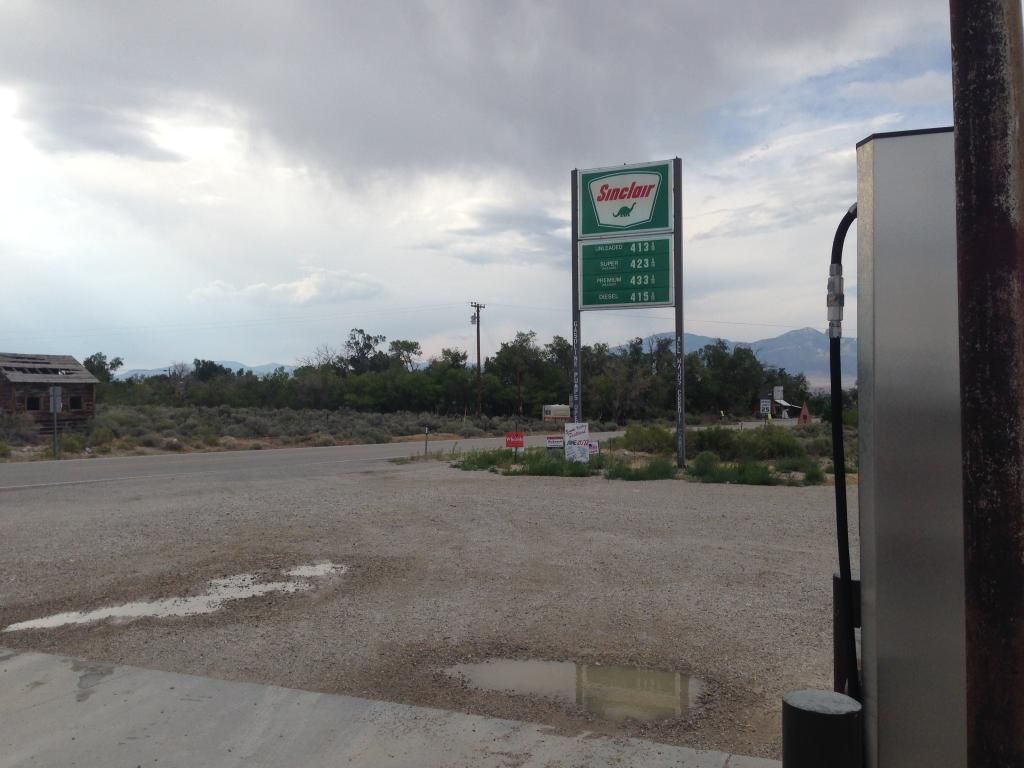
Anyway, we'd both made a mental note to add this remote park to our future visit list. Ely, NV is the closest "city" from GBNP and approximately 70 miles west. Baker, NV is just outside the Park entrance boundary on the East side, but it is a small town with limited facilities. Baker, NV does have an unmanned Sinclair fueling station.
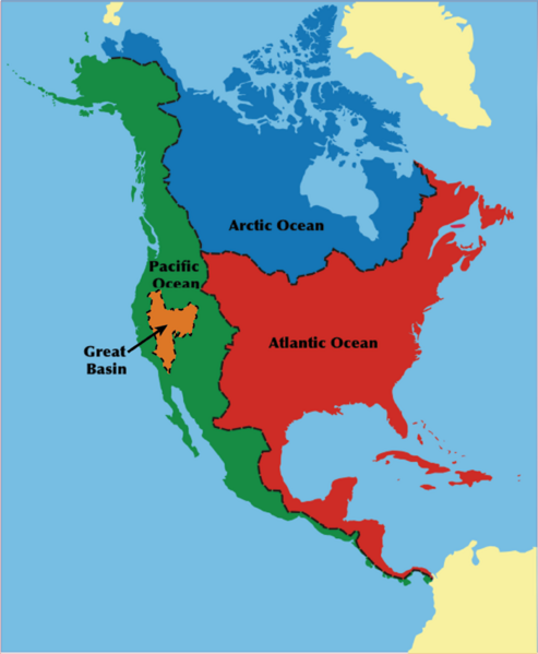
As you know, Nevada is primarily known for Las Vegas, Lake Mead/Hoover Dam and Death Valley. However, most folks don’t know Nevada has a National Park that exudes a beauty all its own. The Great Basin National Park sits almost in the middle of the 190,000 square mile Great Basin Desert bordering the Sierra Nevada Range on the West and the Rocky Mountains on the East; to the North it’s bordered by the Columbia Plateau; and to the South its bordered by the Mojave and Sonoran deserts. This basin is one of the largest endorheic watersheds in North America critical to ground water retention. (image courtesy of http://www.newworldencyclopedia.org)
Here are 10 Other Facts about The Great Basin Desert
Inside the Great Basin Desert is the Great Basin National Park. It's small, with 77,180 acres (it’s almost a fourth the size of Rocky Mountain National Park at 265,781 acres) and its one of America’s least-visited National Parks. According to the Department of Interior's Budget Justifications and Performance Information for fiscal year 2014, Great Basin National Park in FY2012 was the 8th least visited National Park with 94,390 visitors. The least visited NP in FY2012 was The Gates of the Arctic at 10,796 visitors (Alaska). The most visited National Park in FY2012 was The Great Smokey Mountains NP with 9,48,269 visitors. If you don't count the five least visited NP's in Alaska, and the two associated with water (Dry Tortugas NP (FL) and Isle Royale NP in Lake Superior), Great Basin National Park is the least visited land locked NP in the lower 48.
Some Great Basin National Park Facts
Image Below Courtesy Great Basin Park.com
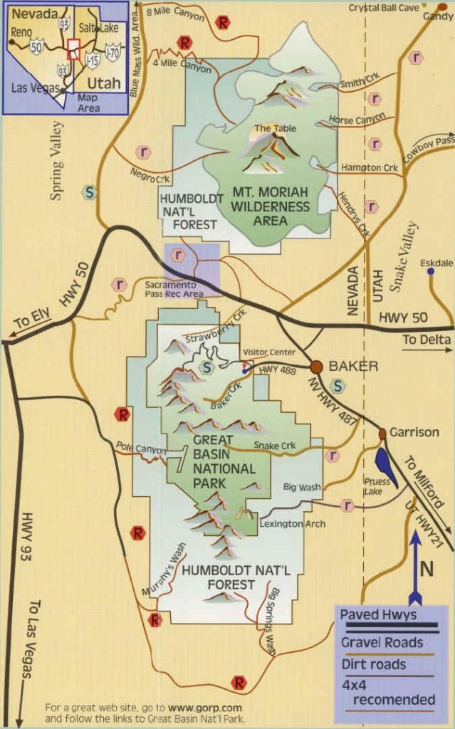
Inside the Great Basin National Park resides the second highest peak in Nevada and the 12th most prominent mountain in the Lower 48. Mt Wheeler (named for George Wheeler, leader of the Wheeler Survey of the late 19th century) stands at just 13,063 feet a mere 81 feet shy of Boundary Peak at 13,143 feet which takes the state highpoint honor. Wheeler Peak is, however, the tallest independent mountain in the state since Boundary Peak is considered a subsidiary summit of Montgomery Peak, whose summit is in California. Wheeler Peak's summit is located just 14 miles (23 km) west of the Utah border.
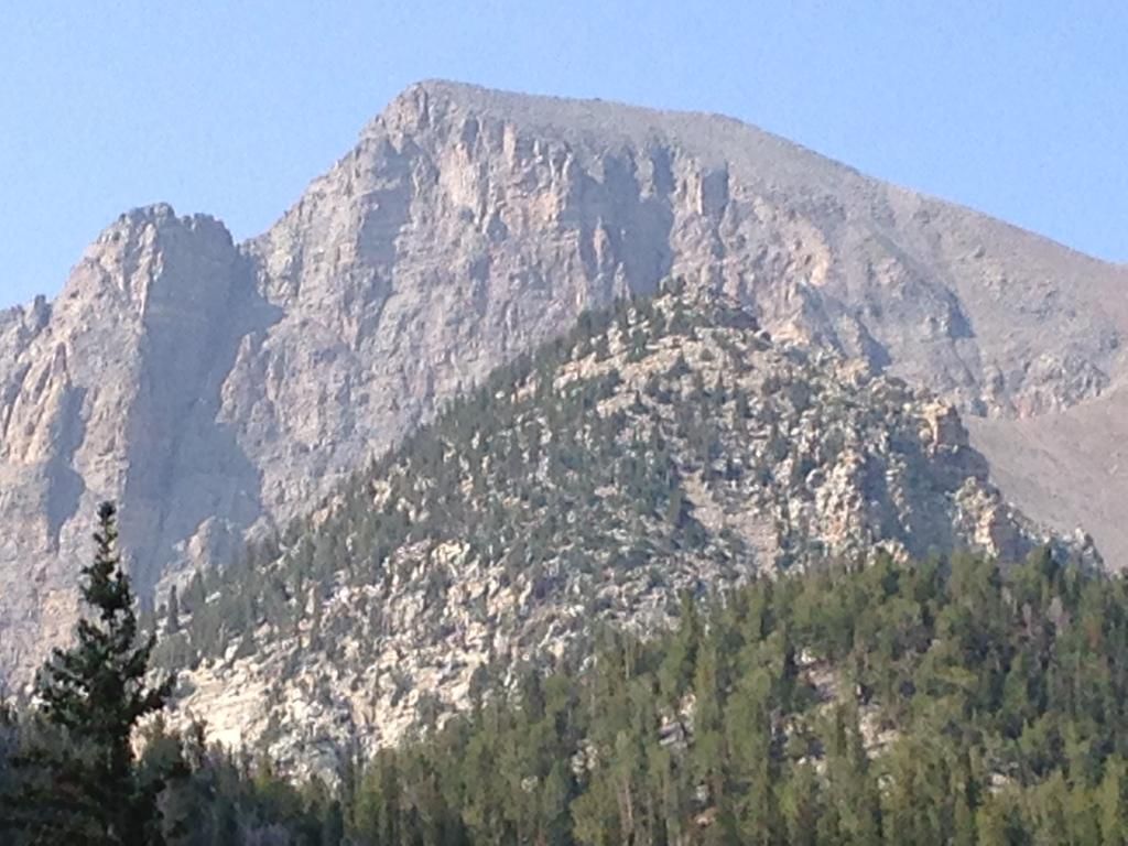
In addition to the very old Bristlecone Pine Trees in the Great Basin National Park, the other main attraction is Laymen Caves. These spectacular marble caverns offer an outstanding opportunity to view and study cave features including stalactites, stalagmites, helictites, flowstone and popcorn. The caverns contain over 300 shield formations, which are rare in other caves. (pics are further on down)
We arrived at GBNP around 4 pm.
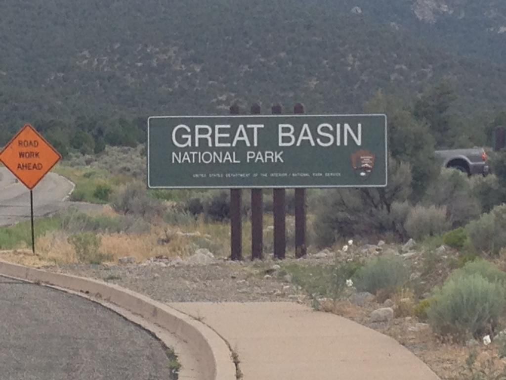
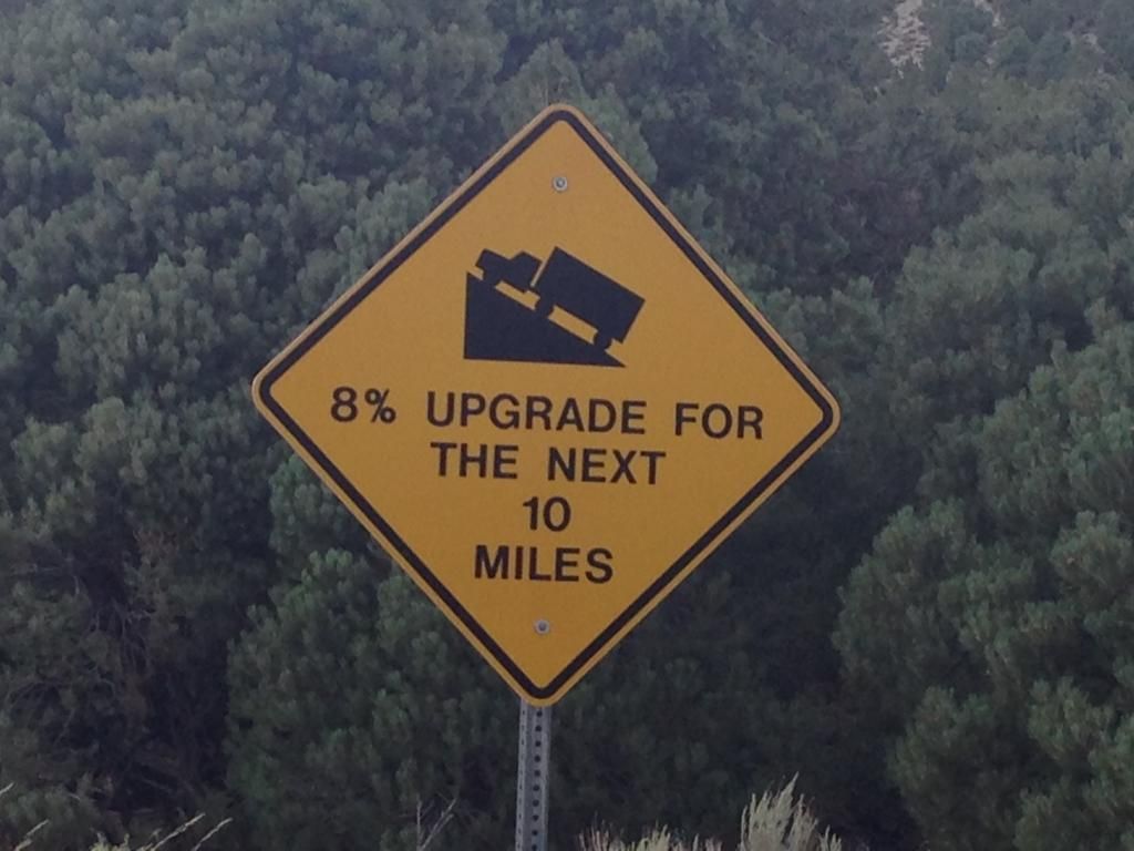
After the entrance sign we turned right and headed up the Wheeler Peak Scenic Drive for 12 miles. From the NPS GBNP Website--Note: The Wheeler Peak Scenic Drive is narrow, winding, and climbs an 8% grade in 12 miles. Wheeler Peak Scenic Drive past Upper Lehman Campground is closed to single vehicles or trailers in excess of 24 feet in length.
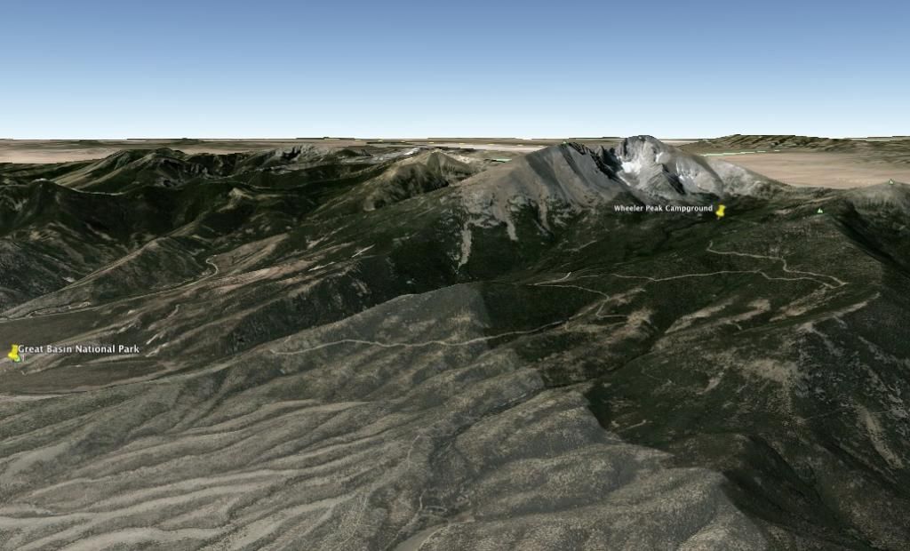
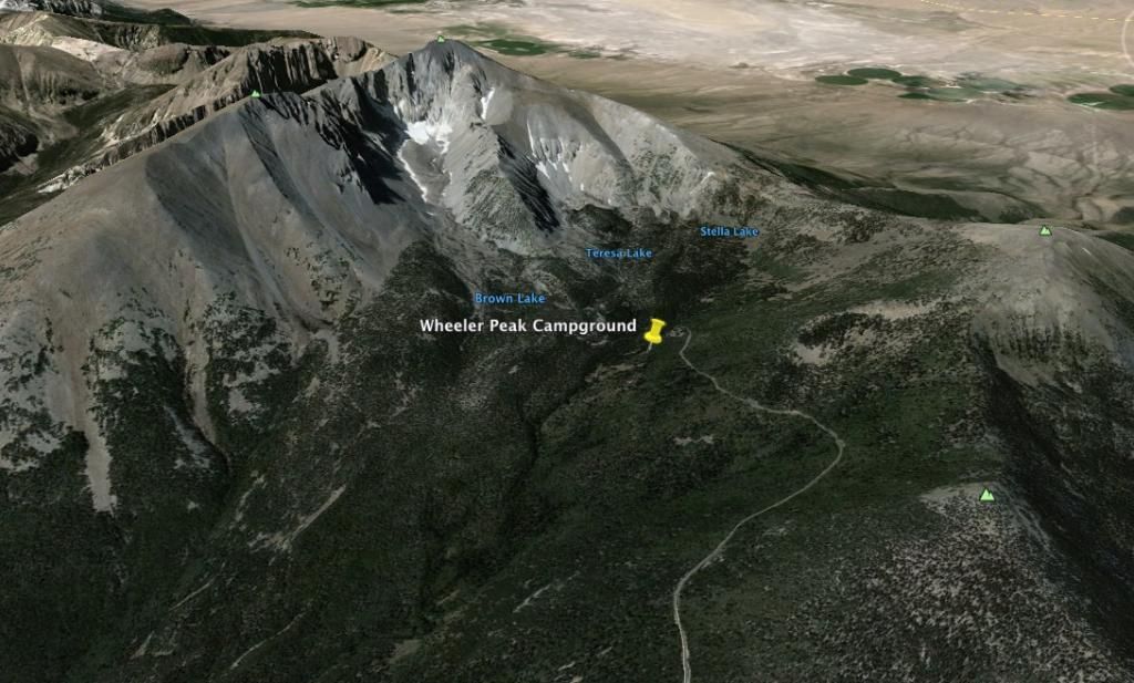
Wheeler Peak Campground at 9,886' elevation.
Its a good little climb....
There are four campgrounds within the Park.
Campground Maps and info at Great Basin NP
Individual campsites are non-reserve able. They are all first come first serve with the standard $12 fee or $6 for Senior Access Pass holders.
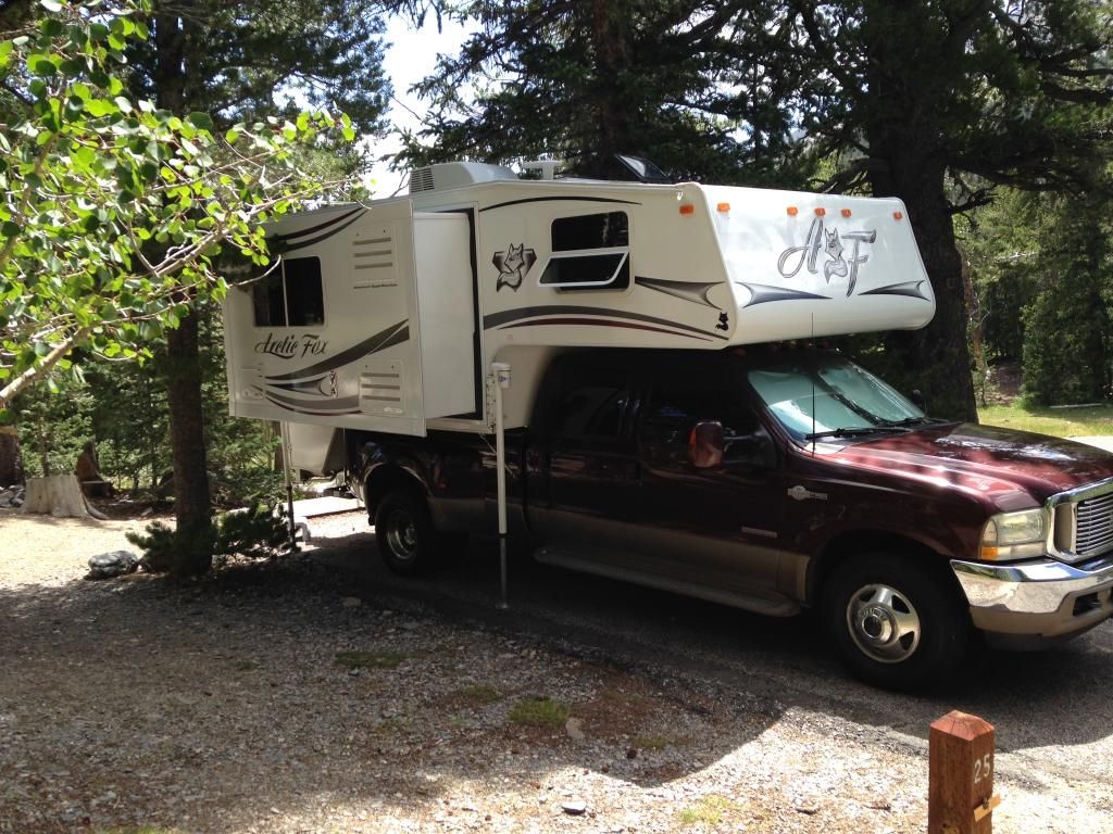
We found about six open sites Thursday afternoon at Wheeler Peak Campground. Boondocking up here off the scenic route is impossible. We settled on Site 25, which had great shade but required me to pull out my levelers for the uneven paved spot--no big deal. Then, I extended the jacks. I extend the camper jacks to just make contact with the ground which significantly improves interior left and right stability.
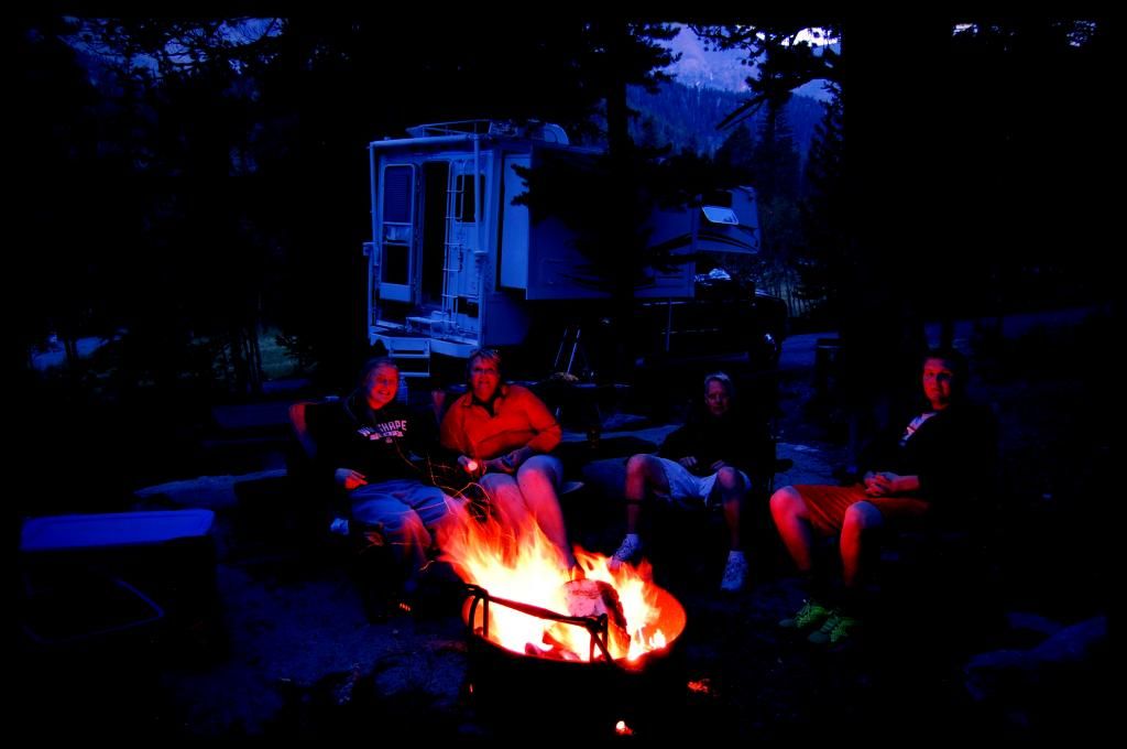
We quickly got settled in and fired up the site charcoal grill for some Greek pork steaks (pork steaks marinated with lemon juice, olive oil, oregano, and salt and pepper) with a tomato, cucumber, onion and feta salad and lastly, some cheesy potatoes. Good stuff!! My son prepped the fire ring for natures evening entertainment. Post dinner while it got dark we just hung out relaxing watching natures tv and enjoying the cool temperatures at 9,900 feet. It was dark under the canopy when I set the timer for this pic.
We awoke at 0530 after a good night sleep, had some bacon and pancakes with coffee and juice and then my two kids and I set off with our jackets on at 0645 to tackle Wheeler Peak's summit. The DW decided a relaxing morning by the fire with the good book would suit her just fine--who was I to argue. Heck, I would have gone back to bed. We hiked up out of the Wheeler Peak campground and stopped at the Trailhead sign for a look at the map.
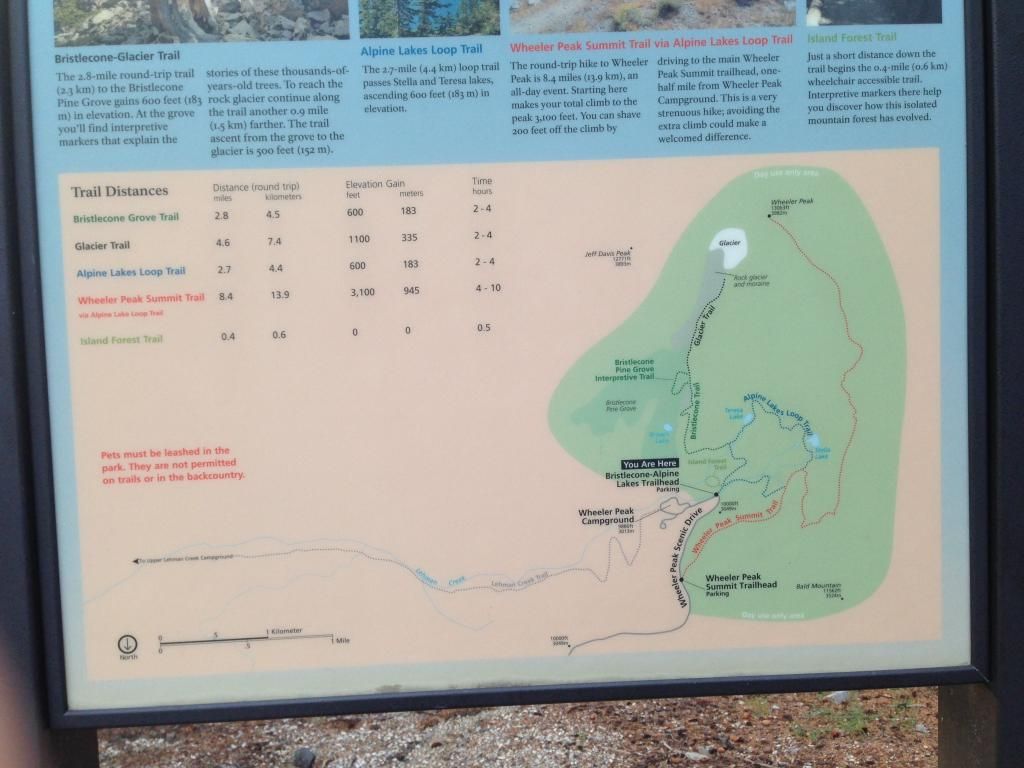
For a GOD's eye view
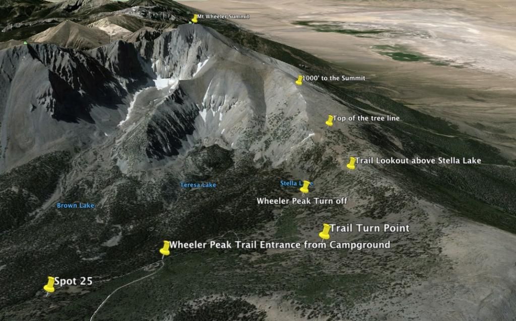
Next, it was over the wood bridge and at the fork a right turn toward the Stella Lake trail (route well marked). The gradual climb began in earnest immediately. The morning was a cool, clean, crisp 47 degrees Fahrenheit. Under the trees it wasn’t full light yet, but it was illuminated in an early morning orange hue nonetheless. Not three minutes up the trail on our 8 mile hike we ran into a beautiful doe and her fawn twenty-five feet in front of us.
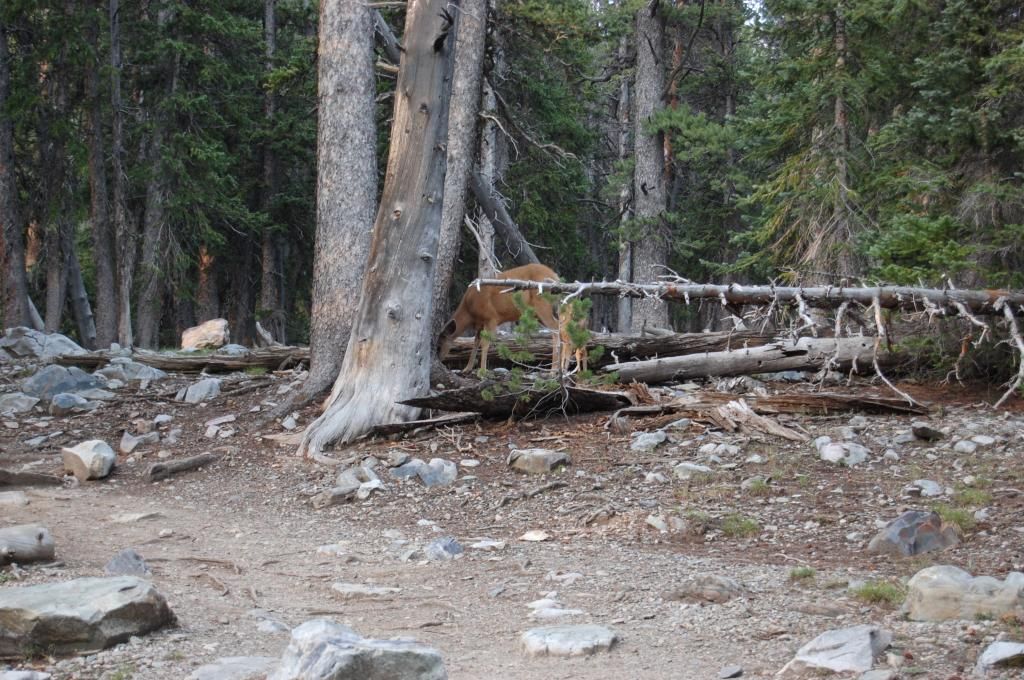
They looked us over and the little “Bambi” gracefully sprung around in a gleeful “springy” jump when its mom began to turn and walk away from us. After getting a few photos and taking in their beauty we continued up the trail.
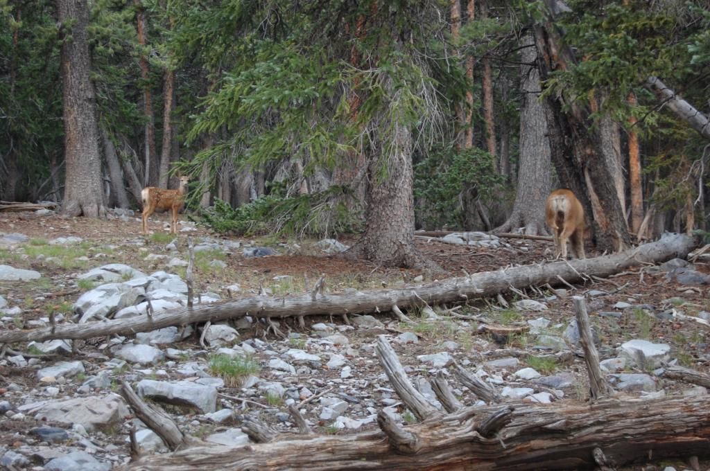
The trail from the Trailhead Parking Area intercepted our trail to Stella Lake and soon we were at the Wheeler Peak turn off from the Stella Lake Trail. We had hiked about .8 tenths of a mile at this point.
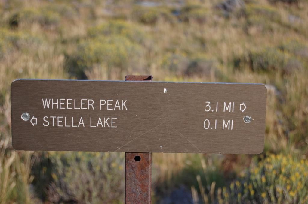
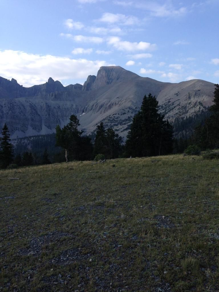
At a clearing we got a great pic of Mt Wheeler and what laid ahead of us...man it seemed so far away!
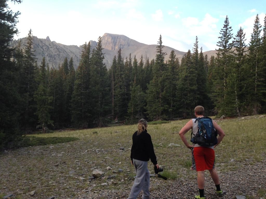
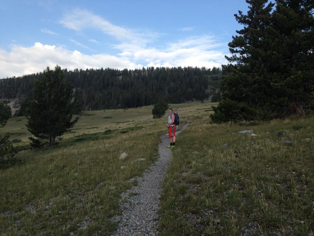
We kept a good little pace going on the trek up the ridge above Stella Lake.
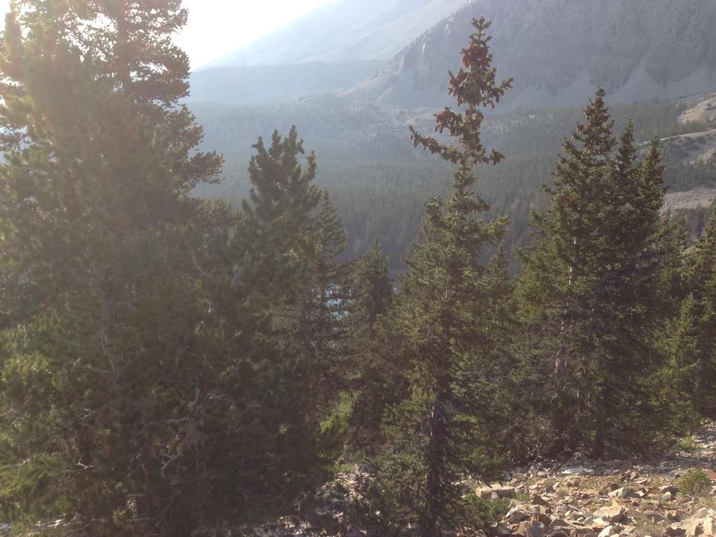
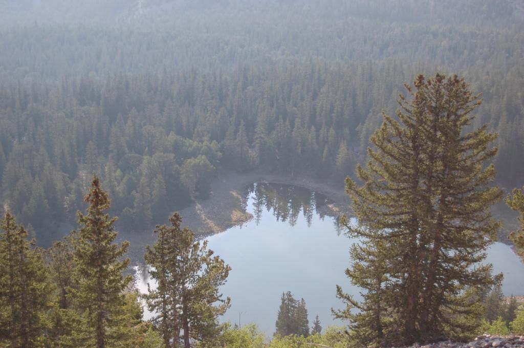
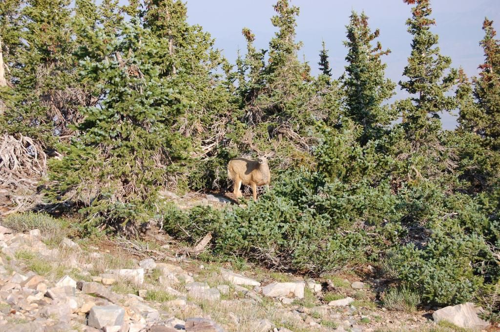
And onward toward the peak we climbed making good time. Near the top of the tree line we ran straight into three big bucks bedded down within 50 feet of the trail. We are pretty quiet climbers so this surprised not only the deer but us too. This first shot is right after the dominant buck arose. The other two were directly behind him and the tree--hard to see with the pics I'm posting. My college graduate daughter could not believe how big this 6 Point buck was. I mean he really was huge.
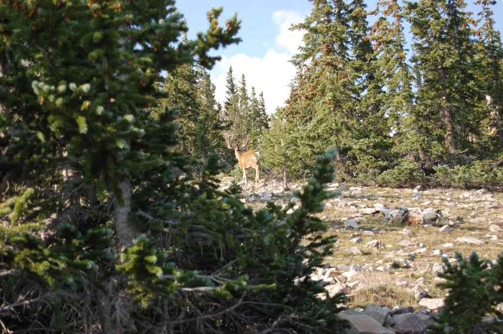
The dominant Buck stayed in front of the other two while they moved to thicker brush always behind the big guy. You can see one of them in the brush to the right (look for the tan against the green) between the dead tree and the live one.
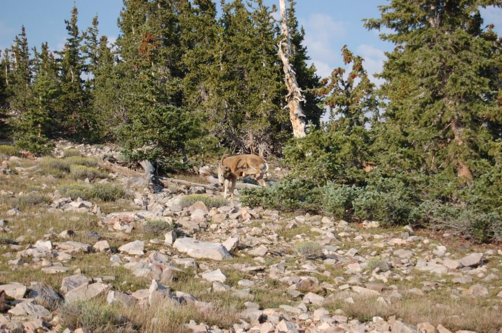
At one point we were no more than 50 feet nose to nose as we continued up the trail. This close was getting a little intimidating anyway as he looked on intently as we moved from his left to right along the trail--glad it was not ruttin' season. Finally, as we moved up the trail he began to move as well.
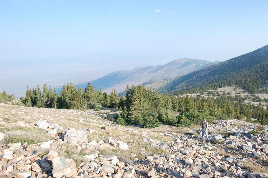
As we pushed on beyond the tree line the air was getting thinner. You can barely see the wind farms on the north west side of the Snake Mountain range down in the valley in this shot.
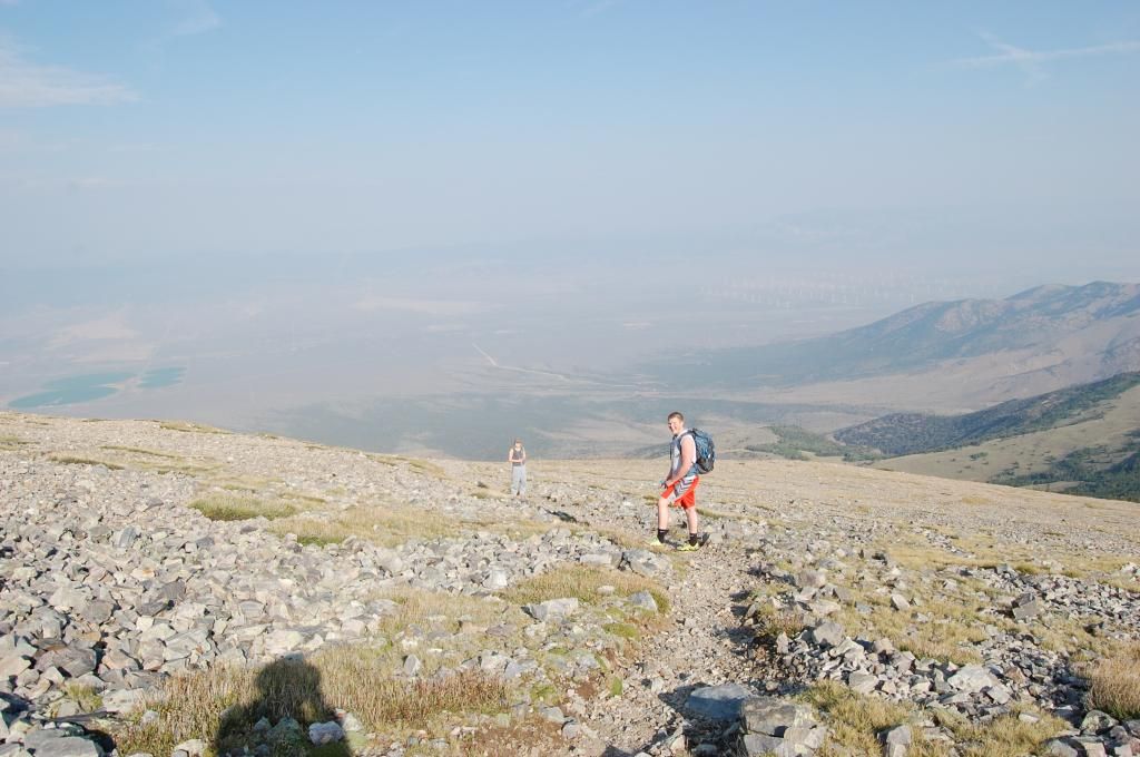
Here we are about 500-1000' above the tree line looking west.
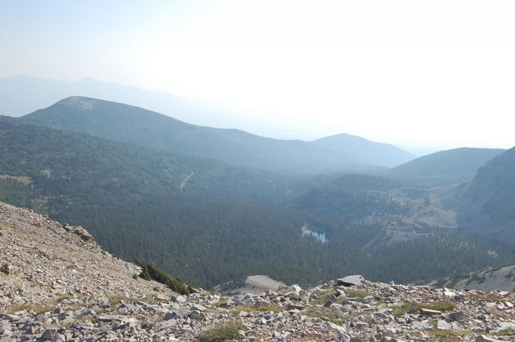
This is looking N down into the Valley. You can make out Teresa Lake and the campground area (further to the left) and the Mt Wheeler Peak Scenic Drive as it comes back down into the Campground entrance.
Looking at the final assent which according to my Garmin was still over a 1000' vertical climb.
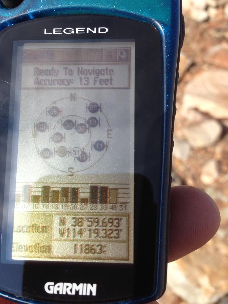
The rock wall is a hiker rest and wx protection area as there is nothing to block the wind up here.
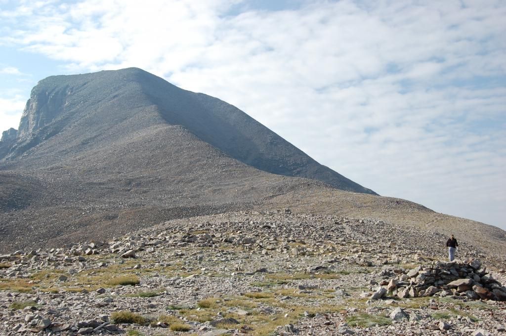
Garmin says 1000' feet to go!
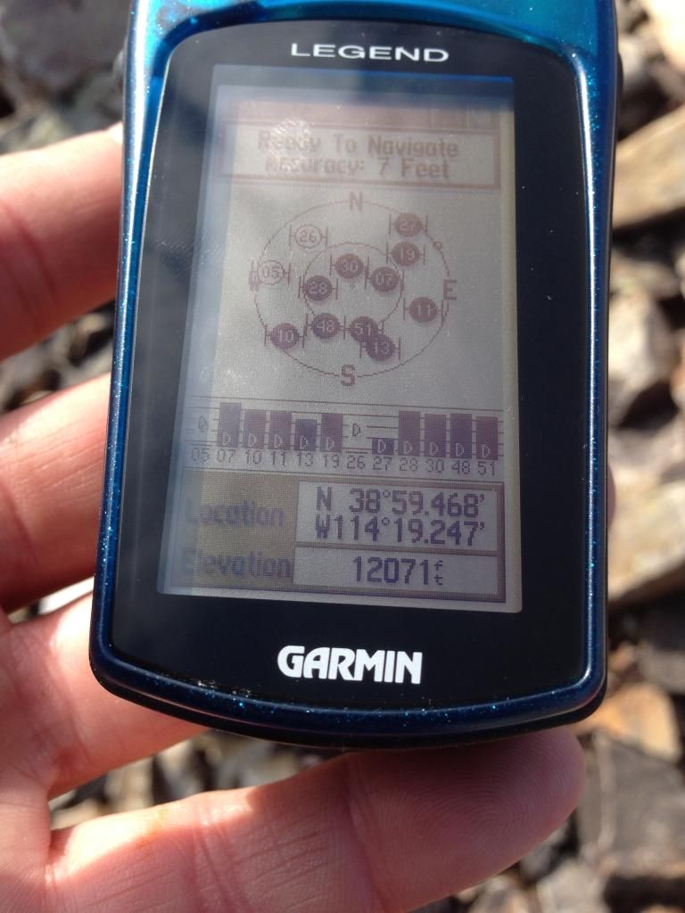
I kept track of the altitude with my Garmin just to provide updates on vertical progress. Here's what 1000' looks like - straight up!
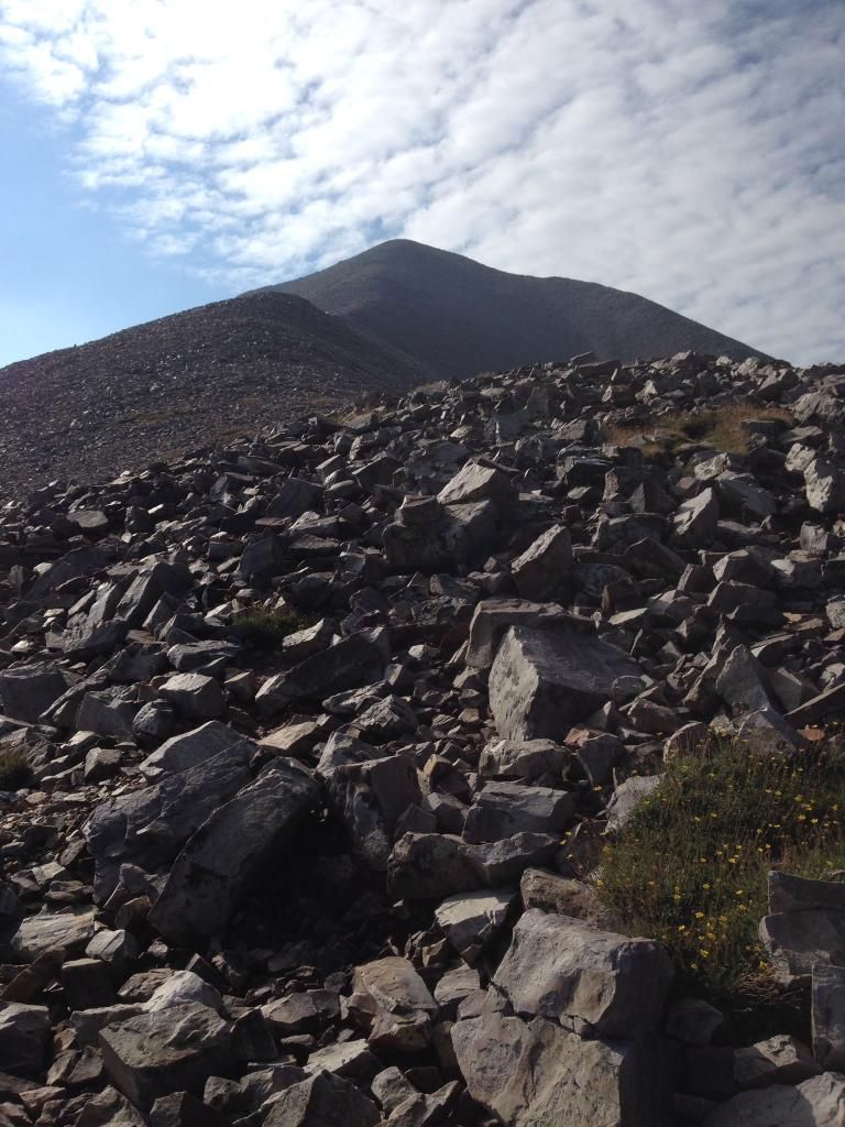
In the flyin' bidness we use the standard lapse rate of 3 degrees fahrenheit per thousand feet of altitude--yep, it's cooling down and the layers are back on. My son refused to hand off the 40-pound backpack of water, jackets, and trail mix so I had it much easier on this hike—man is it nice when they get older and wiser. My daughter brought up the rear but kept up. At 100 pounds I could tell she was experiencing some altitude nausea but she kept climbing.
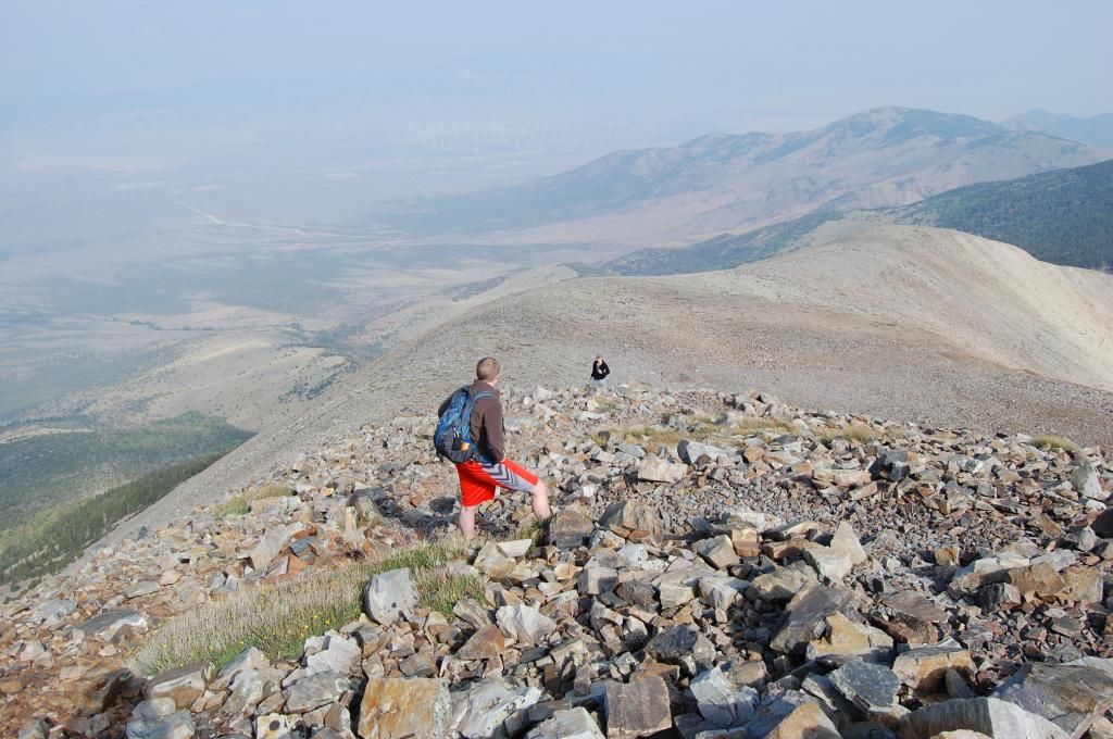
Here's just a shot to show the sheer cliffs. This is looking NW. The road to the right of the "T" toward the windmills is HWY 50--AKA The Loneliest Road in America.
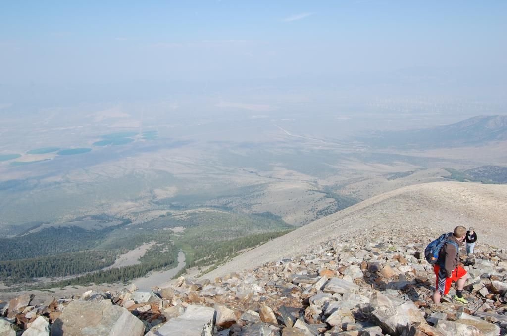
The terrain is getting steeper and more rocky. I need to give a Big Shoutout to the NPS and Conservation corps who maintain this trail. It was in great shape!
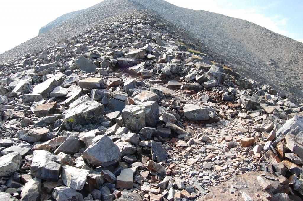
Summit is getting closer. This is looking directly down onto the Wheeler Peak Summit road that leads to the Wheeler Peak Campground. The road makes a left 90 degree turn into the visitor parking area at the bottom left. The road continues to the campground and meadow in the center to lower center of the pic.
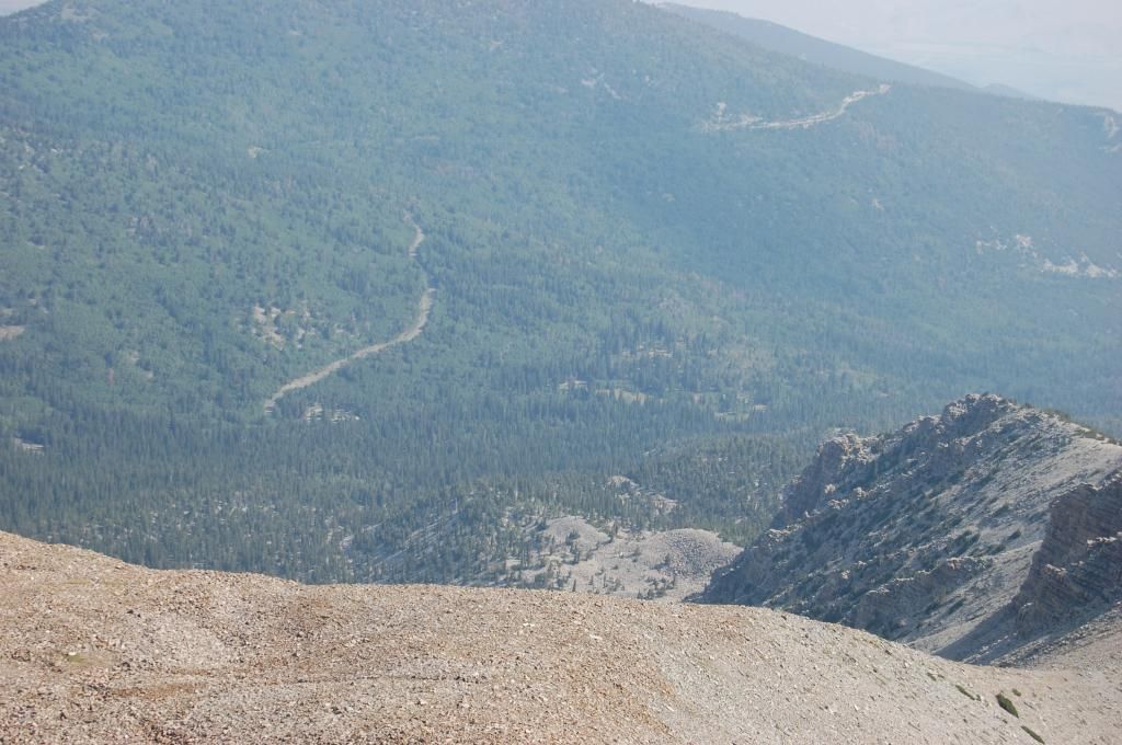
Almost there! This pic is looking down into the valley. Lakes, road and camp area easily discern-able.
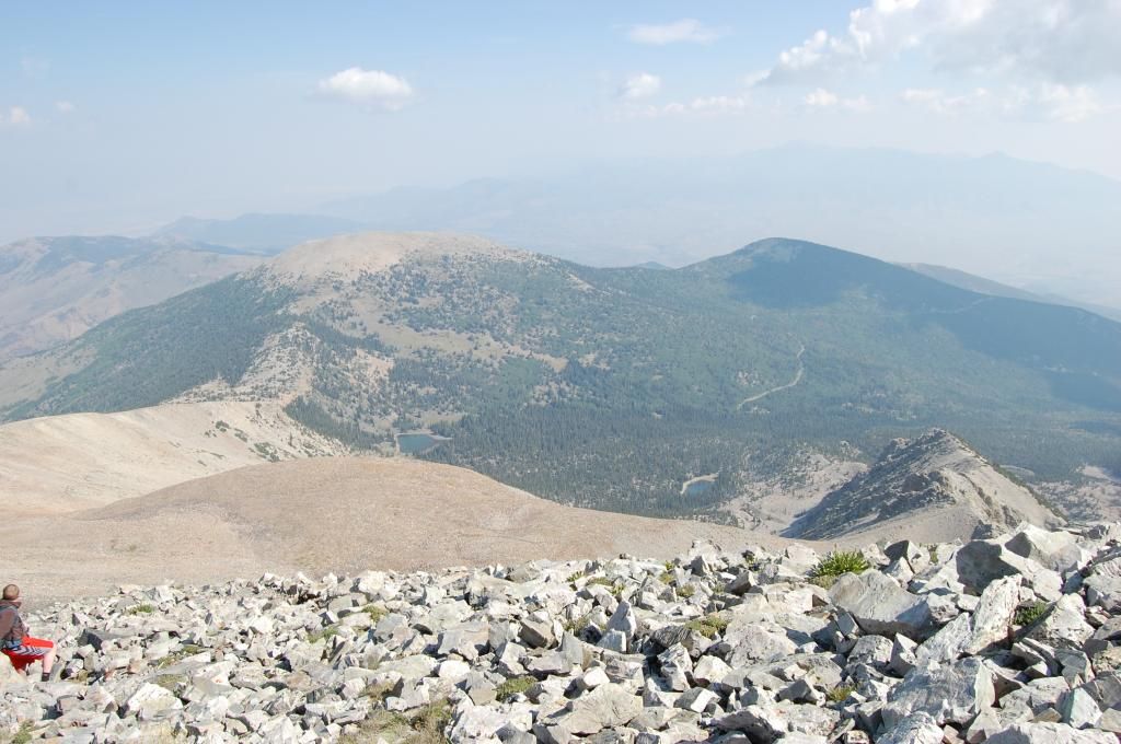
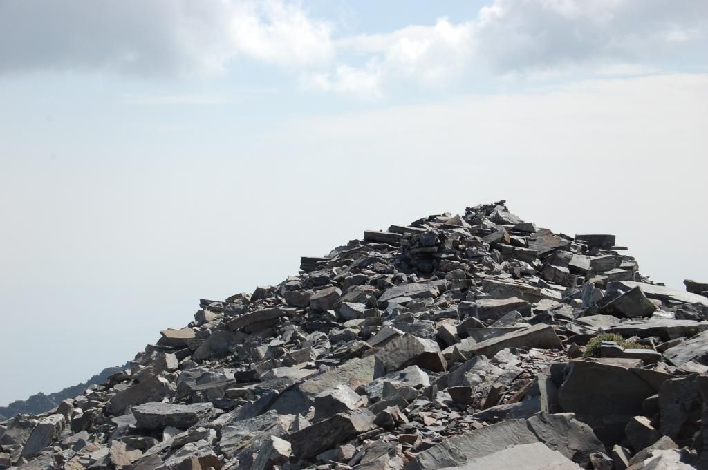
1016L, boom we were on the top - 13,063'. The views were incredible! Since we were the first ones on the summit that morning we took a little break to absorb the views. Then it was time to explore and take some more photos.
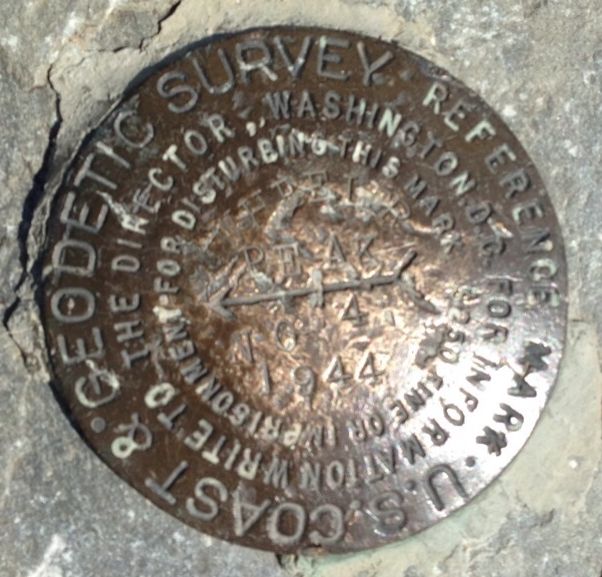
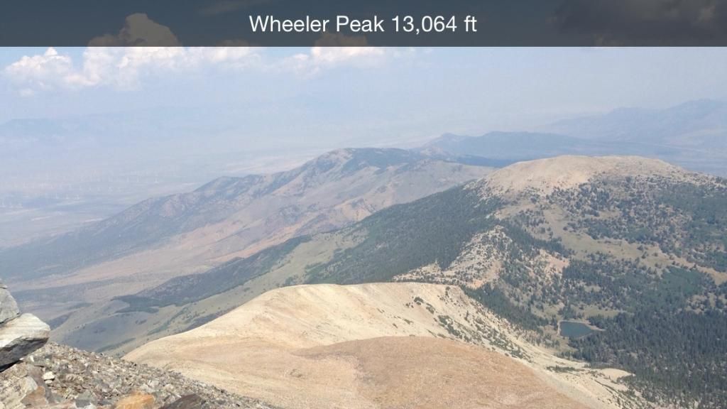
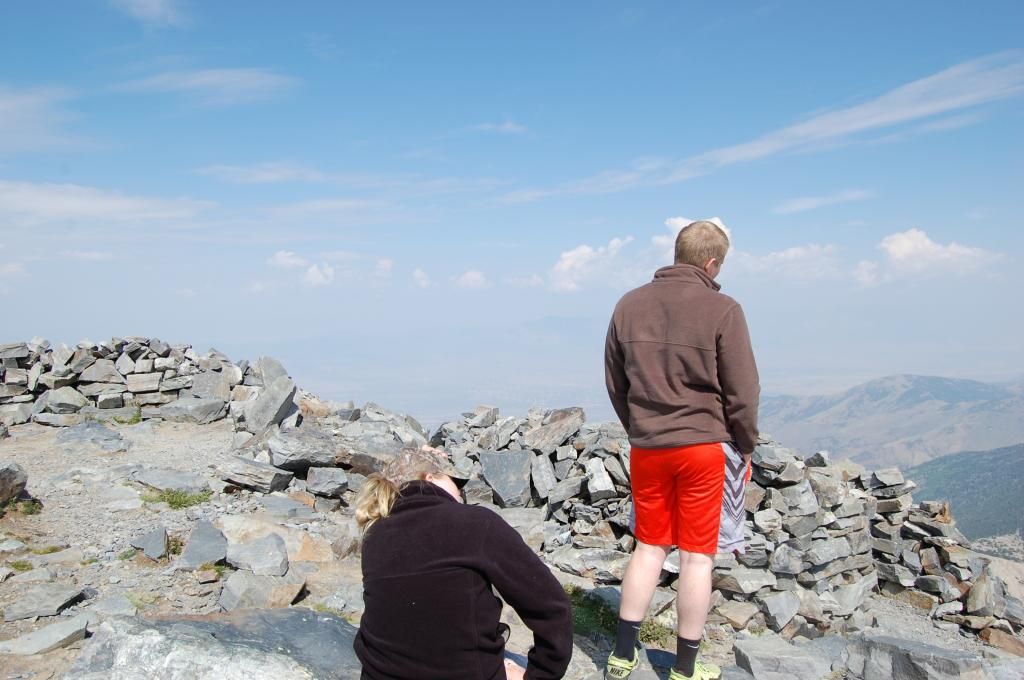
Looking down.

Walking East up on the Summit rocks.
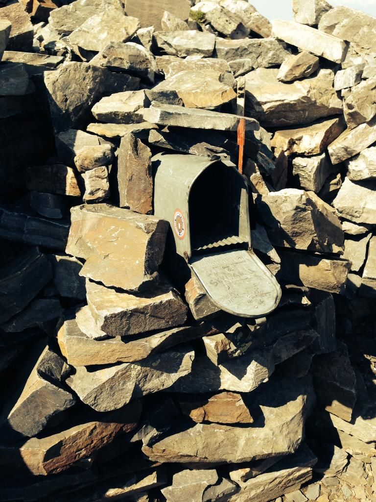
Inside one of the rock shelter on the summit was a mailbox and a record book to add your name and date.
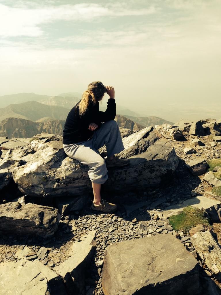
Just enjoying the view
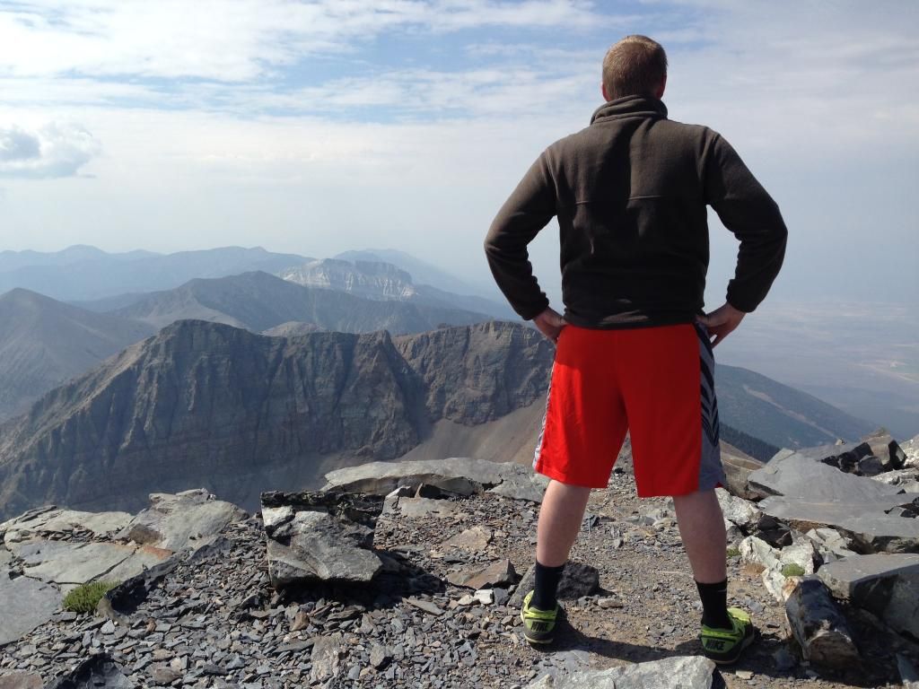
Looking North with the help of Google Maps
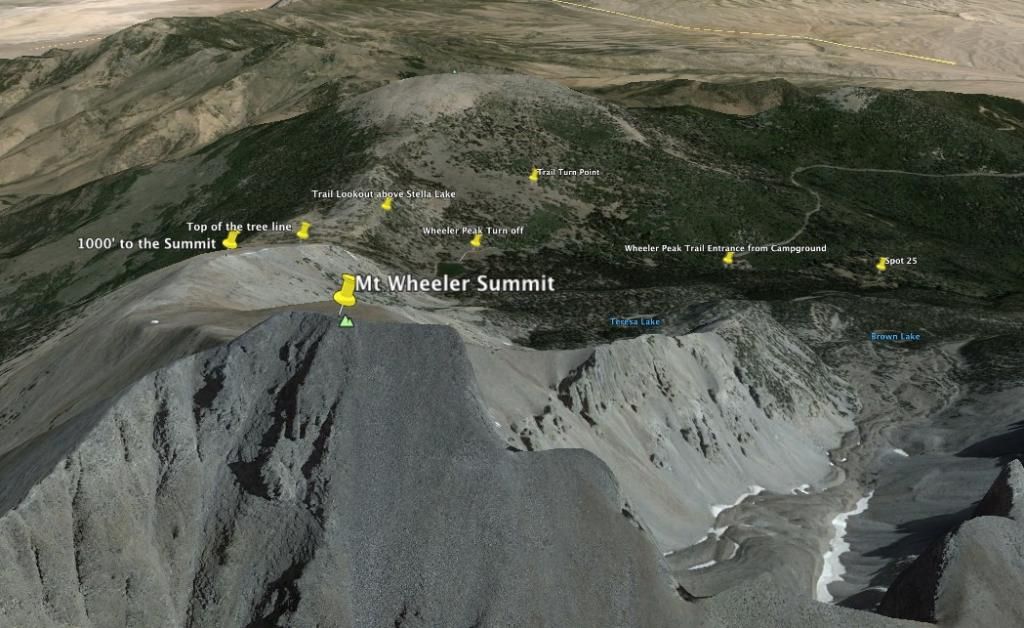
At the summit the winds were light and variable and it was cool. I'd read where the winds get cooking at 50 knots or higher on the way up; not to mention nasty wx in the mid afternoon. On top, they have at least four rock shelters built to get out of the wind. From our campsite to the top was just three hours and 30 minutes--not bad. I got the binoculars and walkie-talkie out and contacted the DW. It was real clear and I could easily see the campground and our campsite. You could also break out the road up to the campground and the Mather Lookout point. I was amazed how steep the last push to the summit was but, the trail was easy and the footing was great--shale rocks but pretty firm nonetheless. The views were incredible. The last 1000' was by far the slowest with the thinner air and steeper climb. All of us could feel the tightness in our lungs and we're all in great physical shape.
After 30 minutes on the summit, we started down just as a solo female Conservation Corps worker reached the summit. We chatted for a few minutes then set off to down the trail. I think the descent is harder on the knees and back than going up. I brought up the rear while my two jackrabbit kids bounced down the mountain. We passed at least 30-40 folks making their way up at different points along the trail. Take some layers, some water and some food. WX changes can put a person in a bind very quickly unprepared.
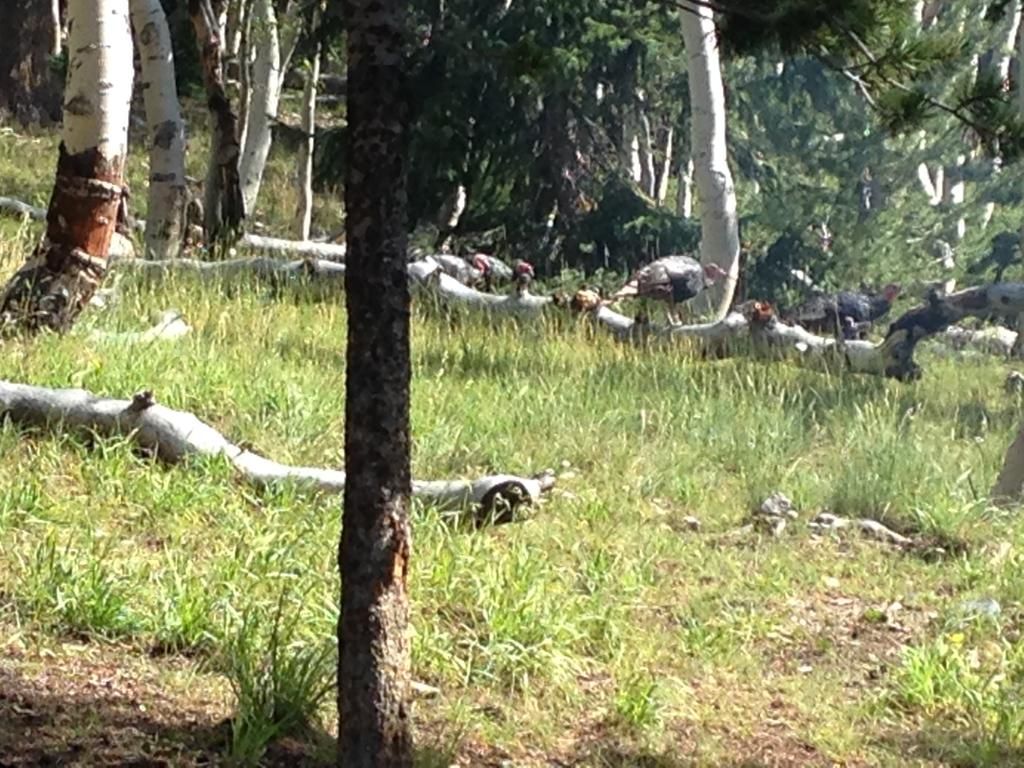
As we approached the trail to Stella Lake we ran into a rafter of turkeys with a few does close by. We listened intently as they clucked and purred interspersed with a few putts. They were moving right along.
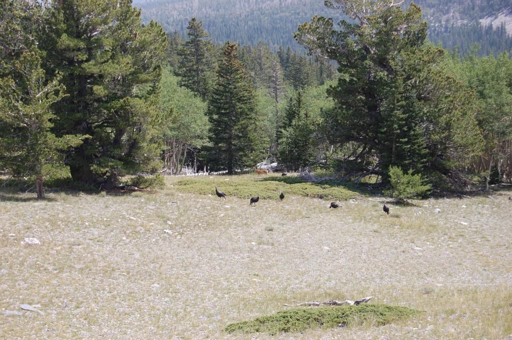
On the descent I passed an ETA via the walkie-talkie and when we reached the campsite we enjoyed a ready cooked lunch the DW had waiting--she's a keeper! The descent took us all of two hours. For the entire trip we drank 10 bottled waters, a bag of trail mix and had our jackets on and off more times than I can remember with the temp changes. I'd say this hike is definitely intermediate/strenuous especially since the last half mile and 1,000 feet is a pretty steep climb, however this area was full of switchbacks and area for short breaks to adjust to the altitude. Getting an early start really made the effort go quick. Overall, what a great hike, some great views, some neat wildlife and some outstanding memories!!
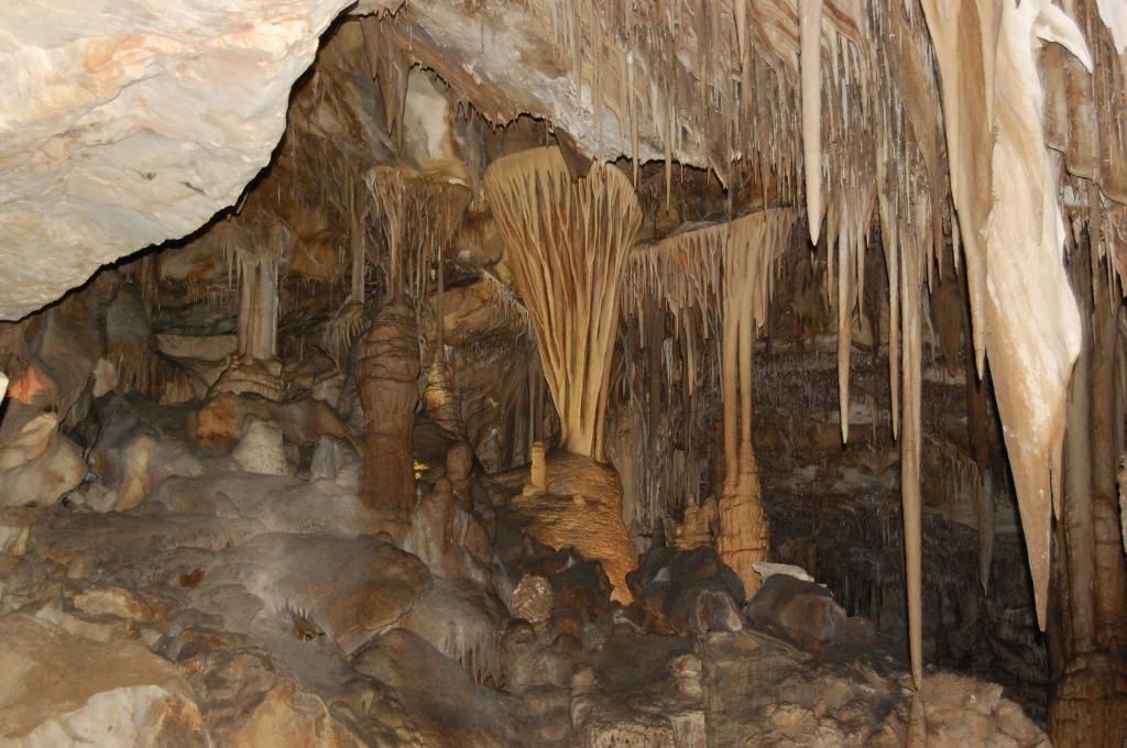
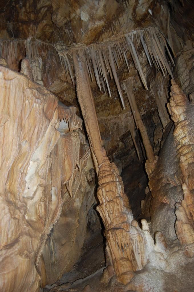
Later in the afternoon after we'd relaxed for awhile we stowed the camping gear and got the camper prepped for a short trip down the Wheeler Peak Scenic road to the Layman Caves visitor center. I'd called earlier in the week to reserve a cave tour time--that's a must do. We started the Layman Cave tour at 1600. I've been in some caves before but this one has some internal characteristics not allot of other caves have particularly the rare shield formations. Here we're starting the tour with the NPS ranger. She's holding a tin can with a candle--a light source before flashlights.
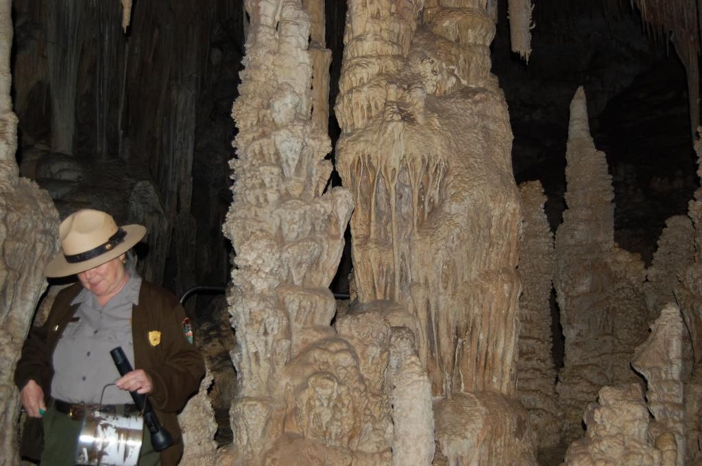
Unbelievable formations.
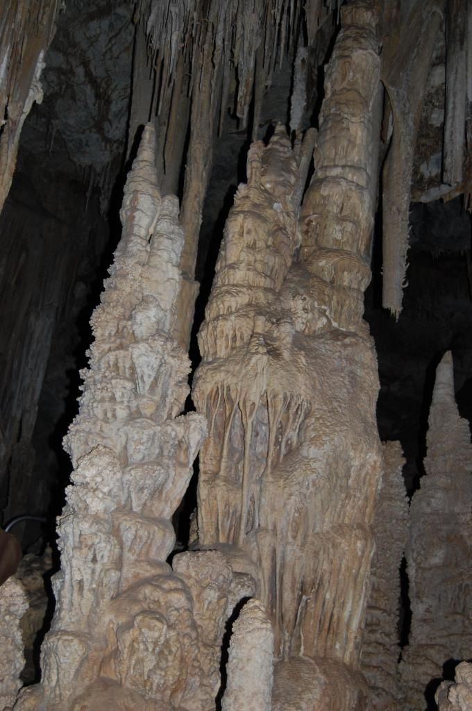
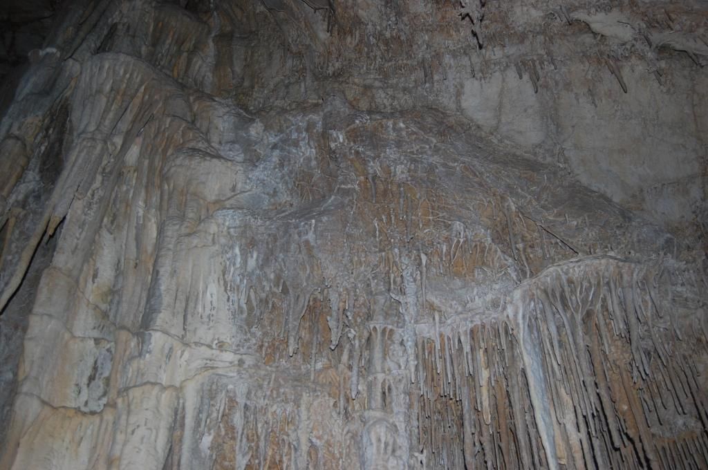
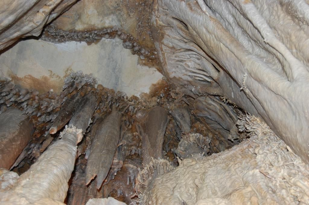
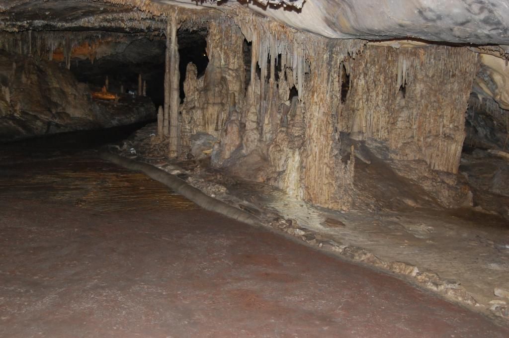
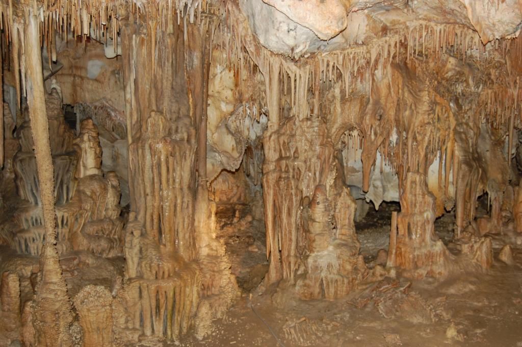
We finished up the cave tour and pressed back up the scenic road to the campsite where we quickly got leveled and settled in. We enjoyed some beef stroganoff on noodles and broccoli for dinner. By twilight we were all exhausted and I think everyone was asleep by 9 pm.
On Saturday, we all set out for a quick hike on the Alpine Lakes Loop trail. It was much shorter (2.7 miles) and felt good to stretch those muscles from the previous day’s excursion.
Just before you get to Stella lake. Trail to Wheeler Peak is off to the right
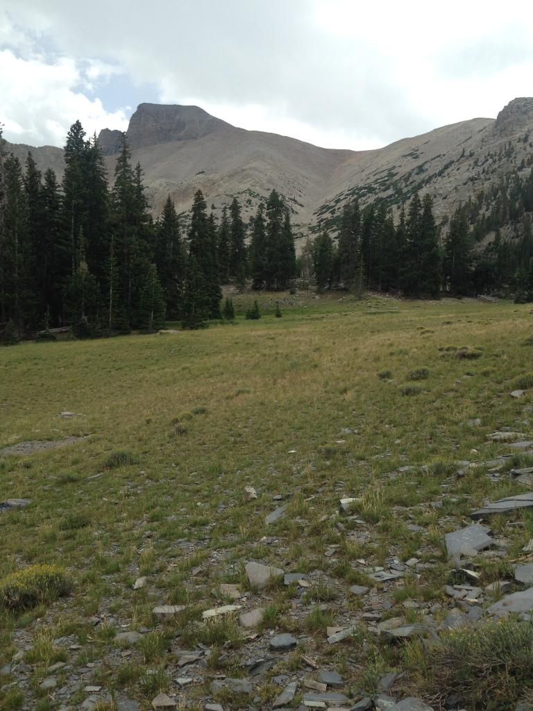
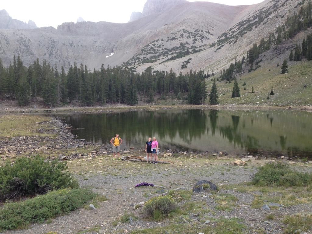
Yep, we climbed that!

And then followed it up and around to Teresa Lake. Total elevation gain was 600’ total-not bad after the previous days assent at 3,100’.
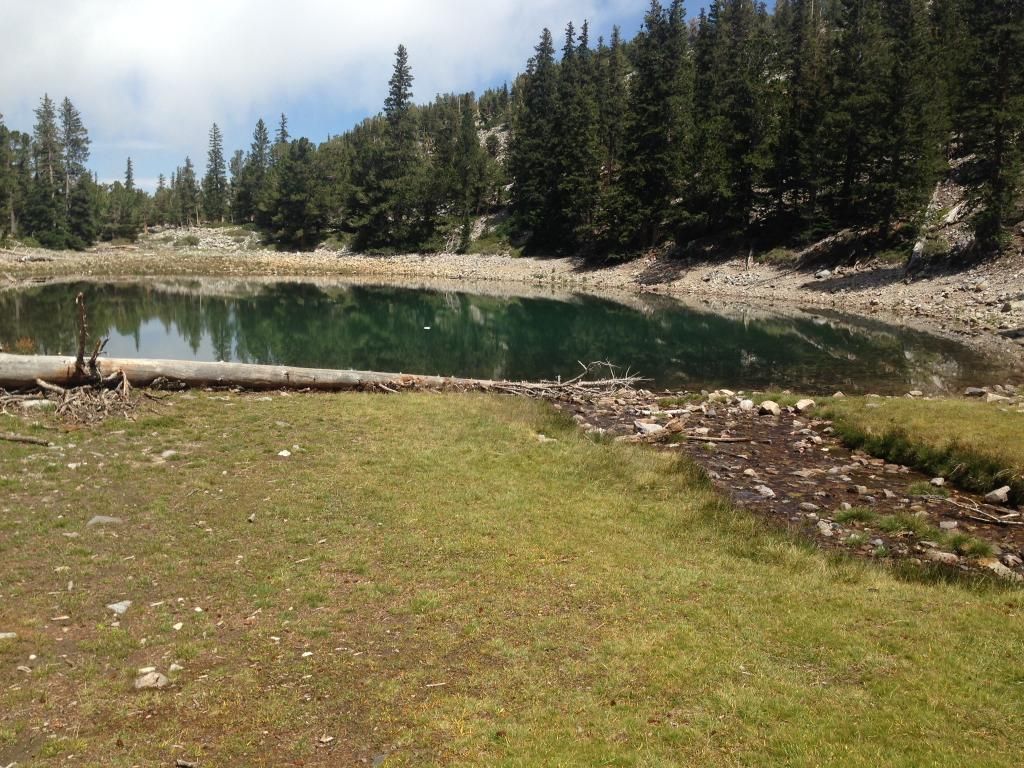
Teresa Lake
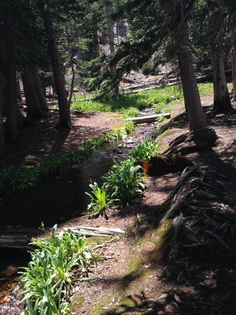
Creek feeding into the Teresa Lake
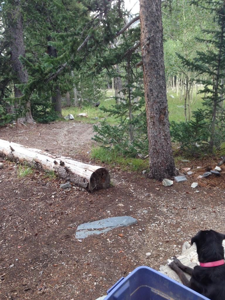
Back at the campground after dinner right outside our camp we enjoyed another rafter of turkeys walking close by talking away. Our dog, on a leash, was still and attentive, just below my wife taking an iphone pic, watching and listening—-it was pretty funny.
Here she is just checking it out as they moved into camp from the right headed left.
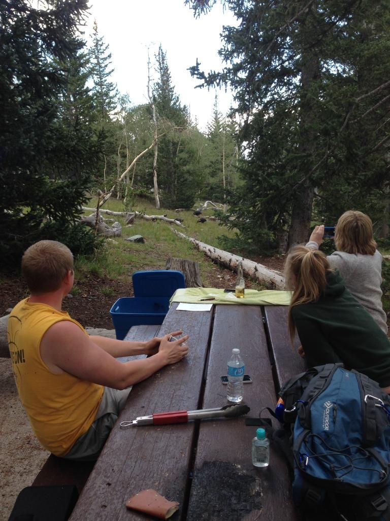
Next, a young Doe decided to make a drive-by. They don't come close and they move with a little fear. This one was on a mission and barely stopped. Again, our dog stayed perfectly still.

We also had many chipmunks around the camp. Our dog was mesmerized by them and their movement. Soon, they began to play games with the dog. She'd be sitting intent on watching one bound around and one would sneak up on her and touch her quickly and skeedaddle up a tree. This went on for hours. We all just laughed and laughed. All we could think about was Alvin and the Chipmunks.
Sunday, we got up early, packed up and headed back to Vegas. I couldn't resist a few shots of Mt Wheeler in the background as we pressed on out of the Park.
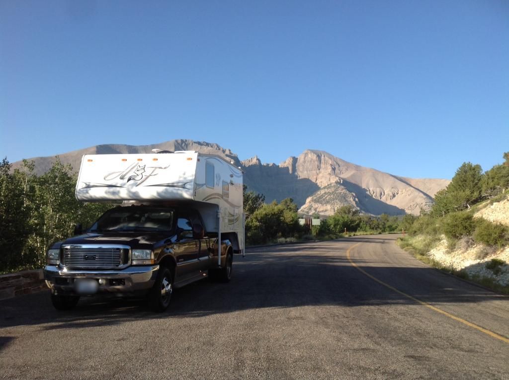
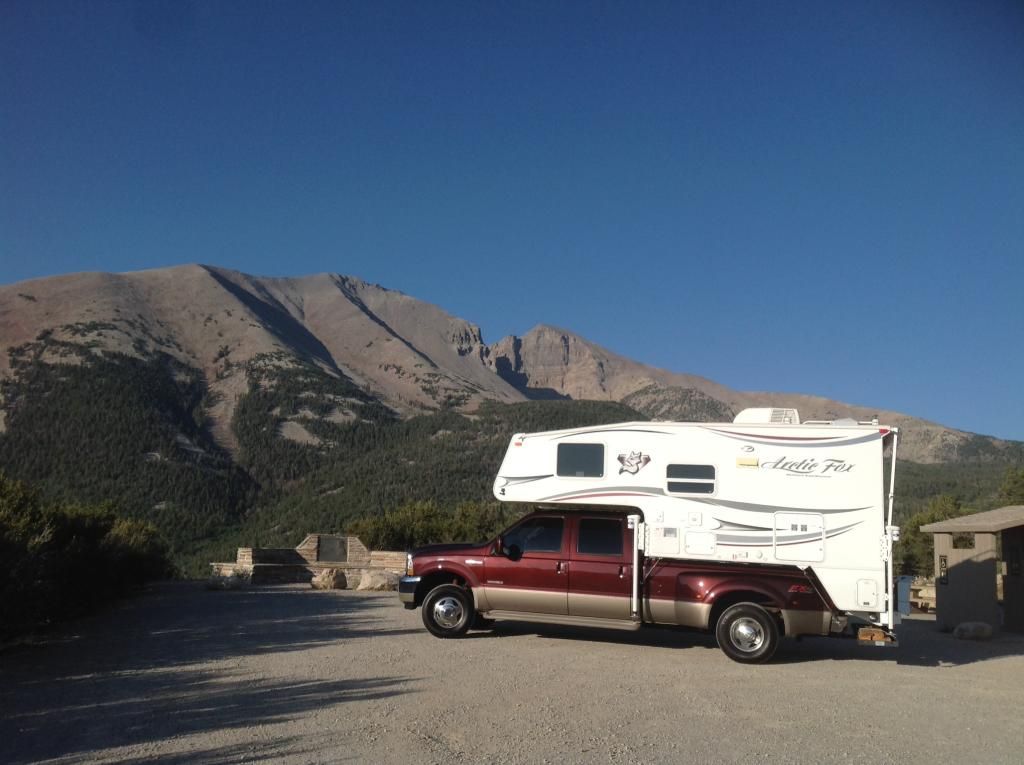
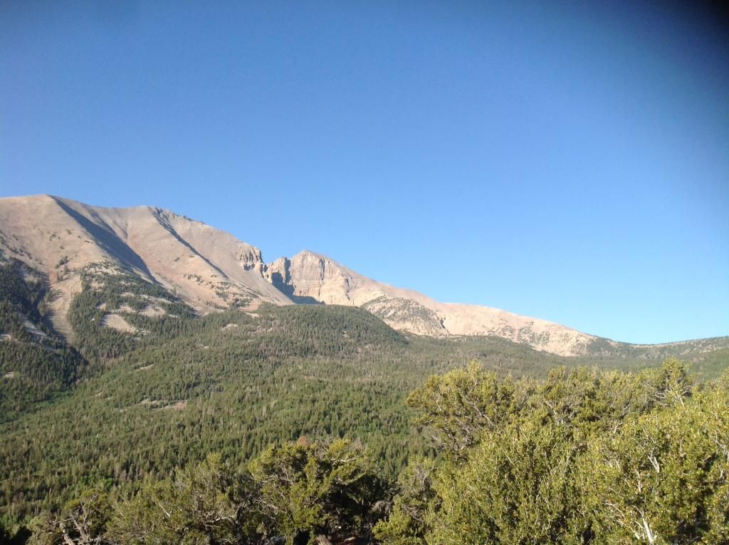
Overall, I came away with the impression Great Basin National Park is what allot of our National Parks used to be like: not allot of visitors, plenty to do without seeing others, a park not worn down by over capacity and wildlife still abundant yet avoiding humans (except the chipmunks). The night views of the stars are absolutely breathtaking - zero light pollution. My family and I truly enjoyed our visit. I think we'll go back and check out some of the places we did not get to.
I decided to take the Utah route home just for some different views. It ended up being a little longer as we ran into a construction slowdown on Interstate 15 southwest of Mesquite, NV that delayed us about 40 minutes. Overall, it was a great long weekend!! Happy Camping.

I got to tell you the forecast park temperatures had zero, and I mean zero, influence whatsoever.....;)

On previous camping trips driving on Highway 93 we'd paralleled the West side of GBNP simultaneously admiring the Snake Mountain Range which stretch over 60 miles. Interestingly, NV has over 314 named mountain ranges. Looking East at GBNP and Mt Wheeler from HWY 93.

Anyway, we'd both made a mental note to add this remote park to our future visit list. Ely, NV is the closest "city" from GBNP and approximately 70 miles west. Baker, NV is just outside the Park entrance boundary on the East side, but it is a small town with limited facilities. Baker, NV does have an unmanned Sinclair fueling station.

As you know, Nevada is primarily known for Las Vegas, Lake Mead/Hoover Dam and Death Valley. However, most folks don’t know Nevada has a National Park that exudes a beauty all its own. The Great Basin National Park sits almost in the middle of the 190,000 square mile Great Basin Desert bordering the Sierra Nevada Range on the West and the Rocky Mountains on the East; to the North it’s bordered by the Columbia Plateau; and to the South its bordered by the Mojave and Sonoran deserts. This basin is one of the largest endorheic watersheds in North America critical to ground water retention. (image courtesy of http://www.newworldencyclopedia.org)

Here are 10 Other Facts about The Great Basin Desert
Inside the Great Basin Desert is the Great Basin National Park. It's small, with 77,180 acres (it’s almost a fourth the size of Rocky Mountain National Park at 265,781 acres) and its one of America’s least-visited National Parks. According to the Department of Interior's Budget Justifications and Performance Information for fiscal year 2014, Great Basin National Park in FY2012 was the 8th least visited National Park with 94,390 visitors. The least visited NP in FY2012 was The Gates of the Arctic at 10,796 visitors (Alaska). The most visited National Park in FY2012 was The Great Smokey Mountains NP with 9,48,269 visitors. If you don't count the five least visited NP's in Alaska, and the two associated with water (Dry Tortugas NP (FL) and Isle Royale NP in Lake Superior), Great Basin National Park is the least visited land locked NP in the lower 48.
Some Great Basin National Park Facts
Image Below Courtesy Great Basin Park.com

Inside the Great Basin National Park resides the second highest peak in Nevada and the 12th most prominent mountain in the Lower 48. Mt Wheeler (named for George Wheeler, leader of the Wheeler Survey of the late 19th century) stands at just 13,063 feet a mere 81 feet shy of Boundary Peak at 13,143 feet which takes the state highpoint honor. Wheeler Peak is, however, the tallest independent mountain in the state since Boundary Peak is considered a subsidiary summit of Montgomery Peak, whose summit is in California. Wheeler Peak's summit is located just 14 miles (23 km) west of the Utah border.

In addition to the very old Bristlecone Pine Trees in the Great Basin National Park, the other main attraction is Laymen Caves. These spectacular marble caverns offer an outstanding opportunity to view and study cave features including stalactites, stalagmites, helictites, flowstone and popcorn. The caverns contain over 300 shield formations, which are rare in other caves. (pics are further on down)
We arrived at GBNP around 4 pm.

After the entrance sign we turned right and headed up the Wheeler Peak Scenic Drive for 12 miles. From the NPS GBNP Website--Note: The Wheeler Peak Scenic Drive is narrow, winding, and climbs an 8% grade in 12 miles. Wheeler Peak Scenic Drive past Upper Lehman Campground is closed to single vehicles or trailers in excess of 24 feet in length.

Wheeler Peak Campground at 9,886' elevation.

Its a good little climb....

There are four campgrounds within the Park.
Campground Maps and info at Great Basin NP
Individual campsites are non-reserve able. They are all first come first serve with the standard $12 fee or $6 for Senior Access Pass holders.
We found about six open sites Thursday afternoon at Wheeler Peak Campground. Boondocking up here off the scenic route is impossible. We settled on Site 25, which had great shade but required me to pull out my levelers for the uneven paved spot--no big deal. Then, I extended the jacks. I extend the camper jacks to just make contact with the ground which significantly improves interior left and right stability.

We quickly got settled in and fired up the site charcoal grill for some Greek pork steaks (pork steaks marinated with lemon juice, olive oil, oregano, and salt and pepper) with a tomato, cucumber, onion and feta salad and lastly, some cheesy potatoes. Good stuff!! My son prepped the fire ring for natures evening entertainment. Post dinner while it got dark we just hung out relaxing watching natures tv and enjoying the cool temperatures at 9,900 feet. It was dark under the canopy when I set the timer for this pic.

We awoke at 0530 after a good night sleep, had some bacon and pancakes with coffee and juice and then my two kids and I set off with our jackets on at 0645 to tackle Wheeler Peak's summit. The DW decided a relaxing morning by the fire with the good book would suit her just fine--who was I to argue. Heck, I would have gone back to bed. We hiked up out of the Wheeler Peak campground and stopped at the Trailhead sign for a look at the map.

For a GOD's eye view

Next, it was over the wood bridge and at the fork a right turn toward the Stella Lake trail (route well marked). The gradual climb began in earnest immediately. The morning was a cool, clean, crisp 47 degrees Fahrenheit. Under the trees it wasn’t full light yet, but it was illuminated in an early morning orange hue nonetheless. Not three minutes up the trail on our 8 mile hike we ran into a beautiful doe and her fawn twenty-five feet in front of us.

They looked us over and the little “Bambi” gracefully sprung around in a gleeful “springy” jump when its mom began to turn and walk away from us. After getting a few photos and taking in their beauty we continued up the trail.

The trail from the Trailhead Parking Area intercepted our trail to Stella Lake and soon we were at the Wheeler Peak turn off from the Stella Lake Trail. We had hiked about .8 tenths of a mile at this point.

At a clearing we got a great pic of Mt Wheeler and what laid ahead of us...man it seemed so far away!


We kept a good little pace going on the trek up the ridge above Stella Lake.


And onward toward the peak we climbed making good time. Near the top of the tree line we ran straight into three big bucks bedded down within 50 feet of the trail. We are pretty quiet climbers so this surprised not only the deer but us too. This first shot is right after the dominant buck arose. The other two were directly behind him and the tree--hard to see with the pics I'm posting. My college graduate daughter could not believe how big this 6 Point buck was. I mean he really was huge.

The dominant Buck stayed in front of the other two while they moved to thicker brush always behind the big guy. You can see one of them in the brush to the right (look for the tan against the green) between the dead tree and the live one.

At one point we were no more than 50 feet nose to nose as we continued up the trail. This close was getting a little intimidating anyway as he looked on intently as we moved from his left to right along the trail--glad it was not ruttin' season. Finally, as we moved up the trail he began to move as well.

As we pushed on beyond the tree line the air was getting thinner. You can barely see the wind farms on the north west side of the Snake Mountain range down in the valley in this shot.

Here we are about 500-1000' above the tree line looking west.

This is looking N down into the Valley. You can make out Teresa Lake and the campground area (further to the left) and the Mt Wheeler Peak Scenic Drive as it comes back down into the Campground entrance.

Looking at the final assent which according to my Garmin was still over a 1000' vertical climb.

The rock wall is a hiker rest and wx protection area as there is nothing to block the wind up here.

Garmin says 1000' feet to go!

I kept track of the altitude with my Garmin just to provide updates on vertical progress. Here's what 1000' looks like - straight up!

In the flyin' bidness we use the standard lapse rate of 3 degrees fahrenheit per thousand feet of altitude--yep, it's cooling down and the layers are back on. My son refused to hand off the 40-pound backpack of water, jackets, and trail mix so I had it much easier on this hike—man is it nice when they get older and wiser. My daughter brought up the rear but kept up. At 100 pounds I could tell she was experiencing some altitude nausea but she kept climbing.

Here's just a shot to show the sheer cliffs. This is looking NW. The road to the right of the "T" toward the windmills is HWY 50--AKA The Loneliest Road in America.

The terrain is getting steeper and more rocky. I need to give a Big Shoutout to the NPS and Conservation corps who maintain this trail. It was in great shape!

Summit is getting closer. This is looking directly down onto the Wheeler Peak Summit road that leads to the Wheeler Peak Campground. The road makes a left 90 degree turn into the visitor parking area at the bottom left. The road continues to the campground and meadow in the center to lower center of the pic.

Almost there! This pic is looking down into the valley. Lakes, road and camp area easily discern-able.

1016L, boom we were on the top - 13,063'. The views were incredible! Since we were the first ones on the summit that morning we took a little break to absorb the views. Then it was time to explore and take some more photos.


Looking down.

Walking East up on the Summit rocks.

Inside one of the rock shelter on the summit was a mailbox and a record book to add your name and date.

Just enjoying the view


Looking North with the help of Google Maps

At the summit the winds were light and variable and it was cool. I'd read where the winds get cooking at 50 knots or higher on the way up; not to mention nasty wx in the mid afternoon. On top, they have at least four rock shelters built to get out of the wind. From our campsite to the top was just three hours and 30 minutes--not bad. I got the binoculars and walkie-talkie out and contacted the DW. It was real clear and I could easily see the campground and our campsite. You could also break out the road up to the campground and the Mather Lookout point. I was amazed how steep the last push to the summit was but, the trail was easy and the footing was great--shale rocks but pretty firm nonetheless. The views were incredible. The last 1000' was by far the slowest with the thinner air and steeper climb. All of us could feel the tightness in our lungs and we're all in great physical shape.
After 30 minutes on the summit, we started down just as a solo female Conservation Corps worker reached the summit. We chatted for a few minutes then set off to down the trail. I think the descent is harder on the knees and back than going up. I brought up the rear while my two jackrabbit kids bounced down the mountain. We passed at least 30-40 folks making their way up at different points along the trail. Take some layers, some water and some food. WX changes can put a person in a bind very quickly unprepared.
As we approached the trail to Stella Lake we ran into a rafter of turkeys with a few does close by. We listened intently as they clucked and purred interspersed with a few putts. They were moving right along.

On the descent I passed an ETA via the walkie-talkie and when we reached the campsite we enjoyed a ready cooked lunch the DW had waiting--she's a keeper! The descent took us all of two hours. For the entire trip we drank 10 bottled waters, a bag of trail mix and had our jackets on and off more times than I can remember with the temp changes. I'd say this hike is definitely intermediate/strenuous especially since the last half mile and 1,000 feet is a pretty steep climb, however this area was full of switchbacks and area for short breaks to adjust to the altitude. Getting an early start really made the effort go quick. Overall, what a great hike, some great views, some neat wildlife and some outstanding memories!!
Later in the afternoon after we'd relaxed for awhile we stowed the camping gear and got the camper prepped for a short trip down the Wheeler Peak Scenic road to the Layman Caves visitor center. I'd called earlier in the week to reserve a cave tour time--that's a must do. We started the Layman Cave tour at 1600. I've been in some caves before but this one has some internal characteristics not allot of other caves have particularly the rare shield formations. Here we're starting the tour with the NPS ranger. She's holding a tin can with a candle--a light source before flashlights.

Unbelievable formations.


We finished up the cave tour and pressed back up the scenic road to the campsite where we quickly got leveled and settled in. We enjoyed some beef stroganoff on noodles and broccoli for dinner. By twilight we were all exhausted and I think everyone was asleep by 9 pm.
On Saturday, we all set out for a quick hike on the Alpine Lakes Loop trail. It was much shorter (2.7 miles) and felt good to stretch those muscles from the previous day’s excursion.
Just before you get to Stella lake. Trail to Wheeler Peak is off to the right


Yep, we climbed that!

And then followed it up and around to Teresa Lake. Total elevation gain was 600’ total-not bad after the previous days assent at 3,100’.
Teresa Lake

Creek feeding into the Teresa Lake

Back at the campground after dinner right outside our camp we enjoyed another rafter of turkeys walking close by talking away. Our dog, on a leash, was still and attentive, just below my wife taking an iphone pic, watching and listening—-it was pretty funny.
Here she is just checking it out as they moved into camp from the right headed left.


Next, a young Doe decided to make a drive-by. They don't come close and they move with a little fear. This one was on a mission and barely stopped. Again, our dog stayed perfectly still.

We also had many chipmunks around the camp. Our dog was mesmerized by them and their movement. Soon, they began to play games with the dog. She'd be sitting intent on watching one bound around and one would sneak up on her and touch her quickly and skeedaddle up a tree. This went on for hours. We all just laughed and laughed. All we could think about was Alvin and the Chipmunks.
Sunday, we got up early, packed up and headed back to Vegas. I couldn't resist a few shots of Mt Wheeler in the background as we pressed on out of the Park.


Overall, I came away with the impression Great Basin National Park is what allot of our National Parks used to be like: not allot of visitors, plenty to do without seeing others, a park not worn down by over capacity and wildlife still abundant yet avoiding humans (except the chipmunks). The night views of the stars are absolutely breathtaking - zero light pollution. My family and I truly enjoyed our visit. I think we'll go back and check out some of the places we did not get to.
I decided to take the Utah route home just for some different views. It ended up being a little longer as we ran into a construction slowdown on Interstate 15 southwest of Mesquite, NV that delayed us about 40 minutes. Overall, it was a great long weekend!! Happy Camping.