jefe_4x4
May 21, 2014Explorer
Lolo Motorway and the Selway wild and crazy river
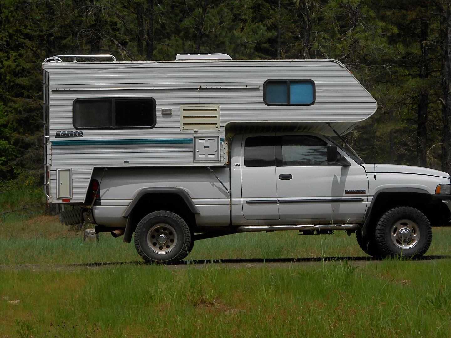
While Jeanie and I were bummed on not being able to attend OX 2014 this year, we did attend to family business in Sand Point ID. We just returned from a wide ranging trip through CA, OR, ID, and WA. in Cabeza de Vaca: in some ways a dry run on traveling using many venues for overnighting as available and as present themselves. These included:
State Camp Ground in E. OR.
Jeanie's brother's driveway overnighting for 4 nights with power hookups and internet.
A failed attempt at traversing the fabled Lolo Motorway
3 nights dry camping (boondocking) along said motorway and the Selway River
A night in St. Mark's Episcopal Cathedral, Seattle, parking lot to attend a memorial service for my mentor.
A high bucks hotel (the only time we spent any money on lodging)
another and final night on a little corner of National Forest land @ 6400 ft. in So. OR, near Siskiyou Pass.
Jeanie's sister-in-law had a severe stroke recently and is recovering miraculously well in Sand Point. We spent a few days there parked on the slab and sleeping in the white box (truth be told, the best night's sleep we ever get, anywhere)
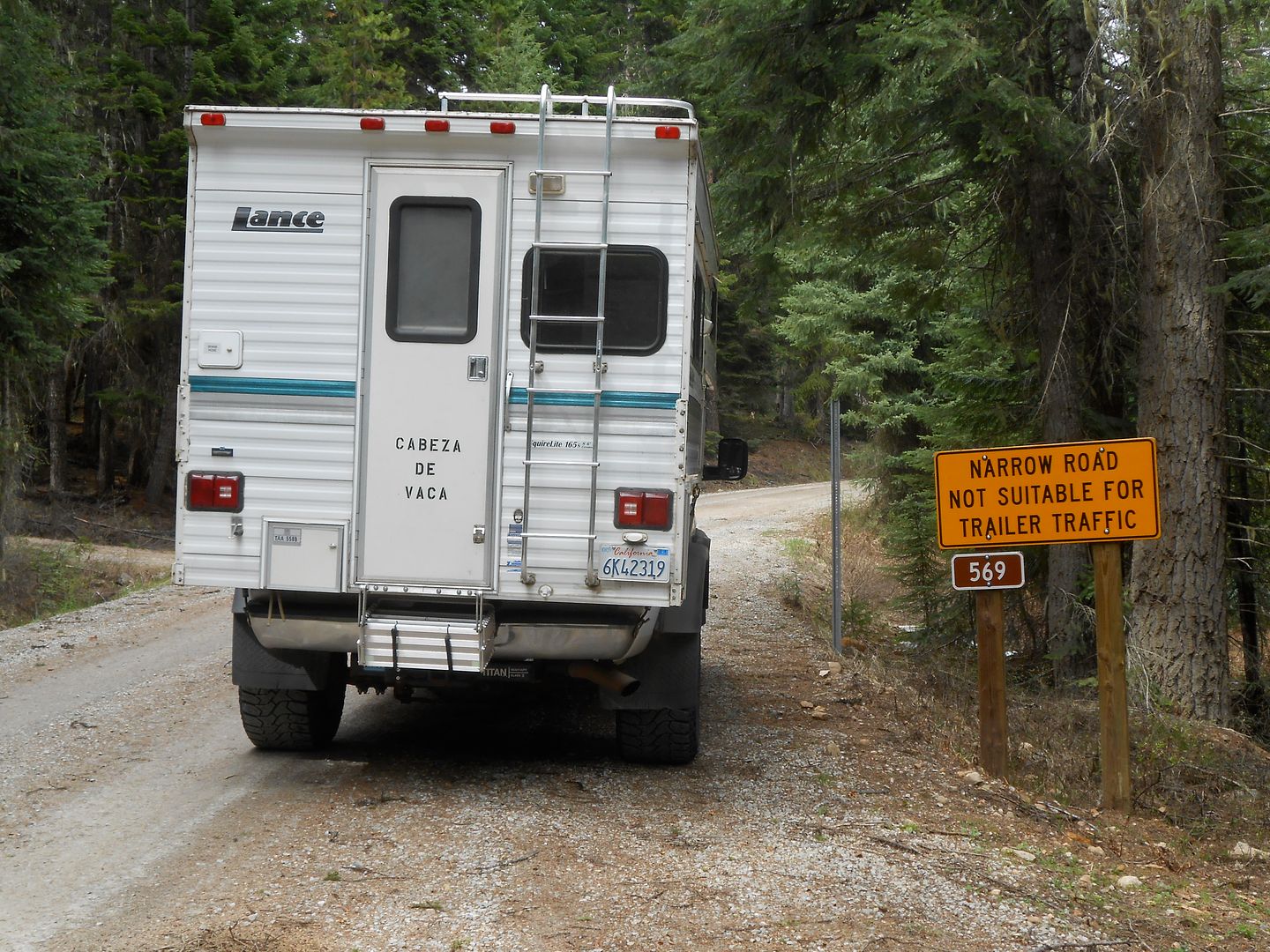
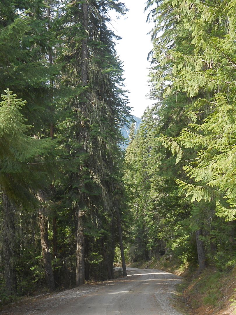
Subsequently, with about 5 days to explore we decided on the Lolo Motorway, a 1930's dirt road following loosely the explorations of Lewis and Clark in 1805-06. It's about 110 miles of dirt, and I was anxious to get off road again. It started out nicely near Lolo Pass with only this sign of things to come:
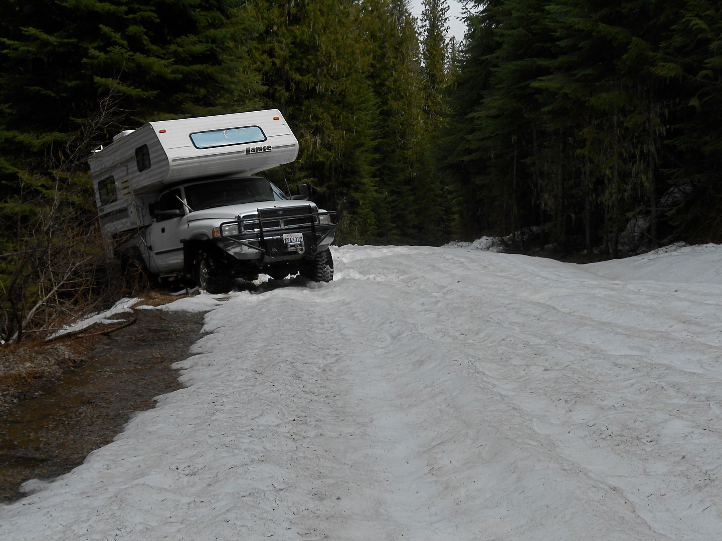
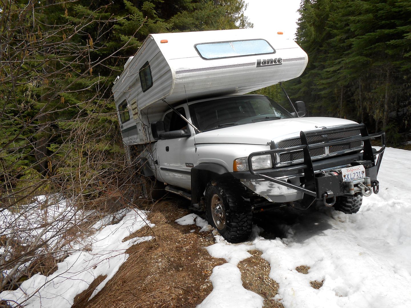
Within a short couple miles uphill, this white stuff appeared across the road. Easy: the 50% effort: pull the short lever into 4WD, right? The snow was very icy and had a crown which afforded my limited slip rear axle to migrate to the downhill side very quickly. The fronts pulled well, but the wide rear tires had very little ground pressure, which led to this awkward situation: "Honey, how close to the edge are we?"
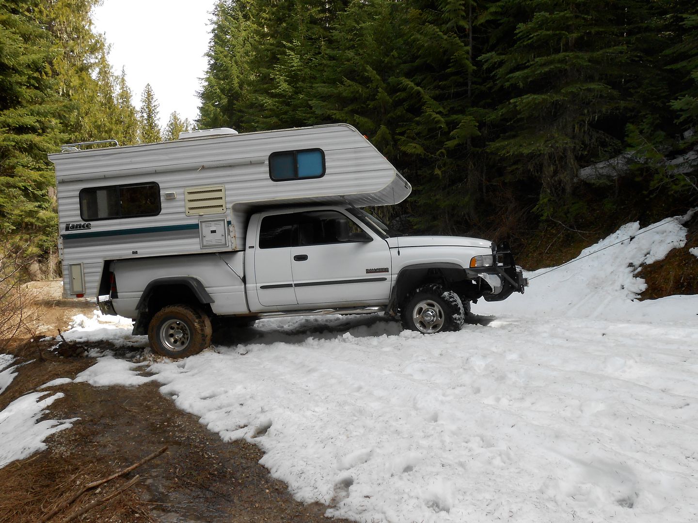
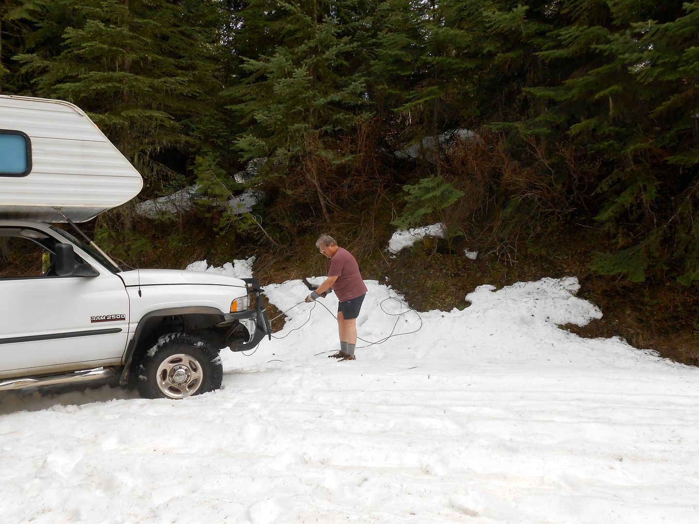
After grinding back up to the middle, it was time for the 100% effort: the boat anchor hanging off the front bumper: You can see the 7/16's wire rope leading up hill to a very stout tree:
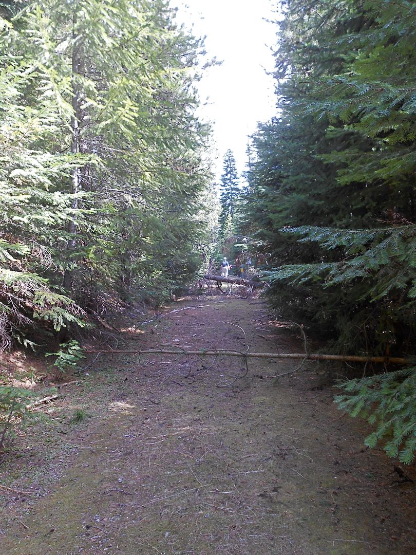
We did after a lot of effort get farther up the trail to no avail. I did a 15 point turn and we drove right back down, this time using gravity as an ally. Within a short time we found what looks to be an abandoned part of the L & C trail:
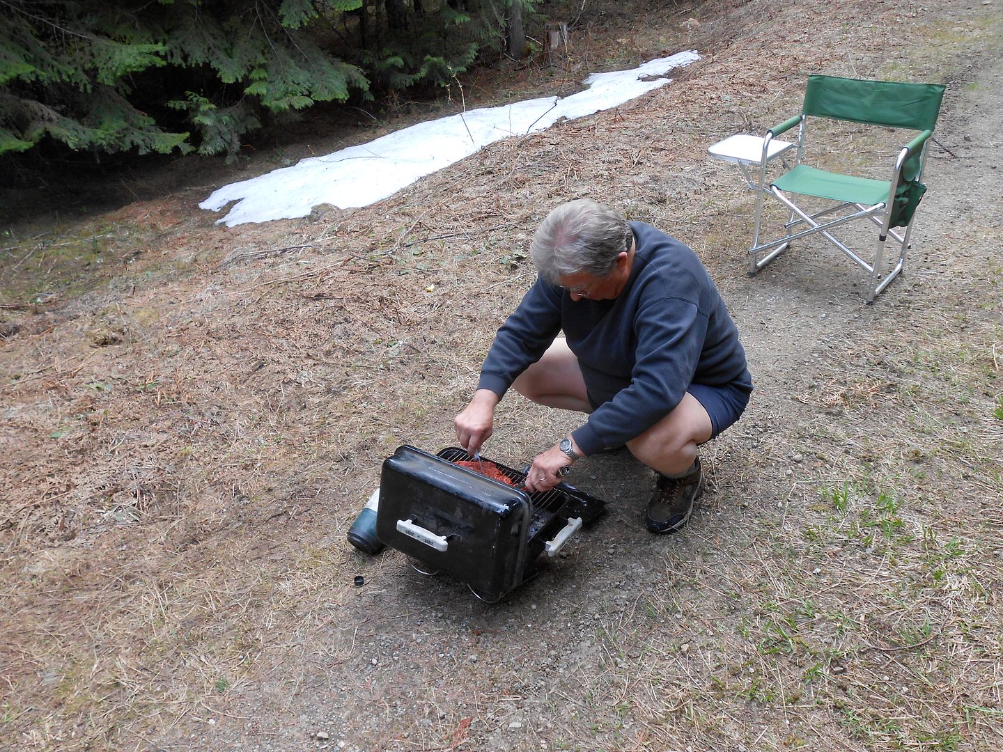
and found a nice camp for the evening, repleat with Carne Asada on the Weber and Jeanie's Margarita Sunset. (Any time you consume said beverage, the sun goes down)
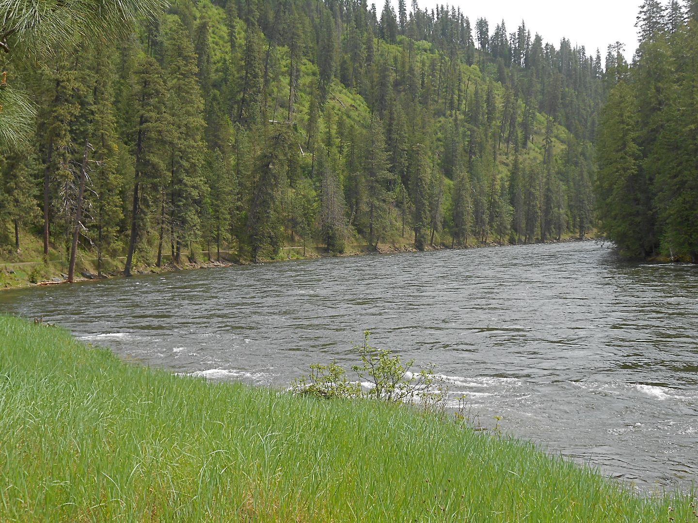
We tried all three entrances along the Lolo Motorway with the same result. Too much snow. On to the Selway Wild and Scenic River, one that has not been dammed or altered to fit man.
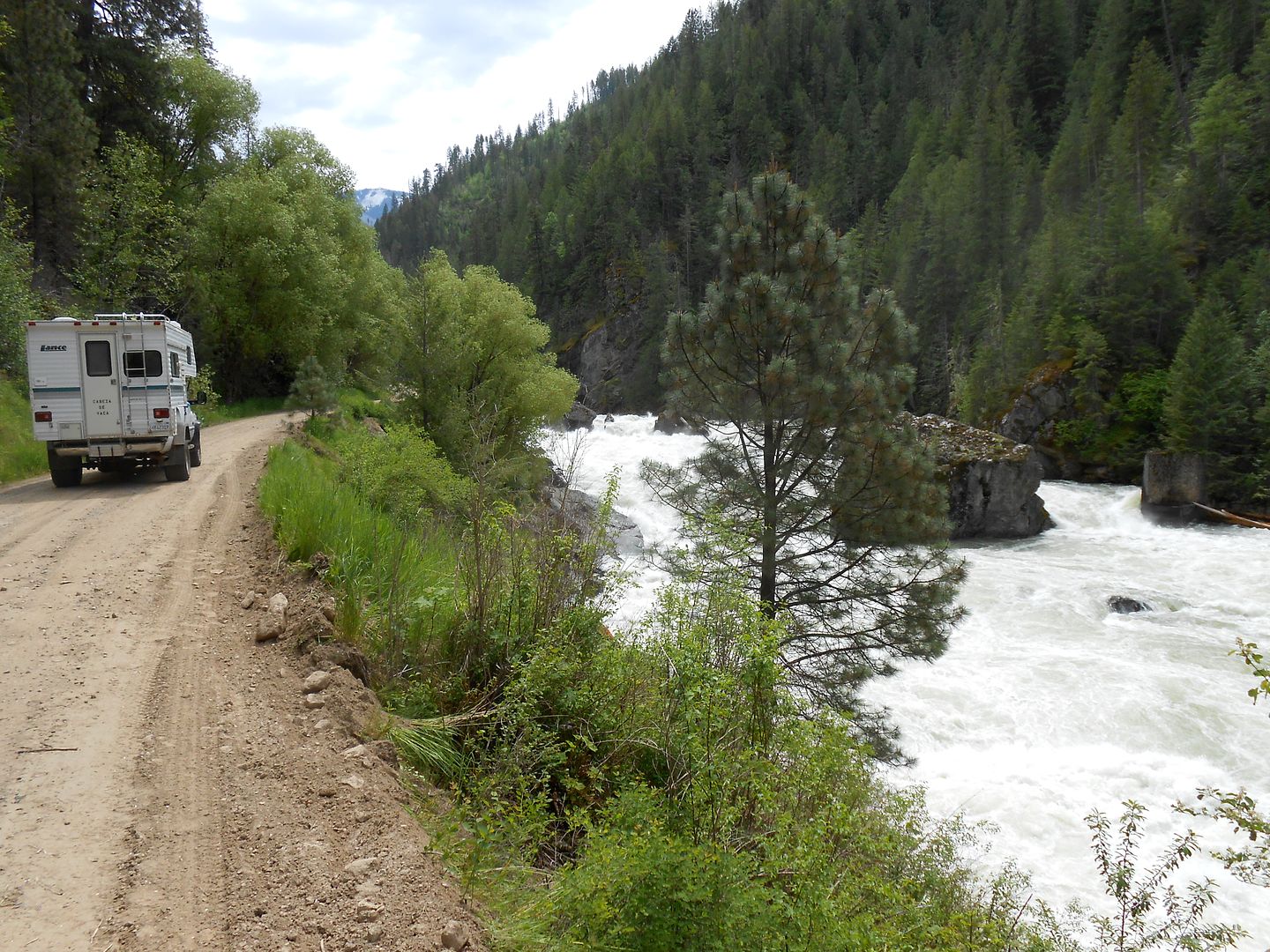
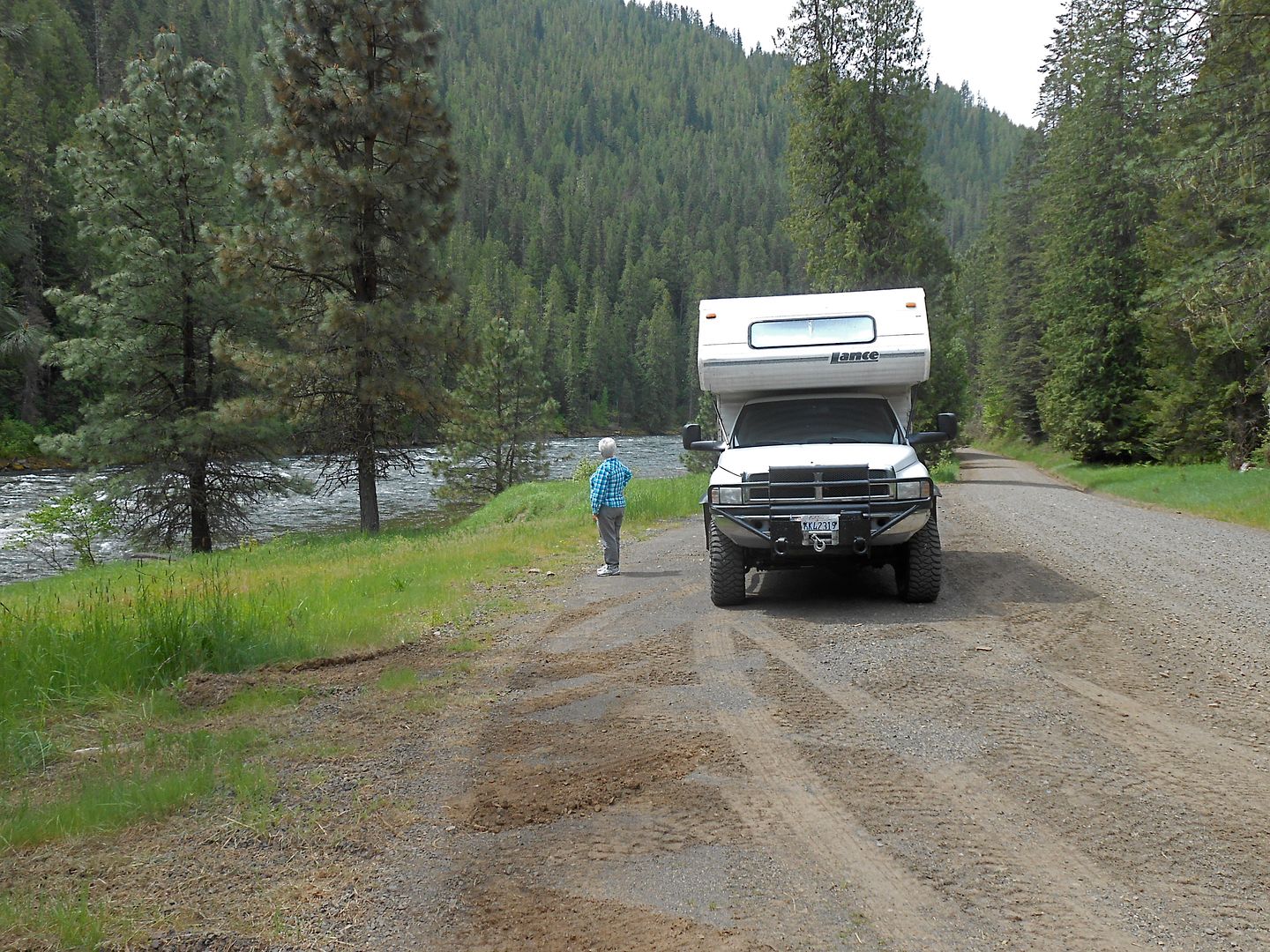
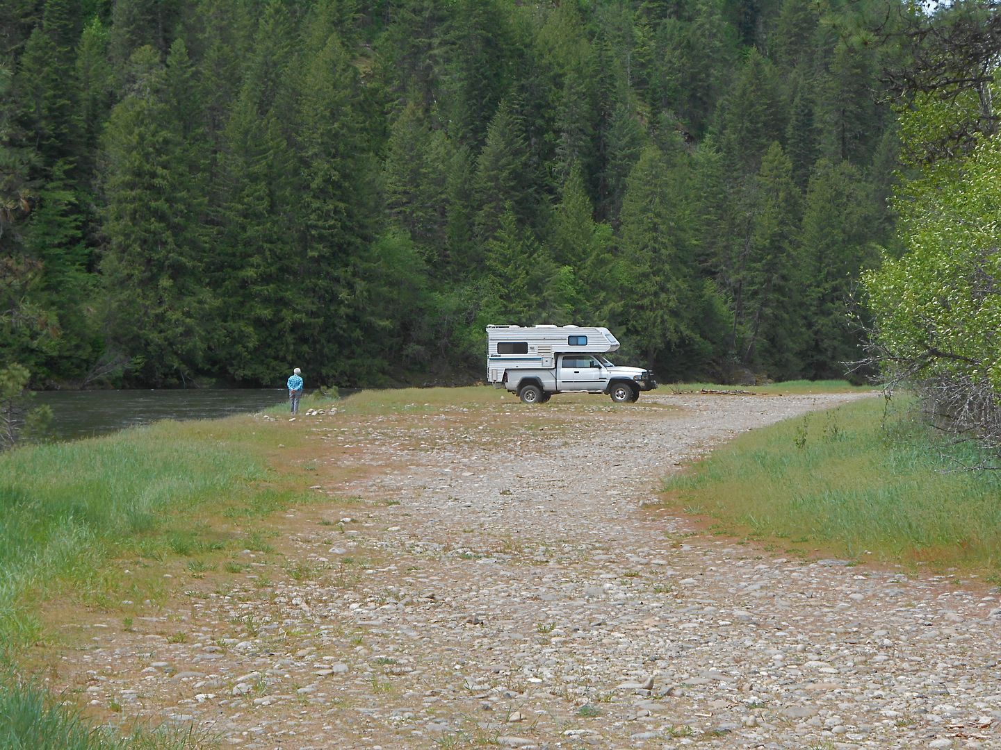
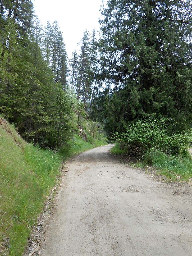
The water level was very high due to much precip late in the spring. See the narrow ribbon of dirt road along the bank:
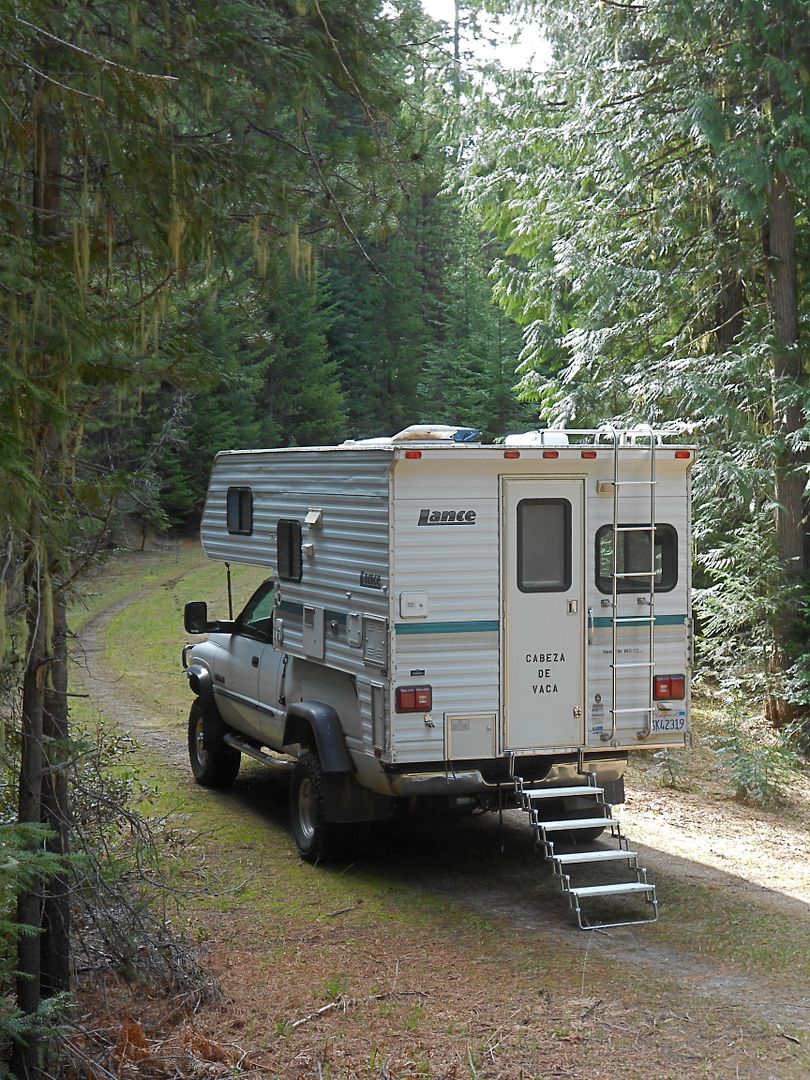
Cabeza with the steps folded under to give the best departure angle:
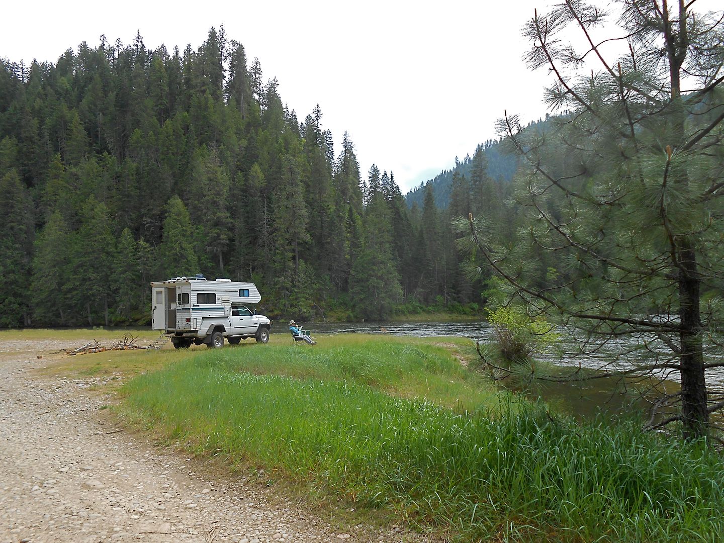
Alone on a rocky spit along the river bank where two rivers come together:
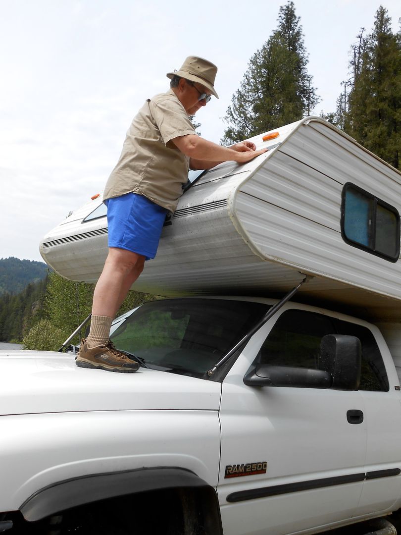
I had punctured a long slit into the epidermis of Cabeza and procured some waterproof tape to patch the gap as the rains were closing in.
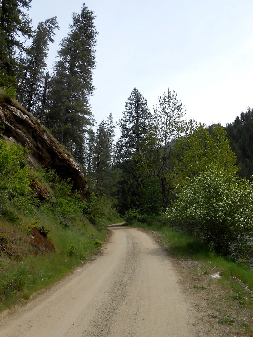
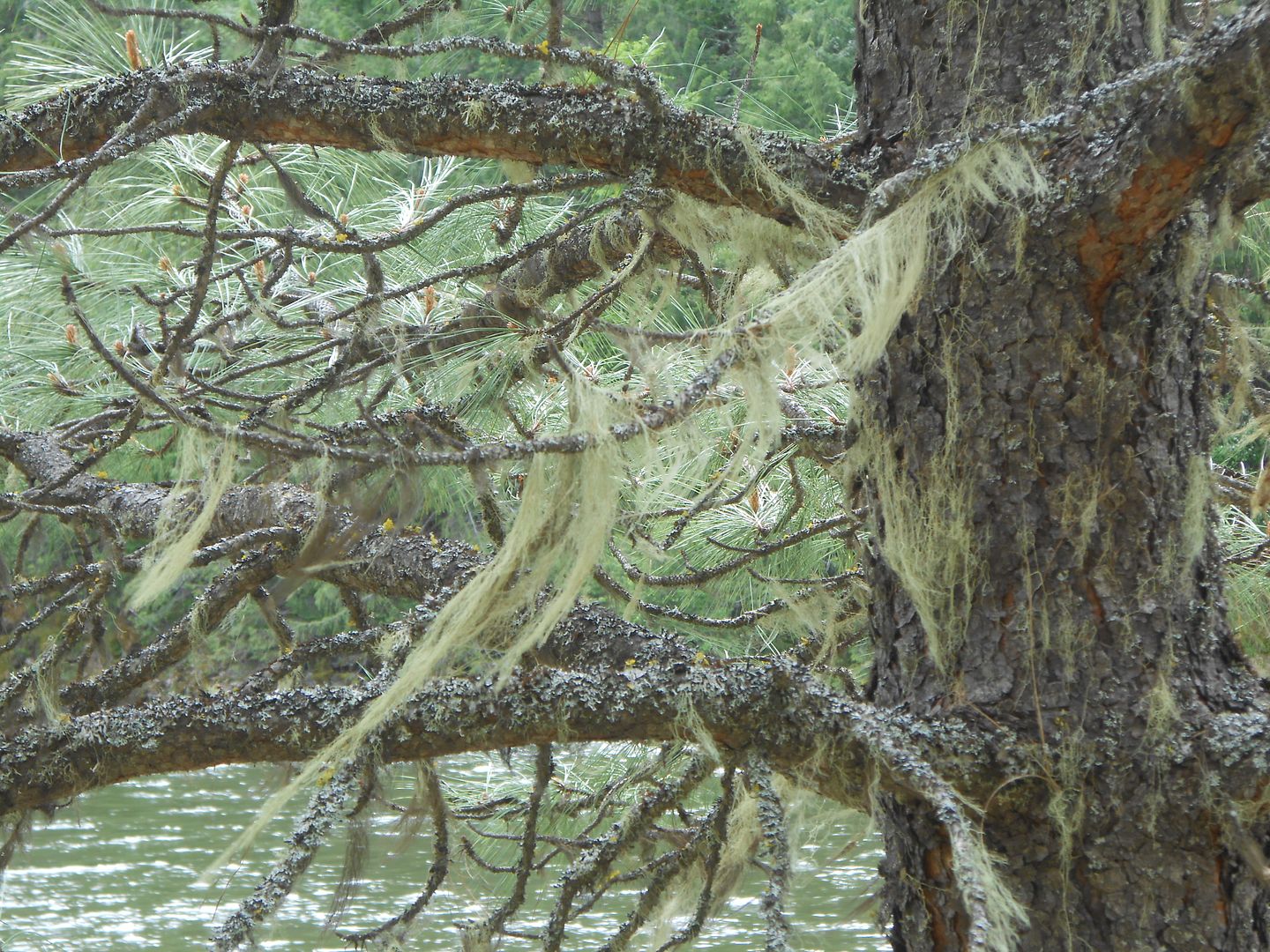
Some more road shots plus the moss that sucked on the trees:
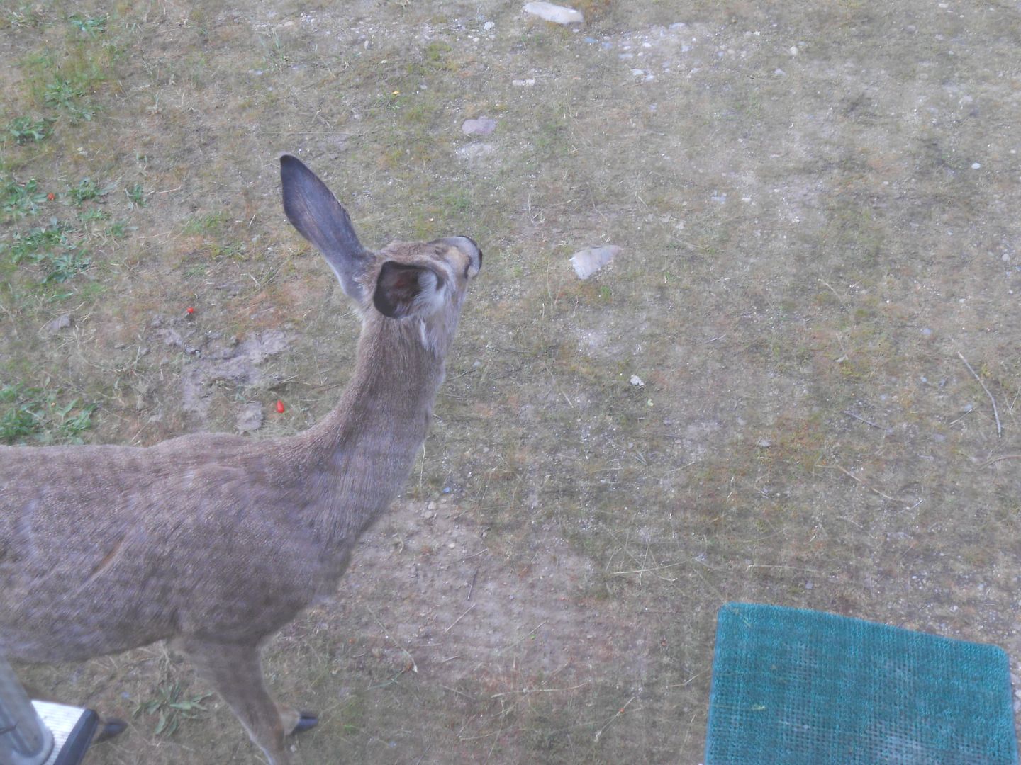
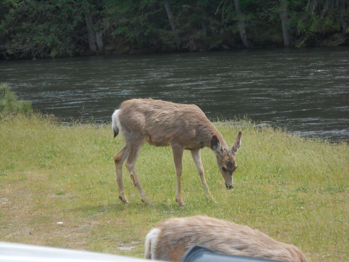
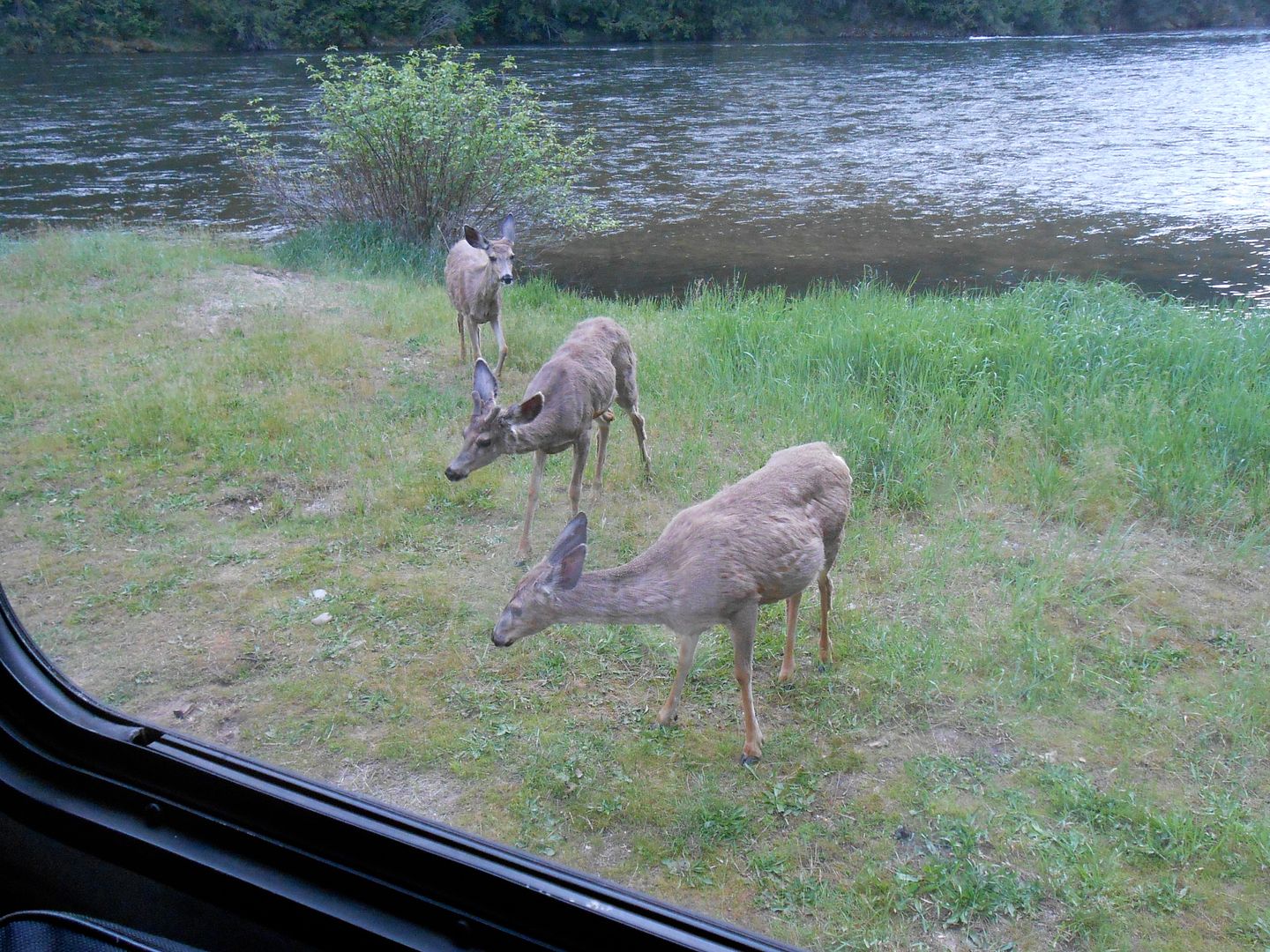
Then there was the invasion of the petting Zoo. Why all those cervidae hung around our camp I'll not venture. No, no feeding. Someone had left a couple apples around which the deer had no interest in.
Then there was the Selway Falls, a mighty noise and tremendous amount of water passed here.
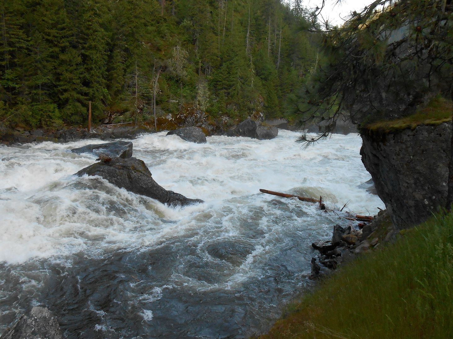
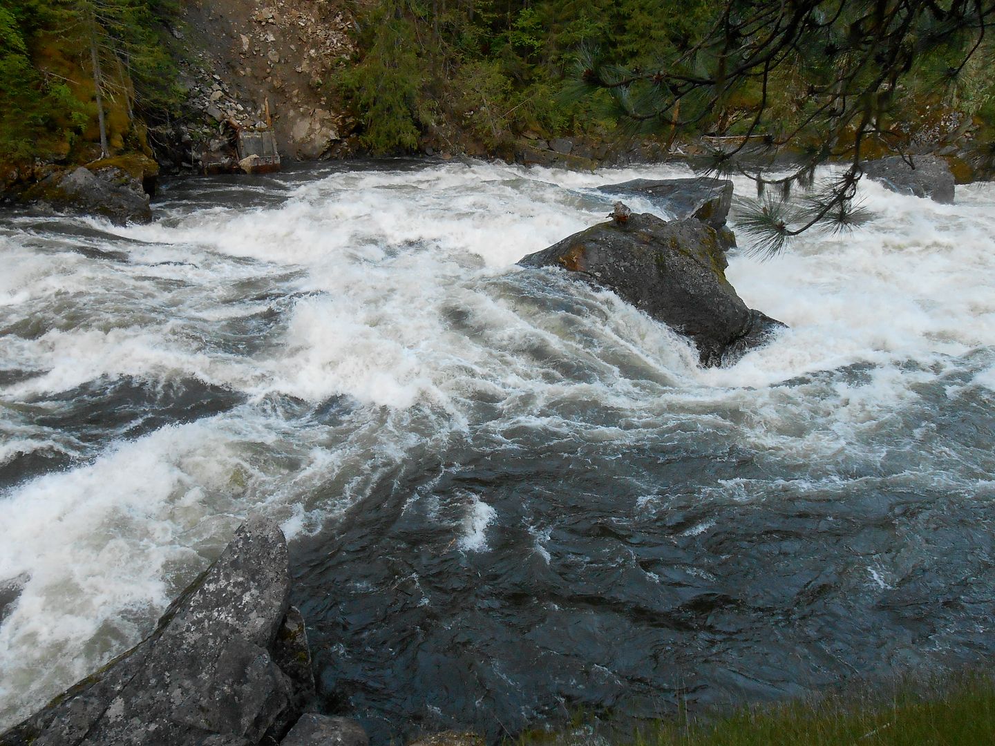
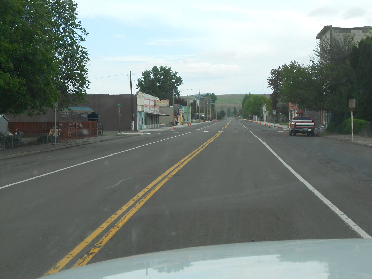
The span is 50M across at this point. My only other foto for you is the Saturday morning rush hour in Washtucna, WA. We were looking for a breakfast/lunch stop. None found.
We drove about 1800 miles and got between 11 (uphill against the wind) and 14 miles per gallon (slight downhill with the wind), mostly 13 mpg. as measured by dividing the miles driven by the gallons consumed. The fuel pressure idiot light flickered on and off while pulling a long steep hill signaling a pump change this week.
regards, as always, jefe
State Camp Ground in E. OR.
Jeanie's brother's driveway overnighting for 4 nights with power hookups and internet.
A failed attempt at traversing the fabled Lolo Motorway
3 nights dry camping (boondocking) along said motorway and the Selway River
A night in St. Mark's Episcopal Cathedral, Seattle, parking lot to attend a memorial service for my mentor.
A high bucks hotel (the only time we spent any money on lodging)
another and final night on a little corner of National Forest land @ 6400 ft. in So. OR, near Siskiyou Pass.
Jeanie's sister-in-law had a severe stroke recently and is recovering miraculously well in Sand Point. We spent a few days there parked on the slab and sleeping in the white box (truth be told, the best night's sleep we ever get, anywhere)
Subsequently, with about 5 days to explore we decided on the Lolo Motorway, a 1930's dirt road following loosely the explorations of Lewis and Clark in 1805-06. It's about 110 miles of dirt, and I was anxious to get off road again. It started out nicely near Lolo Pass with only this sign of things to come:

Within a short couple miles uphill, this white stuff appeared across the road. Easy: the 50% effort: pull the short lever into 4WD, right? The snow was very icy and had a crown which afforded my limited slip rear axle to migrate to the downhill side very quickly. The fronts pulled well, but the wide rear tires had very little ground pressure, which led to this awkward situation: "Honey, how close to the edge are we?"


After grinding back up to the middle, it was time for the 100% effort: the boat anchor hanging off the front bumper: You can see the 7/16's wire rope leading up hill to a very stout tree:


We did after a lot of effort get farther up the trail to no avail. I did a 15 point turn and we drove right back down, this time using gravity as an ally. Within a short time we found what looks to be an abandoned part of the L & C trail:

and found a nice camp for the evening, repleat with Carne Asada on the Weber and Jeanie's Margarita Sunset. (Any time you consume said beverage, the sun goes down)


We tried all three entrances along the Lolo Motorway with the same result. Too much snow. On to the Selway Wild and Scenic River, one that has not been dammed or altered to fit man.


The water level was very high due to much precip late in the spring. See the narrow ribbon of dirt road along the bank:


Cabeza with the steps folded under to give the best departure angle:

Alone on a rocky spit along the river bank where two rivers come together:


I had punctured a long slit into the epidermis of Cabeza and procured some waterproof tape to patch the gap as the rains were closing in.

Some more road shots plus the moss that sucked on the trees:


Then there was the invasion of the petting Zoo. Why all those cervidae hung around our camp I'll not venture. No, no feeding. Someone had left a couple apples around which the deer had no interest in.


Then there was the Selway Falls, a mighty noise and tremendous amount of water passed here.


The span is 50M across at this point. My only other foto for you is the Saturday morning rush hour in Washtucna, WA. We were looking for a breakfast/lunch stop. None found.

We drove about 1800 miles and got between 11 (uphill against the wind) and 14 miles per gallon (slight downhill with the wind), mostly 13 mpg. as measured by dividing the miles driven by the gallons consumed. The fuel pressure idiot light flickered on and off while pulling a long steep hill signaling a pump change this week.
regards, as always, jefe