cewillis
Apr 07, 2017Explorer
TR: SE Az Sky Islands
Specifically, driving, camping, and hiking in the Dragoon and Chiricahua mountains. (no chuckling from the Colorado crew)
First, more and larger pictures are on my web site here .
(also, other trip report, truck upgrade, camper repair, home addition, miscellaneous, and cat pictures are linked at my home page
Here are excerpts from the MVUMs, in case anyone would like to locate the roads mentioned below.
Dragoon MVUM Chiricahua MVUM

The Dragoons

Middlemarch Road -- excellent dirt road that goes all the way across the range.


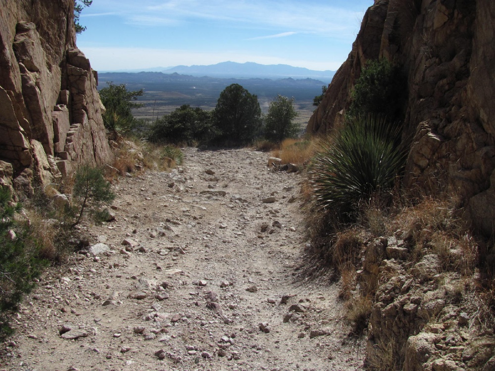
Start of Stronghold Canyon - (687 road to 688)

Got to be some mountain goats over there

Top of Stronghold Canyon -- not far from the semi-mythical Cochise Stronghold

Starting up China Peak road -697. Just past here, two guys on a side-by-side told me 'You can't get up there'

At the top (except for some old mine 'roads')

Nice little valley, just over the top.

Starting back down the next day

Not rock crawling -- but rough enough. I didn't hear anything hit under the truck, but I'm glad I added a transmission skid plate.

Cochise Peak road - 345A. Too high to get over or around -- probably.
So backing down a one lane road -- happy to have a rear view camera.

After a ~10 point turn-around, on foot to the summit - about 7000 ft.

Pinery Canyon road in the Chiricahuas. Another good dirt road that goes across the range.

42D road toward the wilderness area

And on foot again, past the end of the road

Near 9000 ft here. See the miniature mountain lion tracks?

Too hazy today

Rental camper on an F-150

Name suggestions for this little peak? -- remembering that Kitt Peak is taken.

Cave Creek - end of 42A road

There's a 400 foot waterfall up there -- in the shadow at the low point of the ridge line

Closer look

Cave Creek again -- way up one of the trails

Rucker Canyon 74E road via Tex Canyon

628 road - that tree is a little too close, and too high to cut. On foot again

Normal end of road -- trail continues

Near Monte Vista peak

Looks fake to me

Turkey Creek Canyon

Turkey Creek -- got to be some Brook trout in there


Near the Cochise Stronghold campground, back in the Dragoons. The other end of Stronghold Canyon.

4377 road off of the 795 road. Had to get out a few times to guide myself when I couldn't see the road.

4376 road -- no other tire tracks or foot prints

Finally, a poor attempt to photograph the moon and Jupiter.
Hope you enjoyed the pictures. I thought it was a great trip, and quite close to home.
First, more and larger pictures are on my web site here .
(also, other trip report, truck upgrade, camper repair, home addition, miscellaneous, and cat pictures are linked at my home page
Here are excerpts from the MVUMs, in case anyone would like to locate the roads mentioned below.
Dragoon MVUM Chiricahua MVUM

The Dragoons

Middlemarch Road -- excellent dirt road that goes all the way across the range.


Start of Stronghold Canyon - (687 road to 688)

Got to be some mountain goats over there

Top of Stronghold Canyon -- not far from the semi-mythical Cochise Stronghold

Starting up China Peak road -697. Just past here, two guys on a side-by-side told me 'You can't get up there'

At the top (except for some old mine 'roads')

Nice little valley, just over the top.

Starting back down the next day

Not rock crawling -- but rough enough. I didn't hear anything hit under the truck, but I'm glad I added a transmission skid plate.

Cochise Peak road - 345A. Too high to get over or around -- probably.
So backing down a one lane road -- happy to have a rear view camera.

After a ~10 point turn-around, on foot to the summit - about 7000 ft.

Pinery Canyon road in the Chiricahuas. Another good dirt road that goes across the range.

42D road toward the wilderness area

And on foot again, past the end of the road

Near 9000 ft here. See the miniature mountain lion tracks?

Too hazy today

Rental camper on an F-150

Name suggestions for this little peak? -- remembering that Kitt Peak is taken.

Cave Creek - end of 42A road

There's a 400 foot waterfall up there -- in the shadow at the low point of the ridge line

Closer look

Cave Creek again -- way up one of the trails

Rucker Canyon 74E road via Tex Canyon

628 road - that tree is a little too close, and too high to cut. On foot again

Normal end of road -- trail continues

Near Monte Vista peak

Looks fake to me

Turkey Creek Canyon

Turkey Creek -- got to be some Brook trout in there


Near the Cochise Stronghold campground, back in the Dragoons. The other end of Stronghold Canyon.

4377 road off of the 795 road. Had to get out a few times to guide myself when I couldn't see the road.

4376 road -- no other tire tracks or foot prints

Finally, a poor attempt to photograph the moon and Jupiter.
Hope you enjoyed the pictures. I thought it was a great trip, and quite close to home.