NVR2L82AV8
Jun 06, 2014Explorer
Trip Report - Thomas Canyon Spring Creek, NV (May 2014)
With temps already climbing past 100 degrees in the Lost Wages valley, it was time to head north for a little cooler weather on Memorial Day weekend. We prepped the camper on Thurs and then Friday morning we headed North on 93 through the center on Nevada underneath the Nellis AFB Ranges toward Wells, NV and the Ruby Mountains.
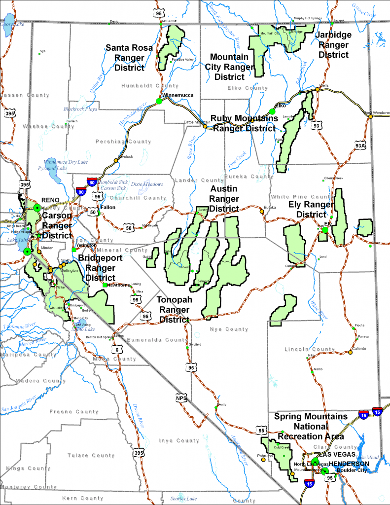
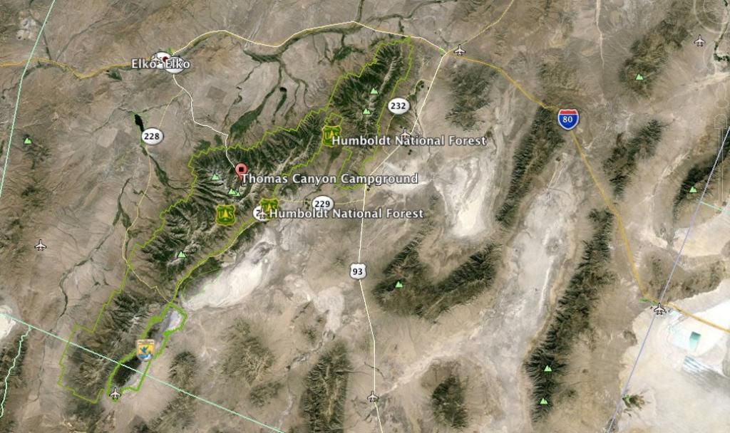
It's a good seven-hour drive from Lost Wages up to I-80 and with the total trip around 8-9 hours one way depending on traffic and route. We decided to alternate destination and return routes so Friday was Hwy 93 all the way to Wells, NV then I-80 West to Elko, NV to the Lamoille Hwy to Spring Creek then National Forrest District 660 Road up into Thomas Canyon via the Lamoille Canyon Scenic By Way (a twelve mile drive).
Eight miles up the canyon you'll see the Thomas Canyon Campground sign.
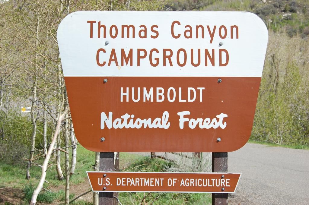
The Thomas Canyon Campground is located in about 30 miles southeast of Elko in the scenic Lamoille Canyon at an elevation of 7,600 feet. This picturesque canyon is surrounded by aspen and cottonwood trees nestled along the Lamoille Creek. The campground itself has at least 40 sites. You can reserve a site that backs right up next to the creek if you desire—I highly suggest you pull up the area on Google to explore the possibilities.
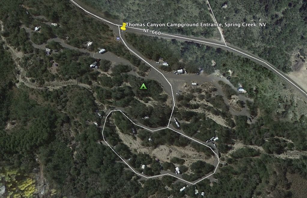
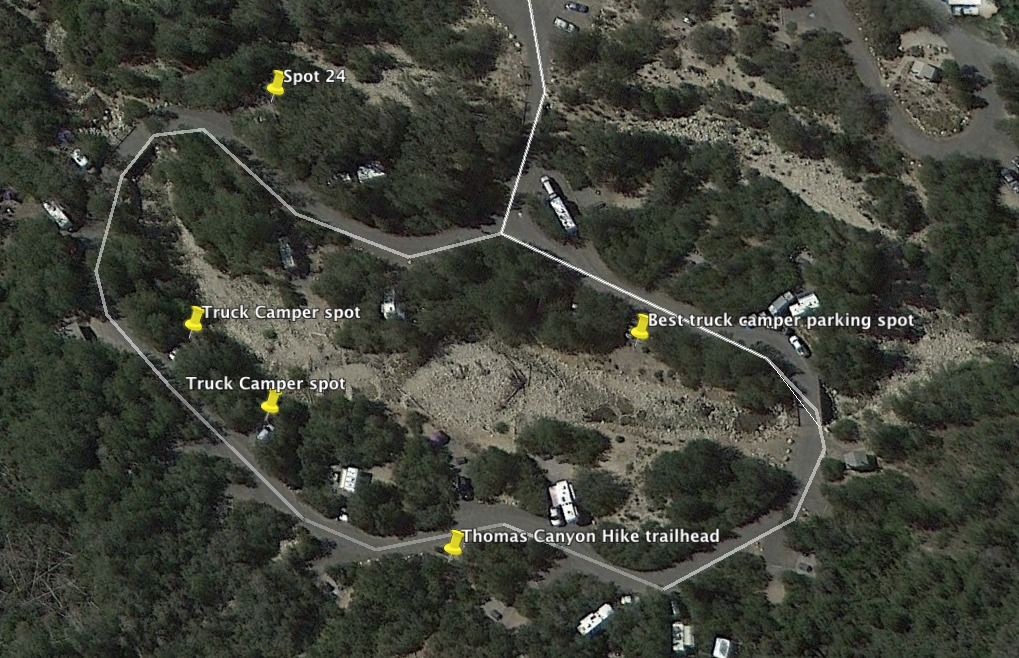
Inside the campground we counted 6 spots dedicated to "Truck Campers" which you cannot reserve nor do they advertise or show on any of the recreation.gov maps. They are not set back very far and most are only 20-40’ deep. I
One “truck camper” site was outstanding but, it like the rest of the truck camper spots, don't have a picnic table, fire ring, or BBQ--they are basically just a level spot to park. Nonetheless, that particular “truck camper" site backed right up against the rushing creek--10 feet away and about 5 foot high from the water. The other drawback was across the river you'd be looking at another campsite. I labeled it the "best" spot in one of the pics.
When I researched the canyon last fall I couldn't find any adequate Boondocking spaces or roads that might be accessible this time in the season or acceptable so, I just reserved a site on:
Thomas Canyon (Recreation.gov)
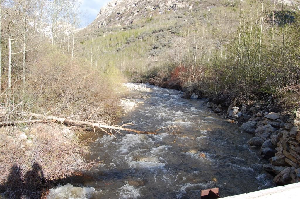
--cost was $17 per night. I can tell you from other local campers this is a popular place during the summer. We had Spot 24 about 50' from the creek. The main water flow is between the bridges (big gravel area in the pic).
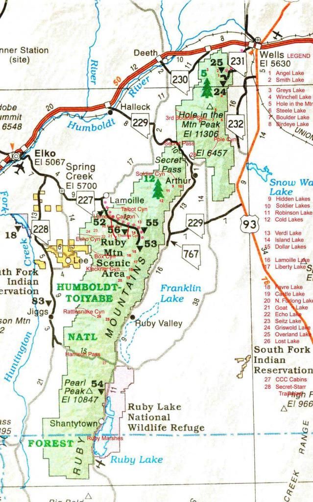
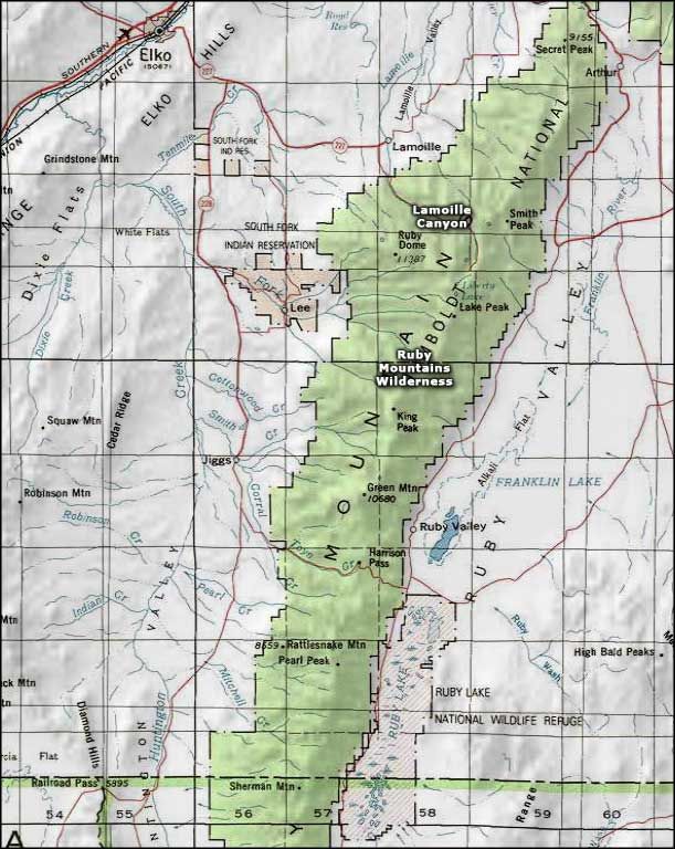
The Toiyabe (toy-ya-be) National Forest (of the Humboldt-Toiyabe National Forest) is divided into several sections, which are located in central, western and southern, Nevada and east central California. Thomas Canyon sits within one of the many Great Basin Mountain ranges inside the Humboldt-Toiyabe National Forrest in the Ruby Mountain State Recreation Area. The Ruby Mountains (so named after the garnets found by early explorers) are often referred to as the "Rubies" by the locals, and "Nevada's Swiss Alps" and once you see them you'll know why. The Ruby Mountains Wilderness contains 93,090 acres of towering summits (10 peaks above 11,000', including Ruby Dome at 11,387'), hanging valleys (with more than 2 dozen alpine lakes and many streams just teeming with trout) and year-round snowfields. The long and narrow Ruby Mountain ranges stretches 100 miles and seldom get more than 10 miles wide. According to Nevadawilderness.org, "Nowhere else in Nevada is there such a spectacular landscape, with hanging valleys, clusters of lakes and snow-fed streams flowing down the U-shaped glacial valleys on the west side of the range. Because they were so heavily glaciated and have such abundant water, the Rubies represent the classic mountain wilderness." Lamoille Canyon inside the Rubies is known as "Nevada's Yosemite" with its hanging valleys, towering peaks, and year round snowfields.
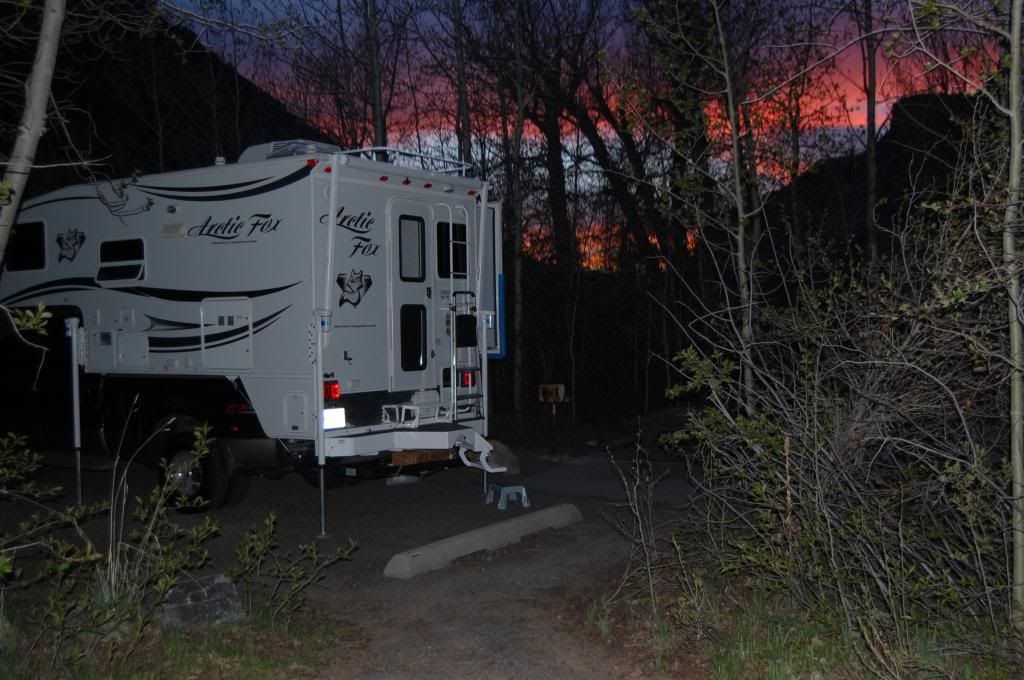
We arrived around sunset but were in awe of the beautiful canyon and picturesque scenery. We quickly found our reserved spot (not 50 feet from the rushing creek),
set up camp, and pulled my chuck roast out of the camper gas oven. Numerous folks on this forum have asked me what pot we use so I'll include a pic. Steve (sabconsulting) is going to love this.....Well, I use a Watson's Pottery "original Clay Hot Pot" from Henry Watson's Pottery in Wattisfield, Suffolk, England. Small world huh? In my past life (first career) I spent numerous TDY's (temporary duty) flying jets out of Mildenhall, UK all around Europe. During the off-times we'd explore the UK and shop. I found Henry Watson's Pottery from a local who said, "it's the best--they've been around since the 1800's with quite the legacy." So, needless to say, I have some terracotta pottery the wife and I occasionally use. It's always a conversation piece whether at home or safari!

Anyway, we sat down for some slow roasted chuck roast that had been on the lowest gas oven setting all day. Before we left Lost Wages I seared the roast in cast iron pan with salt and pepper, caramelized some onions, then threw in some baby potatoes, baby carrots, some garlic, and some cream of mushroom soup with a 1/4 cup of 1/2 and 1/2 into the Hot Pot.
It literally fell apart trying to get it out of the pot (it's always good)! The Hot Pot has an abrasive ring on the bottom of the pot that helps it stay put on the oven rack. So far, we've not had the pot dump in the oven on any of our trips. I brace the door closed with bungee cords regardless.
After dinner we threw some firewood in the fire ring and marveled at nature's TV and enjoyed the smell of wood smoke all the while taking in the breathtaking views of the surrounding peaks and canyons as the sun set. Once the fire died down the stars took a front and center seat beaming with diamond clarity. Temperatures dropping, we donned light jackets while the rushing Lamoille Creek nearby sung it's soothing therapeutic sound.
Fully relaxed, we turned in for the night leaving the camper windows open while the temps dropped into the 40's--perfect!!
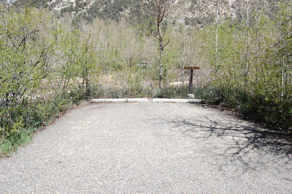
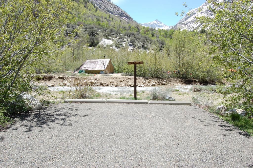
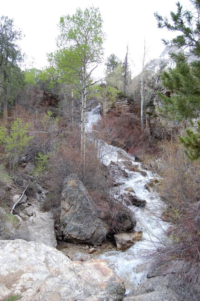
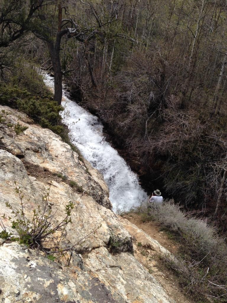
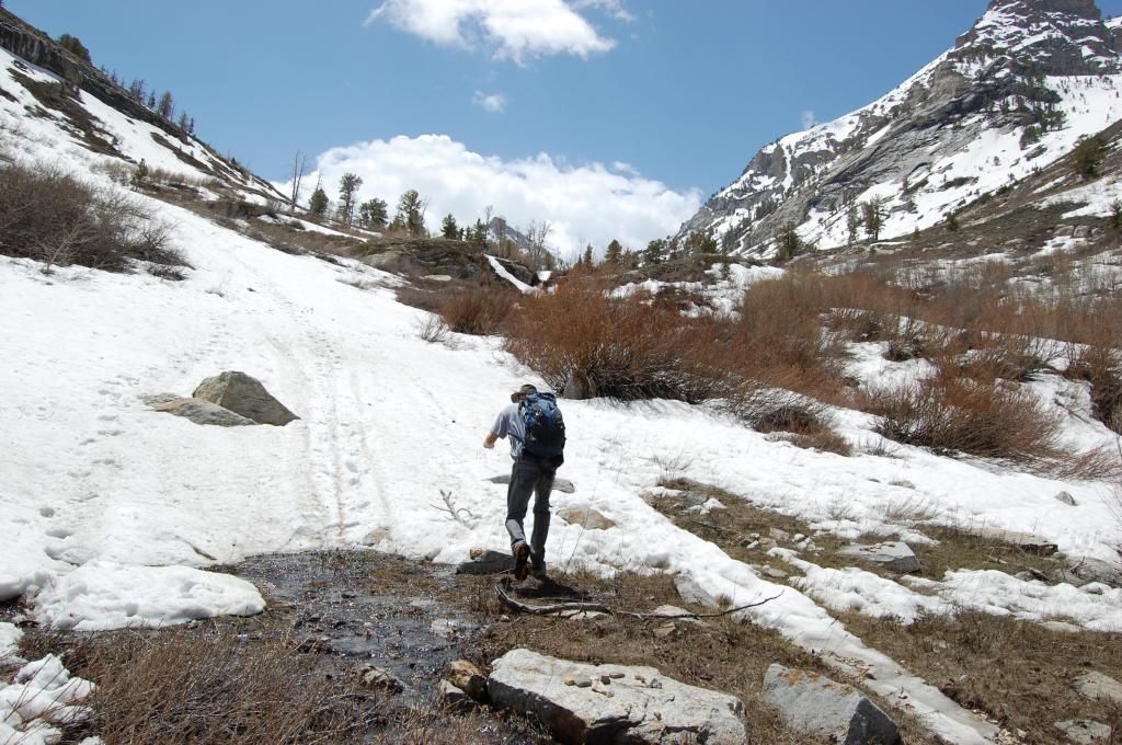
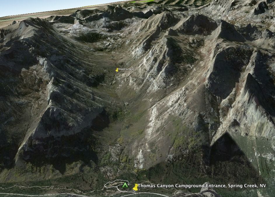
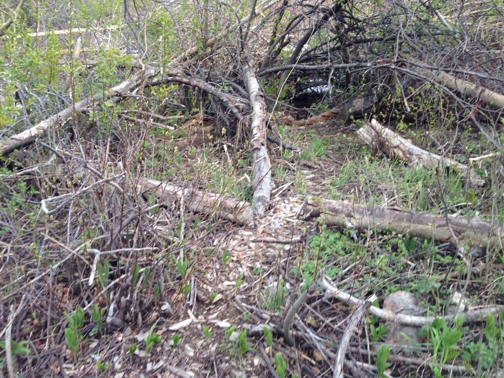
Saturday, after a great breakfast we decided to make a backpacking trip up Thomas Canyon then scope out some trout fishing on the creek. The Thomas Canyon Trail starts in the campground adjacent to site #31 (and marked on the camping spot pic) and climbs its way up alongside Thomas creek leading past several impressive waterfalls,
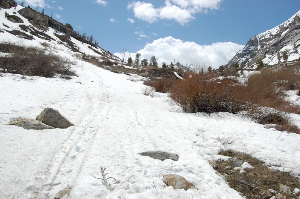
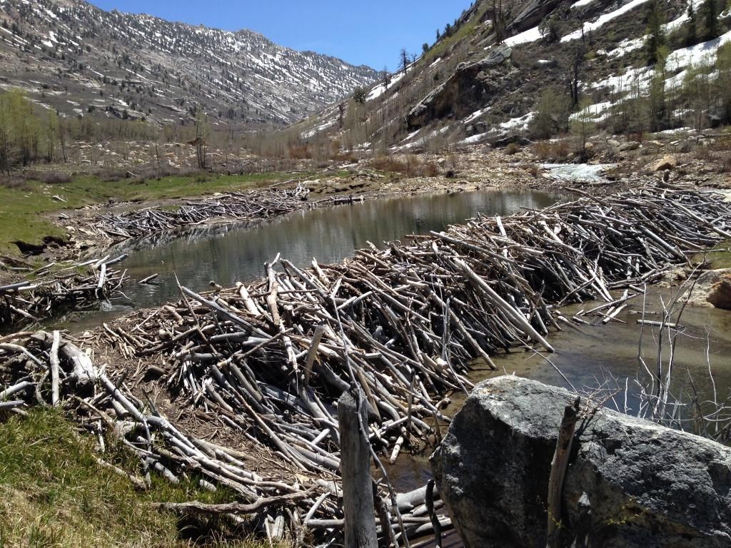
a beaver dam, and an alpine meadow (seen in the pic looking back down the trail)
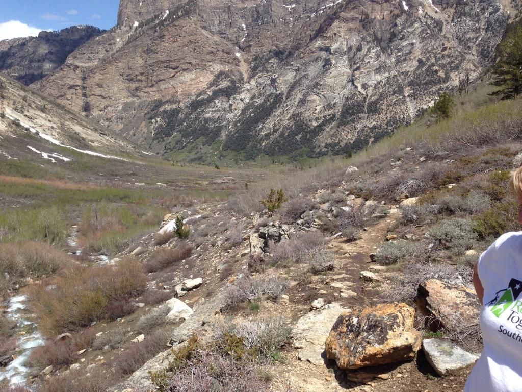
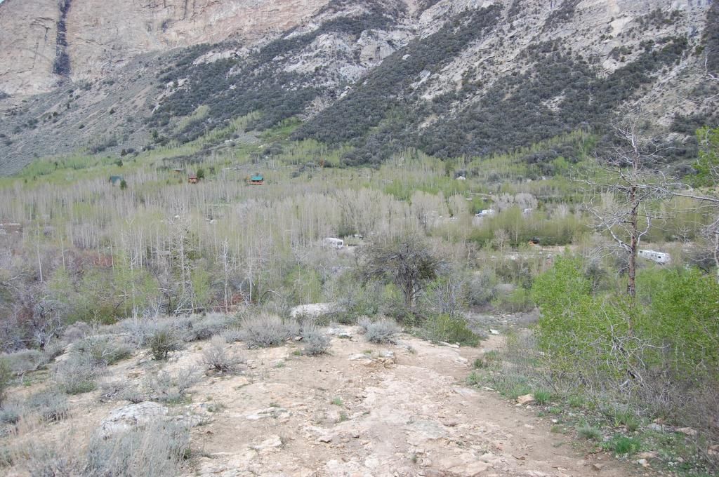
and into a glacial cirque. The first quarter mile is pretty steep (pic looking down into the campground)
but tapers off to a nice leisurely climb but you won't see the Aspens alongside the trail like other trails in the Rubies. The wide trail parallels the creek most of the way with good footing. It got muddy in a few places as the trail competed with snowmelt runoff. As you look up during the climb the big mountain you see is Mt. Fitzgerald.

We bought binoculars and scanned for wildlife but didn't see any. Thomas Creek was running fast and clear with the snowmelt.
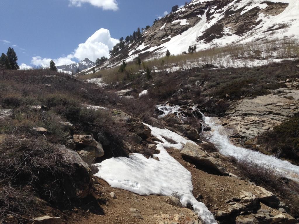
All the bushes had buds but had not yet sprouted as it was still spring. I can imagine when all the greenery is out it is even more picturesque. We continued our climb until the trail ran head first with the snow line
--I'd estimate we climbed up about 1,800 feet.
Not having any snowshoes our hike would end before the alpine meadow and basin not a eighth of a mile away.
The views were stunning and we turned around to make our descent. We took our leisurely time and round trip logged about two hours and thirty minutes. We were just a little too early in the season to backpack this and other trials into the higher elevations. Here's a Link to a good site with maps of the Lamoille Canyon and Ruby Mountain Trails.
Lamoille Canyon
Ruby Mountains
Next, we checked out some of the beaver dams close to the Lamoille Creek that runs through the campground. They were nestled behind some thick brush but we got there.
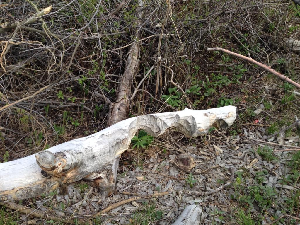
We didn't see any fish even though we could see the bottom clearly however we saw plenty of large beaver iron teeth sign.
Getting my fly and fishing poles rigged on the picnic table a fisherman walked by. We chatted while he explained the beaver dams he'd just checked out and spots in the creek he'd fished all to no avail. The creek was running way too fast and there were hardly any slow stagnant areas on the banks where the fish like to hide. The beaver dams were even more depressing. I think it was the time of the season….
Sunday we decided to make a road trip up as far as we could go up Lamoille Canyon.
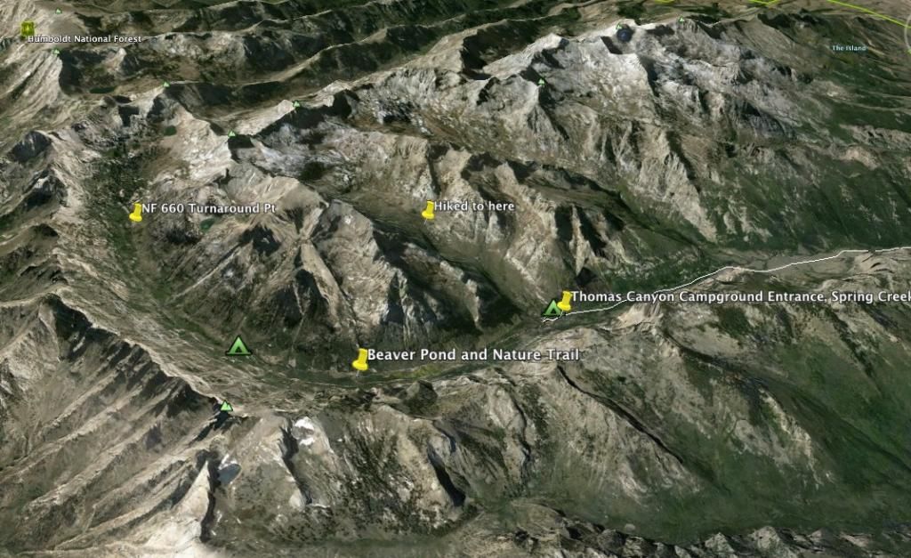
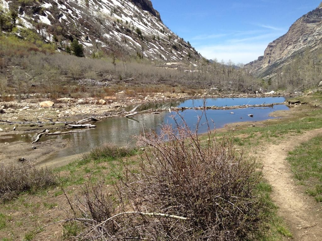
We didn’t think we’d get to the turn around point but we’d take it as far as we could before the snow would block the road. We stopped along the way numerous times to take pics and do a small nature hike to a large beaver pond along the Lamoille Creek.
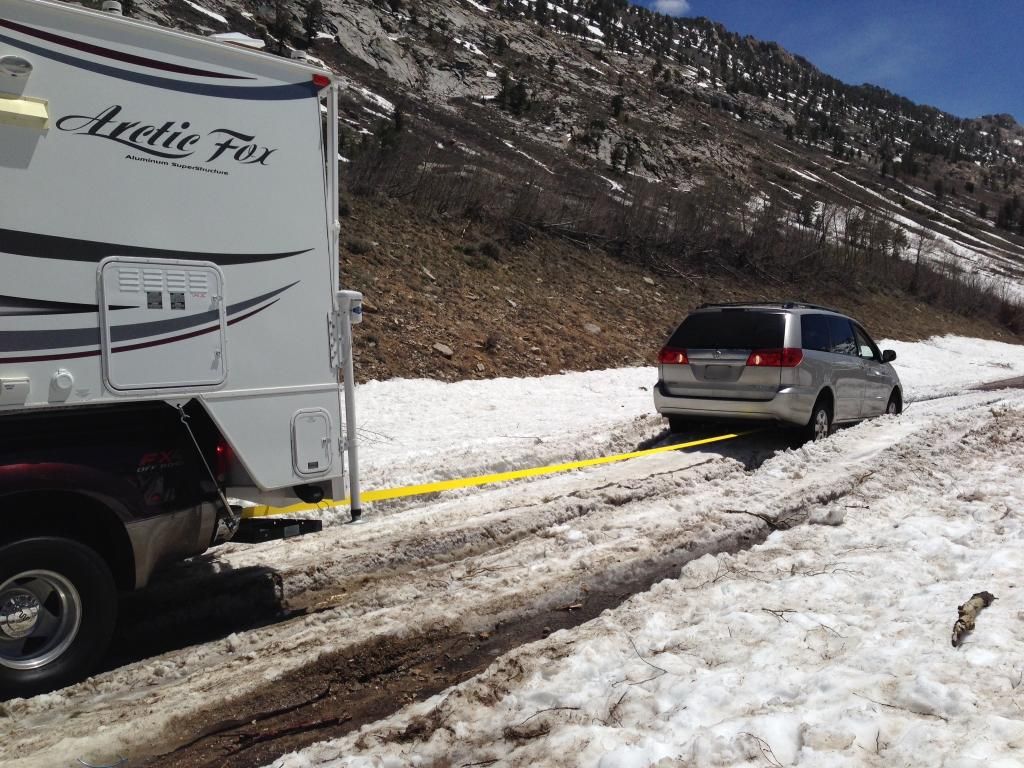
About a half a mile from the Lamoille Canyon Scenic drive turn around we ran into a large snowdrift still blocking the road for smaller non-4x4 vehicles. Then about a quarter of a mile further the road was totally blocked with snow. Naturally, when I get to the first snowdrift there is a mini-van from Cali that tried to traverse an 18-inch rut and was stuck hard. I turned around the 4x4 gave them my tow strap to hook up to their vehicle then hooked it to my F350 and pulled them out with little effort.
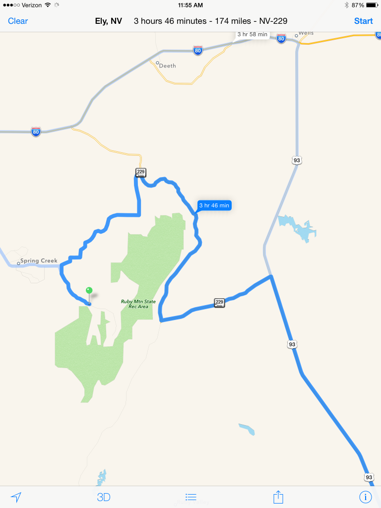
We chilled out Sunday night and hit the rack after dusk so we could get a quick start home on Monday. We rolled out of the campground around 0500 and watched the sunrise as we took a more scenic ride around the Ruby Mountains for home. We ended up on gravel County HWY – 703 to get to NV-229 and then 93.
It wasn’t a bad route with the road following right along the foothills of the Rubies and the lush green farms which were bristling with cattle. The differences between the east and west side of the Ruby mountains reminded me of the Cascade Mountain Range (albeit much larger) in Washington State (God’s Country) where we grew up.
We arrived back in Lost Wages around 3pm. Overall, it was a great getaway to a fantastic "jewel" in the Nevada desert!! Until next time - Happy Camping!
It's a good seven-hour drive from Lost Wages up to I-80 and with the total trip around 8-9 hours one way depending on traffic and route. We decided to alternate destination and return routes so Friday was Hwy 93 all the way to Wells, NV then I-80 West to Elko, NV to the Lamoille Hwy to Spring Creek then National Forrest District 660 Road up into Thomas Canyon via the Lamoille Canyon Scenic By Way (a twelve mile drive).
Eight miles up the canyon you'll see the Thomas Canyon Campground sign.
The Thomas Canyon Campground is located in about 30 miles southeast of Elko in the scenic Lamoille Canyon at an elevation of 7,600 feet. This picturesque canyon is surrounded by aspen and cottonwood trees nestled along the Lamoille Creek. The campground itself has at least 40 sites. You can reserve a site that backs right up next to the creek if you desire—I highly suggest you pull up the area on Google to explore the possibilities.
Inside the campground we counted 6 spots dedicated to "Truck Campers" which you cannot reserve nor do they advertise or show on any of the recreation.gov maps. They are not set back very far and most are only 20-40’ deep. I
One “truck camper” site was outstanding but, it like the rest of the truck camper spots, don't have a picnic table, fire ring, or BBQ--they are basically just a level spot to park. Nonetheless, that particular “truck camper" site backed right up against the rushing creek--10 feet away and about 5 foot high from the water. The other drawback was across the river you'd be looking at another campsite. I labeled it the "best" spot in one of the pics.
When I researched the canyon last fall I couldn't find any adequate Boondocking spaces or roads that might be accessible this time in the season or acceptable so, I just reserved a site on:
Thomas Canyon (Recreation.gov)
--cost was $17 per night. I can tell you from other local campers this is a popular place during the summer. We had Spot 24 about 50' from the creek. The main water flow is between the bridges (big gravel area in the pic).
The Toiyabe (toy-ya-be) National Forest (of the Humboldt-Toiyabe National Forest) is divided into several sections, which are located in central, western and southern, Nevada and east central California. Thomas Canyon sits within one of the many Great Basin Mountain ranges inside the Humboldt-Toiyabe National Forrest in the Ruby Mountain State Recreation Area. The Ruby Mountains (so named after the garnets found by early explorers) are often referred to as the "Rubies" by the locals, and "Nevada's Swiss Alps" and once you see them you'll know why. The Ruby Mountains Wilderness contains 93,090 acres of towering summits (10 peaks above 11,000', including Ruby Dome at 11,387'), hanging valleys (with more than 2 dozen alpine lakes and many streams just teeming with trout) and year-round snowfields. The long and narrow Ruby Mountain ranges stretches 100 miles and seldom get more than 10 miles wide. According to Nevadawilderness.org, "Nowhere else in Nevada is there such a spectacular landscape, with hanging valleys, clusters of lakes and snow-fed streams flowing down the U-shaped glacial valleys on the west side of the range. Because they were so heavily glaciated and have such abundant water, the Rubies represent the classic mountain wilderness." Lamoille Canyon inside the Rubies is known as "Nevada's Yosemite" with its hanging valleys, towering peaks, and year round snowfields.
We arrived around sunset but were in awe of the beautiful canyon and picturesque scenery. We quickly found our reserved spot (not 50 feet from the rushing creek),
set up camp, and pulled my chuck roast out of the camper gas oven. Numerous folks on this forum have asked me what pot we use so I'll include a pic. Steve (sabconsulting) is going to love this.....Well, I use a Watson's Pottery "original Clay Hot Pot" from Henry Watson's Pottery in Wattisfield, Suffolk, England. Small world huh? In my past life (first career) I spent numerous TDY's (temporary duty) flying jets out of Mildenhall, UK all around Europe. During the off-times we'd explore the UK and shop. I found Henry Watson's Pottery from a local who said, "it's the best--they've been around since the 1800's with quite the legacy." So, needless to say, I have some terracotta pottery the wife and I occasionally use. It's always a conversation piece whether at home or safari!
Anyway, we sat down for some slow roasted chuck roast that had been on the lowest gas oven setting all day. Before we left Lost Wages I seared the roast in cast iron pan with salt and pepper, caramelized some onions, then threw in some baby potatoes, baby carrots, some garlic, and some cream of mushroom soup with a 1/4 cup of 1/2 and 1/2 into the Hot Pot.
It literally fell apart trying to get it out of the pot (it's always good)! The Hot Pot has an abrasive ring on the bottom of the pot that helps it stay put on the oven rack. So far, we've not had the pot dump in the oven on any of our trips. I brace the door closed with bungee cords regardless.
After dinner we threw some firewood in the fire ring and marveled at nature's TV and enjoyed the smell of wood smoke all the while taking in the breathtaking views of the surrounding peaks and canyons as the sun set. Once the fire died down the stars took a front and center seat beaming with diamond clarity. Temperatures dropping, we donned light jackets while the rushing Lamoille Creek nearby sung it's soothing therapeutic sound.
Fully relaxed, we turned in for the night leaving the camper windows open while the temps dropped into the 40's--perfect!!
Saturday, after a great breakfast we decided to make a backpacking trip up Thomas Canyon then scope out some trout fishing on the creek. The Thomas Canyon Trail starts in the campground adjacent to site #31 (and marked on the camping spot pic) and climbs its way up alongside Thomas creek leading past several impressive waterfalls,
a beaver dam, and an alpine meadow (seen in the pic looking back down the trail)
and into a glacial cirque. The first quarter mile is pretty steep (pic looking down into the campground)
but tapers off to a nice leisurely climb but you won't see the Aspens alongside the trail like other trails in the Rubies. The wide trail parallels the creek most of the way with good footing. It got muddy in a few places as the trail competed with snowmelt runoff. As you look up during the climb the big mountain you see is Mt. Fitzgerald.
We bought binoculars and scanned for wildlife but didn't see any. Thomas Creek was running fast and clear with the snowmelt.
All the bushes had buds but had not yet sprouted as it was still spring. I can imagine when all the greenery is out it is even more picturesque. We continued our climb until the trail ran head first with the snow line
--I'd estimate we climbed up about 1,800 feet.
Not having any snowshoes our hike would end before the alpine meadow and basin not a eighth of a mile away.
The views were stunning and we turned around to make our descent. We took our leisurely time and round trip logged about two hours and thirty minutes. We were just a little too early in the season to backpack this and other trials into the higher elevations. Here's a Link to a good site with maps of the Lamoille Canyon and Ruby Mountain Trails.
Lamoille Canyon
Ruby Mountains
Next, we checked out some of the beaver dams close to the Lamoille Creek that runs through the campground. They were nestled behind some thick brush but we got there.
We didn't see any fish even though we could see the bottom clearly however we saw plenty of large beaver iron teeth sign.
Getting my fly and fishing poles rigged on the picnic table a fisherman walked by. We chatted while he explained the beaver dams he'd just checked out and spots in the creek he'd fished all to no avail. The creek was running way too fast and there were hardly any slow stagnant areas on the banks where the fish like to hide. The beaver dams were even more depressing. I think it was the time of the season….
Sunday we decided to make a road trip up as far as we could go up Lamoille Canyon.
We didn’t think we’d get to the turn around point but we’d take it as far as we could before the snow would block the road. We stopped along the way numerous times to take pics and do a small nature hike to a large beaver pond along the Lamoille Creek.
About a half a mile from the Lamoille Canyon Scenic drive turn around we ran into a large snowdrift still blocking the road for smaller non-4x4 vehicles. Then about a quarter of a mile further the road was totally blocked with snow. Naturally, when I get to the first snowdrift there is a mini-van from Cali that tried to traverse an 18-inch rut and was stuck hard. I turned around the 4x4 gave them my tow strap to hook up to their vehicle then hooked it to my F350 and pulled them out with little effort.
We chilled out Sunday night and hit the rack after dusk so we could get a quick start home on Monday. We rolled out of the campground around 0500 and watched the sunrise as we took a more scenic ride around the Ruby Mountains for home. We ended up on gravel County HWY – 703 to get to NV-229 and then 93.
It wasn’t a bad route with the road following right along the foothills of the Rubies and the lush green farms which were bristling with cattle. The differences between the east and west side of the Ruby mountains reminded me of the Cascade Mountain Range (albeit much larger) in Washington State (God’s Country) where we grew up.
We arrived back in Lost Wages around 3pm. Overall, it was a great getaway to a fantastic "jewel" in the Nevada desert!! Until next time - Happy Camping!