sabconsulting
Mar 26, 2014Explorer
Trip report : Skafell Pike - the top of England
Sally wanted to return to the Lake District in north western England. Mid March would not be the recommended time for doing this, but it fitted in with my work, so we booked the campground for a long weekend and kept our fingers crossed for the weather.
Friday
I started work at 05:00 and by the time Sally had come back from the dog rescue centre where she volunteers I had already done a full day’s work and the camper was taunting me in the road waiting to go:

We were soon on the road heading north, and heading north means heading for Birmingham – England’s second city and powerhouse of the industrial revolution. We enter at the south east corner and want to exit at the north west corner. There are three routes – the direct route: from the M40 turn right onto the M42 heading north, then left onto the M6 elevated highway across the centre of the city; the less direct route: from the M40 turn left onto the M42 heading south west below Birmingham, then turn north onto the M5 passing the west of Birmingham; the toll route: from the M40 turn right onto the M42, but pass the M6 and then turn left onto the M6 toll which bypasses the city altogether and rejoins the main highway well north away from the traffic.
The GPS started warning of 90 minute delays on the direct route. Looking at the less direct alternative there were also delays on the M5, so we headed for the M6 toll. I’ve avoided this in the past on the assumption we would have to pay the £11 commercial vehicle toll fee instead of the £5 car toll, but this this time we went for it and I was pleased to find that we were considered as a motorhome and only charged £5.50 (though later I met someone in a class C who was charged the full £11).
From Birmingham it was straight north. Unfortunately more warnings appeared on the GPS – this was Friday afternoon approaching rush hour after all. Approaching Stafford the traffic stopped completely. Every few minutes we moved a few hundred yards, then sat. So we took the opportunity to have a late lunch in the cab of the truck. I needed the bathroom and we were crawling towards a service station. Checking the GPS showed the cause of the traffic problem was 3 junctions further up the highway and was marked as an accident – we could be stationary for hours, and if we did manage to get off at the next junction we would be stuck with thousands of other vehicles trying to find an alternative route.
After using the rest area bathroom I noticed a sneaky service road from the back of the staff car park. The GPS showed it headed to a local road. Hoping no-one was looking I pulled the camper through the barrier, through the staff car park and onto the empty road. We spent the next hour detouring through fairly empty roads of Cheshire until we could return to the highway safely north of the obstruction.
It was now plain-sailing to our destination, passing the old sea port of Liverpool, home to the Beatles, and Manchester, but we had already lost 2 hours.
The campground chosen for the first night was on a farm, known mainly for their Maize maze they created each summer as a tourist attraction. It had electric hook-up, but was in an exposed and windy spot.
Sally pulled out some Italian bread with olive oil and balsamic vinegar and some tomato soup for dinner.

Our sleep was interrupted several times by the high winds, hale and intermittent sound of freight trains on the main west-coast line (much shorter trains than those in the US, but moving much faster and therefore pretty noisy). I was pretty bushed after a full day’s work and a 6-hour drive and went to bed early.
Saturday
Next morning Sally looked around the animals the farm keep as a sort of petting zoo and I went to find the farmer to pay (£12 including hook-up). Places like this always look tired and horrible out of season. They are completely different in summer when the sun is shining and everything has been painted and swept and there is no mud.


Weather was better in the morning and we headed for our camp ground for the next few nights via a nearby spot where I wanted to do some walking.

Sally pointed to one of the hills and said “look at the colour of that hill, it is like it is covered in snow even though it isn’t”. “Errr” I replied “I think you will find that is actually snow – what fell on us as rain and hale fell on the hills as snow”.
The GPS wanted to send us the direct route, but I took a much longer route trying to avoid all the 6’6” width restrictions. However, after a while I gave up – it seemed I couldn’t actually get to place I wanted to be without breaking some of these restrictions, plus the roads were no narrower than my local roads. I figured the restrictions were there for the tourist season, when grid lock would ensure as RVs come head to head on a 8’ wide single-lane road. There is hardly any traffic this time of the year, and with our ground clearance and tires I could easily pull off onto terrain regular RV drivers couldn’t risk in order to let traffic past.
We found the start of our walk – a railway station for the narrow-gauge tourist railway that heads for the coast.

We weren’t going to use the railway, but they had a car park. It cost £3 to park all day; I could probably have found somewhere free to park, but it was convenient and these businesses need the money during the difficult times out of season.
The Lake District is a national park and has many trails heading through it, many documented by the great Alfred Wainwright in the ‘50s and ‘60s – his guide books are a fantastic thing to have with their hand-drawn illustrations and colourful descriptions even if you never use them. However, the trails are also marked on official ordnance survey maps and I tend to use these to find nice circular walks.
I chose a walk today that would allow us a number of escape route – i.e. if we felt tired we had some options to cut the walk short without turning around.

The climb from the bottom was pretty steep, even if it wasn’t very high and soon gave nice views:

By the time we reached the first small mountain lake or “tarn” it was time for a sandwich.

We were fairly tired after the climb so I started to think we would cut the walk short and take one of the shorter routes I had identified. Of course, by now we had finished climbing and were up to temperature, so this wasn’t necessary.
I did cut one part of the walk short – I hadn’t checked the contour lines on the map closely enough and the walk I planned would have descended into a neighbouring valley. I didn’t really want to lose all the altitude we had gained and then have to climb back up again, so we turned right off the path and found a route along the crest of the hill. It was clear others had done the same in the past and had worn a track. In most places this would be considered trespass, but this was national park and was allowed.
Soon we reached Burnmore tarn with great views towards Scafell and surrounding ‘mountains’ (they are technically mountains due to their height being above the fairly low threshold used to judge mountains, but we aren’t talking Mont Blanc or Mt Whitney here).

Next to the tarn is a lodge – reachable only on foot. A pretty bleak location, but I think you can rent it.
From there we descended back to the valley and headed off along the edge of Wastwater for our campground.

This is as Wasdale Head – at the end of Wast Water. This used to be a pretty primitive campground, but in recent years they have added little camping pods and hard-standing sites with hook-up for campers.


A good view of the mountains from the door:

The evening was interrupted by a couple in a modern VW camper who turned up fairly late and made several failed attempts to level their camper – which involved a lot of revving and falling off the blocks several times. They annoyed Sally by repeatedly opening and closing doors and banging around in their van until 11:30pm.
Sunday
Heavy rain and hail over night and early morning, so we didn’t rush to get up. When we did we headed for Illgill Head which looms over Wast Water (to the left of the lake below):


This also proved the first chance to try out our new ice spikes and we were very pleased with the results.

We struggled up half of the steep slope without them and it was really hard work. After I put the ice spikes on the difference was tremendous. Unexpectedly they also meant the amount of energy required to climb was substantially reduced – I hadn’t realised how much muscle effort goes into balancing and holding yourself in such a way as to prevent you slipping, but with the ice spike fitted there was no need for that – any incline of slippery grass, mud or snow could be walked up at speed with a fraction of the effort usually required.
From the ridge you can see Windscale (or rather Sellafield nuclear reprocessing plant – it seemed to get a rename after an incident in the ‘50s).

On the horizon you could just make out the Isle of Man, famous for the TT race held there every year.

We found a steep track down the other end of the ridge leading to the river at the end of the lake.

It was much warmer down there and we found a great spot for lunch on the scree slopes below the ridge.

We then followed the screen slopes back along the length of the lake, which turned out to be trickier than expected as it involved negotiating 45 degree boulder fields containing badly balanced rocks ranging in size from car battery to car.


Back at the campground the weather report showed stunning weather predicted for tomorrow and we were able to survey our route up to Scafell Pike using binoculars.

We could even survey part of the route from the roof vent of the camper:

And it was time to settle down for another meal:

Monday
A quick glance outside revealed a clear sky and a pretty reasonable 2.5 degrees C. After a quick breakfast we were on our way just after 7am.
The direct route from Wasdale Head has 2 options. The left hand tourist route, or a more interesting right hand route via a ridge called Mickledore. From a distance the latter appeared vertical and covered in snow, but we decided to go for it anyway.

As we got closer we put on our ice spikes. The exact route up the rock face was still not obvious, but on the plus side a pair of fresh footprints were heading up ahead of us (I checked, there were no matching downwards prints indicating a failed attempt).
We carried on up the slope and the route up then became clear – through a gulley.

With the ice spikes on this climb was OK. We didn’t have ice axes, but the rock either side was pretty craggy and once you had cleared the snow off there were plenty of good hand holds.
Up the top we were greeted by sunshine, great views and an emergency rescue box type thing – I’m not sure if this was for rescue equipment or shelter.

From there it was then a sunny walk up to the summit. This walk is described as being awkward because of the large boulders and rocks you have to keep stepping over, but with the snow filling the gaps it was actually quite easy.


Great views from the summit. While we enjoyed a cup of tea in the lee of the summit cairn, and I used my new-found cell phone reception, a couple of guys joined us from another route up. They were very experienced with this mountain and had some good advice about the route down we were looking to take. I always like to take a circular route – I hate doubling back on myself.

We headed down towards neighbouring Lingmell, watching the spindrift from the mountain and little whirl-winds of snow, and then descended from the col northbound.

There were some slightly precarious points (especially given the snow and ice on the track) and we were very glad of the ice spikes. At one point the trail just ran out, until we saw a vertical arrow painted on the rock and I remember the experienced walker mentioning it. A bit of a scramble and we were on our way again.

It was now a straightforward descent down to Sty Head where we had lunch overlooking the tarn.


At this point we felt completely fresh and Sally wanted to climb nearby Great Gable that loomed over us. I said no as I felt it would be a bit too much for one day. The trail back to Wasdale Head passed under this mountain and by a navigational mistake I put us on the adjoining trail that started to head up it. So I turned left and cut across the marshy ground to head back down to where I guessed the main track was, all the while taking care to check the consistency of the ground and its ability to take my weight. A cry from behind indicated that Sally had failed to take the same precaution and ended up thigh-deep in bog. Luckily she pulled herself out immediately – as I turned around I was greeted by the vision of the bog giving birth to Sally – she actually left a giant mole-hill of peat around where she had exited.

After a change of socks it was then a steady descent back to Wasdale Head, where we were seduced by the smells of the local pub.


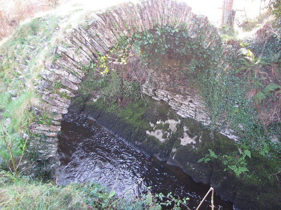
To add one last bit of excitement Sally then fell off the stepping stones into the creek, but at least that washed some of the bog from her boots:

Then back to the campground for a rest, shower and dinner (plus another quick walk up one of the nearby hills to get cellphone coverage to send some important emails, it being the working week for the rest of the world).
The weather seemed to realised we had achieved our goal and that night returned to its usual pattern - low cloud, rain and mist. So we drove home the next day rather than stay any longer for the sake of it.
An excellent little trip and we will definitely be back to climb some more of the mountains in that area.
Steve.
Friday
I started work at 05:00 and by the time Sally had come back from the dog rescue centre where she volunteers I had already done a full day’s work and the camper was taunting me in the road waiting to go:
We were soon on the road heading north, and heading north means heading for Birmingham – England’s second city and powerhouse of the industrial revolution. We enter at the south east corner and want to exit at the north west corner. There are three routes – the direct route: from the M40 turn right onto the M42 heading north, then left onto the M6 elevated highway across the centre of the city; the less direct route: from the M40 turn left onto the M42 heading south west below Birmingham, then turn north onto the M5 passing the west of Birmingham; the toll route: from the M40 turn right onto the M42, but pass the M6 and then turn left onto the M6 toll which bypasses the city altogether and rejoins the main highway well north away from the traffic.
The GPS started warning of 90 minute delays on the direct route. Looking at the less direct alternative there were also delays on the M5, so we headed for the M6 toll. I’ve avoided this in the past on the assumption we would have to pay the £11 commercial vehicle toll fee instead of the £5 car toll, but this this time we went for it and I was pleased to find that we were considered as a motorhome and only charged £5.50 (though later I met someone in a class C who was charged the full £11).
From Birmingham it was straight north. Unfortunately more warnings appeared on the GPS – this was Friday afternoon approaching rush hour after all. Approaching Stafford the traffic stopped completely. Every few minutes we moved a few hundred yards, then sat. So we took the opportunity to have a late lunch in the cab of the truck. I needed the bathroom and we were crawling towards a service station. Checking the GPS showed the cause of the traffic problem was 3 junctions further up the highway and was marked as an accident – we could be stationary for hours, and if we did manage to get off at the next junction we would be stuck with thousands of other vehicles trying to find an alternative route.
After using the rest area bathroom I noticed a sneaky service road from the back of the staff car park. The GPS showed it headed to a local road. Hoping no-one was looking I pulled the camper through the barrier, through the staff car park and onto the empty road. We spent the next hour detouring through fairly empty roads of Cheshire until we could return to the highway safely north of the obstruction.
It was now plain-sailing to our destination, passing the old sea port of Liverpool, home to the Beatles, and Manchester, but we had already lost 2 hours.
The campground chosen for the first night was on a farm, known mainly for their Maize maze they created each summer as a tourist attraction. It had electric hook-up, but was in an exposed and windy spot.
Sally pulled out some Italian bread with olive oil and balsamic vinegar and some tomato soup for dinner.
Our sleep was interrupted several times by the high winds, hale and intermittent sound of freight trains on the main west-coast line (much shorter trains than those in the US, but moving much faster and therefore pretty noisy). I was pretty bushed after a full day’s work and a 6-hour drive and went to bed early.
Saturday
Next morning Sally looked around the animals the farm keep as a sort of petting zoo and I went to find the farmer to pay (£12 including hook-up). Places like this always look tired and horrible out of season. They are completely different in summer when the sun is shining and everything has been painted and swept and there is no mud.
Weather was better in the morning and we headed for our camp ground for the next few nights via a nearby spot where I wanted to do some walking.
Sally pointed to one of the hills and said “look at the colour of that hill, it is like it is covered in snow even though it isn’t”. “Errr” I replied “I think you will find that is actually snow – what fell on us as rain and hale fell on the hills as snow”.
The GPS wanted to send us the direct route, but I took a much longer route trying to avoid all the 6’6” width restrictions. However, after a while I gave up – it seemed I couldn’t actually get to place I wanted to be without breaking some of these restrictions, plus the roads were no narrower than my local roads. I figured the restrictions were there for the tourist season, when grid lock would ensure as RVs come head to head on a 8’ wide single-lane road. There is hardly any traffic this time of the year, and with our ground clearance and tires I could easily pull off onto terrain regular RV drivers couldn’t risk in order to let traffic past.
We found the start of our walk – a railway station for the narrow-gauge tourist railway that heads for the coast.
We weren’t going to use the railway, but they had a car park. It cost £3 to park all day; I could probably have found somewhere free to park, but it was convenient and these businesses need the money during the difficult times out of season.
The Lake District is a national park and has many trails heading through it, many documented by the great Alfred Wainwright in the ‘50s and ‘60s – his guide books are a fantastic thing to have with their hand-drawn illustrations and colourful descriptions even if you never use them. However, the trails are also marked on official ordnance survey maps and I tend to use these to find nice circular walks.
I chose a walk today that would allow us a number of escape route – i.e. if we felt tired we had some options to cut the walk short without turning around.
The climb from the bottom was pretty steep, even if it wasn’t very high and soon gave nice views:
By the time we reached the first small mountain lake or “tarn” it was time for a sandwich.
We were fairly tired after the climb so I started to think we would cut the walk short and take one of the shorter routes I had identified. Of course, by now we had finished climbing and were up to temperature, so this wasn’t necessary.
I did cut one part of the walk short – I hadn’t checked the contour lines on the map closely enough and the walk I planned would have descended into a neighbouring valley. I didn’t really want to lose all the altitude we had gained and then have to climb back up again, so we turned right off the path and found a route along the crest of the hill. It was clear others had done the same in the past and had worn a track. In most places this would be considered trespass, but this was national park and was allowed.
Soon we reached Burnmore tarn with great views towards Scafell and surrounding ‘mountains’ (they are technically mountains due to their height being above the fairly low threshold used to judge mountains, but we aren’t talking Mont Blanc or Mt Whitney here).
Next to the tarn is a lodge – reachable only on foot. A pretty bleak location, but I think you can rent it.
From there we descended back to the valley and headed off along the edge of Wastwater for our campground.
This is as Wasdale Head – at the end of Wast Water. This used to be a pretty primitive campground, but in recent years they have added little camping pods and hard-standing sites with hook-up for campers.
A good view of the mountains from the door:
The evening was interrupted by a couple in a modern VW camper who turned up fairly late and made several failed attempts to level their camper – which involved a lot of revving and falling off the blocks several times. They annoyed Sally by repeatedly opening and closing doors and banging around in their van until 11:30pm.
Sunday
Heavy rain and hail over night and early morning, so we didn’t rush to get up. When we did we headed for Illgill Head which looms over Wast Water (to the left of the lake below):
This also proved the first chance to try out our new ice spikes and we were very pleased with the results.
We struggled up half of the steep slope without them and it was really hard work. After I put the ice spikes on the difference was tremendous. Unexpectedly they also meant the amount of energy required to climb was substantially reduced – I hadn’t realised how much muscle effort goes into balancing and holding yourself in such a way as to prevent you slipping, but with the ice spike fitted there was no need for that – any incline of slippery grass, mud or snow could be walked up at speed with a fraction of the effort usually required.
From the ridge you can see Windscale (or rather Sellafield nuclear reprocessing plant – it seemed to get a rename after an incident in the ‘50s).
On the horizon you could just make out the Isle of Man, famous for the TT race held there every year.
We found a steep track down the other end of the ridge leading to the river at the end of the lake.
It was much warmer down there and we found a great spot for lunch on the scree slopes below the ridge.
We then followed the screen slopes back along the length of the lake, which turned out to be trickier than expected as it involved negotiating 45 degree boulder fields containing badly balanced rocks ranging in size from car battery to car.
Back at the campground the weather report showed stunning weather predicted for tomorrow and we were able to survey our route up to Scafell Pike using binoculars.
We could even survey part of the route from the roof vent of the camper:
And it was time to settle down for another meal:
Monday
A quick glance outside revealed a clear sky and a pretty reasonable 2.5 degrees C. After a quick breakfast we were on our way just after 7am.
The direct route from Wasdale Head has 2 options. The left hand tourist route, or a more interesting right hand route via a ridge called Mickledore. From a distance the latter appeared vertical and covered in snow, but we decided to go for it anyway.
As we got closer we put on our ice spikes. The exact route up the rock face was still not obvious, but on the plus side a pair of fresh footprints were heading up ahead of us (I checked, there were no matching downwards prints indicating a failed attempt).
We carried on up the slope and the route up then became clear – through a gulley.
With the ice spikes on this climb was OK. We didn’t have ice axes, but the rock either side was pretty craggy and once you had cleared the snow off there were plenty of good hand holds.
Up the top we were greeted by sunshine, great views and an emergency rescue box type thing – I’m not sure if this was for rescue equipment or shelter.
From there it was then a sunny walk up to the summit. This walk is described as being awkward because of the large boulders and rocks you have to keep stepping over, but with the snow filling the gaps it was actually quite easy.
Great views from the summit. While we enjoyed a cup of tea in the lee of the summit cairn, and I used my new-found cell phone reception, a couple of guys joined us from another route up. They were very experienced with this mountain and had some good advice about the route down we were looking to take. I always like to take a circular route – I hate doubling back on myself.
We headed down towards neighbouring Lingmell, watching the spindrift from the mountain and little whirl-winds of snow, and then descended from the col northbound.
There were some slightly precarious points (especially given the snow and ice on the track) and we were very glad of the ice spikes. At one point the trail just ran out, until we saw a vertical arrow painted on the rock and I remember the experienced walker mentioning it. A bit of a scramble and we were on our way again.
It was now a straightforward descent down to Sty Head where we had lunch overlooking the tarn.
At this point we felt completely fresh and Sally wanted to climb nearby Great Gable that loomed over us. I said no as I felt it would be a bit too much for one day. The trail back to Wasdale Head passed under this mountain and by a navigational mistake I put us on the adjoining trail that started to head up it. So I turned left and cut across the marshy ground to head back down to where I guessed the main track was, all the while taking care to check the consistency of the ground and its ability to take my weight. A cry from behind indicated that Sally had failed to take the same precaution and ended up thigh-deep in bog. Luckily she pulled herself out immediately – as I turned around I was greeted by the vision of the bog giving birth to Sally – she actually left a giant mole-hill of peat around where she had exited.
After a change of socks it was then a steady descent back to Wasdale Head, where we were seduced by the smells of the local pub.
To add one last bit of excitement Sally then fell off the stepping stones into the creek, but at least that washed some of the bog from her boots:
Then back to the campground for a rest, shower and dinner (plus another quick walk up one of the nearby hills to get cellphone coverage to send some important emails, it being the working week for the rest of the world).
The weather seemed to realised we had achieved our goal and that night returned to its usual pattern - low cloud, rain and mist. So we drove home the next day rather than stay any longer for the sake of it.
An excellent little trip and we will definitely be back to climb some more of the mountains in that area.
Steve.