cancel
Showing results forย 
Search instead forย 
Did you mean:ย 

Painted Hills OR Boondocking?

nina_70
Explorer
Explorer
So, we're headed to the Painted Hills & I'm trying to see if there's anywhere we can boondock in the area. I had originally planned on staying at Ochoco Divide National Forest Campground, but it isn't open until June (argh!). John Day has no campground and the county park at Mitchel looks too small for our size.

Any ideas?
12 paws, 40-feet and the open road
http://wheelingit.us
16 REPLIES 16

NinerBikes
Explorer
Explorer
These threads give me wanderlust.

nina_70
Explorer
Explorer
profdant139 wrote:
Hugemoth, I thought that my little trailer was a semi-offroad ultralight, but yours can apparently fly, too! What are you using for a tow vehicle -- a 747? ๐Ÿ˜‰

Seriously, though, that is an amazing and thought-provoking shot! You've got to wonder how those alternating layers were deposited.


The hills are actually the result of a massive volcanic ash fall from the Cascade Mountains over 33 millions years ago. Natural processes changed the deposits into a type of clay (Bentonite) that expands as it absorbs water creating the close-up popcorn-like appearance. The colors are the result of minerals -> red from iron oxides, yellow from iron & magnesium oxides and lavender from rhyolitic lava.
12 paws, 40-feet and the open road
http://wheelingit.us

nina_70
Explorer
Explorer
hugemoth wrote:
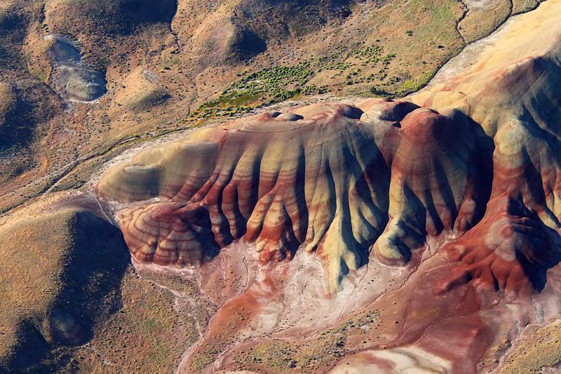
Here is an aerial view of the Painted Hills taken from my ultralight.


WOW!! That picture is AMAZING!!

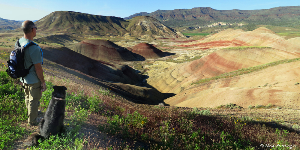
Here's one I took from ground-level:
12 paws, 40-feet and the open road
http://wheelingit.us

profdant139
Explorer II
Explorer II
Hugemoth, I thought that my little trailer was a semi-offroad ultralight, but yours can apparently fly, too! What are you using for a tow vehicle -- a 747? ๐Ÿ˜‰

Seriously, though, that is an amazing and thought-provoking shot! You've got to wonder how those alternating layers were deposited. The red stuff is iron-bearing, and the tan is not. Clearly, these hills were carved from sedimentary rock that accumulated underwater. So that means that sometimes (but not all the time), the shallow sea or lake formed the drainage for a mountain range that contained iron.

Then, somehow, the river that carried the iron into the sea was diverted for a very long time, and the layer of tan sand covered the layer of iron. Then the "iron river" came back. And was shut off. And came back. Judging by those badlands, this happened at least eight times, at irregular intervals. (Sometimes, geology can be like a time-lapse movie.) How could a river turn on and off like that, for thousands or millions of years at a time?

Alternatively, the reddish layers could be beds of volcanic ash. Maybe that is more plausible -- perhaps from successive eruptions from Mt. Hood? But Wikipedia says that the red stuff is not ash -- it is "laterite," weathered iron-rich soil. Quite a puzzle!
2012 Fun Finder X-139 "Boondock Style" (axle-flipped and extra insulation)
2013 Toyota Tacoma Off-Road (semi-beefy tires and components)
Our trips -- pix and text
About our trailer
"A journey of a thousand miles begins with a single list."

hugemoth
Explorer
Explorer
Here is an aerial view of the Painted Hills taken from my ultralight.

greenrvgreen
Explorer
Explorer
This is great looking country. I'm putting this on my bucket list, once the danger passes from meteor strikes.

nina_70
Explorer
Explorer
hugemoth wrote:
Here's a pic I took a couple weeks ago of the boondocking site near the Painted Hills. I'm standing at the far end of where you can drive and the creek is to the left behind the bushes. The road is to the right and above and you can see the road cut in the distance.


Absolutely fabulous. Thanks so much for sharing it!
12 paws, 40-feet and the open road
http://wheelingit.us

hugemoth
Explorer
Explorer
Here's a pic I took a couple weeks ago of the boondocking site near the Painted Hills. I'm standing at the far end of where you can drive and the creek is to the left behind the bushes. The road is to the right and above and you can see the road cut in the distance.

nina_70
Explorer
Explorer
hugemoth wrote:
There is a good spot next to the creek and just off the road to Painted Hills. It has flat spots, grass, fire rings, and several trees. It's a mile or so from Hwy 26, keep a lookout on the left and you should see it. Go a bit past it and you'll find the access road.


Thanks so much hugemoth! That's right around where the BLM ranger recommended we go, so it's nice to hear a second recommendation for the same area.
12 paws, 40-feet and the open road
http://wheelingit.us

hugemoth
Explorer
Explorer
There is a good spot next to the creek and just off the road to Painted Hills. It has flat spots, grass, fire rings, and several trees. It's a mile or so from Hwy 26, keep a lookout on the left and you should see it. Go a bit past it and you'll find the access road.

nina_70
Explorer
Explorer
Thanks Vermilye...we're at Clyde Holiday now (and we like it), but wanted to get closer to the Painted Hills for hiking/photography there (Clyde Holiday is over 70 miles from the Painted Hills overlook...way too far for us). I've got a lead on a spot that should only be around 15 mins away, so that's where we'll head next.
12 paws, 40-feet and the open road
http://wheelingit.us

vermilye
Explorer
Explorer
While not boon docking, Clyde Holliday State Park is 8 miles west of John Day - $24.00 per day with electric & water...

profdant139
Explorer II
Explorer II
Green, the chances are one in 20 billion, or even lower, and the odds are the same whether you are in your back yard or the wilds of Eastern Oregon -- might as well be out in the open, with nice dark clear skies, where you can see what's coming and duck! ๐Ÿ˜‰
2012 Fun Finder X-139 "Boondock Style" (axle-flipped and extra insulation)
2013 Toyota Tacoma Off-Road (semi-beefy tires and components)
Our trips -- pix and text
About our trailer
"A journey of a thousand miles begins with a single list."

greenrvgreen
Explorer
Explorer
Prof, you're just asking to get hit by a meteor.