NVR2L82AV8
Feb 21, 2014Explorer
Trip Report – Death Valley National Park (CA) – Feb 2014
Since we were unable to bolt for the three-day weekend in January, we were determined to enjoy President’s weekend on the road--it was definitely time to get away. So, why not a quick Death Valley (DV) National Park (NP) excursion while the temperatures are half-way moderate? For those in the rest of the cold U.S. it would be balmy!
So, I broke out Benchmark Maps for Chart Study, pulled out Tom Harrison’s DV NP recreation map (highly recommended), reviewed DV NP road restrictions and closures, scanned the internet for must do’s, and researched fellow RV campers trip reports. Immediately you realize there is a ton to do and see in DV. However, with weekend time constraints, the tyranny of distance inside the park required some major prioritization. Additionally, the NPS rules have made "convenient" boondocking tougher. Here's a link:
DV NPS Back Country Map
Regardless, I’m not going to let the NPS put a damper on some fun! I listed some must do’s, some nice to see places (if time), and plotted out a few places to camp based on DV NP’s restrictions above (areas highlighted in yellow are non starters).
Here's a link to all their Maps:
NPS Plan Your Visit Map
I got the camper prepped during the week. So, by Thursday all we had left to do was some minor packing. Sure enough I got delayed and the DW had to work late so an early Friday afternoon departure was out. That also meant I wouldn’t be able to prep a slow roasted TC oven meal for dinner (that could wait till Saturday and Sunday) but, I guess that kept us from eating dinner way late. We rolled out of Lost Wages after 1800 (6 pm) and set our sights on Pahrump, NV for the night so we’d at least cut the trip to DV by half to get an early Saturday start. There are numerous ways to get to Death Valley.
The Numerous Routes into DV
For us the Pahrump route would optimize our time for the places we wanted to see and stay as it was just an hour to the Park from Pahrump, NV.
I have not typically used RV Parks, but we decided to drop into one we’d heard great things about….not to mention it was Valentines Day so I might earn some bonus points :C We arrived at Nevada Treasure RV Resort after 8 pm and it did not disappoint (caveat-I’m in no way associated with this or any other RV Park-just an honest critique).
Nevada Treasure RV Resort Pahrump, NV
They had a special reservation only Valentines Day candlelight dinner function for park occupants or others when we arrived. The check-in staff and security were very friendly and even escorted us to our secluded spot with full hookups—this was a nice change from boondocking. They seemed pretty impressed with the big AF990 TC. On my row (not full at all) the other occupants were all very friendly snow-birds.
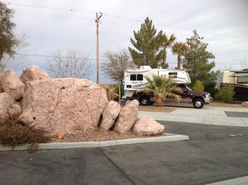
In the morning we walked over to the Grill at the main building for some breakfast. The cook, Mark, cooked us up a big plate of two eggs, sausage, hash browns, toast, and coffee. I think we paid $5.85 per plate...a real deal! Anyway, stomachs full we pressed out to DV via Bella-Vista Ave in Pahrump, topped off the tank, then drove out to Ash Meadows Rd, and DV Junction. From there we headed up CA190 and into the Park.
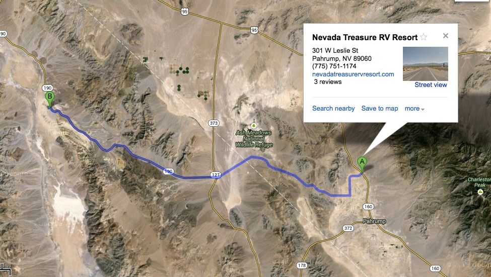
CA190 into Furnace Creek is a pretty tame drive in elevation changes compared to our departure route out but, I’ll get to that later.
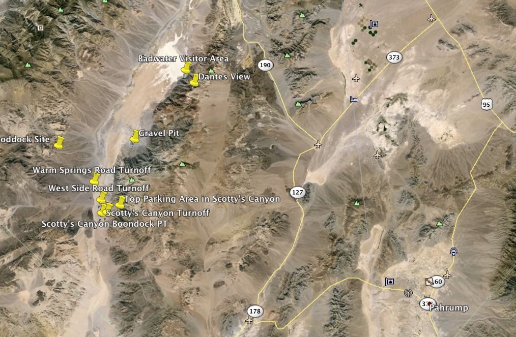
And, for the moderate temps originally planned, the wx forecasters predicted instead DV would see a record high in the 80’s on this day. It would not arrive as predicted. The weather remained overcast and the temps never even approached 80 degrees F…very comfortable! We’d have to wait until Sunday to see clear blue skies and temps in the high 70's.
Once we got into the Park (about 17.5 miles from DV Junction) on CA190 we took the first right to head up to Dantes View at 5475’ elevation. Getting to a highpoint first helps cage the gyros and allows a birds-eye view for some DV situational awareness. The 13.5 mile paved road skirting Mt Perry road to Dantes View is a pretty significant ascent.

Further, the last half mile to reach the view point is a 15% grade (15 feet in elevation per 100 foot distance). As you traverse the climb you’ll undoubtedly pass many huffing bicyclists. With almost two tons strapped on the back of my 6.0L F350 diesel, I just kept the speed around 30 MPH and monitored engine and oil temps (10 degree split) all the way up. As you climb you’ll see signs prohibiting trailers, RV’s and TC’s in excess of 25’ and directing them to a parking area well below the summit. As you get near the top the road will narrow. There is one more small parking area just before you make the 15% push to the top. That section is steep and has multiple switchbacks.
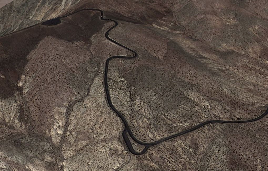
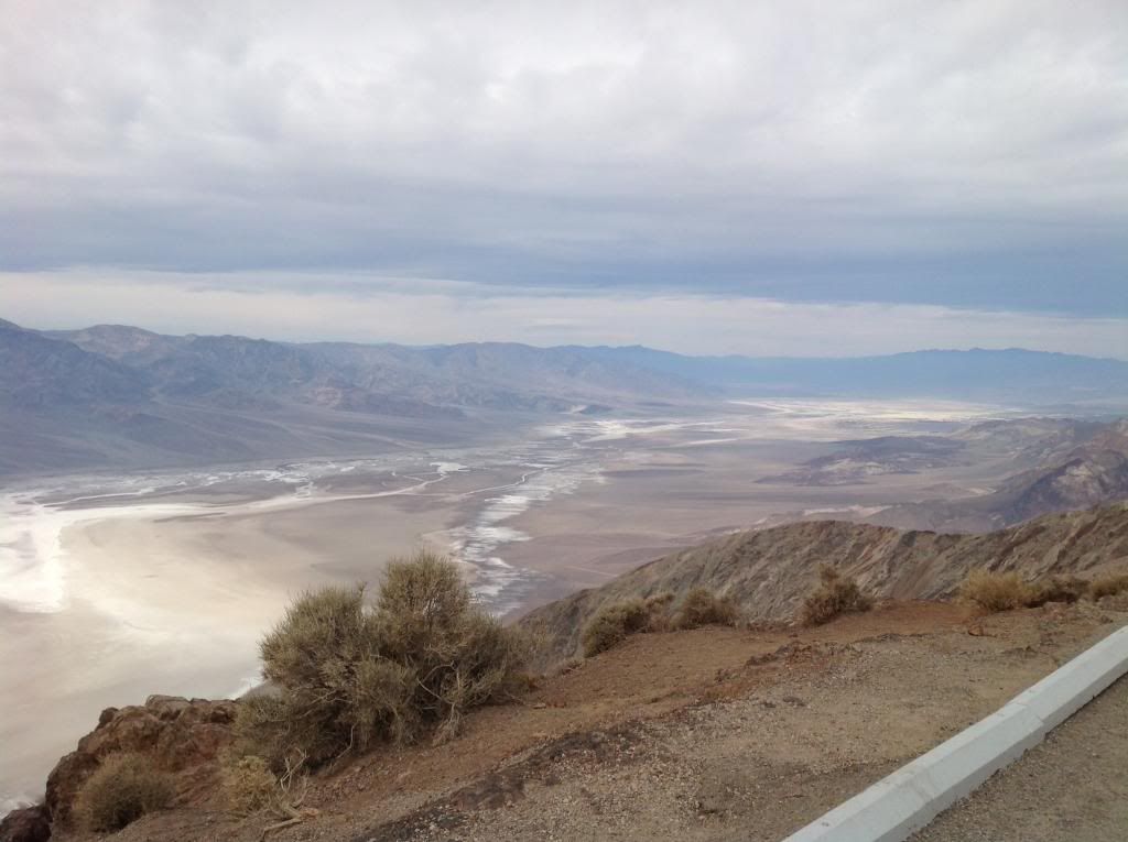
Suddenly you crest and drive a little ways to a big parking and viewing area. The views are absolutely worth it! Take advantage of the walking trails to the North and South to get a better view point of the enormity of DV as far as the eye can see. Here's the View Looking Northwest up the Valley.
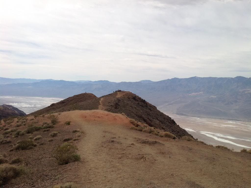
The Trail to the Lookout Facing the South
In the valley below Badwater basin is the lowest elevation in the U.S. at -282 feet. We’re headed down there later.
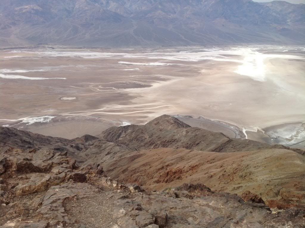
DV NP is over 3,000 square miles (7,800 sq km) and runs from the north to the south. It is bounded by the Amargosa Range to the east, the Panamint Range to the west, the Sylvania Mountains to the north and the Owlshead Mountains to the south. This pic is looking directly East across DV toward the Panamint Range and Telescope Peak at 11,049 feet.

You’ll notice by the parking lot not very many “big” vehicles make it up here.
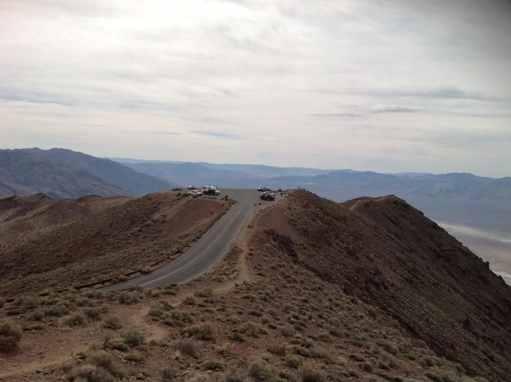
I went down the steep 15% in first gear….failed brakes on this switchback section would not be pretty even though the section is bracketed by guard rails.
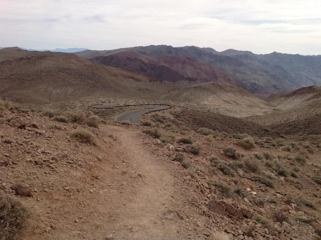
I descended the rest of the drive in third gear at about 30-35 MPH. Bottom line-If you decide to make the push up to Dantes View, make sure your horse is in top shape and your saddle taught.
Next, it was off to 20 Mule Team Canyon.
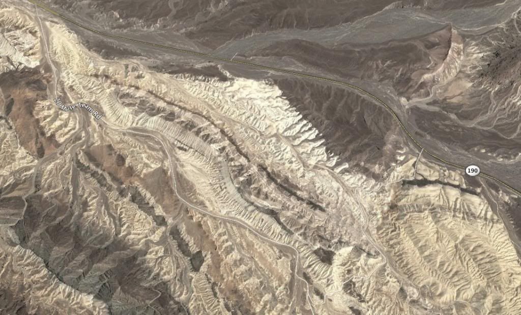
It’s about 5 miles up CA190 once you get back on the highway (watch for the signs). 20 Mule Team Canyon is one-way. There’s a few steep sections, a few narrow areas, and a few spots that had some deep powdery roadbeds…nothing requiring 4x4 on this day however. Stop and get some pics. Here are a few pics while we traversed the canyon.
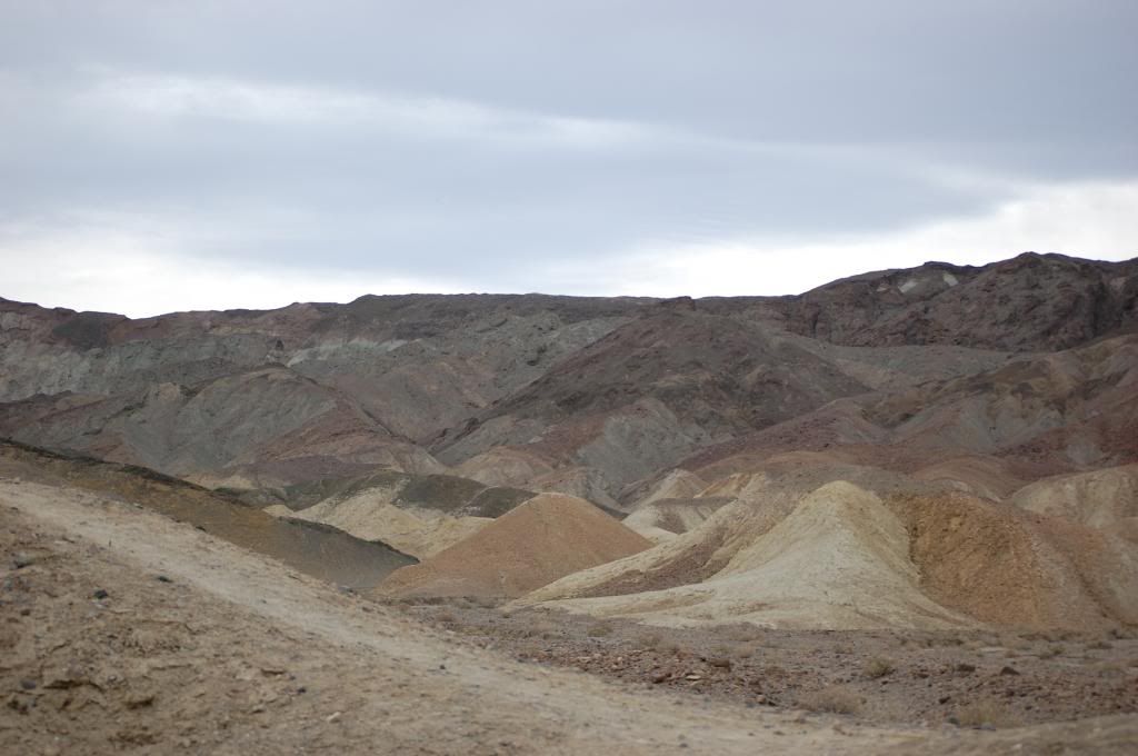
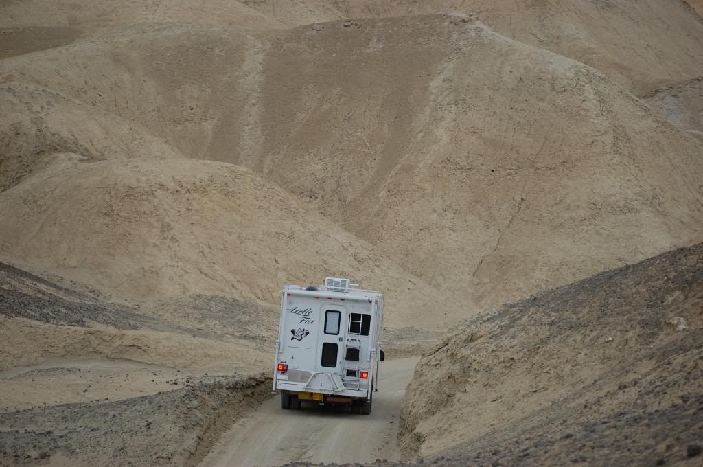
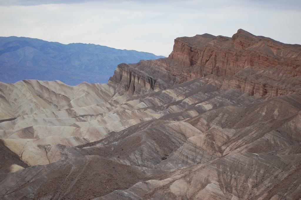
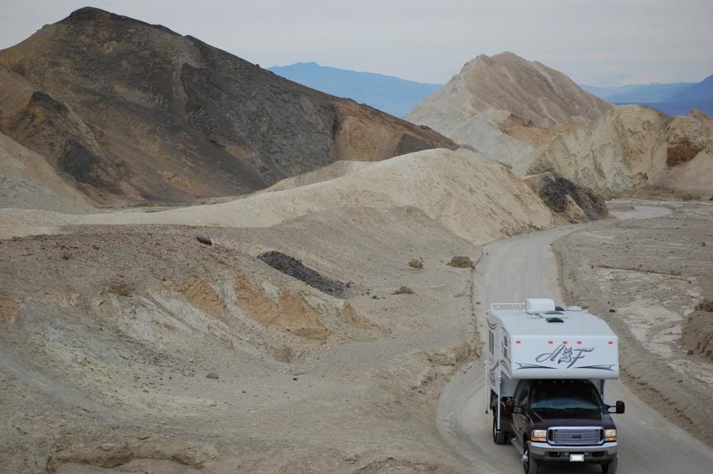
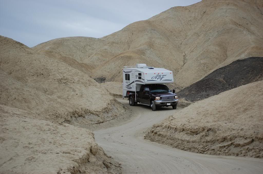
Next, we visited Zabriskie Point which overlooks some of the Borax mining terrain.
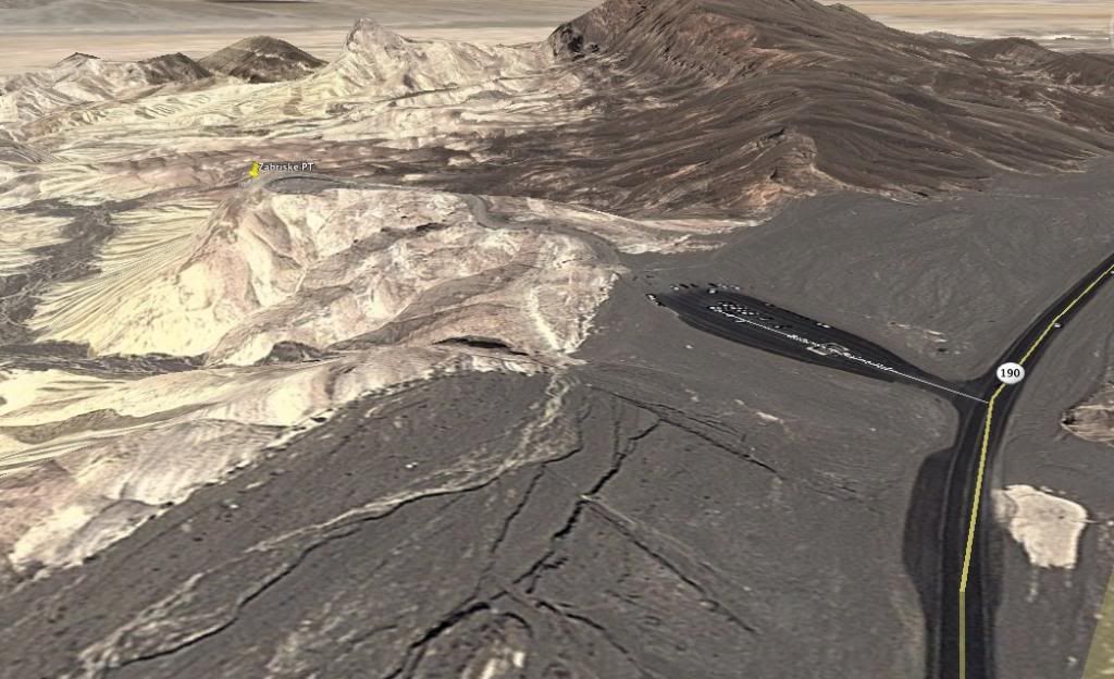
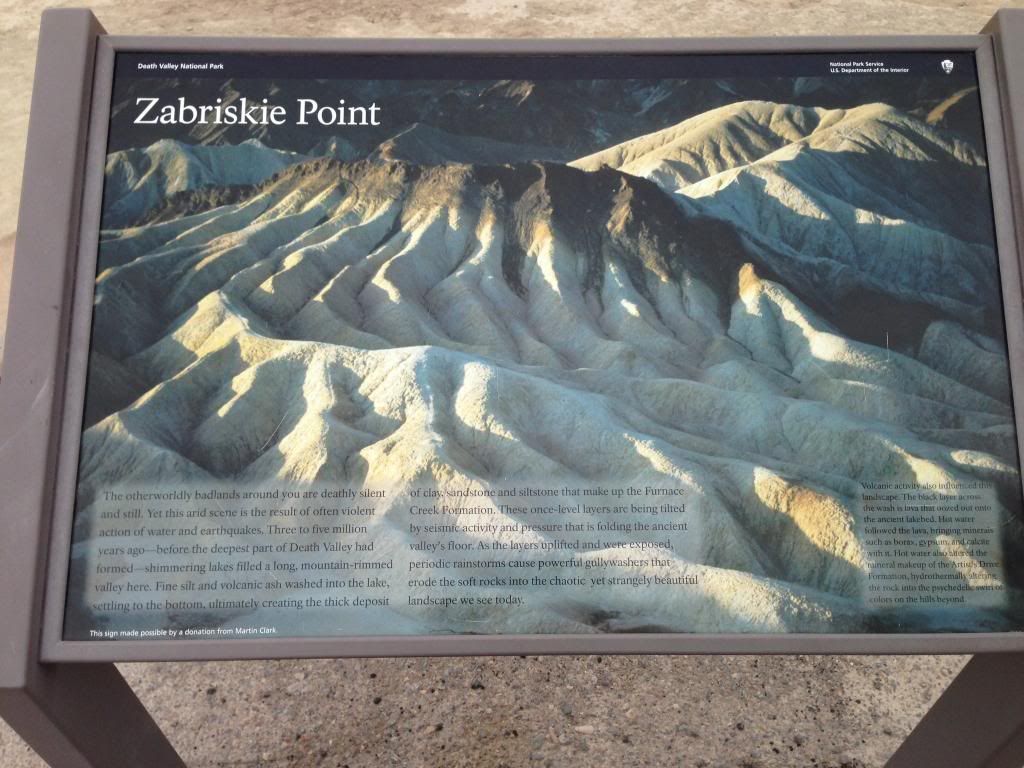
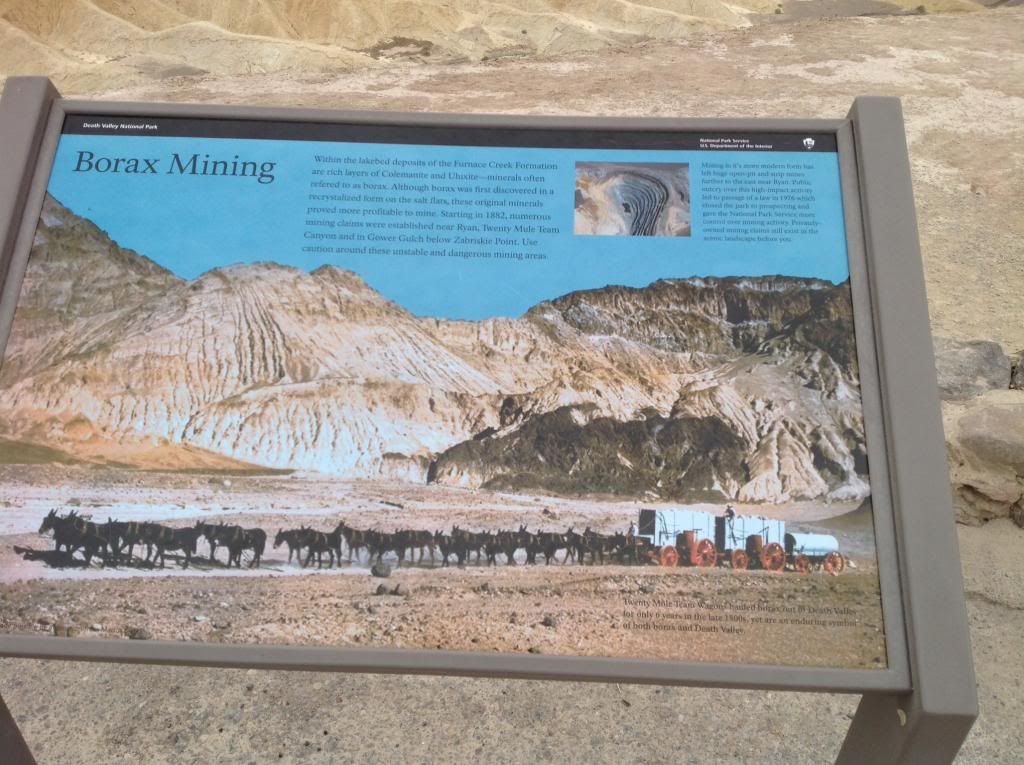
You can hike extensively in this area. Visitors also note this is a great viewpoint to watch sunrise or sunset with the light and shadows making a spectacular scene.
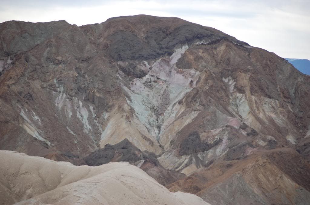
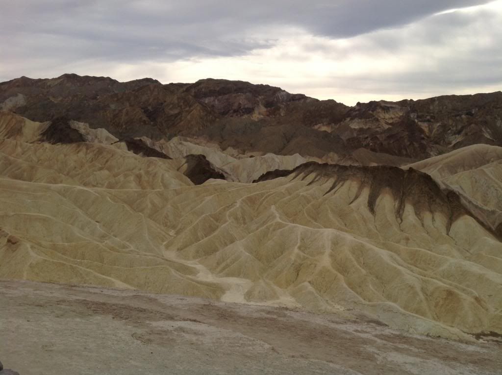
Next, we headed up to the Park HQ and Visitor Center. Just prior to the visitor center is a Chevron station. I saw diesel at $5.37 a gallon....no, I did not stop, but rather just gazed in amazement! We toured the Visitor center, looked over the charts, and marveled at their table-top topographic map. We pushed the slide out in the parking lot, ate some lunch, and put together a crock pot full of pork chops, a can of mushroom soup, vegetables, and a little half and half. I turned the TC oven on as low as it would go, braced in the pot for travel, and put bungee cords on the door handle to keep it closed – just in case.
We were now driving south on Badwater Rd. About five miles down you’ll run into the exit point from the Artists Loop Drive. Drive south another 11 miles and you reach the Badwater Basin viewing area.

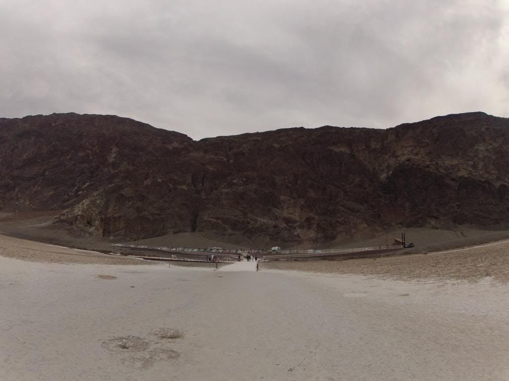
The turnout has plenty of parking and restroom facilities. After you park you can walk down to the viewing deck and then walk out on the salt flat which is -282 below sea level.
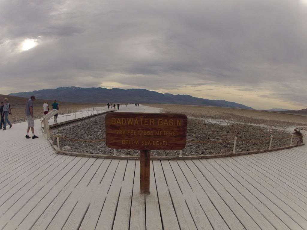
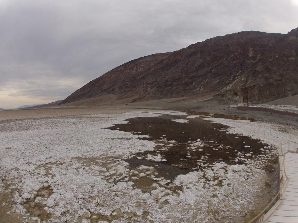
When you turnaround and look east you’ll see a sign on the Black Mountain Range showing where “sea level” would be in relation to the flat.
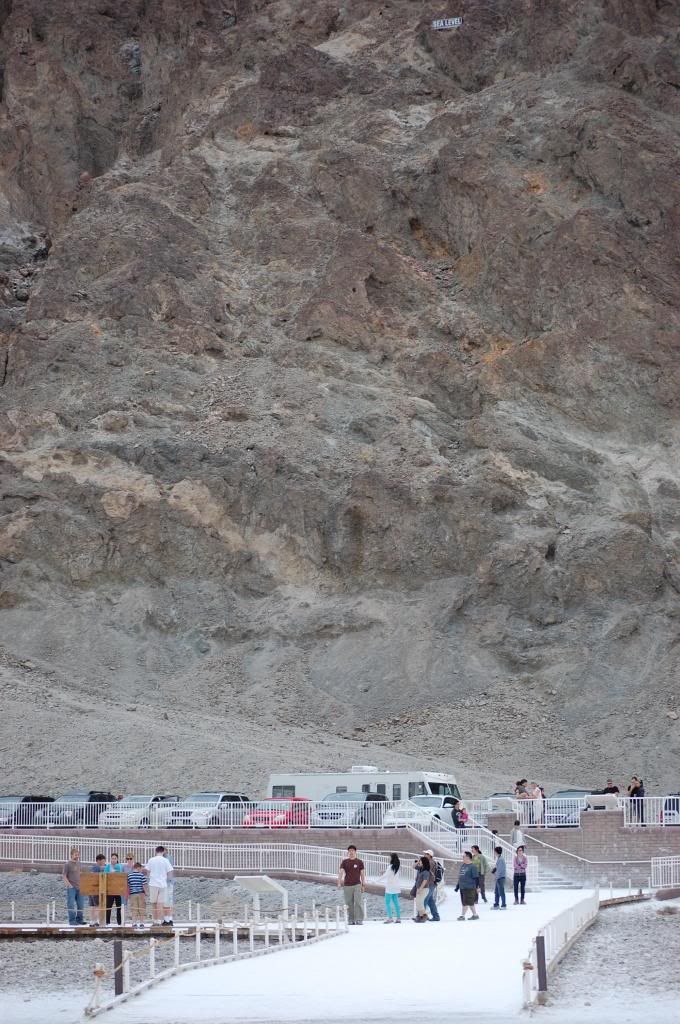
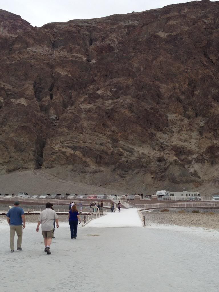
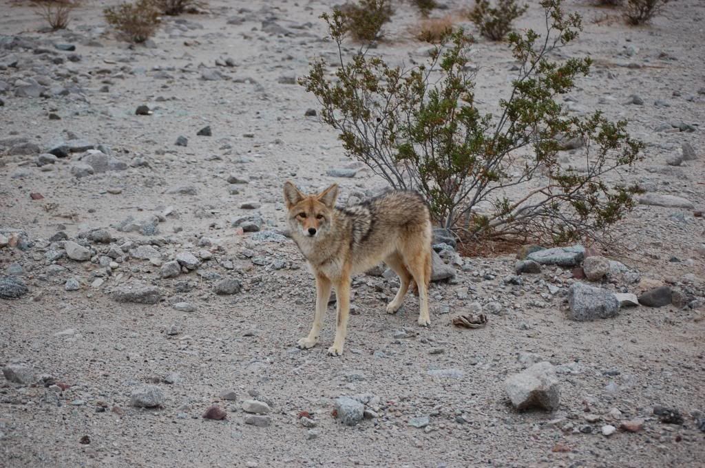
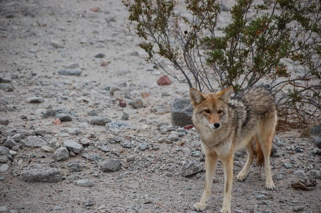
It was now after 2pm so it was time to scope out some camping spots. We rounded a corner and saw two beautiful coyotes hanging close to the highway. They got up as we slowed down and approached in the TC.
We proceeded south a total of 27 miles to Ashford Mill (noted as west side of the road turnoff) from Badwater Basin.
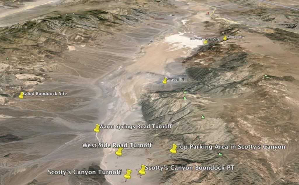
Directly across the street is a rough dirt, rock, and sandy road leading up to Scotty’s Canyon which in parts is part of the wash.
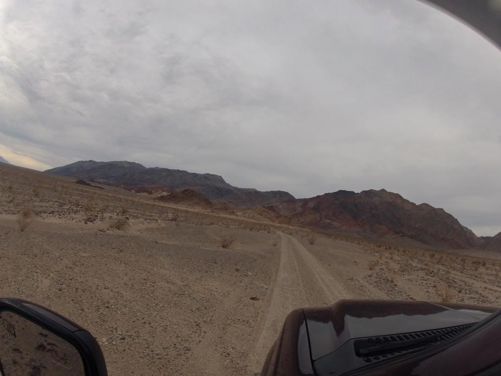
I’d read somewhere this has four good spots to park and camp at the hiking trailhead about 2.6 miles in. I plugged in 4x4 and off we went climbing up the terrain. The road was bumpy in the ascent the entire way. We got a good mile and then some up toward the canyon but just could not pass a wash section of deep loose course sand as the road angled to the left around some higher terrain. Just 100’ further, concealed from the main road by the terrain, there was a level spot I would have boondocked in. In the pic below its just past the green bush on the left tucked back nicely off the road. Oh well.
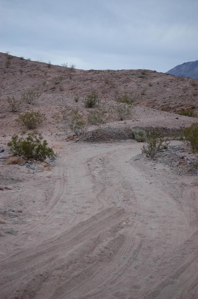
The road continues even further up to Scotty's Canyon, but today passage for us was just not an option based on gross weight and tires. It was still daylight so off we went back down the hill.
Getting back to the main road I turned back North and drove about 2 miles then turned left on West Side Road. This road was even slower going with massive wash-boarding.
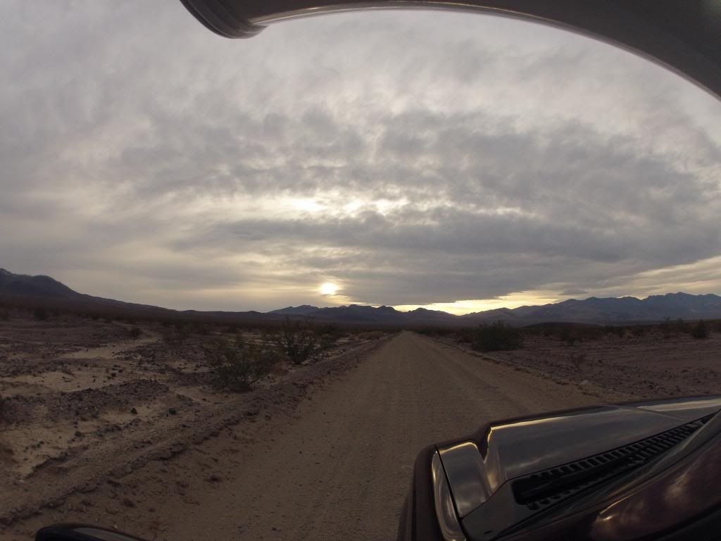
After three miles of bone jarring bouncing I got to Warm Spring Canyon Road which climbs the valley to the west. The road was graded with over a foot of loose gravel curbing on each side. I didn’t see much opportunity to get off the road to do any boondocking nor was I wanting to keep getting bounced around for another six miles up the canyon, so I made a 180 a headed out.
I figured I had one more spot to checkout before dark. I’d remembered reading a post from “RenoAL,” a fellow TC’r on RV Net, who’d mentioned a gravel pit south of Badwater. Darkness was approaching but just beyond Mormon Point, heading north, I found a gravel road heading East.
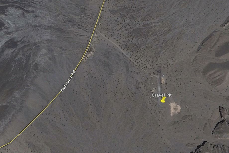
The road went off the highway about a quarter mile to a gravel pit (N36° 3'52.67" W116°44'41.09") with signs all over saying “day use only” and “no camping.” There was no way this met the DV NP camping restrictions. But more importantly, there was zero concealment from the road so this too was ruled out. “Jefe 4x4” also had some good recommendations on boondocking sites too, but they were a little off my itinerary route.
So, back to the fallback option of dry-camping in the large flat open Texas Spring Campground up at Furnace Creek. Going north was just going to cut down on my early morning trek to meet my tour reservation at Scotty's Castle anyway. On our way north we’d have checked out Artists Drive just south of Furnace Creek, but the sun had already set and hour earlier so we'd just missed that sidebar. Arriving at Texas Spring Campground well past dark there was plenty of space and spots to choose. We got the camper parked, setup, and took out dinner. We were hungry and it hit the spot! In the campground you could hear a few genny’s running, but by 9pm the campground was quiet. I was quite proud to not turn mine on!
After a great nights sleep we got up early ate some breakfast and then put some Cornish game hens in the crock pot to slow cook in the TC oven. We got on the road by 0800 headed north to Scotty’s Castle. With the DV NP Service advertising road construction and 30 minute delays, we figured we’d better get started on the hour drive north to ensure we didn’t miss our Castle Tour reservations at 1010.
" Scotty's Castle Road Construction
Expect 30 minute delays Monday-Saturday on Scotty's Castle Road and Mesquite Springs Campground Road. Caution advised due to unpaved surfaces and sections of one-lane road.
Scotty's Castle Road Closure
The road from Scotty's Castle east to the park boundary will be closed to all traffic from February 10 to April 10, 2014. The Castle can be accessed from the south via CA-190 and Scotty's Castle Road; expect 30 minute delays."
The above notice can be found on the DV NP Home Page (Click on "Park Alerts"):
NPS - Death Valley National Park
So, here’s the skinny on the road construction as of our trip on Feb 18, 2013. Scotty’s Castle Road was clear all the way to the Scotty’s Castle turnoff as we headed north. Road construction began and continued all the way to Scotty’s Castle.
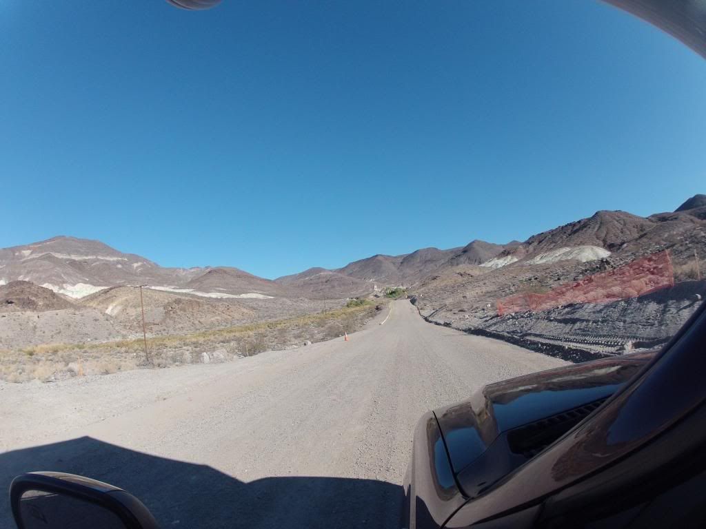
This is approaching the narrowest part of the road under construction (room for only one lane) as you approach the Castle.
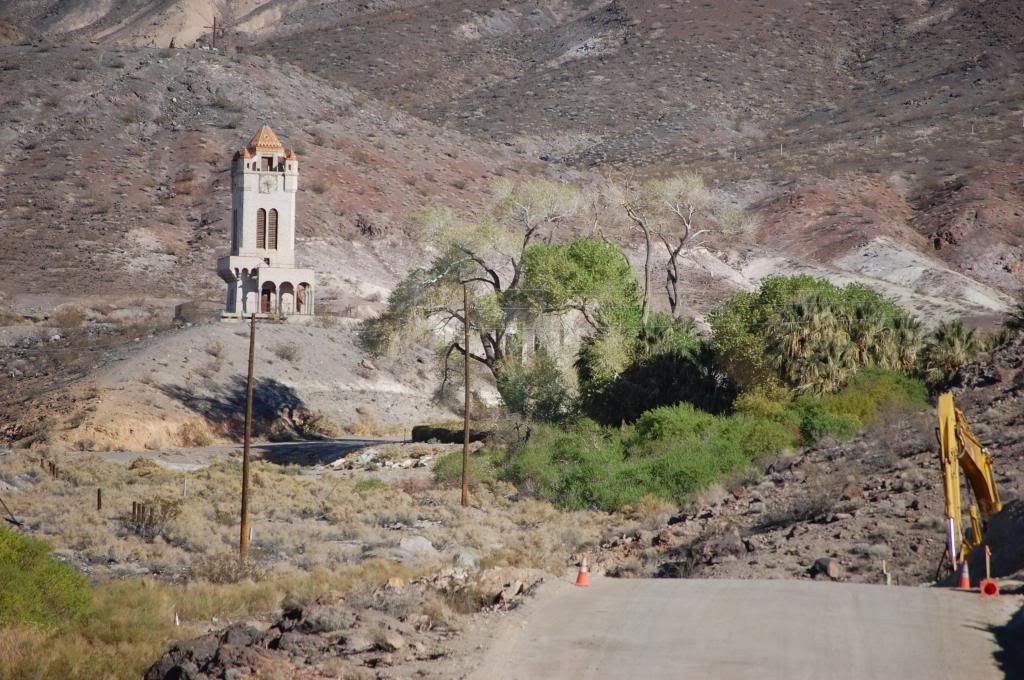
At Scotty’s Castle the road is barricaded preventing any traffic on the east/west road to Scotty’s Junction in Nevada (NV 287). The entire road to the Mesquite Spring Campground is under construction from the campground all the way to Scotty’s Castle road.
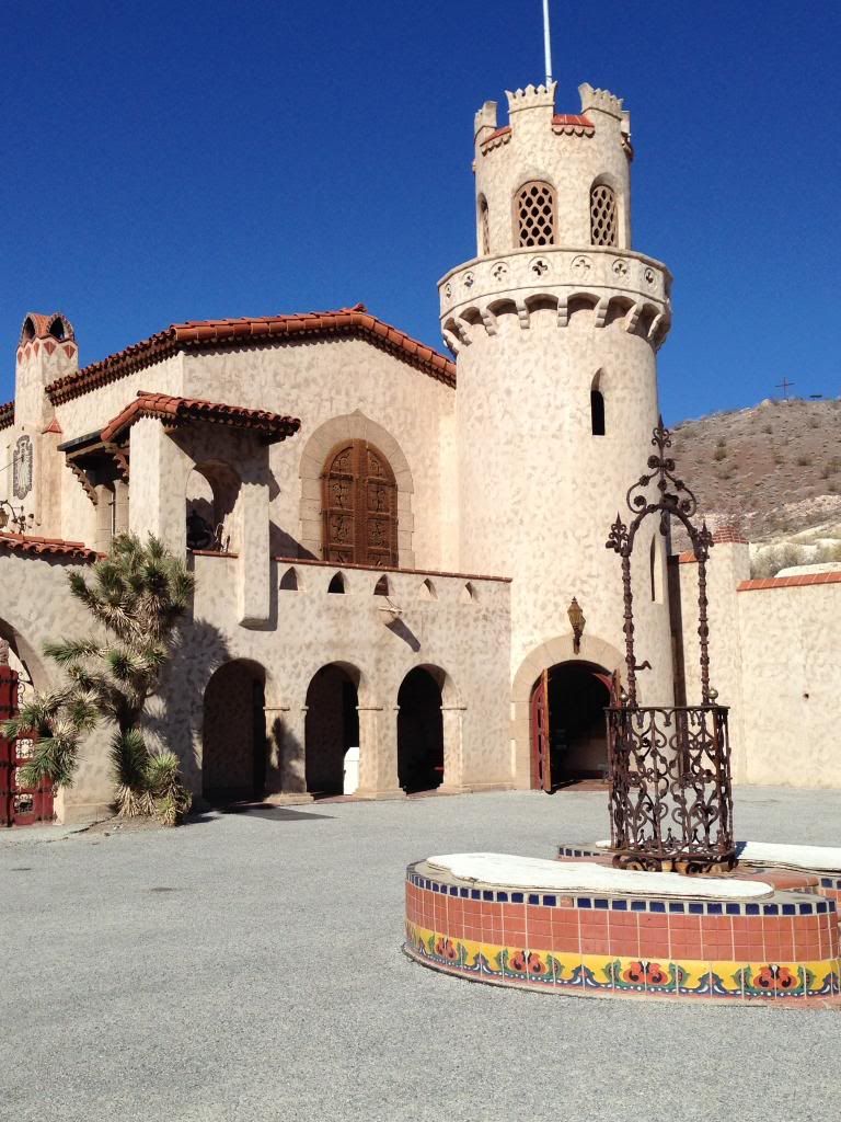
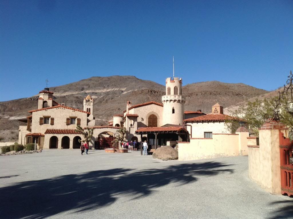
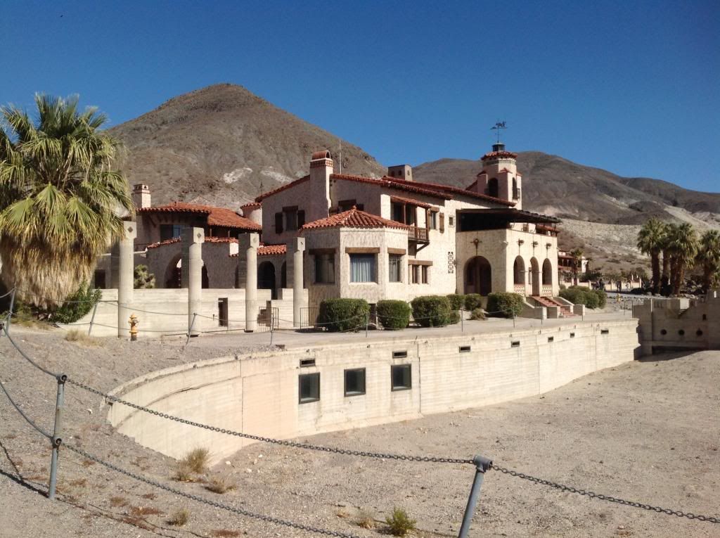
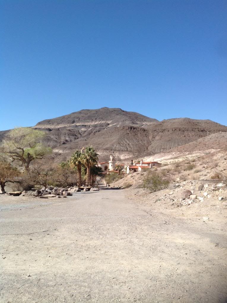
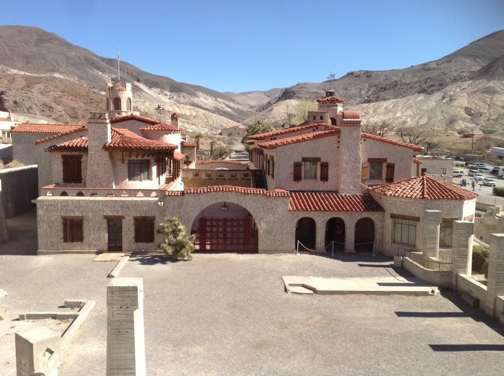
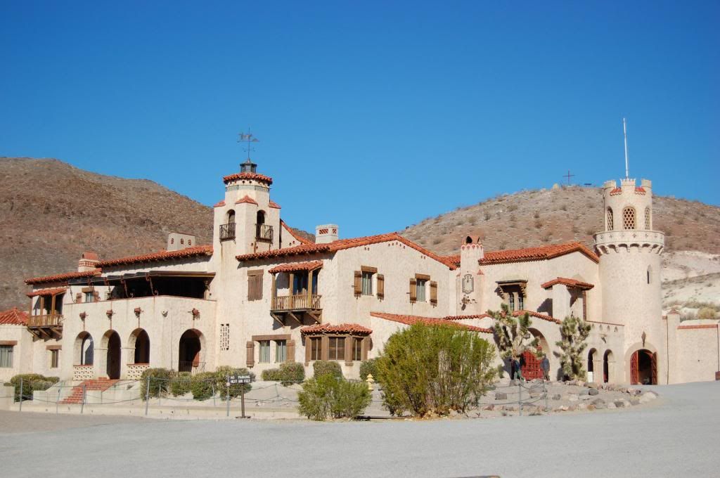
Scotty’s Castle was simply outstanding.
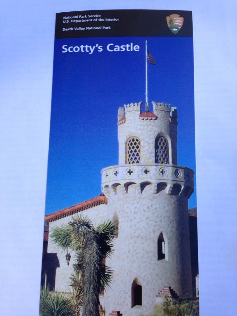
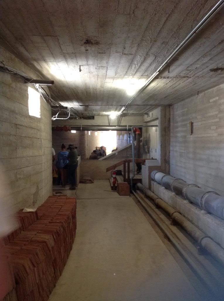
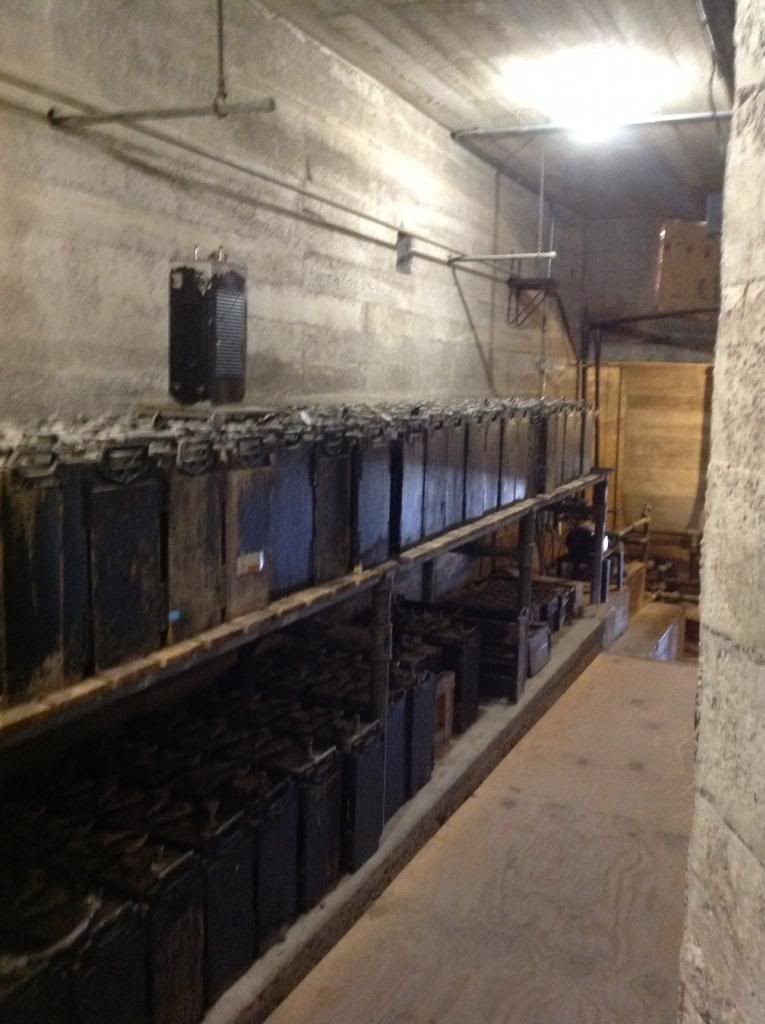
I highly suggest not just the Castle tour, but the underground tour also. The history, artifacts, architecture, people, and early use of technology to light, plumb, cool and heat the Castle was quite impressive.
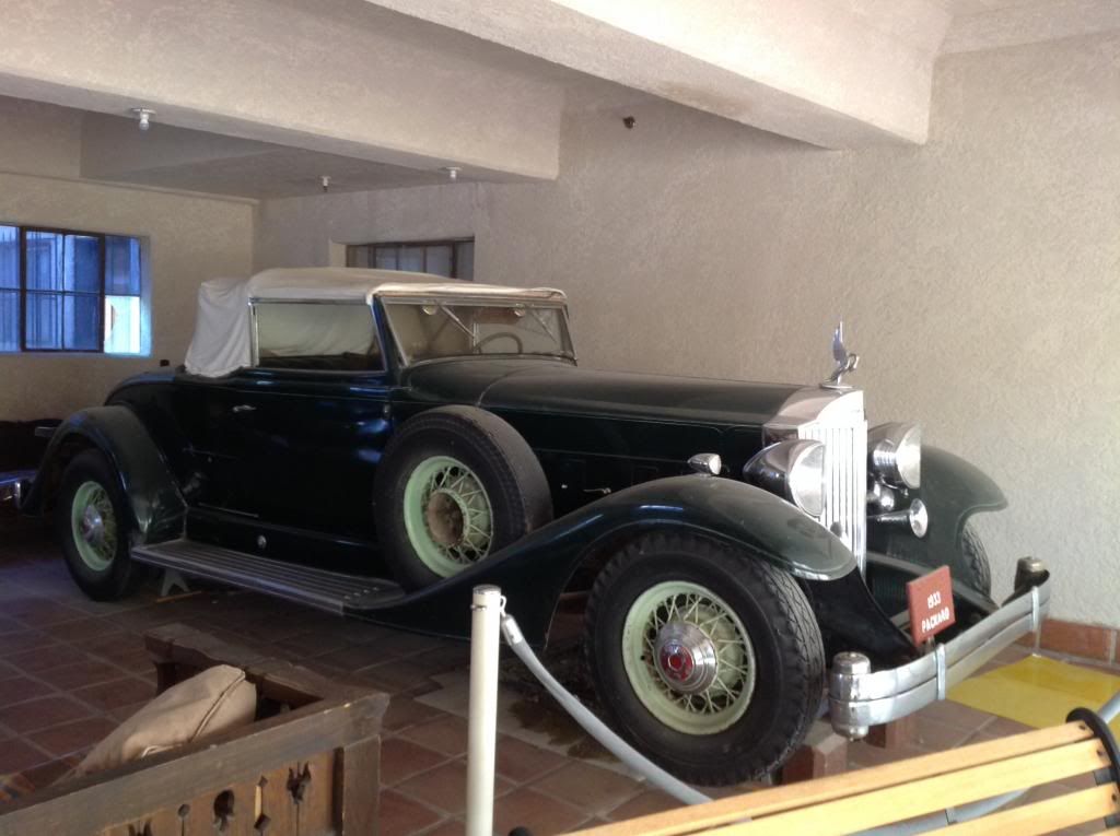
1933 Packard
Underground Tunnel
Battery Storage--unreal.
The NPS tour guides wear clothing reflective of the period and were superb in knowledge and delivery! Here's our NPS Tour Guide in the bottom right of the photo inside the Castle.
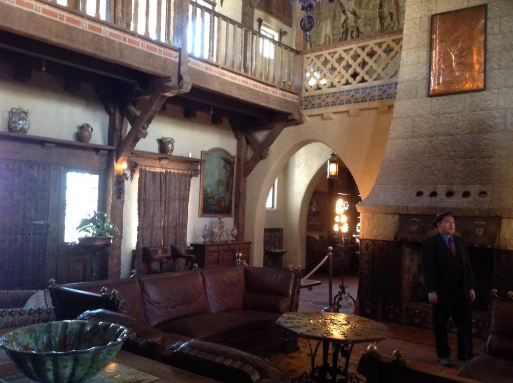
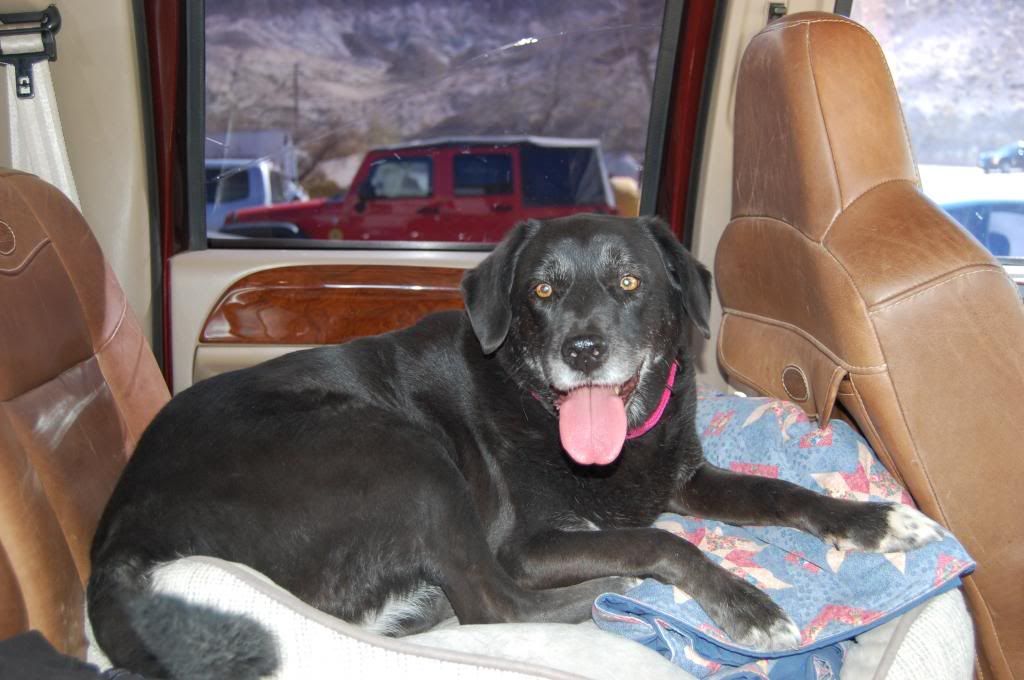
We had a great time at the Castle and decided to head over to Mesquite Campground around 2pm to dry camp. I think our dog was beat from touring anyway....
We arrived at Mesquite Campground with about half the sites already full but plenty left to select. The Camp attendant said they filled up by 5pm on Friday and Saturday.
Spot 20
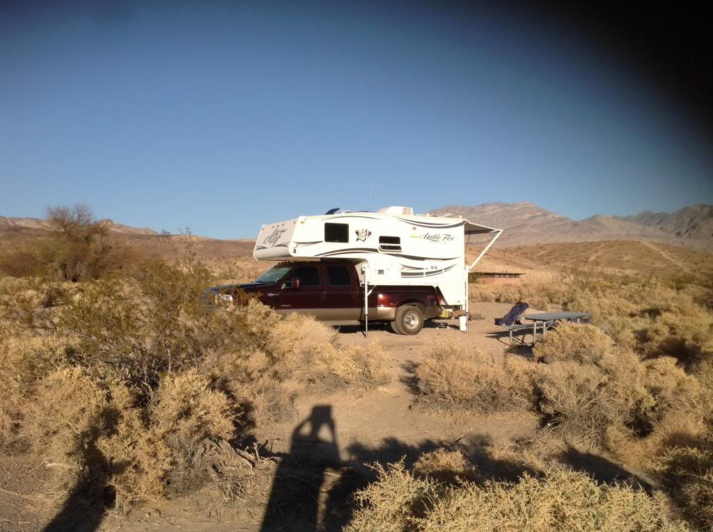
We settled in, eat an early dinner of some excellent slow cooked Cornish game hen with green beans. After the sun went down we got a fire going in the fire ring, relaxed and watched nature's TV (the fire).
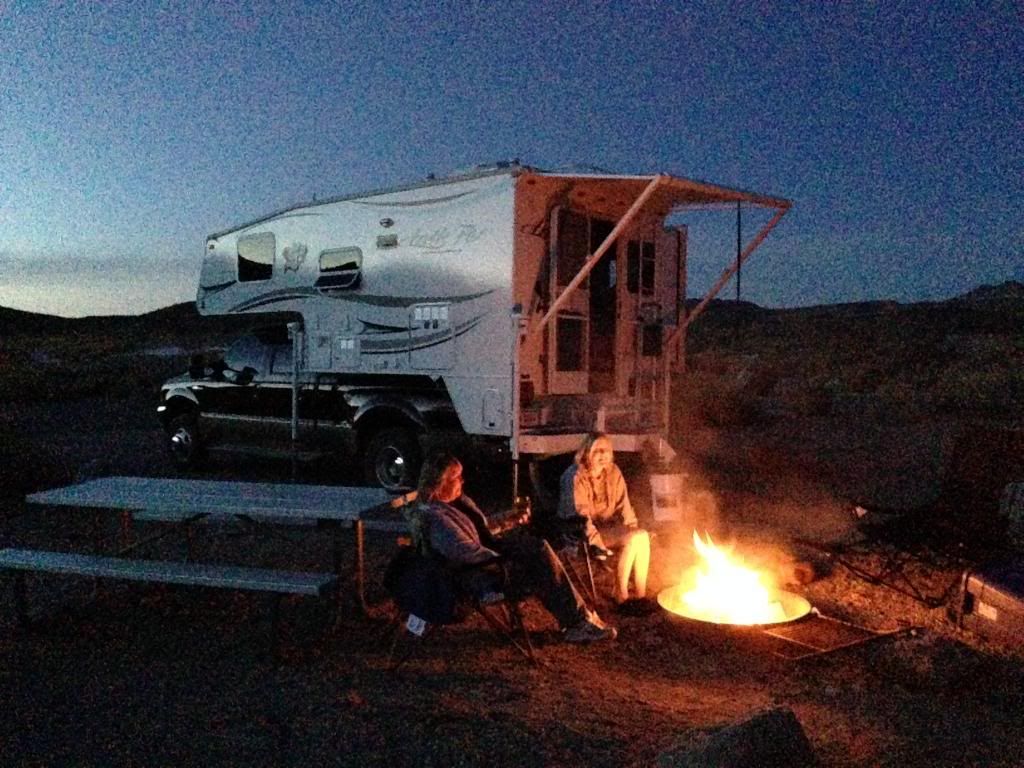
The campground was quiet by 7pm and the night time outdoor temps dropped down to 45. It was outstanding!
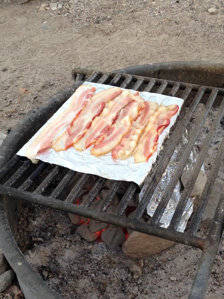
We awoke just after sunrise and I immediately got the coffee percolater going on the stove. I slow cooked some bacon on the BBQ with a early morning cool breeze while the DW made some scrambled eggs and hash browns.
We made our push south after dumping the black/gray tanks at the campground around 0800. We drove down almost to the Stovepipe Wells turnout but turned East toward Beatty on Daylight Pass Road. It’s a pretty good grade up over the Amorgosa Mountains to Daylight Pass at 4317’.
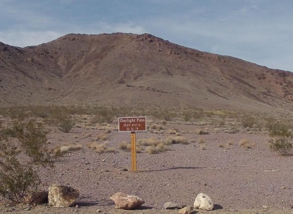
I kept my speed anywhere from 30-40MPH in the climb with engine oil and cooling temps holding about 10 degrees apart. It’s a good paved road with only one turnout as I recall, near the top, and its on the North side of the road. After the summit it’s downhill to NV Highway 374.
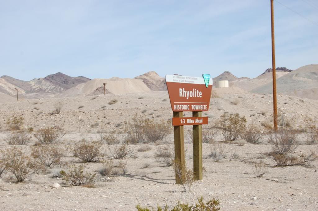
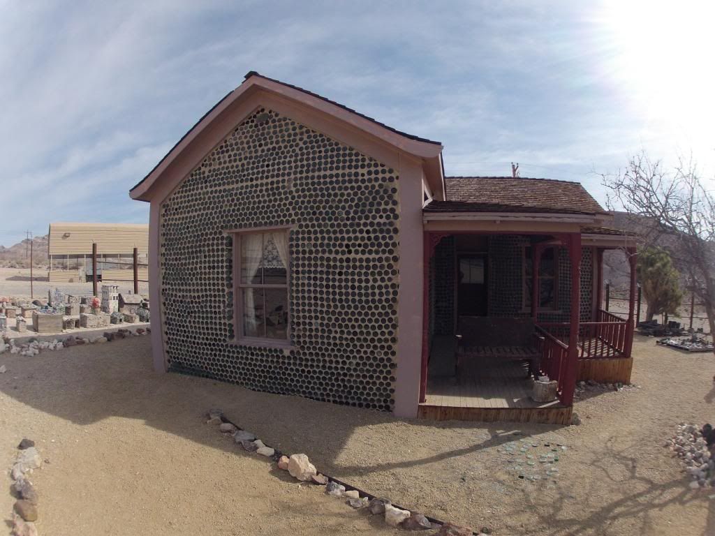
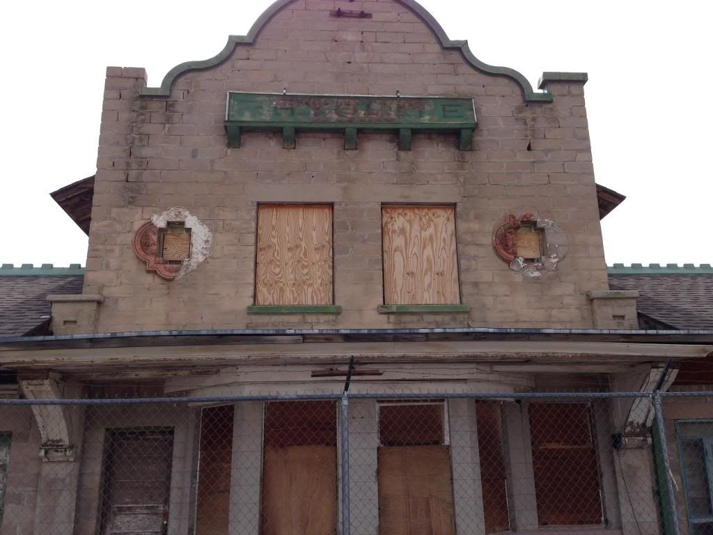
Once on the Nevada side we stopped at Rhyolite to check out the old mining ghost town.
At Beatty make sure you stop at The Death Valley Nut and Candy Co. The candy selection is unreal. Jedidiah's Beef Jerky inside is good too (plenty to sample). As we departed Beatty I noticed Diesel at $3.62...that's anywhere from .10 to .30 cents cheaper than Vegas right now. Soon, we were on Highway 95 toward Lost Wages. A great quick weekend getaway complete! There is so much more I want to see and do in DV, but to do it will require me to take my off-road dirt bikes or a jeep….
Hope you enjoyed as much as we did. So, until next time happy camping!!
So, I broke out Benchmark Maps for Chart Study, pulled out Tom Harrison’s DV NP recreation map (highly recommended), reviewed DV NP road restrictions and closures, scanned the internet for must do’s, and researched fellow RV campers trip reports. Immediately you realize there is a ton to do and see in DV. However, with weekend time constraints, the tyranny of distance inside the park required some major prioritization. Additionally, the NPS rules have made "convenient" boondocking tougher. Here's a link:
DV NPS Back Country Map
Regardless, I’m not going to let the NPS put a damper on some fun! I listed some must do’s, some nice to see places (if time), and plotted out a few places to camp based on DV NP’s restrictions above (areas highlighted in yellow are non starters).
Here's a link to all their Maps:
NPS Plan Your Visit Map
I got the camper prepped during the week. So, by Thursday all we had left to do was some minor packing. Sure enough I got delayed and the DW had to work late so an early Friday afternoon departure was out. That also meant I wouldn’t be able to prep a slow roasted TC oven meal for dinner (that could wait till Saturday and Sunday) but, I guess that kept us from eating dinner way late. We rolled out of Lost Wages after 1800 (6 pm) and set our sights on Pahrump, NV for the night so we’d at least cut the trip to DV by half to get an early Saturday start. There are numerous ways to get to Death Valley.
The Numerous Routes into DV
For us the Pahrump route would optimize our time for the places we wanted to see and stay as it was just an hour to the Park from Pahrump, NV.
I have not typically used RV Parks, but we decided to drop into one we’d heard great things about….not to mention it was Valentines Day so I might earn some bonus points :C We arrived at Nevada Treasure RV Resort after 8 pm and it did not disappoint (caveat-I’m in no way associated with this or any other RV Park-just an honest critique).
Nevada Treasure RV Resort Pahrump, NV
They had a special reservation only Valentines Day candlelight dinner function for park occupants or others when we arrived. The check-in staff and security were very friendly and even escorted us to our secluded spot with full hookups—this was a nice change from boondocking. They seemed pretty impressed with the big AF990 TC. On my row (not full at all) the other occupants were all very friendly snow-birds.

In the morning we walked over to the Grill at the main building for some breakfast. The cook, Mark, cooked us up a big plate of two eggs, sausage, hash browns, toast, and coffee. I think we paid $5.85 per plate...a real deal! Anyway, stomachs full we pressed out to DV via Bella-Vista Ave in Pahrump, topped off the tank, then drove out to Ash Meadows Rd, and DV Junction. From there we headed up CA190 and into the Park.

CA190 into Furnace Creek is a pretty tame drive in elevation changes compared to our departure route out but, I’ll get to that later.

And, for the moderate temps originally planned, the wx forecasters predicted instead DV would see a record high in the 80’s on this day. It would not arrive as predicted. The weather remained overcast and the temps never even approached 80 degrees F…very comfortable! We’d have to wait until Sunday to see clear blue skies and temps in the high 70's.
Once we got into the Park (about 17.5 miles from DV Junction) on CA190 we took the first right to head up to Dantes View at 5475’ elevation. Getting to a highpoint first helps cage the gyros and allows a birds-eye view for some DV situational awareness. The 13.5 mile paved road skirting Mt Perry road to Dantes View is a pretty significant ascent.

Further, the last half mile to reach the view point is a 15% grade (15 feet in elevation per 100 foot distance). As you traverse the climb you’ll undoubtedly pass many huffing bicyclists. With almost two tons strapped on the back of my 6.0L F350 diesel, I just kept the speed around 30 MPH and monitored engine and oil temps (10 degree split) all the way up. As you climb you’ll see signs prohibiting trailers, RV’s and TC’s in excess of 25’ and directing them to a parking area well below the summit. As you get near the top the road will narrow. There is one more small parking area just before you make the 15% push to the top. That section is steep and has multiple switchbacks.

Suddenly you crest and drive a little ways to a big parking and viewing area. The views are absolutely worth it! Take advantage of the walking trails to the North and South to get a better view point of the enormity of DV as far as the eye can see. Here's the View Looking Northwest up the Valley.

The Trail to the Lookout Facing the South

In the valley below Badwater basin is the lowest elevation in the U.S. at -282 feet. We’re headed down there later.

DV NP is over 3,000 square miles (7,800 sq km) and runs from the north to the south. It is bounded by the Amargosa Range to the east, the Panamint Range to the west, the Sylvania Mountains to the north and the Owlshead Mountains to the south. This pic is looking directly East across DV toward the Panamint Range and Telescope Peak at 11,049 feet.

You’ll notice by the parking lot not very many “big” vehicles make it up here.

I went down the steep 15% in first gear….failed brakes on this switchback section would not be pretty even though the section is bracketed by guard rails.

I descended the rest of the drive in third gear at about 30-35 MPH. Bottom line-If you decide to make the push up to Dantes View, make sure your horse is in top shape and your saddle taught.
Next, it was off to 20 Mule Team Canyon.

It’s about 5 miles up CA190 once you get back on the highway (watch for the signs). 20 Mule Team Canyon is one-way. There’s a few steep sections, a few narrow areas, and a few spots that had some deep powdery roadbeds…nothing requiring 4x4 on this day however. Stop and get some pics. Here are a few pics while we traversed the canyon.


Next, we visited Zabriskie Point which overlooks some of the Borax mining terrain.


You can hike extensively in this area. Visitors also note this is a great viewpoint to watch sunrise or sunset with the light and shadows making a spectacular scene.


Next, we headed up to the Park HQ and Visitor Center. Just prior to the visitor center is a Chevron station. I saw diesel at $5.37 a gallon....no, I did not stop, but rather just gazed in amazement! We toured the Visitor center, looked over the charts, and marveled at their table-top topographic map. We pushed the slide out in the parking lot, ate some lunch, and put together a crock pot full of pork chops, a can of mushroom soup, vegetables, and a little half and half. I turned the TC oven on as low as it would go, braced in the pot for travel, and put bungee cords on the door handle to keep it closed – just in case.
We were now driving south on Badwater Rd. About five miles down you’ll run into the exit point from the Artists Loop Drive. Drive south another 11 miles and you reach the Badwater Basin viewing area.

The turnout has plenty of parking and restroom facilities. After you park you can walk down to the viewing deck and then walk out on the salt flat which is -282 below sea level.


When you turnaround and look east you’ll see a sign on the Black Mountain Range showing where “sea level” would be in relation to the flat.


It was now after 2pm so it was time to scope out some camping spots. We rounded a corner and saw two beautiful coyotes hanging close to the highway. They got up as we slowed down and approached in the TC.


We proceeded south a total of 27 miles to Ashford Mill (noted as west side of the road turnoff) from Badwater Basin.

Directly across the street is a rough dirt, rock, and sandy road leading up to Scotty’s Canyon which in parts is part of the wash.

I’d read somewhere this has four good spots to park and camp at the hiking trailhead about 2.6 miles in. I plugged in 4x4 and off we went climbing up the terrain. The road was bumpy in the ascent the entire way. We got a good mile and then some up toward the canyon but just could not pass a wash section of deep loose course sand as the road angled to the left around some higher terrain. Just 100’ further, concealed from the main road by the terrain, there was a level spot I would have boondocked in. In the pic below its just past the green bush on the left tucked back nicely off the road. Oh well.

The road continues even further up to Scotty's Canyon, but today passage for us was just not an option based on gross weight and tires. It was still daylight so off we went back down the hill.
Getting back to the main road I turned back North and drove about 2 miles then turned left on West Side Road. This road was even slower going with massive wash-boarding.

After three miles of bone jarring bouncing I got to Warm Spring Canyon Road which climbs the valley to the west. The road was graded with over a foot of loose gravel curbing on each side. I didn’t see much opportunity to get off the road to do any boondocking nor was I wanting to keep getting bounced around for another six miles up the canyon, so I made a 180 a headed out.
I figured I had one more spot to checkout before dark. I’d remembered reading a post from “RenoAL,” a fellow TC’r on RV Net, who’d mentioned a gravel pit south of Badwater. Darkness was approaching but just beyond Mormon Point, heading north, I found a gravel road heading East.

The road went off the highway about a quarter mile to a gravel pit (N36° 3'52.67" W116°44'41.09") with signs all over saying “day use only” and “no camping.” There was no way this met the DV NP camping restrictions. But more importantly, there was zero concealment from the road so this too was ruled out. “Jefe 4x4” also had some good recommendations on boondocking sites too, but they were a little off my itinerary route.
So, back to the fallback option of dry-camping in the large flat open Texas Spring Campground up at Furnace Creek. Going north was just going to cut down on my early morning trek to meet my tour reservation at Scotty's Castle anyway. On our way north we’d have checked out Artists Drive just south of Furnace Creek, but the sun had already set and hour earlier so we'd just missed that sidebar. Arriving at Texas Spring Campground well past dark there was plenty of space and spots to choose. We got the camper parked, setup, and took out dinner. We were hungry and it hit the spot! In the campground you could hear a few genny’s running, but by 9pm the campground was quiet. I was quite proud to not turn mine on!
After a great nights sleep we got up early ate some breakfast and then put some Cornish game hens in the crock pot to slow cook in the TC oven. We got on the road by 0800 headed north to Scotty’s Castle. With the DV NP Service advertising road construction and 30 minute delays, we figured we’d better get started on the hour drive north to ensure we didn’t miss our Castle Tour reservations at 1010.
" Scotty's Castle Road Construction
Expect 30 minute delays Monday-Saturday on Scotty's Castle Road and Mesquite Springs Campground Road. Caution advised due to unpaved surfaces and sections of one-lane road.
Scotty's Castle Road Closure
The road from Scotty's Castle east to the park boundary will be closed to all traffic from February 10 to April 10, 2014. The Castle can be accessed from the south via CA-190 and Scotty's Castle Road; expect 30 minute delays."
The above notice can be found on the DV NP Home Page (Click on "Park Alerts"):
NPS - Death Valley National Park
So, here’s the skinny on the road construction as of our trip on Feb 18, 2013. Scotty’s Castle Road was clear all the way to the Scotty’s Castle turnoff as we headed north. Road construction began and continued all the way to Scotty’s Castle.

This is approaching the narrowest part of the road under construction (room for only one lane) as you approach the Castle.

At Scotty’s Castle the road is barricaded preventing any traffic on the east/west road to Scotty’s Junction in Nevada (NV 287). The entire road to the Mesquite Spring Campground is under construction from the campground all the way to Scotty’s Castle road.
Scotty’s Castle was simply outstanding.

I highly suggest not just the Castle tour, but the underground tour also. The history, artifacts, architecture, people, and early use of technology to light, plumb, cool and heat the Castle was quite impressive.


1933 Packard

Underground Tunnel

Battery Storage--unreal.

The NPS tour guides wear clothing reflective of the period and were superb in knowledge and delivery! Here's our NPS Tour Guide in the bottom right of the photo inside the Castle.

We had a great time at the Castle and decided to head over to Mesquite Campground around 2pm to dry camp. I think our dog was beat from touring anyway....

We arrived at Mesquite Campground with about half the sites already full but plenty left to select. The Camp attendant said they filled up by 5pm on Friday and Saturday.
Spot 20

We settled in, eat an early dinner of some excellent slow cooked Cornish game hen with green beans. After the sun went down we got a fire going in the fire ring, relaxed and watched nature's TV (the fire).

The campground was quiet by 7pm and the night time outdoor temps dropped down to 45. It was outstanding!
We awoke just after sunrise and I immediately got the coffee percolater going on the stove. I slow cooked some bacon on the BBQ with a early morning cool breeze while the DW made some scrambled eggs and hash browns.

We made our push south after dumping the black/gray tanks at the campground around 0800. We drove down almost to the Stovepipe Wells turnout but turned East toward Beatty on Daylight Pass Road. It’s a pretty good grade up over the Amorgosa Mountains to Daylight Pass at 4317’.

I kept my speed anywhere from 30-40MPH in the climb with engine oil and cooling temps holding about 10 degrees apart. It’s a good paved road with only one turnout as I recall, near the top, and its on the North side of the road. After the summit it’s downhill to NV Highway 374.
Once on the Nevada side we stopped at Rhyolite to check out the old mining ghost town.


At Beatty make sure you stop at The Death Valley Nut and Candy Co. The candy selection is unreal. Jedidiah's Beef Jerky inside is good too (plenty to sample). As we departed Beatty I noticed Diesel at $3.62...that's anywhere from .10 to .30 cents cheaper than Vegas right now. Soon, we were on Highway 95 toward Lost Wages. A great quick weekend getaway complete! There is so much more I want to see and do in DV, but to do it will require me to take my off-road dirt bikes or a jeep….
Hope you enjoyed as much as we did. So, until next time happy camping!!