RGar974417
Jun 18, 2015Explorer
Ricketts Glen State Park,Pa
We are planning a trip to Ricketts Glenn State Park in August. I was looking at a map and it looks like staying on I-81 to Wilkes-Barre and then head north west to the park. But map quest has us jumping off I-81 south of I-80.Below are their directions.Anyone familiar with this route and how it would be pulling a 27ft TT?
Merge onto I-81 N toward Hazleton.
21.2 mi
10. Take the PA-93 exit, EXIT 145, toward West Hazleton.
0.3 mi
11. Keep left to take the ramp toward Conyngham.
0.06 mi
12. Turn left onto PA-93/State Route 93. Continue to follow PA-93.
8.4 mi
13. Turn right onto Hobbie Rd/PA-239.
Hobbie Rd is 0.3 miles past E Hollow Rd
If you are on Berwick Hazleton Hwy and reach Old Berwick Hwy you've gone about 0.2 miles too far
0.9 mi
14. Turn left onto Wapwallopen Rd/PA-239. Continue to follow PA-239.
PA-239 is 0.7 miles past Old Berwick Hwy
If you reach Chapin Ln you've gone about 1.1 miles too far
7.7 mi
15. Turn left onto Main St/PA-239. Continue to follow PA-239.
0.7 mi
16. Turn right onto S Main St/US-11 N/PA-239/PA-11.
S Main St is 0.2 miles past Main St
0.5 mi
17. Turn left onto W Union St/PA-239/SR 4007. Continue to follow PA-239.
PA-239 is just past W Vine St
Wells Fargo Bank is on the left
If you are on N Main St and reach McClintock St you've gone about 0.1 miles too far
6.3 mi
18. Turn slight right onto Bethel Hill Rd.
Bethel Hill Rd is 0.1 miles past Cottermans Hill Rd
2.8 mi
19. Turn left onto Mossville Rd.
Mossville Rd is 0.4 miles past Red Hill Rd
If you reach Johnson Rd you've gone about 0.6 miles too far
5.3 mi
20. Turn left onto PA-118/State Route 118.
0.03 mi
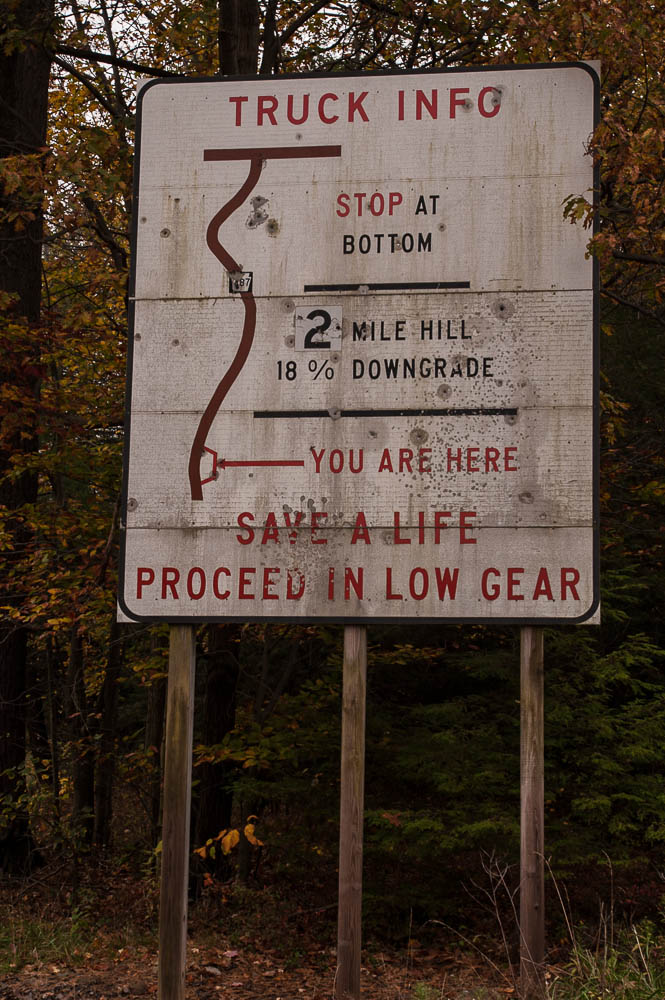
21. Take the 1st right onto PA-487.
If you are on State Route 118 and reach Conference Rd you've gone about 0.1 miles too far
3.7 mi
22. Turn right.
If you are on PA-487 and reach Jemerson City Rd you've gone about 0.1 miles too far
0.3 mi
23. Welcome to BENTON, PA 17814.
If you reach Ricketts Glen State Park you've gone about 1.1 miles too far
Merge onto I-81 N toward Hazleton.
21.2 mi
10. Take the PA-93 exit, EXIT 145, toward West Hazleton.
0.3 mi
11. Keep left to take the ramp toward Conyngham.
0.06 mi
12. Turn left onto PA-93/State Route 93. Continue to follow PA-93.
8.4 mi
13. Turn right onto Hobbie Rd/PA-239.
Hobbie Rd is 0.3 miles past E Hollow Rd
If you are on Berwick Hazleton Hwy and reach Old Berwick Hwy you've gone about 0.2 miles too far
0.9 mi
14. Turn left onto Wapwallopen Rd/PA-239. Continue to follow PA-239.
PA-239 is 0.7 miles past Old Berwick Hwy
If you reach Chapin Ln you've gone about 1.1 miles too far
7.7 mi
15. Turn left onto Main St/PA-239. Continue to follow PA-239.
0.7 mi
16. Turn right onto S Main St/US-11 N/PA-239/PA-11.
S Main St is 0.2 miles past Main St
0.5 mi
17. Turn left onto W Union St/PA-239/SR 4007. Continue to follow PA-239.
PA-239 is just past W Vine St
Wells Fargo Bank is on the left
If you are on N Main St and reach McClintock St you've gone about 0.1 miles too far
6.3 mi
18. Turn slight right onto Bethel Hill Rd.
Bethel Hill Rd is 0.1 miles past Cottermans Hill Rd
2.8 mi
19. Turn left onto Mossville Rd.
Mossville Rd is 0.4 miles past Red Hill Rd
If you reach Johnson Rd you've gone about 0.6 miles too far
5.3 mi
20. Turn left onto PA-118/State Route 118.
0.03 mi
21. Take the 1st right onto PA-487.
If you are on State Route 118 and reach Conference Rd you've gone about 0.1 miles too far
3.7 mi
22. Turn right.
If you are on PA-487 and reach Jemerson City Rd you've gone about 0.1 miles too far
0.3 mi
23. Welcome to BENTON, PA 17814.
If you reach Ricketts Glen State Park you've gone about 1.1 miles too far