Clattertruck
Sep 23, 2013Explorer
Utah's Old Burr Trail
Torrey UT Trip Report: The Burr Trail
We have been attracted to Southeast Utah for many years. Edward Abbey said," God goes here when he's tired of listening to the whining". It has been described as the land of standing rocks where the color red permeates everything.
We drove from Colorado to the Thousand Lakes RV Park, a little west of Torrey, Utah.
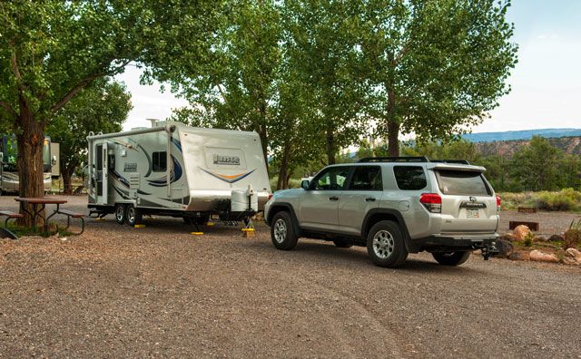
Our site had good shade.
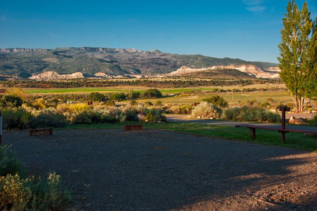
The view from our site as luck would have it was nice.
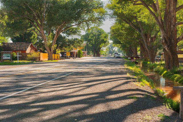
Main Street in Torrey. A pleasant town located on State Route 24 at an elevation of 6839 ft. The population in 2010 was 182.
Our plan was to travel the Burr Trail, which we only vaguely remembered from the 1970s when it was a dirt trail. The Burr Trail is named after John Atlantic Burr, a homesteader and rancher.
In 1876, John Burr soon developed a trail to move cattle back and forth between winter and summer ranges and to market, known as the Burr Trail.
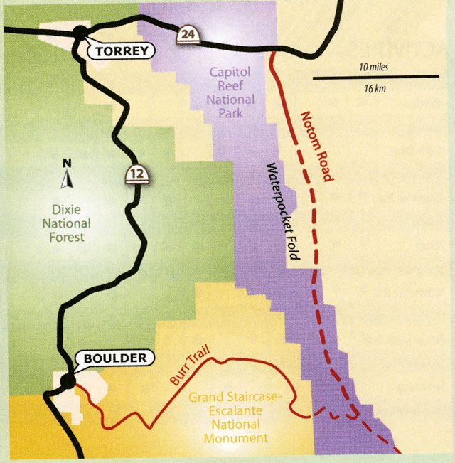
Boulder Town is 37 miles south of Torrey where the Burr Trail road starts. From there, the distance to the Notom Road is about 37 miles. It is a paved without a centerline until it crosses the Capitol Reef border where it changes to gravel.
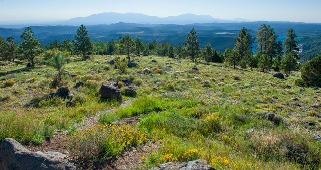
Highway 12 goes to 9600 ft. south of Torrey. It was a very hazy morning looking east to the Henry Mountains.
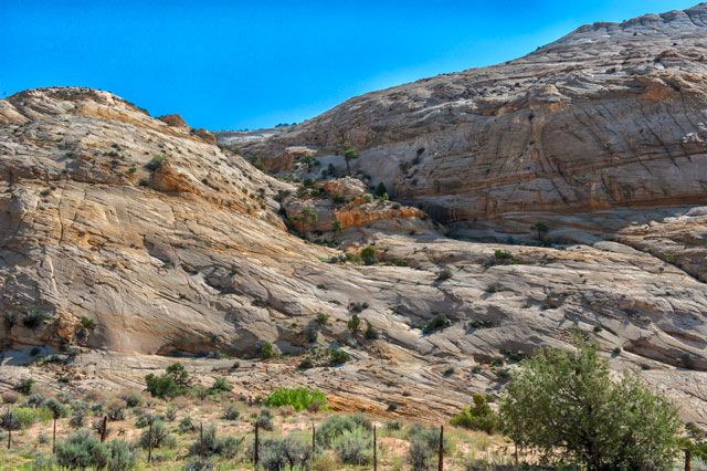
The start of the Burr Trail drive soon shows Navajo Sandstone which is light colored.
Navajo Sandstone was originally a Sahara like desert of dunes, which was compressed under later sediments.
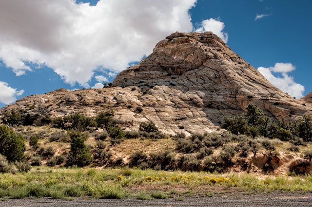
Winding across the Steep Creek Bench.
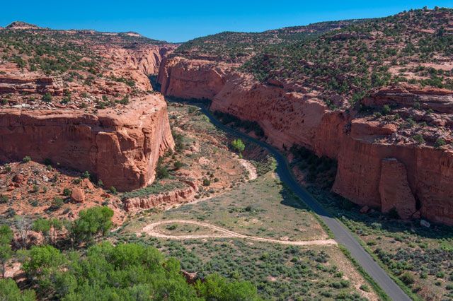
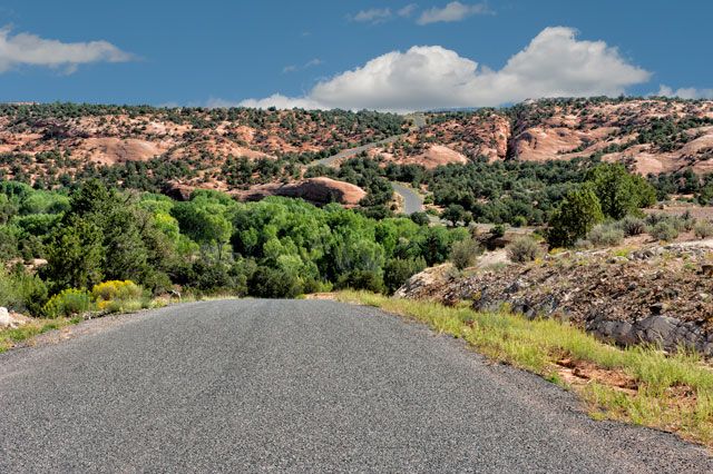
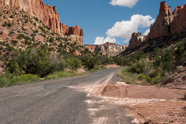
The road enters beautiful Long Canyon, which runs for 7.4 miles.
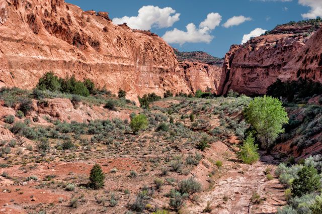
The wash was dry even though there has been rain a couple of days before. Water below the surface feed the rich stands of cottonwoods.
Late summer flowers.
Rattlesnake Bench on the left has been cut by the grinding of canyon erosion.
The right side of the canyon is the King Bench.
Rains leave a telltale sign.
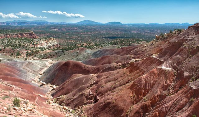
Long Overlook sees White Canyon Flats with the Henry Mountains to the east.
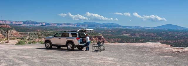
Lunch at the overlook in hot sun. We were blessed with a fine day.
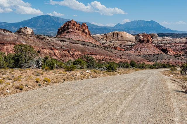
After entering Capitol Reef NM the last 19 miles to Notom Road are gravel.
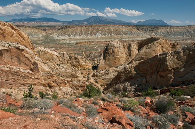
View from the switchbacks to the Grand Bench and Notom road, which heads left (north) 34 miles to Highway 24.At this time the Notom road was closed due to flooding so we would have to wait a couple of days before trying it.
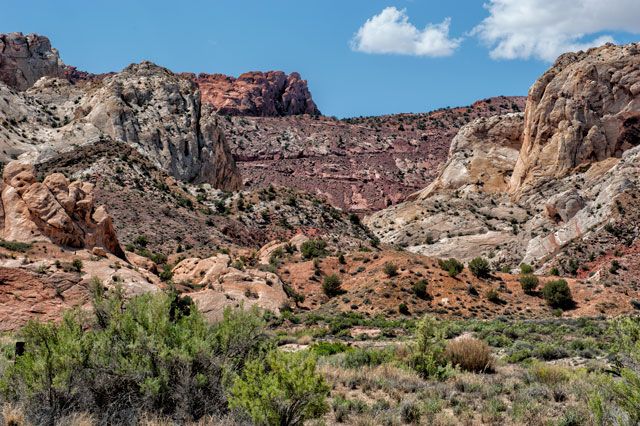
Looking back west to the wall of the switchbacks. This is a slot in the Water Pocket Fold of Capitol Reef NM.
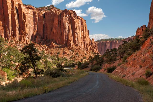
We returned on the Burr to Boulder Town. The 37 mile drive was just as good going west. The delicious greens of trees in the red canyons are a visual delight.
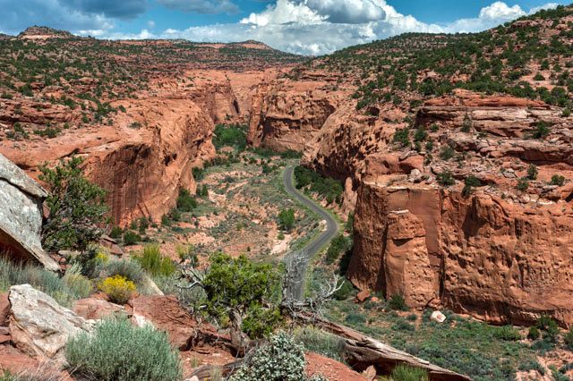
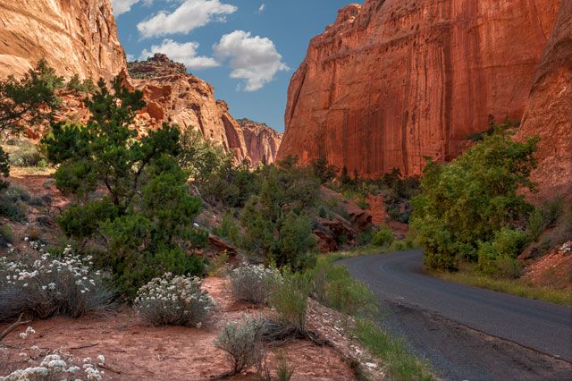
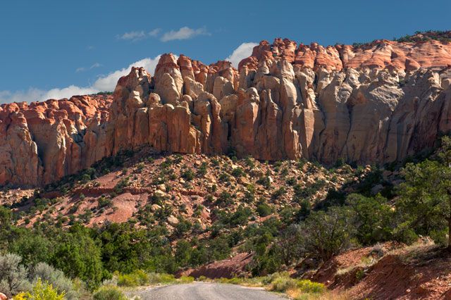
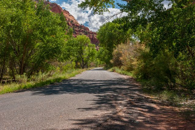
Coming out of Long Canyon I found a little spot to park to get this photo. The walls are Wingate sandstone. Of all the things that the desert landscape offers, runs in tight walled canyons are the best. That goes for driving, hiking, and riding.
Ron and Margot
We have been attracted to Southeast Utah for many years. Edward Abbey said," God goes here when he's tired of listening to the whining". It has been described as the land of standing rocks where the color red permeates everything.
We drove from Colorado to the Thousand Lakes RV Park, a little west of Torrey, Utah.

Our site had good shade.

The view from our site as luck would have it was nice.

Main Street in Torrey. A pleasant town located on State Route 24 at an elevation of 6839 ft. The population in 2010 was 182.
Our plan was to travel the Burr Trail, which we only vaguely remembered from the 1970s when it was a dirt trail. The Burr Trail is named after John Atlantic Burr, a homesteader and rancher.
In 1876, John Burr soon developed a trail to move cattle back and forth between winter and summer ranges and to market, known as the Burr Trail.

Boulder Town is 37 miles south of Torrey where the Burr Trail road starts. From there, the distance to the Notom Road is about 37 miles. It is a paved without a centerline until it crosses the Capitol Reef border where it changes to gravel.

Highway 12 goes to 9600 ft. south of Torrey. It was a very hazy morning looking east to the Henry Mountains.

The start of the Burr Trail drive soon shows Navajo Sandstone which is light colored.

Navajo Sandstone was originally a Sahara like desert of dunes, which was compressed under later sediments.

Winding across the Steep Creek Bench.

The road enters beautiful Long Canyon, which runs for 7.4 miles.

The wash was dry even though there has been rain a couple of days before. Water below the surface feed the rich stands of cottonwoods.

Late summer flowers.

Rattlesnake Bench on the left has been cut by the grinding of canyon erosion.

The right side of the canyon is the King Bench.

Rains leave a telltale sign.

Long Overlook sees White Canyon Flats with the Henry Mountains to the east.

Lunch at the overlook in hot sun. We were blessed with a fine day.

After entering Capitol Reef NM the last 19 miles to Notom Road are gravel.

View from the switchbacks to the Grand Bench and Notom road, which heads left (north) 34 miles to Highway 24.At this time the Notom road was closed due to flooding so we would have to wait a couple of days before trying it.

Looking back west to the wall of the switchbacks. This is a slot in the Water Pocket Fold of Capitol Reef NM.

We returned on the Burr to Boulder Town. The 37 mile drive was just as good going west. The delicious greens of trees in the red canyons are a visual delight.

Coming out of Long Canyon I found a little spot to park to get this photo. The walls are Wingate sandstone. Of all the things that the desert landscape offers, runs in tight walled canyons are the best. That goes for driving, hiking, and riding.
Ron and Margot