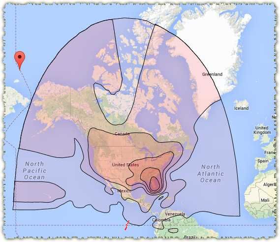
My experience going to Alaska in 2009 and Atlantic Canada in 2010 using an 18" dish on a tripod trying to get the 101 satellite was that, though the low angle can be a problem, the biggest problem was the distance to the satellite. That's why they use 4 foot dishes in Alaska! Once you get about 37,000 km (or 24,000 miles) from the satellite the signal becomes to weak too use. I use
the Sadoun site to locate the heading and elevation for the dish alignment and it also gives you the distance to the satellite. While in the Insde Passage on the Alaska trip I was able to get a weak but usable signal all the way up to Petersburg and on the way back we came down the Cassiar and I was able to get a usable signal once we got to Hazelton, BC. On the Atlantic trip, we got a usable (as long as it wasn't slightly cloudy) all the way up to Baddeck, NS.