- Good Sam Community
- Groups
- Travel Trailer Group
- Forum
- Another White RimTrail TR
- Subscribe to RSS Feed
- Mark Topic as New
- Mark Topic as Read
- Float this Topic for Current User
- Bookmark
- Subscribe
- Mute
- Printer Friendly Page
Another White RimTrail TR
- Mark as New
- Bookmark
- Subscribe
- Mute
- Subscribe to RSS Feed
- Permalink
- Report Inappropriate Content
Jul-06-2015 03:53 PM
The WRT is often described as 'moderately difficult in good weather'. I'd say it's primarily just a slow drive; e.g., 35 miles in 9 hours. Many sections are rough, or steep, or narrow, or deep sand, or badly rutted, or have sharp turns, or some combination - but it is not really very difficult with respect to any of those conditions (could be much worse in wet conditions).
For anyone interested in my equipment setup, it's here.
Here's a great map of Canyonlands and the surrounding area.
My amateur panorama from the Grand View Point Overlook (way above the WRT) is here. (too big too post here)
I'm posting a good sample of pictures here, and may add more. For anyone interested, my web site has more info and ~150 larger pictures.
I stopped overnight going north at the Goosenecks of the San Jaun. (thanks, Dave)


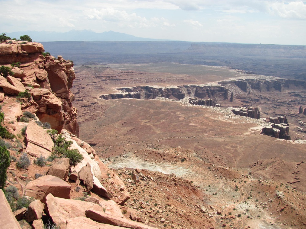
The WRT from the Grand View Point Overlook.
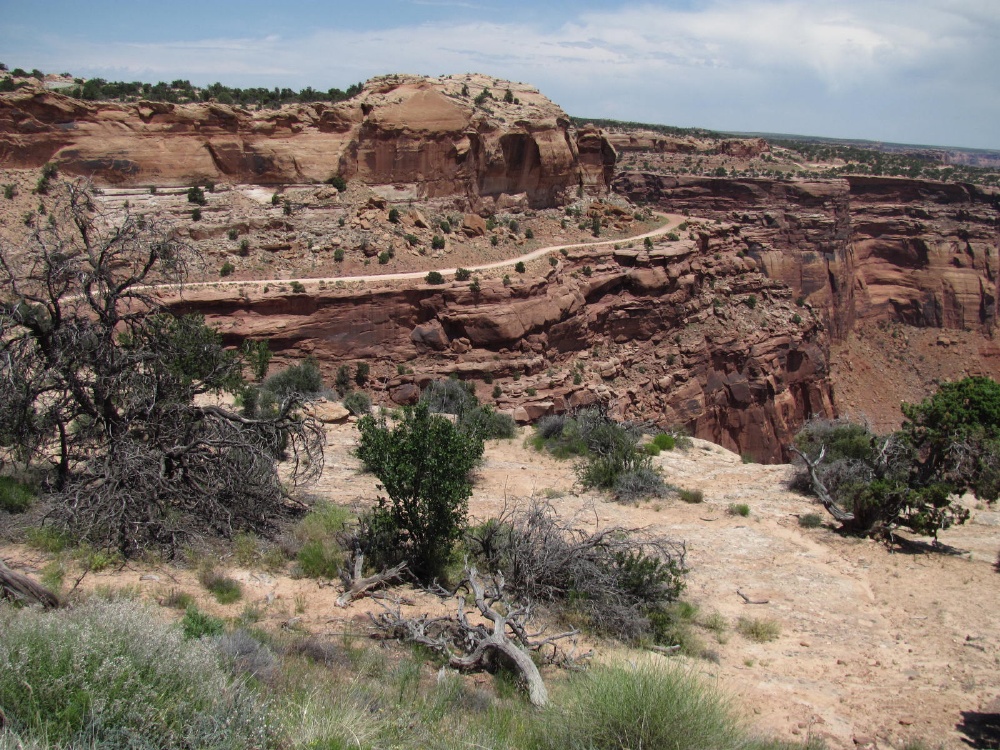
Starting down the Shafer Trail to the WRT.


At the bottom

The Colorado River
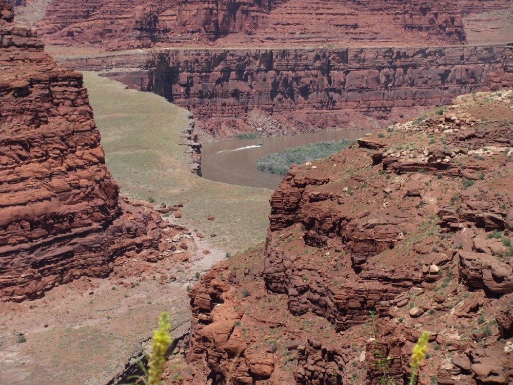

Airport Tower -- 1st campsite


A section of 'paved' road.
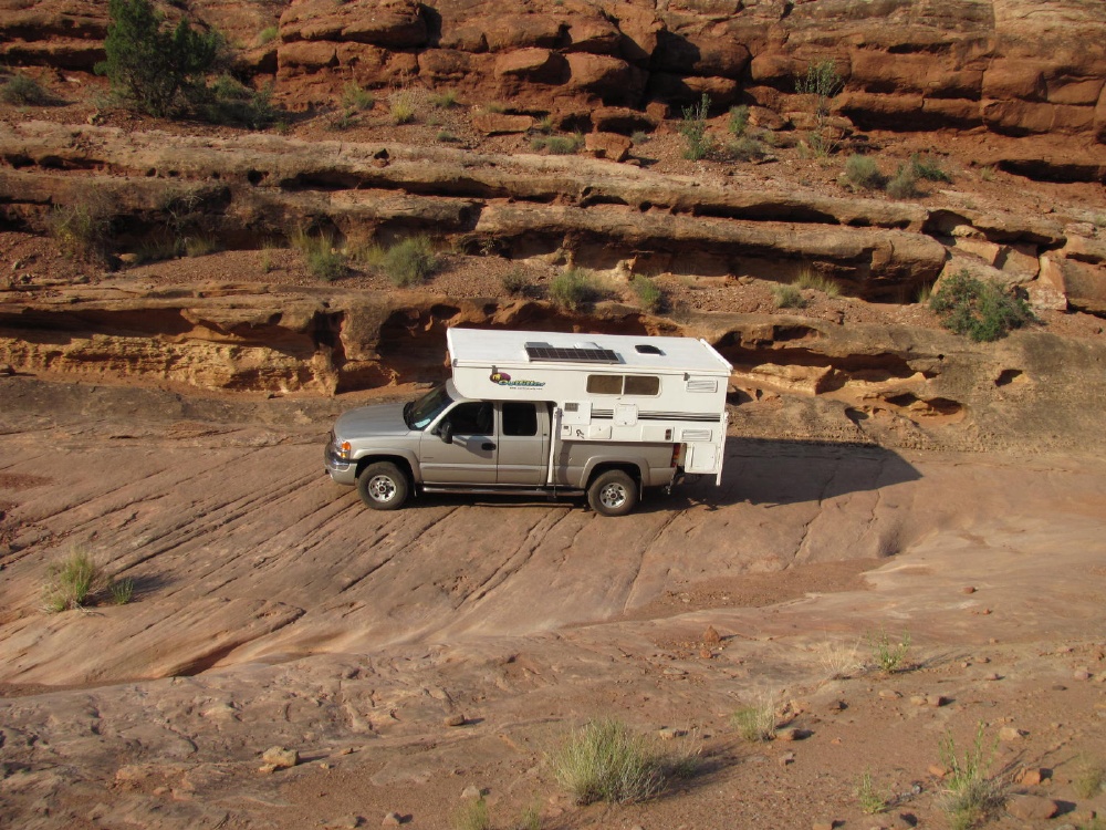
And not paved


Napoleon addressing his troops

Approaching the (in)famous 'Murphy's Hogback'

That must be it

Looks like an ordinary little hill to me


And down the other side

'The' overhang? An overhang. More than 2 feet clearance.


Good look at the Green River.

Which also has a gooseneck


This is about as rough as the road got -- so not very, if slow.


A Ford 3500 dually flatbed pumper. This is between Murphy hill and Hardscrabble hill. So how bad can the road be?.

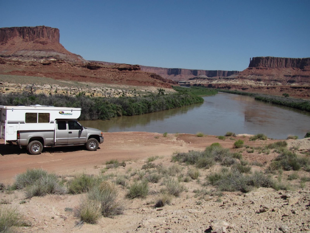
On Hardscrabble Hill

Near the top

Here's what it looks like. One turn was too tight for me. There are wide turn areas at three corners.

Pretty nice views around here

Hardscrabble B camp area - quite nice.
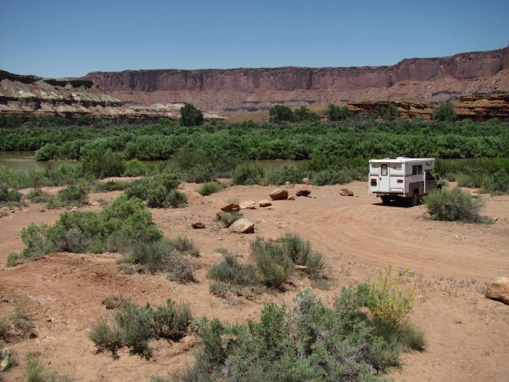
This is a big river. Lots of splashes out there, too.

Finally found the nearly hidden river access - would be better without so much Coyote Willow and Tamerisk.

The bank is steep and slippery, and the mud is very soft -- sink right in.

A little sand --
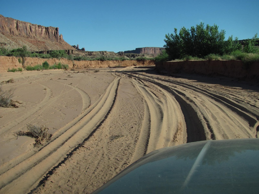
Labyrinth camp area -- near the Mineral Bottom exit. Also nice.


Wanna wind up in the Green River? Don't pay attention through here.
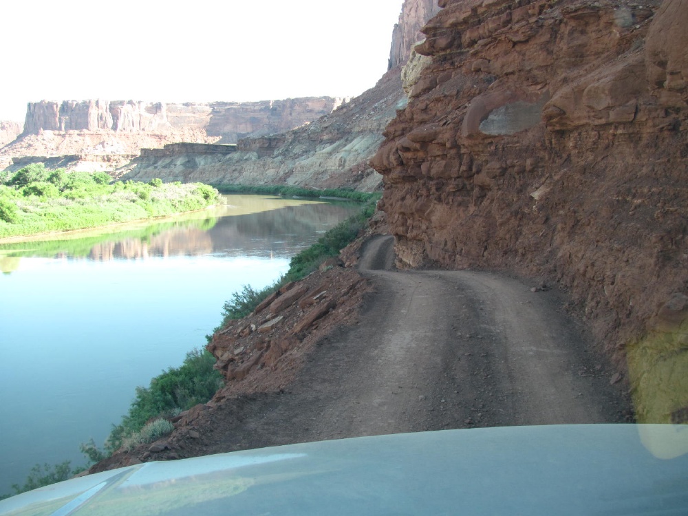
OK -- but a dually flatbed can make it.

Now come on! The road is rougher than that. Near the Mineral Bottom boat ramp turn. There were dozens of kids over there - about to start or just ended a canoe trip.

Mineral Bottom switchbacks. Had to back up here to let a van and canoe trailer by. Then wait as at least a dozen Suburbans and a few trucks pulling empty canoe trailers went by. See the bus?

That afternoon, 10000+ feet in the Manti-La Sal NF. Temp: 75 at 4:30. 25+ degrees lower than on the WRT.
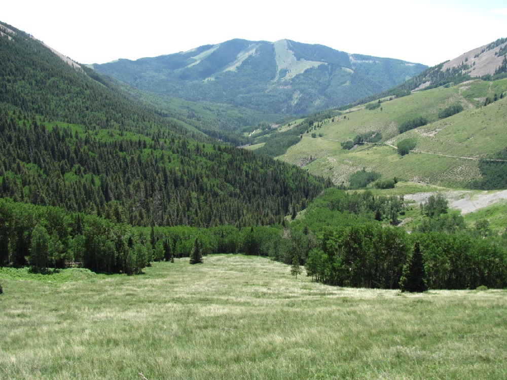
Think I'll stay here.

Stopped at Muley Point on the way home.

Panorama from Muley Point.
- Labels:
-
Truck Campers
- Mark as New
- Bookmark
- Subscribe
- Mute
- Subscribe to RSS Feed
- Permalink
- Report Inappropriate Content
Jul-13-2015 03:17 PM
Don't mean to step on any toes with my description of the road as fairly tame. Honestly, I had a little trepidation based on other descriptions of the road and the various warnings on the Canyonlands site. But I described it as I found it in the dry, uncrowded conditions I had (by plan). I said it could be much worse when wet.
For instance, currently on the Canyonlands site:
White Rim Road: open with some significant flood damage.It would also be 'undesirable' if much backing up for traffic was required in the narrow places .
Lathrop Road: impassable after two miles
UPDATE – July 13, 2015 – Recent rain events have heavily impacted certain sections of the White Rim. Significant impacts occurred mostly in wash bottoms between Murphy Hogback and Airport, including Lathrop Canyon. One occurrence of rockfall on Murphy Hogback has created a significant barrier to four-wheeled vehicles attempting to drive the White Rim in its entirety.
Bicycles: If you ride this road in the summer, you're a much better man than I -- or flat out nuts. Or both.
Narrow spots and overhangs: No, there is no bail out room. You either fit, or you back out. My camper is 7 feet wide, and the mirrors stick out to almost 9 feet. I didn't pull in the mirrors, and never touched them on any obstacles, but it was very close. As you can see in the pictures, my Apex 8 basement popup (travel height approximately 8'-9") cleared the lowest overhang by about 2 feet.
Hardside campers: As I read the TC trip reports, NedRierson78 is the only one here who has made the entire route in a hardside camper, although C.Traveler2 got close by by combining two trips and starting in different directions. Please correct if mistaken. So it can be done. The two tightest places are between Hardscrabble camp area and Mineral Bottom. So if you're concerned about making it, I'd suggest starting at Mineral Bottom, and walking the tight areas first.
Wheelbase: Obviously, shorter is better for the tight turns. My wheelbase is 143", and I had to make one 2-point turn. However, there are large turn areas at every really tight turn that I remember.
silversand wrote:And many say 'You can't slip anything by ole Silver'.
....this one slipped by me!
And finally,
67avion wrote:You are TOTALLY on your own with that situation, Sir.
I know Dear Jane would flat get out and walk back....and I'd have to go on without her ;-(
If more questions, let me know.
- Mark as New
- Bookmark
- Subscribe
- Mute
- Subscribe to RSS Feed
- Permalink
- Report Inappropriate Content
Jul-11-2015 01:40 PM
Lance 815/ 85 watts solar panel (sold)
2020 Bunduvry by BundutecUSA
Travelingman2 Photo Website
Truck Camper Trip Reports 3.0
travelingman21000 YouTube Videos
Alex and Julie's Travels Blog
- Mark as New
- Bookmark
- Subscribe
- Mute
- Subscribe to RSS Feed
- Permalink
- Report Inappropriate Content
Jul-10-2015 08:24 PM
jefe
- Mark as New
- Bookmark
- Subscribe
- Mute
- Subscribe to RSS Feed
- Permalink
- Report Inappropriate Content
Jul-10-2015 07:43 AM
A lot of forethought, it appears, went into choosing your "weather window". This made for a very smooth "expedition" through terrain that could have otherwise been a hellacious slog.
Excellent report!
S-
2004 Chevy Silverado 2500HD 4x4 6.0L Ext/LB Tow Package 4L80E Michelin AT2s| Outfitter Caribou
- Mark as New
- Bookmark
- Subscribe
- Mute
- Subscribe to RSS Feed
- Permalink
- Report Inappropriate Content
Jul-10-2015 05:35 AM
Certainly better than the view out of my office window 😉
Thanks a lot for taking me along, TR-wise!
- Mark as New
- Bookmark
- Subscribe
- Mute
- Subscribe to RSS Feed
- Permalink
- Report Inappropriate Content
Jul-09-2015 11:03 PM
Thanks for the report.
Steve.
'98 Jeep TJ 4.0
'15 Ford Fiesta ST
'09 Fiat Panda 1.2
- Mark as New
- Bookmark
- Subscribe
- Mute
- Subscribe to RSS Feed
- Permalink
- Report Inappropriate Content
Jul-09-2015 04:12 AM
- Mark as New
- Bookmark
- Subscribe
- Mute
- Subscribe to RSS Feed
- Permalink
- Report Inappropriate Content
Jul-09-2015 12:00 AM
TCinmydreams40yrs wrote:
Kinda new here, but..
Real nice!
I went to Canyonlands site and was disturbed that you can't take pets.
Darn.
Tom
Ouch. Thanks, just looked too for curiosity.
From Canyonlands website: Pets are not allowed on any hiking trails or in the backcountry, even on a boat or in a vehicle.
Guess that takes WRT off my bucket list. Shoot!
2014 Ram 3500 w/ Cummins/Aisin
2019 Northern Lite 10-2 EX CD LE Wet Bath
RV'ing since 1991
I took the road less traveled .....Now I'm Lost!
- Mark as New
- Bookmark
- Subscribe
- Mute
- Subscribe to RSS Feed
- Permalink
- Report Inappropriate Content
Jul-08-2015 12:46 PM
Real nice!
I went to Canyonlands site and was disturbed that you can't take pets.
Darn.
Tom
1997 Lance Squire 3000-My first Truck Camper
- Mark as New
- Bookmark
- Subscribe
- Mute
- Subscribe to RSS Feed
- Permalink
- Report Inappropriate Content
Jul-08-2015 08:39 AM
'04 Northstar Laredo SC
Bilsteins 5100
2014 1500 Silverado 5.3 Double Cab
1951 Chevy 3100
Formally OBXcamper
- Mark as New
- Bookmark
- Subscribe
- Mute
- Subscribe to RSS Feed
- Permalink
- Report Inappropriate Content
Jul-08-2015 07:13 AM
Thanks for posting.
- Mark as New
- Bookmark
- Subscribe
- Mute
- Subscribe to RSS Feed
- Permalink
- Report Inappropriate Content
Jul-07-2015 06:37 PM
2008 Bigfoot 25C10.4
Torklift/Fastguns/Hellwig/StableLoads
- Mark as New
- Bookmark
- Subscribe
- Mute
- Subscribe to RSS Feed
- Permalink
- Report Inappropriate Content
Jul-07-2015 04:41 PM
- Mark as New
- Bookmark
- Subscribe
- Mute
- Subscribe to RSS Feed
- Permalink
- Report Inappropriate Content
Jul-07-2015 02:55 PM
I've done it during a 3 day/2 night sojourn but know of people who have ridden it in one. I would think in a vehicle it would be tougher than on the bike, rough road.


