Turn on suggestions
Auto-suggest helps you quickly narrow down your search results by suggesting possible matches as you type.
Showing results for
- Good Sam Community
- Everything RV
- Campground 101
- Lake City Colorado Area
Options
- Subscribe to RSS Feed
- Mark Topic as New
- Mark Topic as Read
- Float this Topic for Current User
- Bookmark
- Subscribe
- Mute
- Printer Friendly Page
Lake City Colorado Area
Options
- Mark as New
- Bookmark
- Subscribe
- Mute
- Subscribe to RSS Feed
- Permalink
- Report Inappropriate Content
Aug-01-2014 11:33 AM
Trip Report Lake City CO area
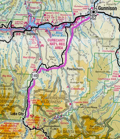
Lake City is the county seat and the only incorporated town in Hinsdale County. It is on State Highway 149 about 55 miles southwest of Gunnison. Historically Lake City began as a mining town that grew because of a toll road built by Otto Mears to service gold and silver mines in the San Juan Mountains. In 1875 it became the county seat.
A geologic history of great volcanic events resulted in the San Juan Range that grew from the many caldera which dominate the landscape. The beauty of the San Juan Range along with the San Miguel, and La Plata ranges is unquestioned.
I made the July 2014 trip with my friend, Steve, who is also a landscape enthusiast. He is a specialist in panorama photos.
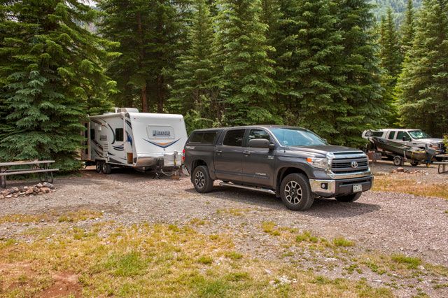
We camped at the Woodlake Park RV where the sites were not jammed together.
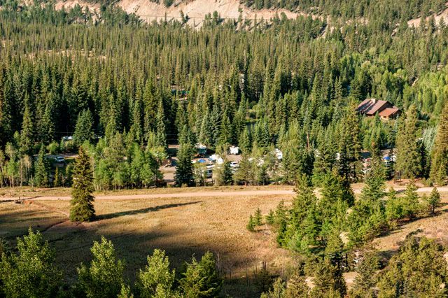
The campground sits nestled in the trees south of Lake City.
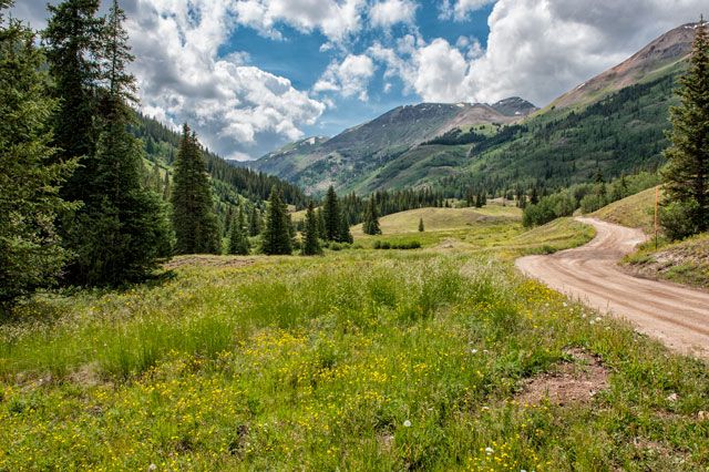
After arriving early in the afternoon we took a recon run up Cinnamon Pass.
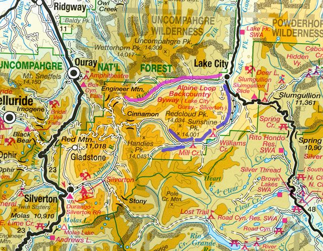
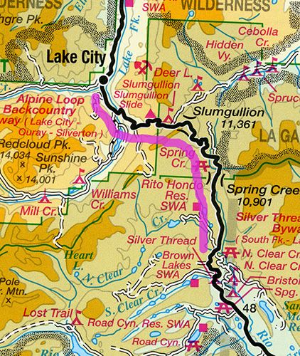
Cinnamon is the southern part of the Alpine Loop. "The Alpine Loop is generally considered to begin and end at Lake City. From there the route commonly followed is west over Cinnamon Pass to Animas Forks, and then returning east over Engineer Pass back to Lake City." High clearance vehicles are recommended."
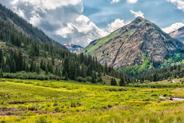
The road follows the Lake Fork of the Gunnison up to alpine tundra.
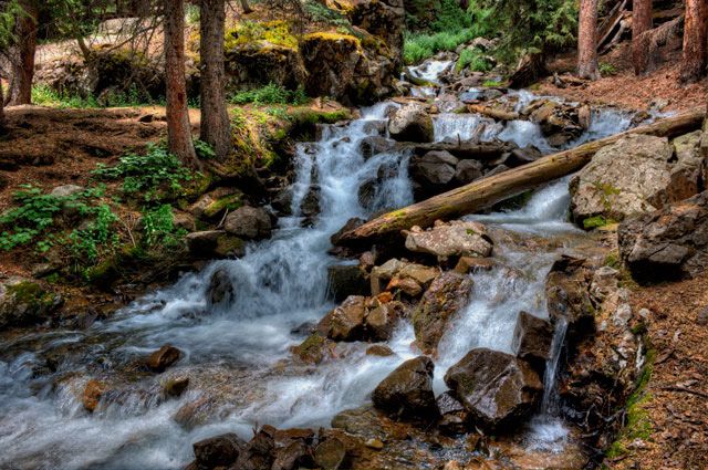
The road passes over a stream of falls grinding it's way down Edith Mountain. We thought this was Rock Creek, but later found it is unnamed on the USGS map.
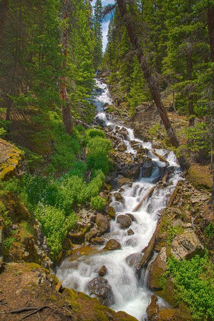
Steve made this vertical panorama shot higher up from the road.
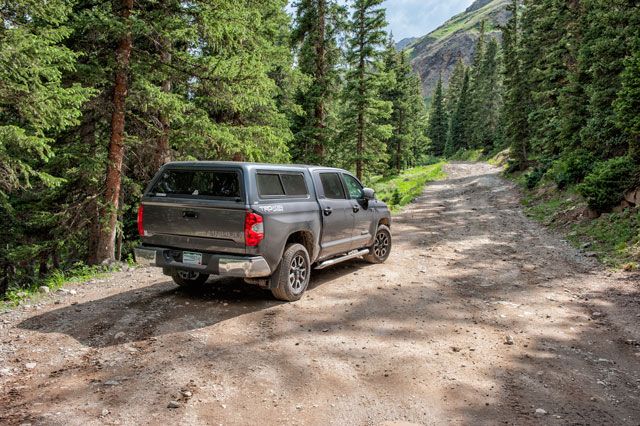
From our parking place at the falls, the road narrows.
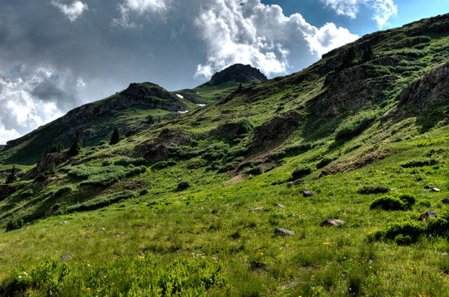
Lush green tundra is typical of the San Juan Mountains.
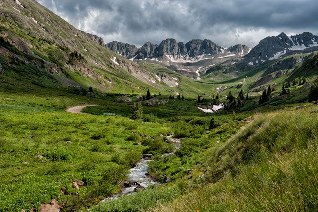
At timberline, you come to American Basin where aside road leads into it. The basin is well known for it's beauty.
We came at the recommended time for wildflowers, but the flowers missed the schedule.
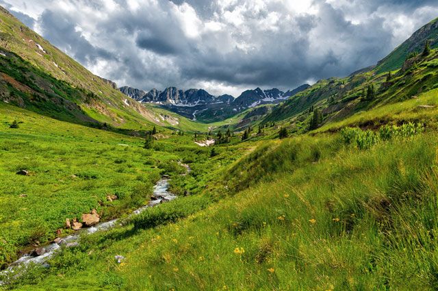
Steve's pano of American Basin looking through the shoulders of the cirque scooped by the head if a glacier.
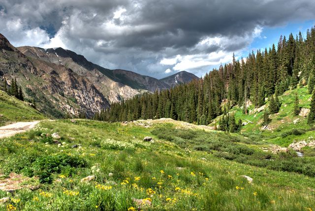
Looking east from the basin
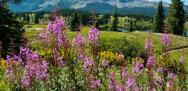
Unfortunately, Fireweed like these were not out in American Basin.
The next day we headed south on Hwy 149 to North Clear Creek Falls.
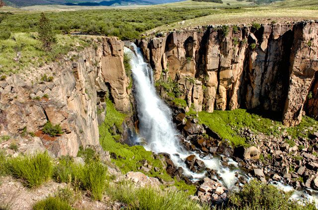
North Clear Creek Falls
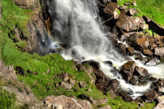
The rocks resisting erosion.
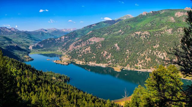
Coming down Slumgullion Pass To Lake City, Steve shot a nice pano of Lake San Cristobal. Lake San Cristobal was formed about 700 years ago when the Slumgullion Earthflow, a natural landslide, created a dam across the Lake Fork of the Gunnison River. Lake City got it's name because of the lake.
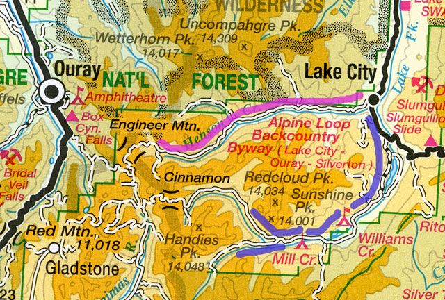
We started early in the morning to Take the Engineer Pass road up Henson Creek.
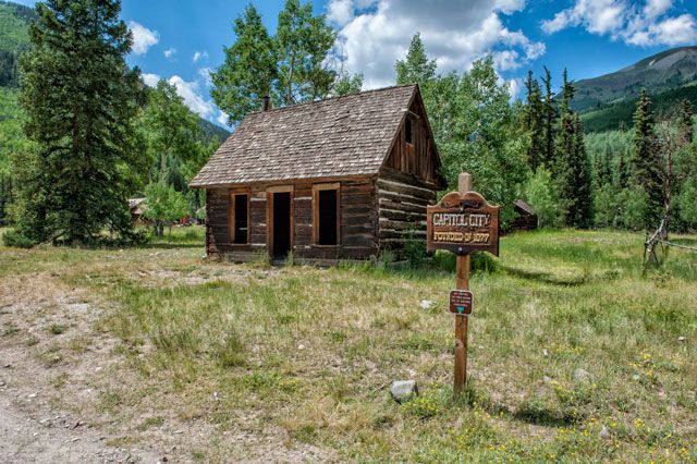
George Lee bought the 200 acre property in 1877 and called it Capitol City, and envisioned himself as Governor of Colorado.
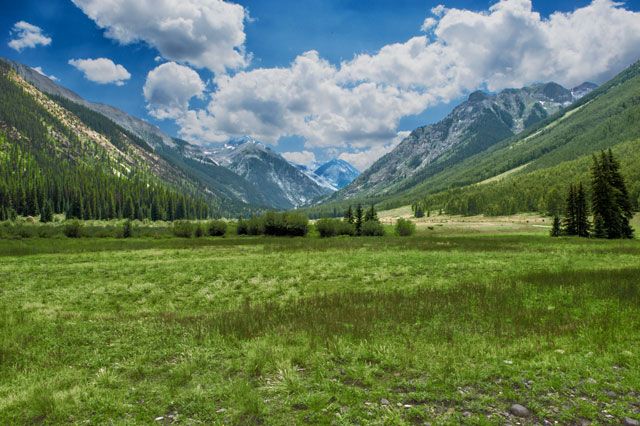
The Henson Creek Valley part of the road before ascending high region of Engineer Pass.
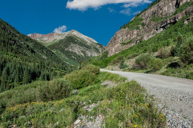
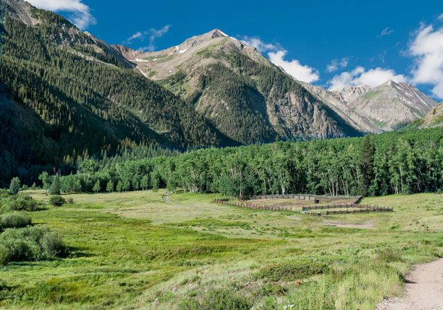
This aspen grove would be a good fall scene.
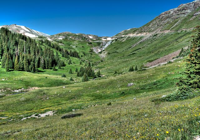
Approaching the top of the pass.
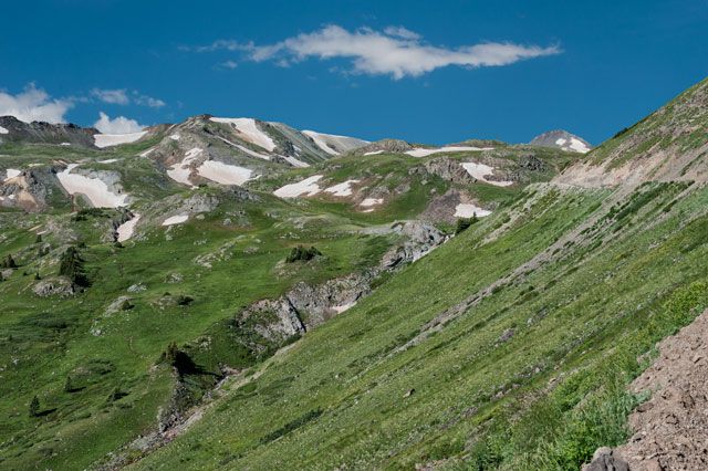
Trees are victims of elevation, 11,952 feet at this road elevation.

Steve shot this pano off the summit of Engineer Pass at 12,800 feet elevation. Looking west to the Sneffles Range.
I last viewed this scene in 1983.
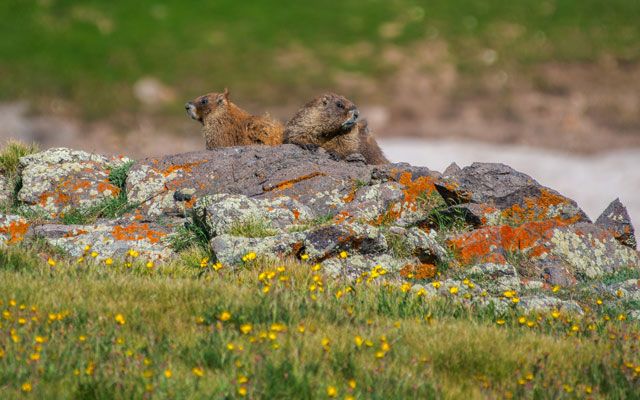
On the way back down to Lake City, Steve captured Maw and Paw Marmot watching us.
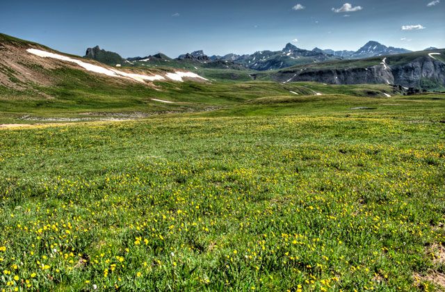
Looking north from Engineer across American Flats (12,300 feet) to the Uncompahgre Caldera and it's high peaks.
Mountains have long brought a flow of human emotions so deep as Edward Abby said they "lie closer to music than to words".
Miners cursed them. Katherine Lee Bates viewed the mountains from Pikes Peak (14,000 feet) in 1895 and conceived a poem that became the song
America The Beautiful.
Ron and Steve
Lake City is the county seat and the only incorporated town in Hinsdale County. It is on State Highway 149 about 55 miles southwest of Gunnison. Historically Lake City began as a mining town that grew because of a toll road built by Otto Mears to service gold and silver mines in the San Juan Mountains. In 1875 it became the county seat.
A geologic history of great volcanic events resulted in the San Juan Range that grew from the many caldera which dominate the landscape. The beauty of the San Juan Range along with the San Miguel, and La Plata ranges is unquestioned.
I made the July 2014 trip with my friend, Steve, who is also a landscape enthusiast. He is a specialist in panorama photos.


We camped at the Woodlake Park RV where the sites were not jammed together.

The campground sits nestled in the trees south of Lake City.

After arriving early in the afternoon we took a recon run up Cinnamon Pass.

Cinnamon is the southern part of the Alpine Loop. "The Alpine Loop is generally considered to begin and end at Lake City. From there the route commonly followed is west over Cinnamon Pass to Animas Forks, and then returning east over Engineer Pass back to Lake City." High clearance vehicles are recommended."

The road follows the Lake Fork of the Gunnison up to alpine tundra.

The road passes over a stream of falls grinding it's way down Edith Mountain. We thought this was Rock Creek, but later found it is unnamed on the USGS map.

Steve made this vertical panorama shot higher up from the road.

From our parking place at the falls, the road narrows.

Lush green tundra is typical of the San Juan Mountains.

At timberline, you come to American Basin where aside road leads into it. The basin is well known for it's beauty.
We came at the recommended time for wildflowers, but the flowers missed the schedule.

Steve's pano of American Basin looking through the shoulders of the cirque scooped by the head if a glacier.

Looking east from the basin

Unfortunately, Fireweed like these were not out in American Basin.

The next day we headed south on Hwy 149 to North Clear Creek Falls.

North Clear Creek Falls

The rocks resisting erosion.

Coming down Slumgullion Pass To Lake City, Steve shot a nice pano of Lake San Cristobal. Lake San Cristobal was formed about 700 years ago when the Slumgullion Earthflow, a natural landslide, created a dam across the Lake Fork of the Gunnison River. Lake City got it's name because of the lake.

We started early in the morning to Take the Engineer Pass road up Henson Creek.

George Lee bought the 200 acre property in 1877 and called it Capitol City, and envisioned himself as Governor of Colorado.

The Henson Creek Valley part of the road before ascending high region of Engineer Pass.


This aspen grove would be a good fall scene.

Approaching the top of the pass.

Trees are victims of elevation, 11,952 feet at this road elevation.

Steve shot this pano off the summit of Engineer Pass at 12,800 feet elevation. Looking west to the Sneffles Range.
I last viewed this scene in 1983.

On the way back down to Lake City, Steve captured Maw and Paw Marmot watching us.

Looking north from Engineer across American Flats (12,300 feet) to the Uncompahgre Caldera and it's high peaks.
Mountains have long brought a flow of human emotions so deep as Edward Abby said they "lie closer to music than to words".
Miners cursed them. Katherine Lee Bates viewed the mountains from Pikes Peak (14,000 feet) in 1895 and conceived a poem that became the song
America The Beautiful.
Ron and Steve
Clattertruck
2008 SD F450 Pickup PSD 6.4L CC 4X4 DRW, Lariat Auto trans 4.30 LS, 2013 Lance TT 1885, Toyota 2014 Tundra Crew Max 5.7.
2008 SD F450 Pickup PSD 6.4L CC 4X4 DRW, Lariat Auto trans 4.30 LS, 2013 Lance TT 1885, Toyota 2014 Tundra Crew Max 5.7.
7 REPLIES 7
Options
- Mark as New
- Bookmark
- Subscribe
- Mute
- Subscribe to RSS Feed
- Permalink
- Report Inappropriate Content
Aug-04-2014 12:50 PM
4runnerguy wrote:
We generally find American Basin peaks during the first week or so in August. Heading that direction in a couple more days.
Thanks for the tip.
Ron
Clattertruck
2008 SD F450 Pickup PSD 6.4L CC 4X4 DRW, Lariat Auto trans 4.30 LS, 2013 Lance TT 1885, Toyota 2014 Tundra Crew Max 5.7.
2008 SD F450 Pickup PSD 6.4L CC 4X4 DRW, Lariat Auto trans 4.30 LS, 2013 Lance TT 1885, Toyota 2014 Tundra Crew Max 5.7.
Options
- Mark as New
- Bookmark
- Subscribe
- Mute
- Subscribe to RSS Feed
- Permalink
- Report Inappropriate Content
Aug-04-2014 12:44 PM
We generally find American Basin peaks during the first week or so in August. Heading that direction in a couple more days.
Ken & Allison
2 Camping Cats (1 diabetic)
1996 4Runner, TRD Supercharger, Edelbrock headers
2007 Fleetwood Arcadia, Honda EU2000i
4 mountain bikes, 1 canoe, 4 tents, 8 sleeping bags, 2 backpacks
(You get the idea!)
2 Camping Cats (1 diabetic)
1996 4Runner, TRD Supercharger, Edelbrock headers
2007 Fleetwood Arcadia, Honda EU2000i
4 mountain bikes, 1 canoe, 4 tents, 8 sleeping bags, 2 backpacks
(You get the idea!)
Options
- Mark as New
- Bookmark
- Subscribe
- Mute
- Subscribe to RSS Feed
- Permalink
- Report Inappropriate Content
Aug-02-2014 08:17 AM
Thanks for the photo's. We Camped near Lake City around 20 years ago. Took a drive over Cinnamon Pass down to Animas Forks. Two things I will long remember, two men in a Honda Civic or similar vehicle going over the same road we were on. A 4-wheel drive road. We passed them several times and they passed us several times. They always said they were o.k. Then we came upon a traffic jam in the middle of the San Juan mountains. Someone in a Scout had flipped their vehicle in the middle of the road and numerous people were helping to right it. No one injured but it made for about a 2-3 hour delay. But it was delightful with the beauty of the mountains and watching them jack and winch the vehicle very carefully to an upright position. I don't think they were able to drive the Scout back down the mountain though. Those people in their jeeps with the BIG jacks and winches were great. Knew what they were doing and got it done.
Options
- Mark as New
- Bookmark
- Subscribe
- Mute
- Subscribe to RSS Feed
- Permalink
- Report Inappropriate Content
Aug-01-2014 07:39 PM
You and your friend captured the beauty of the area....beautifully! Thanks so much for sharing those photos with all of us!!!
2007 GMC Sierra SLE 3500HD Dually
2016 Coachmen Catalina Legacy Edition 243RBS
2007 Keystone Outback 25RSS - R.I.P.
2016 Coachmen Catalina Legacy Edition 243RBS
2007 Keystone Outback 25RSS - R.I.P.
Options
- Mark as New
- Bookmark
- Subscribe
- Mute
- Subscribe to RSS Feed
- Permalink
- Report Inappropriate Content
Aug-01-2014 05:25 PM
Beautiful photos of a very beautiful area. Thanks for sharing.
2015 Fleetwood Excursion 33D
2016 Grand Cherokee Limited
Retired Law Enforcement
U.S. Army 1965-1973/RVN 1968-'69
I am the frequent recipient of "Get out of the way old man!"
2016 Grand Cherokee Limited
Retired Law Enforcement
U.S. Army 1965-1973/RVN 1968-'69
I am the frequent recipient of "Get out of the way old man!"
Options
- Mark as New
- Bookmark
- Subscribe
- Mute
- Subscribe to RSS Feed
- Permalink
- Report Inappropriate Content
Aug-01-2014 02:38 PM
Thanks for sharing the photo's -- was flying home yesterday and picked out Lizard Head Pass and Lake City from the air, truly one of my favorite spots in all the US.
Looked like you had a great trip on the Alpine Loop.
BOL,
Looked like you had a great trip on the Alpine Loop.
BOL,
Busskipper
Maryland/Colorado
Travel Supreme 42DS04
GX470-FMCA - Travel less now - But still love to be on the Road
States traveled in this Coach

Maryland/Colorado
Travel Supreme 42DS04
GX470-FMCA - Travel less now - But still love to be on the Road
States traveled in this Coach

Options
- Mark as New
- Bookmark
- Subscribe
- Mute
- Subscribe to RSS Feed
- Permalink
- Report Inappropriate Content
Aug-01-2014 01:22 PM
Thanks for a wonderful trip report from one of my favorite Colorado spots.


