Turn on suggestions
Auto-suggest helps you quickly narrow down your search results by suggesting possible matches as you type.
Showing results for
- Good Sam Community
- Everything RV
- RV Must Haves
- Re: what can I get
Options
- Subscribe to RSS Feed
- Mark Topic as New
- Mark Topic as Read
- Float this Topic for Current User
- Bookmark
- Subscribe
- Mute
- Printer Friendly Page
what can I get
Options
- Mark as New
- Bookmark
- Subscribe
- Mute
- Subscribe to RSS Feed
- Permalink
- Report Inappropriate Content
Feb-16-2018 03:08 PM
I use to use Delorme hooked to a GPS but they are no more. Is there any other good comparable, and reasonable priced, off line mapping programs that can connect to a GPS like Delorme had.
16 REPLIES 16
Options
- Mark as New
- Bookmark
- Subscribe
- Mute
- Subscribe to RSS Feed
- Permalink
- Report Inappropriate Content
Mar-19-2018 01:44 PM
RLS7201 wrote:
Delorme Street Atlas USA is Windows software. 2015 being the last published version. The OP is looking for replacement software for his laptop. I too would like to find windows based mapping software that is up to date. Much easier looking at a laptop screen on the dash of my MH, then looking at a small screen GPS or phone. And no data required. With my mouse on the dog house center console, I can zoom with out distraction.
Richard
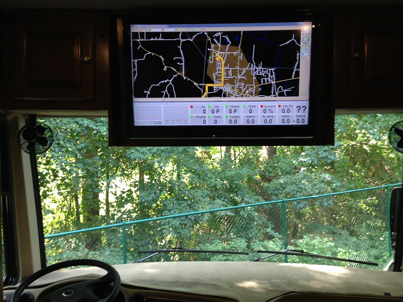
I'm still using Street Atlas as my GPS. Roads change but not that often. I'm like you I like a larger screen. I'm using my front overhead 40 inch HGTV as my monitor. My wife controls everything with a wireless keyboard with built in mouse.
I like to plan all fuel stops, WalMart stops, POI stops and overnight stops for every trip we do. Typically our trips are a few thousand miles. Street Atlas is the only software I have found that can do this. I've tried Co-Pilot for Windows. It's worthless, I rather us a paper map.
2012 Phaeton 40QBH
2015 Jeep Cherokee
SMI Air Force One
Retired USAF - CEVG and AFTAC
Member of Tiffin RV Network Forum
2015 Jeep Cherokee
SMI Air Force One
Retired USAF - CEVG and AFTAC
Member of Tiffin RV Network Forum
Options
- Mark as New
- Bookmark
- Subscribe
- Mute
- Subscribe to RSS Feed
- Permalink
- Report Inappropriate Content
Mar-04-2018 04:03 PM
All the talk about safety is a known number one priority and a larger computer screen easier to glance at then adjusting your eyes to a small gps device or smart phone. But as i am driving down the road my wife reads the directions and the computer also has voice directions. We also have a gps but cannot program a route of our preference like we can on the computer nor can we find something a little further out because the gps just shows a small area. I guess if you only plan on going to what you program in if you know it and not see anything else you can just follow gps but I have had a gps give wrong directions when i am sitting there looking at my destination.
Options
- Mark as New
- Bookmark
- Subscribe
- Mute
- Subscribe to RSS Feed
- Permalink
- Report Inappropriate Content
Feb-20-2018 05:37 AM
When towing I always stick the GPS to the rear view mirror. It's useless anyways and my eyes are use to scanning up there once in a while.
Options
- Mark as New
- Bookmark
- Subscribe
- Mute
- Subscribe to RSS Feed
- Permalink
- Report Inappropriate Content
Feb-20-2018 04:56 AM
I was rear-ended and shoved into the vehicle in front of me (we were waiting in on the approach to an entrance ramp) and the vehicle was totaled although less than one year old. The driver was distracted by their GPS which they immediately admitted. Taking your eyes off the road for any reason is dangerous. Fortunately in this case, no one was injured.
David & Margaret - 2005 LTV 210B 3S
- Our Blog -
- Our Blog -
Options
- Mark as New
- Bookmark
- Subscribe
- Mute
- Subscribe to RSS Feed
- Permalink
- Report Inappropriate Content
Feb-19-2018 07:49 PM
Bill.Satellite wrote:
YOU CANNOT use a mouse and not take your eyes off the road. You MUST look at the screen and that requires taking your eyes off the road. The mouse is a GREAT option as long as the passenger is the one using it. While GPS units are great, they can all also be considered a distraction if you are looking at the screen. I nearly got in an accident when I was trying to locate a POI and the traffic ahead came to an unexpected stop. That GPS was located almost directly in front of me and I still missed the stopped traffic (thanks Janet!).
But Bill, you CAN NOT use any on screen guidance device with out looking at it. But yes, I can scroll the the mouse wheel with out taking my off the road. IE Scroll a few clicks, move eyes to see the screen. Geesh!
Richard
95 Bounder 32H F53 460
2013 CRV Toad
2 Segways in Toad
First brake job
1941 Hudson
2013 CRV Toad
2 Segways in Toad
First brake job
1941 Hudson
Options
- Mark as New
- Bookmark
- Subscribe
- Mute
- Subscribe to RSS Feed
- Permalink
- Report Inappropriate Content
Feb-19-2018 02:57 PM
For me it's a voice guidance only.
Anything that needs use of my hands, should be done through tactile response without looking, like adjusting the heater toggle etc.
It's interesting that higher pitch female voice in smartphone navigator is better heard over the ambient noise than male voice. Must be the nature planned it this way - the need to get noticed 🙂
Options
- Mark as New
- Bookmark
- Subscribe
- Mute
- Subscribe to RSS Feed
- Permalink
- Report Inappropriate Content
Feb-18-2018 03:22 AM
YOU CANNOT use a mouse and not take your eyes off the road. You MUST look at the screen and that requires taking your eyes off the road. The mouse is a GREAT option as long as the passenger is the one using it. While GPS units are great, they can all also be considered a distraction if you are looking at the screen. I nearly got in an accident when I was trying to locate a POI and the traffic ahead came to an unexpected stop. That GPS was located almost directly in front of me and I still missed the stopped traffic (thanks Janet!).
What I post is my 2 cents and nothing more. Please don't read anything into my post that's not there. If you disagree, that's OK.
Can't we all just get along?
Can't we all just get along?
Options
- Mark as New
- Bookmark
- Subscribe
- Mute
- Subscribe to RSS Feed
- Permalink
- Report Inappropriate Content
Feb-17-2018 05:19 PM
The only system that provides almost no distraction while driving, is a voice guidance with pre-planned route that you've already loaded into your device.
You can use a mouse without taking eyes off the road, but you need to take eyes off the road to see WHERE you are moving that mouse.
About Copilot - I used it in free smartphone version and wasn't too thrilled. Besides, it let me down by disabling the most needed feature - voice guidance. Nowhere in the description it said that the free version was voiceless, there even was a test of voice, like in a real thing - only it didn't work on the road. Instead, it displayed a message suggesting to buy their paid version - very nice, when you're on the road without data connection 🙂
Options
- Mark as New
- Bookmark
- Subscribe
- Mute
- Subscribe to RSS Feed
- Permalink
- Report Inappropriate Content
Feb-17-2018 11:06 AM
Bill.Satellite wrote:
Using a mouse would be quite a distraction if you are the driver! You can get a very nice Android tablet in the 8-10" range for much less than a similar sized GPS would cost and you will have full access to mapping programming plus the added benefit of 1000's more POI's. No cellular signal is required while traveling as you simply download the maps during your planning sessions. When you do have cellular (nearly all of the time) you will also have live traffic data along the way. I tracked usage from both Google Maps and WAZE and the total data on a 250 mile drive was something like 15-25 MB (basically nothing).
If you can't use a mouse with out taking your eyes off the road, then don't. With zooming most guidance system you will have to take a hand off the wheel. Street Atlas USA does have a voice function, which I never set up. Why use a 8-10" tablet when a 16" laptop screen is available. Install software one and be done with it.
Richard
95 Bounder 32H F53 460
2013 CRV Toad
2 Segways in Toad
First brake job
1941 Hudson
2013 CRV Toad
2 Segways in Toad
First brake job
1941 Hudson
Options
- Mark as New
- Bookmark
- Subscribe
- Mute
- Subscribe to RSS Feed
- Permalink
- Report Inappropriate Content
Feb-17-2018 08:20 AM
I have to agree with Matt. While Delorme's Street Atlas had a somewhat steep learning curve, it included many features that are not available on any other software. I was hoping that when Garmin bought them, they would end up with a product that combined the best features of both companies, but instead, they just killed Delorme.
While I often see posts describing software that is "just as good", I have to believe that the posters have never used Street Atlas to plan a trip. While there are many GPS based mapping devices that will get you from here to there, none that I've found can plot a long trip on non interstates. Street Atlas is sorely missed.
While I often see posts describing software that is "just as good", I have to believe that the posters have never used Street Atlas to plan a trip. While there are many GPS based mapping devices that will get you from here to there, none that I've found can plot a long trip on non interstates. Street Atlas is sorely missed.
Options
- Mark as New
- Bookmark
- Subscribe
- Mute
- Subscribe to RSS Feed
- Permalink
- Report Inappropriate Content
Feb-17-2018 06:15 AM
Now days I use Google Maps on my phone easier than a PC program
Co-Pilot is about the best RVers PC program from what I understand, but it is not cheap being as it is designed for commercial drivers so the Trucker version avoids low bridges and other "issue" locations. also tells you where the truckers stop for lunch and such.
Co-Pilot is about the best RVers PC program from what I understand, but it is not cheap being as it is designed for commercial drivers so the Trucker version avoids low bridges and other "issue" locations. also tells you where the truckers stop for lunch and such.
Home was where I park it. but alas the.
2005 Damon Intruder 377 Alas declared a total loss
after a semi "nicked" it. Still have the radios
Kenwood TS-2000, ICOM ID-5100, ID-51A+2, ID-880 REF030C most times
2005 Damon Intruder 377 Alas declared a total loss
after a semi "nicked" it. Still have the radios
Kenwood TS-2000, ICOM ID-5100, ID-51A+2, ID-880 REF030C most times
Options
- Mark as New
- Bookmark
- Subscribe
- Mute
- Subscribe to RSS Feed
- Permalink
- Report Inappropriate Content
Feb-17-2018 06:02 AM
Dear G1g,
The simple answer is NO.....
In three solid years of searching, I have found no replacement.
Everything except CoPilot are on-line apps.
If you go the places we go (even carrying wire and a 3w repreater) on-line is off-line too much of the time to be counted on.
CoPilot will read your GPS and give you a "You are Here", and chart your progress along the laid out route. But I have not been able to get it to accept POI entries and project End of Day or recommend fuel stops. And those are the two things I valued most about SA. A one time cost of 20$ is supposed to get you continues upgrades of road data. I have not tried to transfer the plan to a stand-alone GPS - Yet.
An On-line that has promise is at Furkot. This has a steep learning curve, and it is nearly as powerful as SA, but you have to dig through the help files as many of the best features are almost easter eggs.
RV Trip Planner is only good if you want to stop at places that they recommend. It is 40$ to find out what it can do.
As I sit at my keyboard, I am trying to remember all that I have investigated. I should have made notes. There are more than a few, but that On-line thing is an instant killer for us.
I have badgered both Garmin and Google about this, but I fear that they do not see any market potential here. I find that kind of a surprise with the RV market as big as it is.
If you should happen to discover something, please come back here and tell us.
Matt
If you should discover an actual
Matt & Mary Colie
A sailor, his bride and their black dogs (one dear dog is waiting for us at the bridge) going to see some dry places that have Geocaches in a coach made the year we married.
A sailor, his bride and their black dogs (one dear dog is waiting for us at the bridge) going to see some dry places that have Geocaches in a coach made the year we married.
Options
- Mark as New
- Bookmark
- Subscribe
- Mute
- Subscribe to RSS Feed
- Permalink
- Report Inappropriate Content
Feb-17-2018 03:01 AM
Using a mouse would be quite a distraction if you are the driver! You can get a very nice Android tablet in the 8-10" range for much less than a similar sized GPS would cost and you will have full access to mapping programming plus the added benefit of 1000's more POI's. No cellular signal is required while traveling as you simply download the maps during your planning sessions. When you do have cellular (nearly all of the time) you will also have live traffic data along the way. I tracked usage from both Google Maps and WAZE and the total data on a 250 mile drive was something like 15-25 MB (basically nothing).
What I post is my 2 cents and nothing more. Please don't read anything into my post that's not there. If you disagree, that's OK.
Can't we all just get along?
Can't we all just get along?
Options
- Mark as New
- Bookmark
- Subscribe
- Mute
- Subscribe to RSS Feed
- Permalink
- Report Inappropriate Content
Feb-16-2018 06:20 PM
Delorme Street Atlas USA is Windows software. 2015 being the last published version. The OP is looking for replacement software for his laptop. I too would like to find windows based mapping software that is up to date. Much easier looking at a laptop screen on the dash of my MH, then looking at a small screen GPS or phone. And no data required. With my mouse on the dog house center console, I can zoom with out distraction.
Richard
Richard
95 Bounder 32H F53 460
2013 CRV Toad
2 Segways in Toad
First brake job
1941 Hudson
2013 CRV Toad
2 Segways in Toad
First brake job
1941 Hudson
Related Content


