Turn on suggestions
Auto-suggest helps you quickly narrow down your search results by suggesting possible matches as you type.
Showing results for
- Good Sam Community
- Groups
- Bucket List Trips
- Forum
- Grand Canyon Village to Moab
Options
- Subscribe to RSS Feed
- Mark Topic as New
- Mark Topic as Read
- Float this Topic for Current User
- Bookmark
- Subscribe
- Mute
- Printer Friendly Page
Grand Canyon Village to Moab
Options
- Mark as New
- Bookmark
- Subscribe
- Mute
- Subscribe to RSS Feed
- Permalink
- Report Inappropriate Content
Jul-28-2014 06:05 PM
During my initial planning for our upcoming trip, I used the Trip Planner on the Good Sam web site. For the segment from the Grand Canyon Village to Moab, it has us heading east on Rt 64 to 89 N. However, I just entered the trip on Garmin's BaseCamp, and it routed us from Grand Canyon Village, south on Rt 64 to I-40 East, and then Rt 89 N from I-40. The travel time for that route was about 1.5 hours longer than the route the GoodSam planner came up with. When I added a waypoint to force BaseCamp to take us out on 64 East to 89, it shows the trip taking significantly longer.
I have Basecamp set to RV mode. Is route 64 East out of Grand Canyon Village significantly slower due to terrain, road conditions, etc? I'm wondering why BaseCamp is saying the best route is the longer route.
Thanks,
Doug
2013 Camplite 21BHS Trailer, Ram 1500 Tow Vehicle
I have Basecamp set to RV mode. Is route 64 East out of Grand Canyon Village significantly slower due to terrain, road conditions, etc? I'm wondering why BaseCamp is saying the best route is the longer route.
Thanks,
Doug
2013 Camplite 21BHS Trailer, Ram 1500 Tow Vehicle
Labels:
- Labels:
-
Roads and Routes
7 REPLIES 7
Options
- Mark as New
- Bookmark
- Subscribe
- Mute
- Subscribe to RSS Feed
- Permalink
- Report Inappropriate Content
Jul-29-2014 06:55 AM
Hate to be a "been there done that many times" but we have. The 64 east to 89 is just great. And pulloffs to gawk at things as well.
On edit. Even with all this great technology out there, you can now understand why I love the Forums!
On edit. Even with all this great technology out there, you can now understand why I love the Forums!
Barbara-DW 55 years
Sadie-"Aussie" Terrier
06 Mobile Suites 32TK3
06 Chev 3500 4x4 Dmax
20 yrs PT RVing - 190 RV parks; some many times

Sadie-"Aussie" Terrier
06 Mobile Suites 32TK3
06 Chev 3500 4x4 Dmax
20 yrs PT RVing - 190 RV parks; some many times
Options
- Mark as New
- Bookmark
- Subscribe
- Mute
- Subscribe to RSS Feed
- Permalink
- Report Inappropriate Content
Jul-29-2014 05:57 AM
Yumm! Din Din. Just joking, I gave up hunting a long time ago due to lack of time to do it. I sure miss all those roasts my cement finisher would bring us from his hunts in CO. A couple of years ago the crews in the Village were planting new local plants around the visitors center. The elk were coming in about sunset and eating everything in the planters. Even they prefer native plants.
The route by the way is really interesting, I never tire of how the whole West can change in appearance from breakfast through sunset. Sometimes it can get a little windy over there but all I do is slow down and relax. Here is hoping we get some of rain we have missed in the last seven years. Powell needs it as does the folks on the South Rim.
Dave and Sharon
Grand Canyon Association Members
"I travel not to go anywhere, but to go. I travel for travel's sake. The great affair is to go". R. L. Stevenson
David Bishop
2002 Winnebago Adventurer 32V
2009 GMC Canyon
Roadmaster 5000
BrakeBuddy Classic II
David Bishop
2002 Winnebago Adventurer 32V
2009 GMC Canyon
Roadmaster 5000
BrakeBuddy Classic II
Options
- Mark as New
- Bookmark
- Subscribe
- Mute
- Subscribe to RSS Feed
- Permalink
- Report Inappropriate Content
Jul-29-2014 05:37 AM
Just drove that exact route two weeks ago. 64 east to 89 is fine. Garmin probably doesn't like it because it's through the park and has a lower speed limit. One or two steep grades (downhill), but otherwise an easy route. Just be on the lookout for idiots stopped in the middle of the road looking at elk.
We saw this guy right on 64, about 4 miles east of GCV.
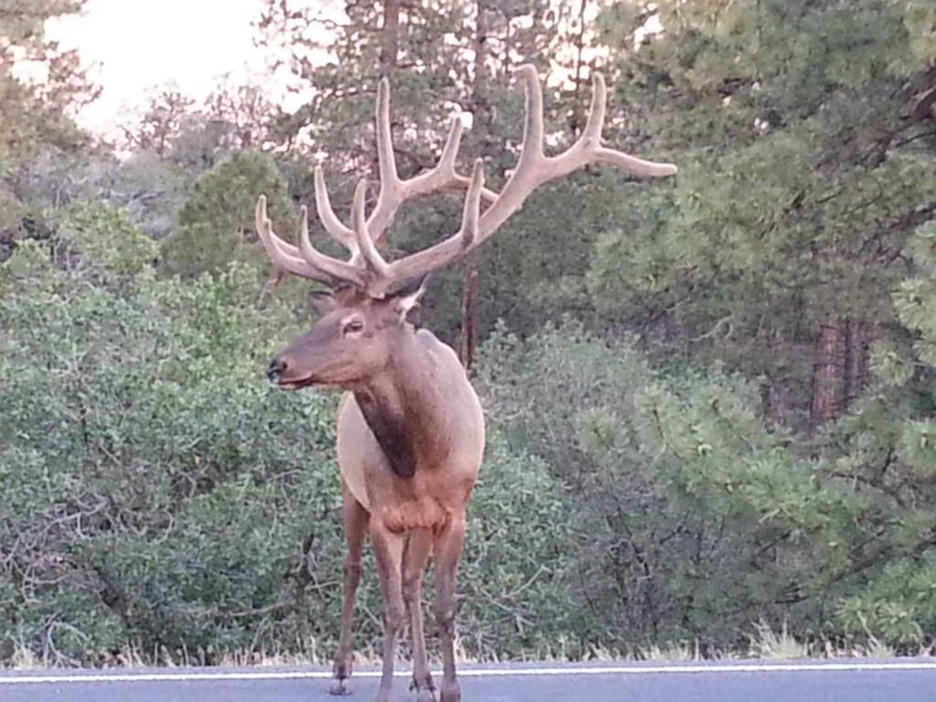
We saw this guy right on 64, about 4 miles east of GCV.
2008 Suburban 2500 3LT 3.73 4X4 "The Beast"
2013 Springdale 303BHS, 8620 lbs
2009 GMC Sierra 1500 Denali (backup TV, hot rod)
2016 Jeep JKU Sahara in Tank, 3.23 (hers)
2010 Jeep JKU Sahara in Mango Tango PC, 3.73 (his)
2013 Springdale 303BHS, 8620 lbs
2009 GMC Sierra 1500 Denali (backup TV, hot rod)
2016 Jeep JKU Sahara in Tank, 3.23 (hers)
2010 Jeep JKU Sahara in Mango Tango PC, 3.73 (his)
Options
- Mark as New
- Bookmark
- Subscribe
- Mute
- Subscribe to RSS Feed
- Permalink
- Report Inappropriate Content
Jul-28-2014 08:40 PM
64 east to 89 is the way to go. We've done it a few times. No big deal.
Full-Timed for 16 Years
.... Back in S&B Again
Traveled 8 yr in a 40' 2004 Newmar Dutch Star Motorhome
& 8 yr in a 33' Travel Supreme 5th Wheel
.... Back in S&B Again
Traveled 8 yr in a 40' 2004 Newmar Dutch Star Motorhome
& 8 yr in a 33' Travel Supreme 5th Wheel
Options
- Mark as New
- Bookmark
- Subscribe
- Mute
- Subscribe to RSS Feed
- Permalink
- Report Inappropriate Content
Jul-28-2014 06:33 PM
We've driven 64 east to 89 and vice-versa several times. Its a perfectly fine highway. We always enjoy stopping at the Cameron Trading Post.
06 RAM 3500,Dually,CTD,Auto(ATS Stage 1),QC,4X4,PacBrake,Spyntec Freespin Hubs,60 Gal Titan Tank,EFI Live, Line-X,Torklifts and SuperHitch,Fastguns
2013 Arctic Fox 990, 275 Watts Solar, 2 Grp 31 AGMs
US Navy 1964-1968, 2-Tour Vietnam Vet
2013 Arctic Fox 990, 275 Watts Solar, 2 Grp 31 AGMs
US Navy 1964-1968, 2-Tour Vietnam Vet
Options
- Mark as New
- Bookmark
- Subscribe
- Mute
- Subscribe to RSS Feed
- Permalink
- Report Inappropriate Content
Jul-28-2014 06:24 PM
dahkota wrote:
some pics of the route
Can't tell you why the Garmin wants to avoid it, unless it doesn't consider it a state road (rather, a park road) and so assumes the speed limit is lower than it is.
I've driven the road - no big deal... Google maps shows that section as 55 miles and 1.25 hours - that includes the GC congested area.
This is exactly what I needed. Thanks!
Doug
2013 Camplite 21BHS Trailer, Ram 1500 Tow Vehicle
Options
- Mark as New
- Bookmark
- Subscribe
- Mute
- Subscribe to RSS Feed
- Permalink
- Report Inappropriate Content
Jul-28-2014 06:15 PM
some pics of the route
Can't tell you why the Garmin wants to avoid it, unless it doesn't consider it a state road (rather, a park road) and so assumes the speed limit is lower than it is.
I've driven the road - no big deal... Google maps shows that section as 55 miles and 1.25 hours - that includes the GC congested area.
2015 Jeep Willys Wrangler
2014 Fleetwood Bounder 33C
States camped: all but Hawaii
more than 1700 days on the road
2014 Fleetwood Bounder 33C
States camped: all but Hawaii
more than 1700 days on the road


