- Good Sam Community
- Everything RV
- Campground 101
- Re: ~Post your campsite photos here~
- Subscribe to RSS Feed
- Mark Topic as New
- Mark Topic as Read
- Float this Topic for Current User
- Bookmark
- Subscribe
- Mute
- Printer Friendly Page
~Post your campsite photos here~
- Mark as New
- Bookmark
- Subscribe
- Mute
- Subscribe to RSS Feed
- Permalink
- Report Inappropriate Content
Feb-26-2006 11:21 AM
If you have recently posted photos of this sort, please re-post them here. If you have new ones to share, please do!
Don't forget to label the photos: Campground name, site #'s if you know them, area of campground, etc.
Picture Posting Help
**A photo width of 500 works really well.
I am taking the liberty of copying here some recent photos submitted by member 'marites62'.
Fishing Bridge - This is site 60 in the B loop - back-in, full hookups (It can be tough for long trailers and 5th wheels):

More of the same site:


Colter Bay Village - This is site 40, Pull through, full hookups. It is at the end of the loop which was nice.

More of the same site:


Thanks,
Sandi (Moderator)
- Mark as New
- Bookmark
- Subscribe
- Mute
- Subscribe to RSS Feed
- Permalink
- Report Inappropriate Content
Dec-04-2011 01:50 PM
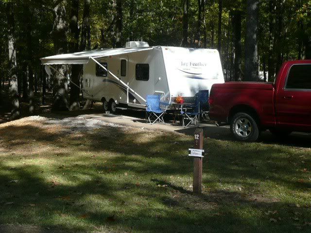
# 12 George Cossar State Park at Enid Lake in MS. It was Halloween weekend and the campground was packed. This site was not on the water. All the sites in this loop (Yocona) have water,elec & sewer. There is a bathouse with hot showers. Nice mature trees everywhere. I think we paid $20.
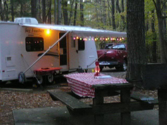
Wall Doxey State Park just south of Holly Springs MS. All of the sites in the newer back campground are heavily wooded. Sites have water & elec. There is a dump station. Clean bathouse with hot showers and the water pressure will blast your skin off. There is a lake in the park but not in the campground. I think we paid $18.
Love looking at everyone's pics! I am going to start a wishlist file of places to go camping.
We Would Rather Be Camping
- Mark as New
- Bookmark
- Subscribe
- Mute
- Subscribe to RSS Feed
- Permalink
- Report Inappropriate Content
Dec-04-2011 07:22 AM
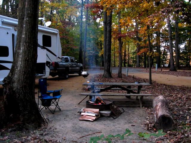
Power only, lots of sites suitable for large rigs. We use this park often as our just after pickup from storage & last stop before storage park. All sites heavily treed, all flat, all enough separation room to be comphy.
Bukhrn, There are not many Deadhorse sites suitable for larger units. We had to overhang, unable to use stabilizers at the back, to have room for the truck unhitched. Minor inconveience. Well worth it. Sites are well spaced. There is an empty right in front of us. Our site is one of the highest in the CG hence the spectacular view.
40+ night per year overnighter
2007 Alpenlite 34RLR
2006 Chevy 3500 LT, CC,LB 6.6L Diesel
Ham Radio: VP9KL, IRLP node 7995
- Mark as New
- Bookmark
- Subscribe
- Mute
- Subscribe to RSS Feed
- Permalink
- Report Inappropriate Content
Dec-03-2011 08:40 PM

Back of site, lots of pine needles on ground because it stormed really bad the night before, usually the sites are very clean.

Front of site. The site opens up about where the front of the trailer is, there is a nice cement pad w/ a picnic table behind the bushes.

Concrete pad area:

2014 Palomino Sabre 34REQS -
2011 Crossroads Zinger ZT26BL - sold in 2014
- Mark as New
- Bookmark
- Subscribe
- Mute
- Subscribe to RSS Feed
- Permalink
- Report Inappropriate Content
Dec-03-2011 08:17 AM
Veebyes wrote:Now THATS what I call privacy !!
Dead Horse State Park, Utah
Don't remember site # but all of them are good. Arrive with full water tank.
Stunning stary nights.
2014 Ford Focus
Zamboni, Long Haired Mini Dachshund
- Mark as New
- Bookmark
- Subscribe
- Mute
- Subscribe to RSS Feed
- Permalink
- Report Inappropriate Content
Dec-03-2011 06:02 AM
Dave & Renee plus (Champ, Molly, Paris, Missy, and Maggie in spirit), Mica, Mabel, and Melton
- Mark as New
- Bookmark
- Subscribe
- Mute
- Subscribe to RSS Feed
- Permalink
- Report Inappropriate Content
Dec-02-2011 06:22 PM
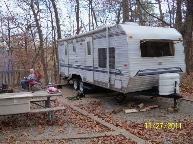
Indian Springs State Park, Flovilla GA, site number #43
2016 Jay Flight 27RLS
- Mark as New
- Bookmark
- Subscribe
- Mute
- Subscribe to RSS Feed
- Permalink
- Report Inappropriate Content
Dec-02-2011 05:52 PM
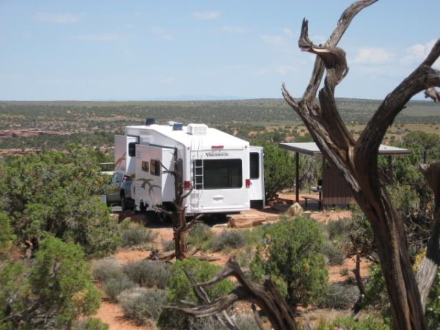
Don't remember site # but all of them are good. Arrive with full water tank.
Stunning stary nights.
40+ night per year overnighter
2007 Alpenlite 34RLR
2006 Chevy 3500 LT, CC,LB 6.6L Diesel
Ham Radio: VP9KL, IRLP node 7995
- Mark as New
- Bookmark
- Subscribe
- Mute
- Subscribe to RSS Feed
- Permalink
- Report Inappropriate Content
Dec-02-2011 11:03 AM
nandj wrote:
Catalina State Park - Tucson taken in November 2011.
One of our all-time favorite campgrounds!
- Mark as New
- Bookmark
- Subscribe
- Mute
- Subscribe to RSS Feed
- Permalink
- Report Inappropriate Content
Dec-02-2011 09:02 AM
This is a nice state park.
Most sites have water and electric. A few are without hookups.
It's very close to civilization but was quiet.
Sites and loops are paved.
The camping areas are on a very flat area of savannah grasslands with a scattering of mostly mesquite trees.
The Santa Catalina Mountains provide the background.
Loop A, which we prefer, has a more natural look.
Loop B has the feel of an RV park because the vegetation is kept cut down, and the sites are more in a straight row.
Our site, #A40:
GPS Coordinates: 32.42493, -110.92459
Neil & JoAnn
2017 Thor Compass 23TR
- Mark as New
- Bookmark
- Subscribe
- Mute
- Subscribe to RSS Feed
- Permalink
- Report Inappropriate Content
Nov-23-2011 01:40 PM
RetiredBob wrote:nandj wrote:
Below are campground pictures from southern California we took in late October 2011.
That's the kind of campground/campsite description I wish everyone would post. Thanks.
You're welcome. I always try to give a mini-description and review.
Regards,
Neil
Neil & JoAnn
2017 Thor Compass 23TR
- Mark as New
- Bookmark
- Subscribe
- Mute
- Subscribe to RSS Feed
- Permalink
- Report Inappropriate Content
Nov-23-2011 06:20 AM
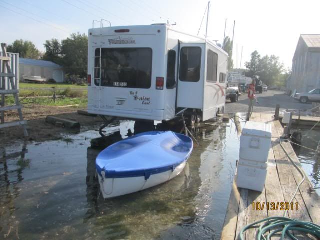
Now this is a real DINGHY.
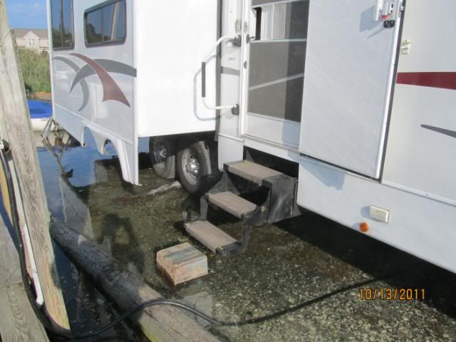
This has true meaning when we say our wheels have been from Atlantic to Pacific waters.
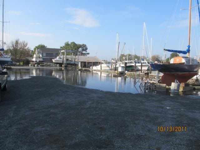
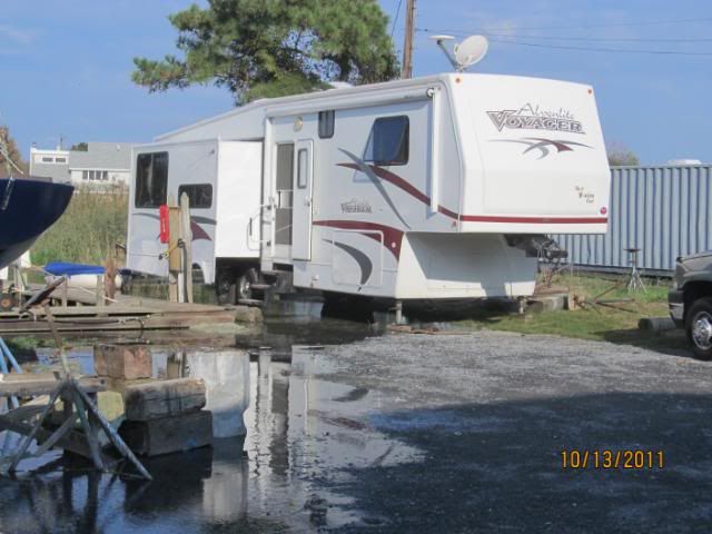
A couple inches short of full tide
40+ night per year overnighter
2007 Alpenlite 34RLR
2006 Chevy 3500 LT, CC,LB 6.6L Diesel
Ham Radio: VP9KL, IRLP node 7995
- Mark as New
- Bookmark
- Subscribe
- Mute
- Subscribe to RSS Feed
- Permalink
- Report Inappropriate Content
Nov-22-2011 04:41 PM
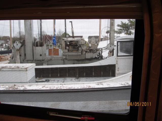
Not many RVers get to look straight at a boat & travelift. Got a warning from boatyard owner. "Stay out of the way or be launched."

The reason we come to this friends boatyard. A full workshop with anything we could possibly need.
40+ night per year overnighter
2007 Alpenlite 34RLR
2006 Chevy 3500 LT, CC,LB 6.6L Diesel
Ham Radio: VP9KL, IRLP node 7995
- Mark as New
- Bookmark
- Subscribe
- Mute
- Subscribe to RSS Feed
- Permalink
- Report Inappropriate Content
Nov-22-2011 09:02 AM
nandj wrote:
Below are campground pictures from southern California we took in late October 2011.
That's the kind of campground/campsite description I wish everyone would post. Thanks.
- Mark as New
- Bookmark
- Subscribe
- Mute
- Subscribe to RSS Feed
- Permalink
- Report Inappropriate Content
Nov-22-2011 05:37 AM
Yucaipa Regional Park, Yucaipa, CA
This is a San Bernardino County park.
GPS Coordinates: 34.049238, -117.047245
Site #35
Full hookups, lot's of grass and trees. Level sites. Mountains in the background.
About 4 miles north of I-10, close to a suburban environment.
Morro Bay State Park, Morro Bay, CA
GPS Coordinates: 35.346670, -120.841840
Site #23
Water and Electric though many sites are without hookups.
Trees and large shrubs. Level sites. Close to water. Walking distance to restaurant.
Black Rock Canyon Campground, Joshua Tree National Park
GPS Coordinates: 34.07273, -116.39155
Site #25
No hookups. Loops paved but getting old. Sites are compact sand and are uneven.
Very scenic. You do not have to enter the park to get to this campground.
You do not have to pay the park fee on top of the campground fee.
Mayflower Park, Blythe, CA
This is a Riverside County park.
GPS Coordinates: 33.670198, -114.534024
We did not stay overnight. We just pulled in for lunch.
Sites are on grass. The hookup sites are clustered around utility poles servicing 4 RV's.
So you would be side by side and back to back with other RV's, where you would be very close.
Nice location right on the Colorado River.
Neil & JoAnn
2017 Thor Compass 23TR
- Mark as New
- Bookmark
- Subscribe
- Mute
- Subscribe to RSS Feed
- Permalink
- Report Inappropriate Content
Nov-21-2011 12:31 PM
GPS Coordinates: 35.01250, -111.73858
This is a Coconino National Forest campground north of Sedona, AZ.
There are no hookups. It's right off the road (AZ-89A), but night traffic is very light.
Sites and loops are paved. Most sites are uneven due to the terrain.
#28 on the west side was good with just a slight incline.
On the east side, sites 41, 44, and 50 looked level, but on site #50 there is a steep drive to reach the level parking pad.
Site #28:
Neil & JoAnn
2017 Thor Compass 23TR


